Mount Yōtei (羊蹄山) | 100 Famous Japanese Mountains #009

Walking through the alpine plants trail designated as national nature treasure

There is snow until the beginning of July. Foot also until May.

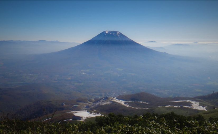
Mt.Yōtei (羊蹄山) is an independent mountain which have a conical shaped summit. It boasts a beautiful shape and size suitable for being called “Ezo-Fuji”. Once it was also called “Shiribeshi-yama”.
As Alpine plants are abundant, the trail is designated as a national nature treasure, and if you choose Kucchan Course you will proceed through the nature trail.
The top of the mountain is a crater, hikers go around here. Snow will also disappear in mid-July, alpine plants will bloom.


Detailed Data of Mount Yōtei (羊蹄山)

The vast crater of the summit is commonly called "father kiln" (父窯).
The vast crater of the summit is commonly called “father kiln” (父窯).

AREA: Makkari village Niseko cho / Kyōgoku cho / Kimobetsu cho, Hokkaido
HIGHEST POINT: 1898 m, Mt. Yōteizan
LEVEL OF COURSE: ★★☆
PLAN: a trip for 1 nights and 2 days
DURATION: 1st day: 4 hours and 50 minutes, 2nd day: 4 hours and 50 minutes
DISTANCE: About 17 km
DIFFERENCE OF ELEVATION: 1668 m
ENDURANCE: ★☆☆
DIFFICULTY LEVEL: ★★☆
BEST SEASON: July to September


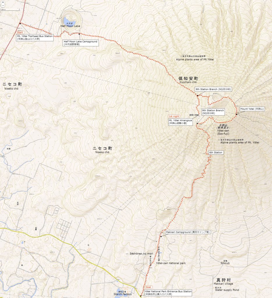
Mt. Yōtei’s Hiking Course Map

Map of Mt. Yōtei | Click on the image above to open the enlarged image in a separate tab.

The source of above the three maps are “Digital Japan Web System” of The Geospatial Information Authority of Japan. The maps were edited a author of this blog.
In Japanese: これらの3枚の地図は国土地理院の電子国土Webシステムから配信されたものをこのブログの著者が加工したものである。


How to travel to Mt. Poroshiridake’s Trailhead (Second Gate)

the total amount: about 890 JPY

The Way There

Kucchan Station (倶知案駅)

Niseko Bus / Dōnan Bus (about 10 minutes): 230 JPY

Yōtei Trailhead Bus Station (羊蹄登山口バス停)

The Way Back

Yōtei National Park Entrance Bus Station (羊蹄自然公園入口バス停駅)

Dōnan Bus (about 30 minutes): 660 JPY

Kucchan Station (倶知案駅)


Inquire:

Niseko Bus (ニセコバス) 0136-44-2001

Dōnan Bus Kucchan Sales Official (道南バス倶知案営業所) 0136-22-1558


By Car:

From Chitose (Chitose) via Shikotu Lake (支笏湖), take Route 276 via Bifue Tōge (美笛峠) to Mt. Yōtei Trailhead (羊蹄山登山口)


Paking Lot Infomation:

Half Moon Campground (半月湖キャンプ場) has a parking lot (about 15 units)


Lodging Facility:

Yōtei-zan Hinangoya (羊蹄山避難小屋)

Newly built mountain lodge in 2013.
Water and meals are not provided, but you can rent shruffs and blankets.

Tel: 0136-23-3388 (Kucchan Chō Tourism Division)

Opening: Mid-June to Mid-October

Fee: 1000 yen per night, rest 300 yen, blanket 200 yen, sleeping bag 300 yen

Capacity: about 20 people


Hot Springs After Hiking

Makkari Hot Spring (まっかり温泉)

Official Web Site: http://www.makkarionsen.com/

A hot spring looking up Mt.Yōtei from the south. From the outdoor bath you can see the Makkari Course where you came down.

Tel: 0136-45-2717

Adress: 174-3 Midorioka Makkari village, Hokkaido

Opening hour: 10:30 am – 9:00 pm

Closed: Monday (If it is a holiday the next day)

Fee: 500 JPY

Access: 30 minutes from Makkari village Bus Stop (真狩村バス停) on foot

Mount Poroshiri-dake (幌尻岳) | 100 Famous Japanese Mountains #008

Walking while enjoying the scenery created by active volcanoes

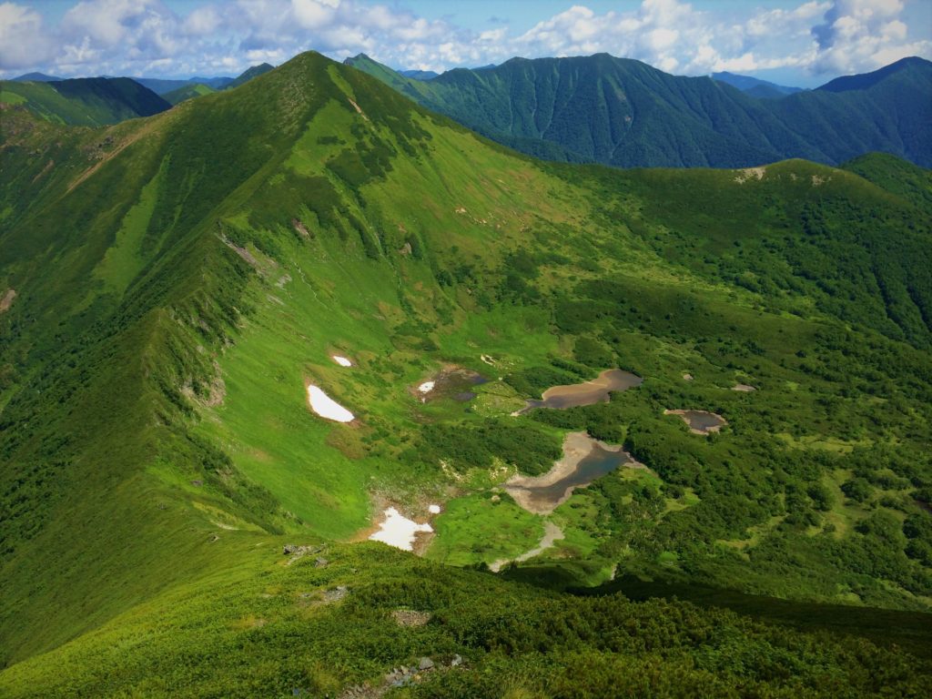
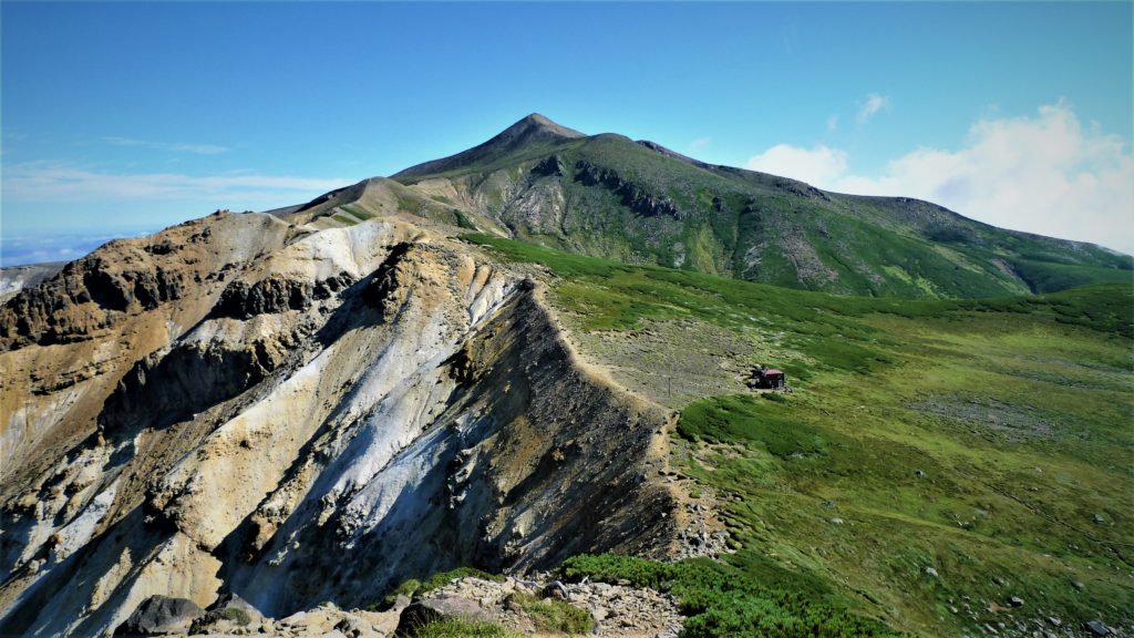
Hiker walks the floor of the cirque under Poroshiri-dake to the summit.

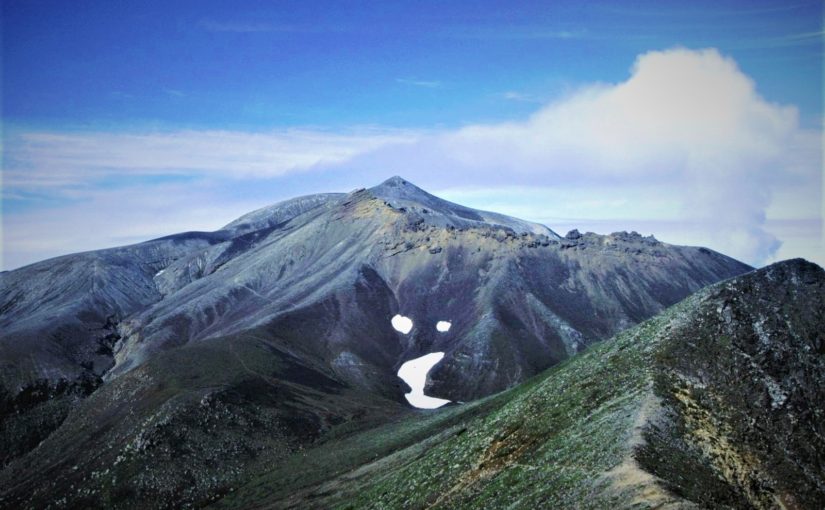
Mt.Poroshiri (幌尻岳) which is also selected as “100 famous japanese mountains” at the highest peak of Hidaka Range. Mt.Poroshiri, which is said to be the most difficult mountain of “100 famous japanese mountains” is a mountain for skilled hikers where difficult trails like dozens of wading across rivers and climbing steep slopes follow.
However, it is must-sees for the superb ridgeline that extends beyond the difficult trail and “Nanatsunuma” selected for “Japan’s top 100 geological selections”! You can see various animals on the ground where the flower garden spreads. In this article I will introduce representative courses and spots of Mt.Poroshiri.


Detailed Data of Mount Poroshiri-dake (幌尻岳)

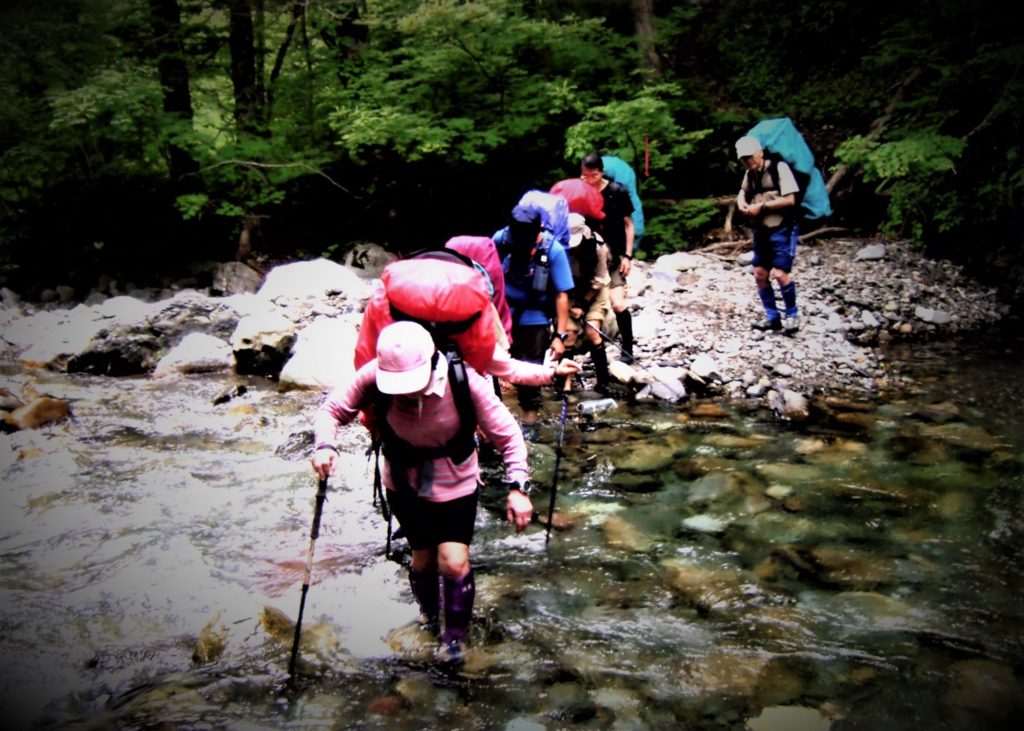
Hikers cross the Nukabira River tens of times and heads to Poroshiri-sansō.

AREA: Niikappu cho Biratori cho, Hokkaido
HIGHEST POINT: 2052 m, Mt. Poroshiridake
LEVEL OF COURSE: ★★★
PLAN: a trip for 2 nights and 3 days
DURATION: 1st day: 4 hours and 40 minutes, 2nd day: 7 hours and 10 minutes, 3rd day: 4 hours and 20 minutes
DISTANCE: About 23 km
DIFFERENCE OF ELEVATION: 1522 m
ENDURANCE: ★★☆
DIFFICULTY LEVEL: ★★★
BEST SEASON: July to September


Mt.Tomuraushi’s Hiking Course Map

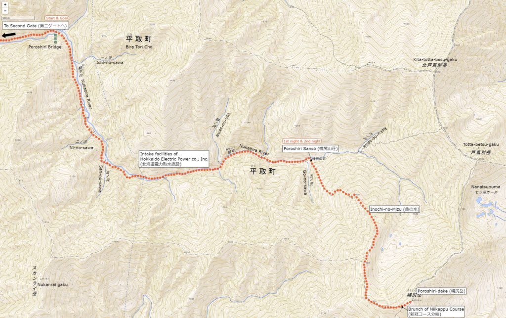
Map of the Nukabira River Route | Click on the image above to open the enlarged image in a separate tab.
Map of the Nukabira River Route (額平川ルート) | Click on the image above to open the enlarged image in a separate tab.

The source of above the three maps are “Digital Japan Web System” of The Geospatial Information Authority of Japan. The maps were edited a author of this blog.
In Japanese: これらの3枚の地図は国土地理院の電子国土Webシステムから配信されたものをこのブログの著者が加工したものである。


How to travel to Mt. Poroshiridake’s Trailhead (Second Gate)

the total amount: about 1310 JPY

Tomikawa Station (富川駅)

Dōnan Bus (about 1 hour): 1310 JPY
↓↑
Toyonuka sansō (とよぬか山荘)

Shuttle Bus (one way, about 1 hour): Round trip fare 4000 JPY
↓↑
Second Gate (第2ゲート)

From Toyonuka sansō, traffic to general vehicles is prohibited.
Hikers use a private shuttle bus.
From the 2nd gate is a walk only.


Inquire:

South Hokkadō Bus Biratori Sales Office (道南バス平取営業所) 01457-2-2311

Furenai Kōtsū (振内交通) 01457-3-3021

Biratori Taxi (平取ハイヤー) 01457-2-3181

Toyonuka sansō (とよぬか山荘) 0145-7-33568


By Car:

From Biratori cho Honcho (平取町本町) toward Hidaka (日高) 40 minutes, after Furenai city (振内市街), there is a sign of “Poroshiri Trailhead” (幌尻岳登山入り口) in the branch of Niseu (仁世宇). From there about 20 minutes you arrive at Toyonukasō (とよぬか山荘).


Paking Lot Infomation:

Toyonukasō has public car park (about 50 units)


Lodging Facility:

Poroshiri sansō (幌尻山荘)

At Mountain lodge where reservation is not without meals. There is no meal or bedding so let’s prepare yourself. The reservation reception starts from April 1.

Tel: 01457-3-3838

Opening: June 1 to September 30

Fee: 1500 (without meals)


Hot Springs After Hiking

Biratori Hot Spring Yukara (びらとり温泉 ゆから)

Official Web Site: http://www.biratori-onsen.com/

The lily’sa habitat is right next to and is a hot spring accommodation that is perfect for healing tiredness of hiking.
Day bathing is also possible.

Tel: 01457-2-3280

Adress: 92-6 Nibutani Biratori cho, Hokkaido

Opening hour: 10:00 am – 9:30 pm

Closed: open all year arond

Fee: 420 JPY

Access: Immediately from Biratori Onsen Mae Bus Stop (平取温泉前バス停)

Mount Tokachi (十勝岳) | 100 Famous Japanese Mountains #007

Walking while enjoying the scenery created by active volcanoes

Volcanic gravel and volcanic routes follow towards Mt. Tokoki.

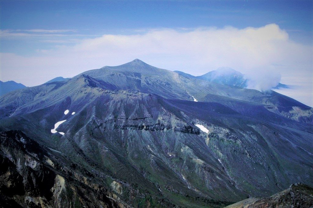
Mount Tokachi (十勝岳) is the main peak of the Tokachi mountain range, and active volcanoes where volcanic activity is still active now. The crater which send up great volumes of smoke and the mountain views of narrow ridge are peculiar, it is a mountain popular with hikers. From the summit you can see the mountains of Hidaka and Mt. Tomuraushi, Mt. Daisetuzan.


Detailed Data of Mount Tokachi (十勝岳)

Mt.Tokachi is a unique landscape like a moon.

AREA: Shintoku cho Kami-furano cho Biei cho, Hokkaido
HIGHEST POINT: 2077 m, Mt. Tokachi
LEVEL OF COURSE: ★★☆
PLAN: day hike
DURATION: 6 hours and 55 minutes
DISTANCE: About 10 km
DIFFERENCE OF ELEVATION: 1147 m
ENDURANCE: ★★☆
DIFFICULTY LEVEL: ★☆☆
BEST SEASON: July to September


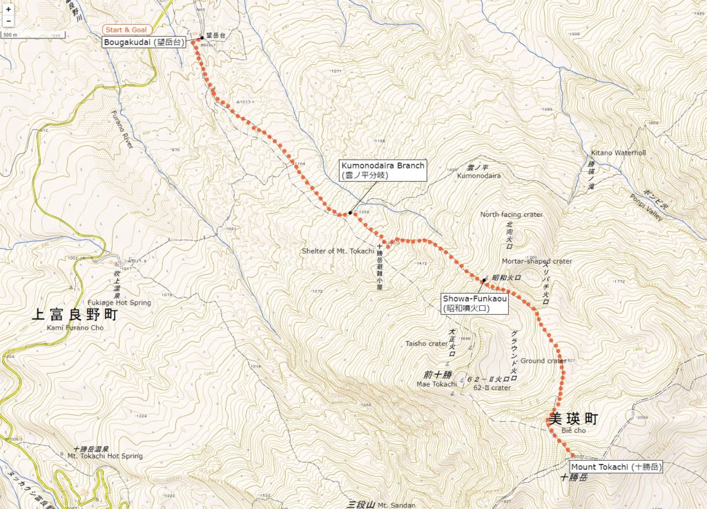
Mt.Tomuraushi’s Hiking Course Map

Mt. Tokachi's Hiking Course (トムラウシ短縮コース) | Click on the image above to open the enlarged image in a separate tab.
Mt. Tokachi’s Hiking Course | Click on the image above to open the enlarged image in a separate tab.

The source of above the three maps are “Digital Japan Web System” of The Geospatial Information Authority of Japan. The maps were edited a author of this blog.
In Japanese: これらの3枚の地図は国土地理院の電子国土Webシステムから配信されたものをこのブログの著者が加工したものである。


How to travel to Mt. Tokachi’s Trailhead

the total amount: about 14000 JPY

Biē Station (美瑛駅)

Taxi (about 35 minutes): 7000 JPY

Bougakudai (望岳台)

From Shirogane Onsen Bus Stop (白銀温泉バス停) it is possible to get to Bougakudai in about 1 hour and 10 minutes on foot.
North Hokkaido Bus General information (道北バス総合案内) 0166-23-4161

Inquire:

Biē Taxi (美瑛ハイヤー) 0166-92-1181

By Car:

From Asahikawa, take national road No. 237 south, in Biei, take road 966 towards Shirogane Hot Spring, and 52 km to Shirogane Hot Spring. It is 3 km further to Bougakudai.

Paking Lot Infomation:

Bougakudai has public car park (about 40 units)


Hotel:

Daisetsuzan Shirogane Tourist hotel (大雪山白金観光ホテル)

Accommodation in Shirogane Onsen.
A day-long bathing plan of 1300 yen with a meal is recommended.

Tel: 0166-94-3111

Opening: late June to late September

Fee: Need to confirm

Official Web Site: http://www.shirogane-kankou.com/

Access: Immediately from the shirogane hot spring bus stop


Hot Springs After Hiking

Kokumin Hoyō Center (国民保養センター)

Official Web Site: http://town.biei.hokkaido.jp/facility/hoyou.html

One day bathing facilities in Shirogane Onsen.
It is also popular with locals at 100% natural hot springs.

Tel: 0166-94-3016

Adress: Shirogane Onsen Biē cho, Hokkaido

Opening hour: 9:30 am – 8:00 pm

Closed: Monday

Fee: 300 JPY

Access: Immediately from Hoyō Center Bus Stop


Sightseeing Area

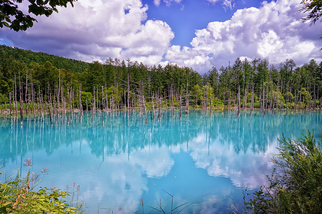
Shirogane Blue Pond (白金青い池)

SHIROGANE BLUE POND (白金青い池)

The pond called “Biē Blue” from the color of the beautiful blue lake surface. The river containing the hot spring ingredients is making beautiful colors.

Adress: Shirogane Biē cho, Hokkaido

Access: About 2.5 Km from Shirogane Hot Spring

Parking Lot: about 100 units

Mount Tomuraushi (トムラウシ山) | 100 Famous Japanese Mountains #006

A Course of Popular Mountain in Daisetsuzan National Park

Sceneries like Hokkaido where rocks and snow are beautiful

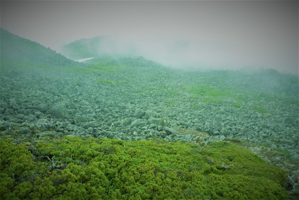
Mt. Tomuraushi (トムラウシ山), located in the middle of Daisetsuzan National Park, is a long course that goes back and forth about 15 km from ”the Tomuraushi hot spring climbing course”.
Complex terrain and snowy and alpine plants brought by rich natural environment are unbelievably beautiful.
It gives you the pleasure of bliss that deserves hardship of the long trail.


Detailed Data of Mount Tomuraushi (トムラウシ山)

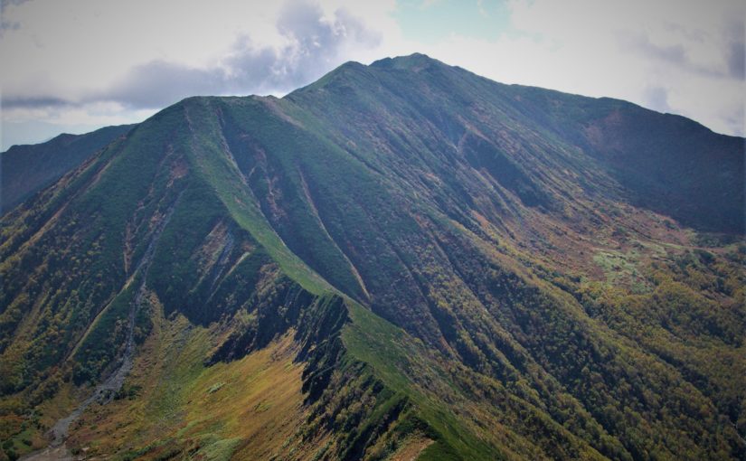
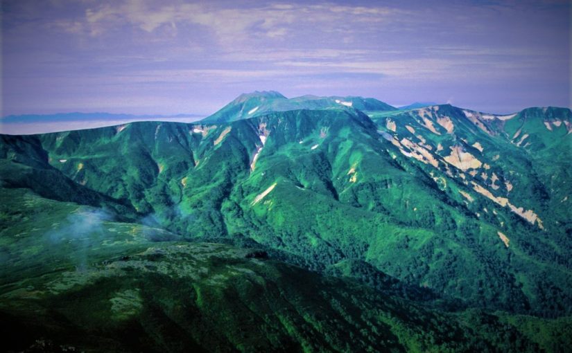
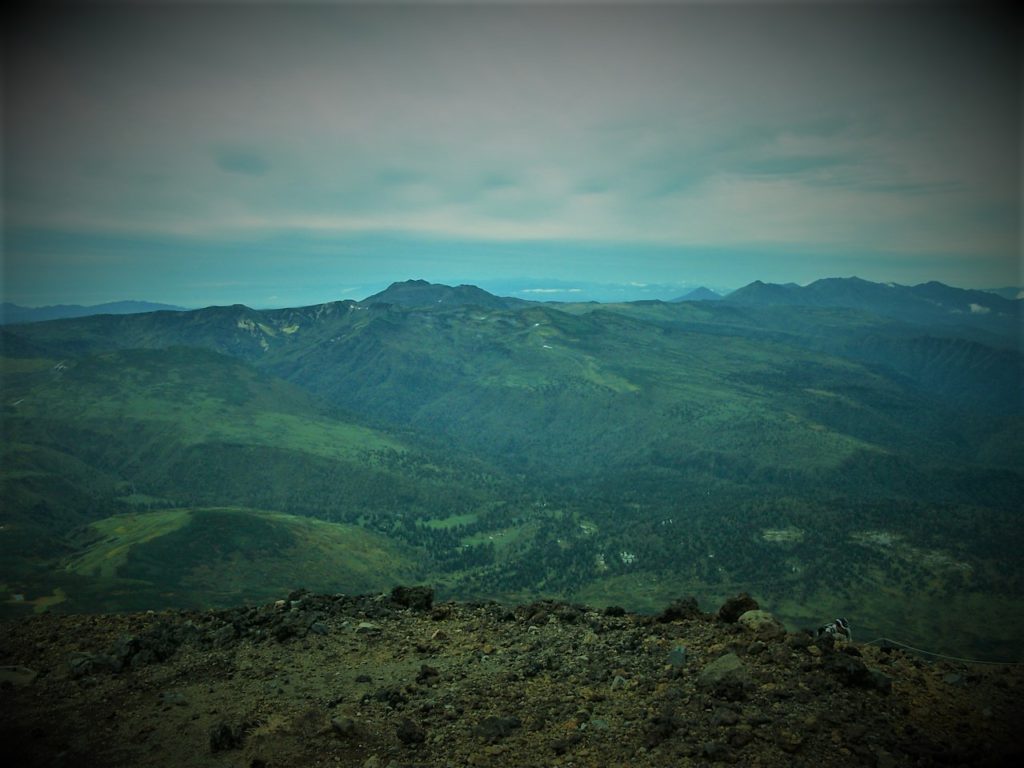
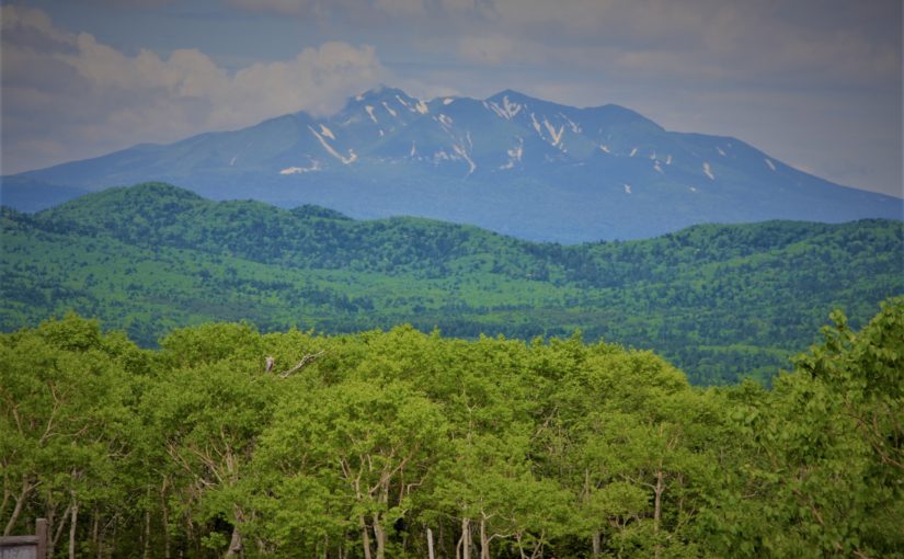
Mt. Tomurashi from the summit of Mt. Asahidake

AREA: Shintoku cho Biei cho, Hokkaido
HIGHEST POINT: 2141 m, Mt. Shari
LEVEL OF COURSE: ★★★
PLAN: day hike
DURATION: 11 hours and 50 minutes
DISTANCE: About 15 km
DIFFERENCE OF ELEVATION: 1181 m
ENDURANCE: ★★★
DIFFICULTY LEVEL: ★★☆
BEST SEASON: July to September


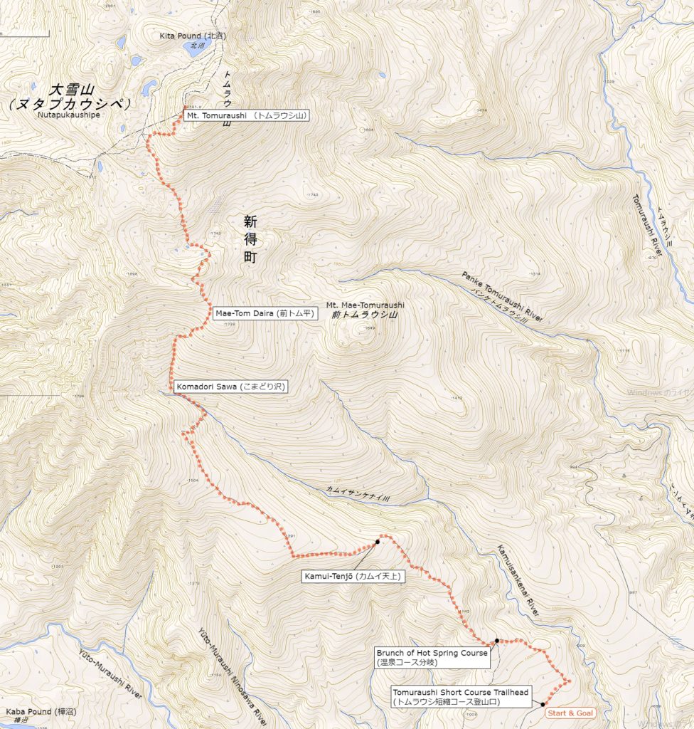
Mt.Tomuraushi’s Hiking Course Map

Mt. Tomuraushi's Hiking Course (トムラウシ短縮コース) | Click on the image above to open the enlarged image in a separate tab.
Mt. Tomuraushi’s Hiking Course (トムラウシ短縮コース) | Click on the image above to open the enlarged image in a separate tab.

The source of above the three maps are “Digital Japan Web System” of The Geospatial Information Authority of Japan. The maps were edited a author of this blog.
In Japanese: これらの3枚の地図は国土地理院の電子国土Webシステムから配信されたものをこのブログの著者が加工したものである。


How to travel to Mt. Tomuraushi’s Trailhead

the total amount: about 32000 JPY

Shintoku cho Station (新得町駅)

Taxi (about 1 hour and 30 minutes): 16000 JPY

Mt. Tomuraushi’s Trailhead (トムラウシ短縮コース)

There is a service of “Tomuraushi Hot Spring Bus” for a limited time from July to August. It is approximately one and a half hours from Shintoku Station to Tomuraushi Hot Spring. Reservations are required.
Hokkaido Takushoku Bus (北海道拓殖バス) 0156-64-5202

Inquire:

Shintoku Taxi (新得ハイヤー) 0156-64-5202

By Car:

From Shintoku Station via Route 718 about 60 km.
Please note that the vicinity is unpaved.

Paking Lot Infomation:

There is a public car park (50 units)


Hotel:

Higashi Daisetu Sō (東大雪荘)

An inexpensive hotel operated by a local government.
It was renewed in 2008. A large outdoor bath along the mountain stream and a spacious bath are reputed.

Tel: 0152-25-4111

Opening: late June to late September

Fee:
9870 JPY – / 1 person with dinner and breakfast per night
・Prices change according to the season
・2 people in one room

Official Web Site: http://www.tomuraushionsen.com/

Access: 1 hour and 30 minutes from Shintoku Station by car


Hot Springs After Hiking

Hotel Kuttari Hot Spring Lake-In (湯宿くったり温泉 レイクイン)

Official Web Site: https://www.lakeinn.jp/

A resort hotel on the bank of Lake Kuttari.
You can enjoy a spacious outdoor bath and an inner bath.

Tel: 0156-65-2141

Adress: 808 Kuttari Shintoku cho, Hokkaido

Opening hour: 12:00 am – 10:30 pm (it’s depend on seasons)

Closed: Request inquiry

Fee: 480 JPY

Access: 20 minutes from Shintoku Station by car.

Hot Spring Osoushi sHIKANO-YU Sō (オソウシ温泉 鹿乃湯荘)

Official Web Site: http://osoushi.foodsnet.net/

Accommodation along Osoushi River. The strong alkaline ion’s hot water is comfortable.

Tel: 0156-65-3338

Adress: 330 Osoushi-Shikanosawa Shintoku cho, Hokkaido

Opening hour: 10:00 am – 8:00 pm

Closed: Request inquiry

Fee: 600 JPY

Access: 40 minutes from Shintoku Station by car.

Mount Shari (斜里岳) | 100 Famous Japanese Mountains #005

Hike to the mountain called On-nepuri “big mountain” in Ainu language

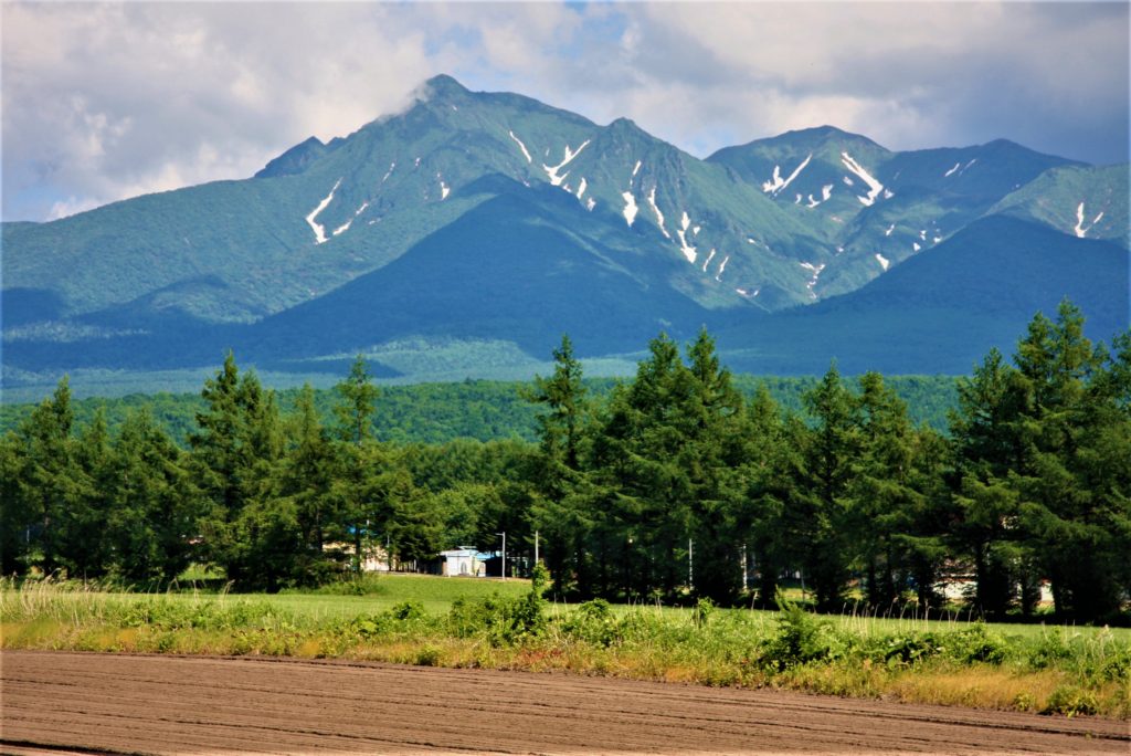
Mt.Sharidake's view from Kiyosato cho, this is a big mountain connected to the south Mt.shari and Mt.Onnebetsu, Mt.Unabetsu.
Mt.Sharidake’s view from Kiyosato cho, this is a big mountain connected to the south Mt.shari and Mt.Onnebetsu, Mt.Unabetsu.

Mt. Shari (斜里岳) is a volcano at the bottom of Shiretoko Peninsula in Hokkaido.
It is a beautiful mountain of independent peak like Mt. Fuji.
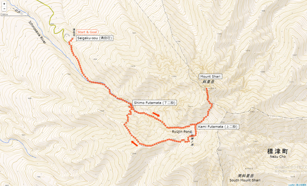
In this article I will introduce the Kiyosato course which most hikers choose.
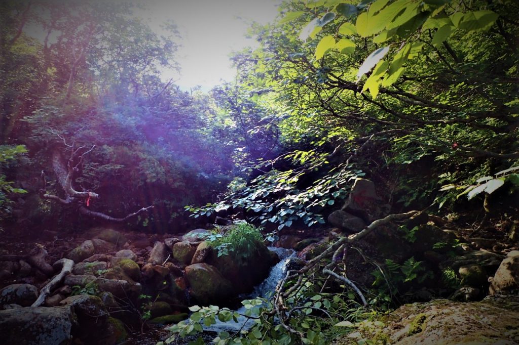
In this course you will cross the small waterfalls of Ichiosawa River left and right to Kami-Futamata, you can enjoy river trekking.
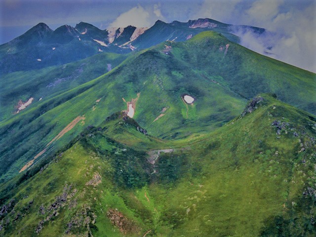
You can also see the Shiretoko mountain ranges and Akan mountain ranges from the summit. You go down a new road while looking to the wonderful view of Mt.Shari.


Detailed Data of Mount Shari (斜里岳)

Walking while enjoying a beautiful waterfalls such as Seven-fold waterfall (七重の滝).

AREA: Shari cho Kiyosato cho, Hokkaido
HIGHEST POINT: 1547 m, Mt. Shari
LEVEL OF COURSE: ★★★
PLAN: day hike
DURATION: 7 hours and 20 minutes
DISTANCE: About 10 km
DIFFERENCE OF ELEVATION: 867 m
ENDURANCE: ★★☆
DIFFICULTY LEVEL: ★★☆
BEST SEASON: July to September


Mt.Rausu’s Hiking Course Map

the Kiyosato course (清里コース) | Click on the image above to open the enlarged image in a separate tab.

The source of above the three maps are “Digital Japan Web System” of The Geospatial Information Authority of Japan. The maps were edited a author of this blog.
In Japanese: これらの3枚の地図は国土地理院の電子国土Webシステムから配信されたものをこのブログの著者が加工したものである。


How to travel to Rishiri Island

the total amount: about 8000 JPY

Kiyosato cho Station

Taxi (about 30 minutes): 4000 JPY

Seigaku sou

Inquire:

Kiyosato Taxi (清里ハイヤー) 0152-25-2538

By Car:

From Memanbetsu via Route 39 and Route 334 about 70 km

Paking Lot Infomation:

40 units at Seigaku sou


Lodging Facility and Hotel:

Seigaku Sou (清岳荘)

A lodge located nearby trailhead. Let’s ask them because they provide information on Mt.Shari even if you are not a guest.

Tel: 0152-25-4111

Opening: late June to late September

Fee:
2050 JPY / per 1 person (staying without meals)
300 JPY / Bedding rental

Maximum Capacity: 50 people

Adress: Kōnan Kiyosato cho, Hokkaido

Access: 30 minutes from Kiyosato Station by car


Hot Springs After Hiking

Papasu Land Sattsuru (パパスランド さっつる)

There are the hot spring facility with foot baths and open-air baths, normal inside bathes. Local vegetables and special products are also on sale.

Opening hour: 10:00 am – 21:00 pm

Closed: No holiday

Fee: 390 JPY

Access: 10 minutes from Sattsuru Station (札弦駅) on foot.

Mount Rausu (羅臼岳) | 100 Famous Japanese Mountains #004

World Heritage Shiretoko’s highest peak hiking course

Shiretoko (知床) was added to the UNESCO Wold Heritage List on July 17, 2005.

Mount Rausu (羅臼岳) is The farthest desolate spot where the untouched nature remains.
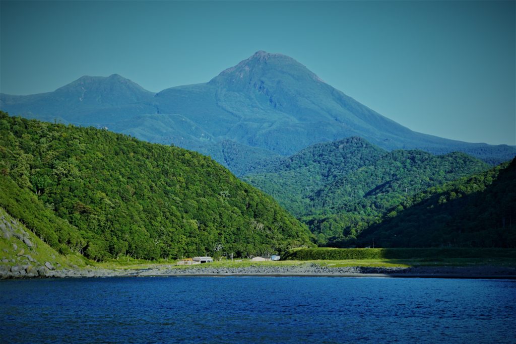
Mt.Rausu, the highest mountain of Shiretoko National Park (知床国立公園), is a bell-shaped mountain with huge and strange stacked lava domes on summit.
There are three hiking routes, the most popular trail is the course from Iwaobetsu hot spring (岩尾別温泉).
From the mountaintop with many rocky places it is an superb prospect such as views of Kunashirijima and Mount Shari.


Detailed Data of Mount Rausu (羅臼岳)

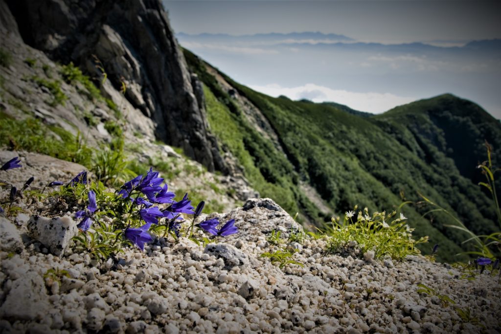
Alpine plants such as Campanula bloom during the short summer.

AREA: Shari cho Rausu cho, Hokkaido
HIGHEST POINT: 1660 m, Mt. Rausu
LEVEL OF COURSE: ★★★
PLAN: day hike
DURATION: 8 hours and 20 minutes
DISTANCE: About 12 km
DIFFERENCE OF ELEVATION: 1440 m
ENDURANCE: ★★★
DIFFICULTY LEVEL: ★★☆
BEST SEASON: July to September


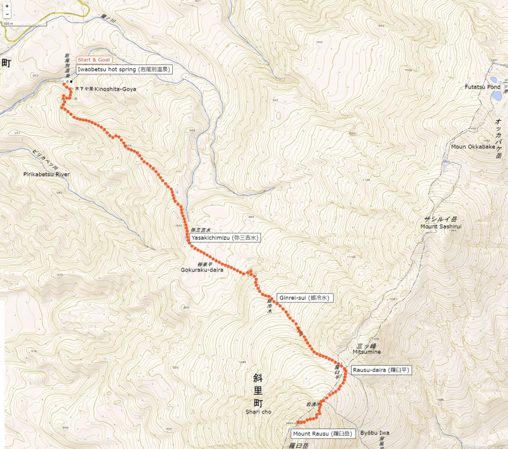
Mt.Rausu’s Hiking Course Map

the course from Iwaobetsu hot spring (岩尾別温泉) | Click on the image above to open the enlarged image in a separate tab.

The source of above the three maps are “Digital Japan Web System” of The Geospatial Information Authority of Japan. The maps were edited a author of this blog.
In Japanese: これらの3枚の地図は国土地理院の電子国土Webシステムから配信されたものをこのブログの著者が加工したものである。


How to travel to Rishiri Island

the total amount: about 34000 JPY

Shiretoko Shari Station

Taxi (about 1 hour 20 minutes): 17000 JPY

Iwaobetsu Hot Spring

Inquire:

Shari Taxi (斜里ハイヤー) 0152-23-2100

Utoro Kankō Taxi (ウトロ観光ハイヤー) 0152-24-2121

By Car:

From Abashiri via Route 244 and Route 344 about 90 km

Paking Lot Infomation:

30 units for Hotel Chinohate guests,
5 units for Kinoshita Goya


Lodging Facility and Hotel:

Kinoshita Lodg (Kinoshita Goya, 木下小屋)

A lodge located right next to trailhead with beds without meals.
There is a natural hot spring in the lodge.

Tel: 0152-24-2824

Opening: late June to late September

Fee:
2500 JPY / per 1 person (a bed without meals, reservation required)
500 JPY / Bathing and resting only

Maximum Capacity: 30 people

Adress: Iwaubetsu Onne-betsu village Shari cho, Hokkaido

Access: 1 hour and 20 minutes from Shiretoko Shari Station by car

Hotel Chinohate (Iwabetsu-insen chinohate, 岩別温泉地の果て)

Mt. Rausu Hotel which many travelers use as base for hiking and Shiretoko sightseeing.
The open air bath surrounded by virgin forest can also be used for day trip.

Tel: 0152-24-2331

Official HP: https://iwaobetu.com/


Hot Springs After Hiking

Iwaobetsu Hot Spring Open Air Bath (Iwaobetsu Onsen Yaten Buro, 岩尾別温泉野天風呂)

A unisex hot spring a bit behind from “Iwao Betsu Hot Spring”.
You can wild experience in a mossy rocky natural hot bath.

Opening hour: 24 hours

Closed: No holiday

Fee: Free

Access: 1 hour and 20 minutes from Shiretoko Shari Station by car

Daisetsuzan National Park Mt. Asahidake (旭岳) | 100 Famous Japanese Mountains #002

Mt.Asahidake (旭岳) which is the main peak of Daisetsuzan National Park spreads view.
It is the highest mountain in Hokkaido, but you can go to the fifth stop on a ropeway.
For that reason it is a popular mountain ranging from beginners to experts with various hikers.
The scenery around Mt.Asahidake is really wonderful and it shows us various scenes depending on the four seasons.
In this article I will introduce three recommended hiking courses, from a walk course for beginners to a course for advanced hikers.
Furthermore, I will introduce all your doubts, including ropeway, hot springs and access information.

Due to the influence of the earthquake that occurred on September 6, 2018, there is a risk that the risk of aftershocks, sediment disasters, etc. may be increased. Please pay attention to future aftershock activity and rainfall situation. (As of September 6, 2018)

What’s Kind of Mountain about Mt. Asahidake (旭岳)

Elevation : 2,291 m
Location : Higashikawa town kamikawa-gun Hokaidō, Japan
Mountans : Daisetsuzan National Park (大雪山国立公園)
Highest Temperature (June-August) : 10.6 ℃
Lowest Temperature (June-August) : -2.3 ℃

Mt.Asahidake, which has a magnificent landscape of nature, is the highest mountain in Hokkaido.
It is the main peak of Daisetuzan National Park with more than 2,000 meters of mountains, and many hikers and tourists gather from all over the country every year.
It is also one of Mt.Asahidake’s attractions that you can easily enjoy superb views by using the ropeway and that there is a lot of hot springs nearby.

Mt. Asahidake which can enjoy various views throughout the year

Mt.Asahidake can enjoy various landscapes every season.
Colorful alpine plants are in full bloom in summer, bright autumn leaves spread in autumn.
In the winter it is also possible to see rare scenery such as “Sunpillar” where the sun shines vertically and “Diamond dust” which shines brightly as sunlight reflects on countless ice particles.

High altitude Asahidake is an area where many alpine plants are in full bloom.
A beautiful flower community that peaks in late July is also called “Kamiminimara (god ‘s garden)” in Ainu language.
Because Hokkaido has a high latitude and Asahi-dake is a high place, the temperature will be low even in the summer, so it is one of the attractions that you can enjoy both flower garden and snowy river at the same time. Blue sky and green color are added there, and Asahidake become a more gorgeous landscape.

Mt.Asahi-dake is also famous as the earliest leaves spot in Japan, at the end of August the mountain starts preparing autumn leaves.
While the fresh green of summer still remains, the spectacle that stains in red and yellow such as Sorbus matsumurana and Geum pentapetalum is a beautiful figure.
In September’s long weekend which is the peak of autumn leaves, many tourists come from abroad to see the best view.

Sugatami Pond Shining Blue

If you visit Mt.Asahidake please be sure to visit “Sugatami Pond”. There you can see superb veiw of Mt.Asahidake from the altitude of 1,600 m so it is a popular photo spot.
Also, the appearance of Asahidake reflected on the blue shining water surface is a mysterious sight.
You can get there from the ropeway “Kyoto” station in about 30 minutes on foot.
Therefore it is a place recommended for tourists as well as full-scale climbers.

Easy to get to the elevation of 1,600 m by riding the ropeway
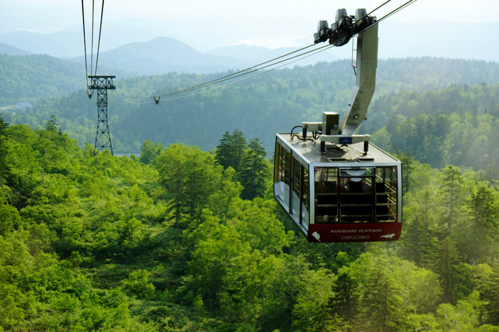
The reason that many tourists gather at Asahidake may be because you can easily enjoy a superb view by riding the ropeway.
With the ropeway which is the only service in Japan to the alpine zone, you can access up to 5th station in 10 minutes. As you can ride the ropeway and enjoy a spectacular view of Daisetsuyama including Asahikake, it is familiar to a wide range of people from mountaineering experts to families.

Click here for the operation status and fee of the ropeway

Let’s bring a map of Daisetuzan National Park

English Map of Daisetuzan National Park (Amazon)

How is the weather in Daisetuzan?

Let’s CHECK the local weather before going to Asahidake.

Click here for weathet information of Mt. Asahidake

Notes on Asahidake hiking and mountain climbing

Even when you enjoy light walks such as hiking at Asahidake as well as climbing it is necessary to pay attention to clothes and shoes.
Nobody can predict what kind of happening will happen if walking in nature.
For that reason, let’s prepare firmly and go mountains.

Even at easy-walking courses let’s go with sneakers or climbing shoes!

Asahi-dake has various courses ranging from easy-walking courses to full-scale climbing courses.
Easy walking courses have well meintained climbing paths, but there are also some gravel roads and so on, so it is recommended to go shoes with sneakers or climbing shoes.
If you have high heel shoes or sandals, you may suffer feet or injure you.
Also, Daisetuzan area has a lot of rain, so it is safe to have waterproof function in addition to easy walking.
People planning to go to the summit, be sure to wear climbing shoes.

Brown bears are in the surrounding mountains! Let’s confirm the information just in case

The season when hiking is fun for human beings is also easy to encounter brown bears asking for food. There are not many sightings of brown bear at Asahidake, but many brown bears inhabit the mountains of the surrounding Daisetsuzan. Especially when you are hike longitudinally, you need to be careful, check the brown bear information in advance or take measures against bear with bells etc in advance.

Brown appearance information (Japanese)

【Difficulty ★】 Feel free to explore by riding the ropeway

Distance:1.7 km
Total Time:45 minutes
Difficuly:★☆☆

Sugatami Pond Ropeway Station (姿見駅) 15 minutes → 3rd observation platform (第三展望台) 25 minutes → Sugatami observation platform (姿見展望台)  → Sugatami Pond Ropeway Station (姿見駅)

Start from Asahi-dake ropeway station.
The year round ropeway is easy to move because it is connected from the altitude of 1100 m to the Sugatami station of the terminal station.
Even if you are not confident in your physical strength, you can easily go by riding a ropeway.

Popular ropeway arrives at Sugatami station in about 10 minutes.
Beyond the forest limits you can enjoy a large panorama of lush green mountains from the train window. In autumn we can see the autumn leaves neatly.

After enjoying the spectacular view from the ropeway, we will arrive at Sugatami station. From here we will enter the walk course on the boardwalk.
Since Mt.Asahidake can be seen also from Sugatami station, it may be good to look at the mountain of Mt.Asahidake slowly first.

As you walk around the observation deck around the boardwalk, you can see two adjacent ponds called “couple pond” (夫婦池). It is the “suribachi pond” (擂鉢池) that has a deep shape like a mortar and the “mirror pond” (鏡池) that has a loose shape. On sunny days the blue sky appears on the surface of the water and you can enjoy the magnificent mountain scenery.

After walking for a while from the couple pond, you arrive at “Sugatami Pond” (Mimi pond). Behind Sugatami Pond, Mt.Asahidake of overwhelming scale feeling is near, and magnificent scenery spreads.
On a sunny day the lake shines on the emerald green and reflects Mt.Asahidake like a mirror, so please take a look when you visit.

【Difficulty ★ ★】 From the ropeway to the summit

There are two ways to aim at the top of the Asahidake mountain: a way to climb using the ropeway and a way to access from Asahidake Trailhead. Most of the climbers seem to use a ropeway in many cases.
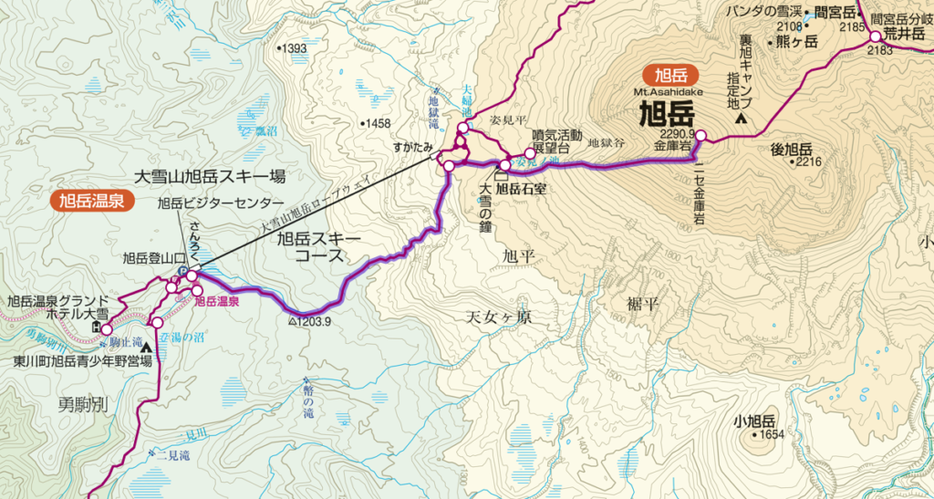
Distance:5.1 km
Total Time:4 hours and 55 minutes
Difficuly:★★☆

Sugatami (姿見) 20 minutes → Sugatami Pond (姿見の池) 150 minutes → Mt.Asahidake (旭岳) 110 minutes → Sugatami Pond (姿見の池) 15 minutes → Sugatami (姿見)

You go to the Sugatami station on the ropeway and start climbing from there towards the summit.
Movement of the ropeway is comfortable and physical strength can be preserved.
Besides, it is the best way to enjoy the wonderful panorama.
After finally checking the equipment at Sugatami station, hiking will start from here.
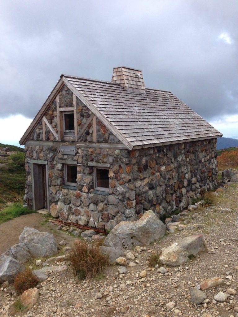
“Asahi-dake stones room” (旭岳石室) that will be visible soon as you reach Sugatami Pond.
Buildings made with a lot of stones can be used as a shelter cabin.
However, because it is for emergency purposes, it is forbidden to use it as an ordinary inn.
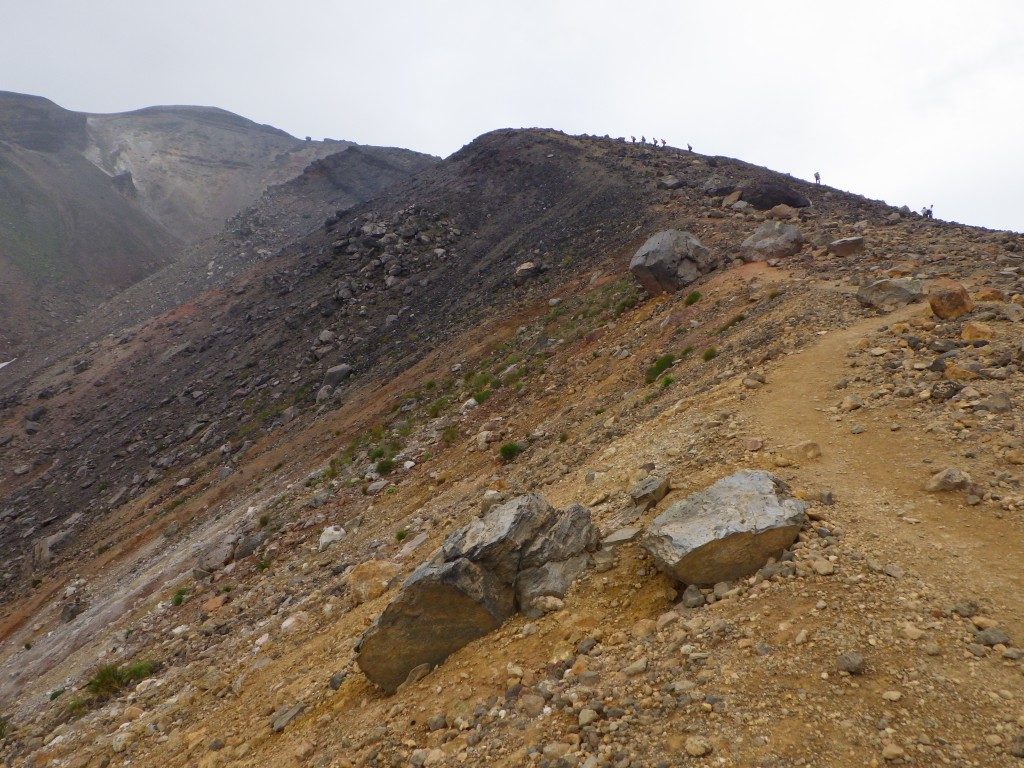
Walking for a while from the “Asahi-dake stones room”, the road will gradually become harder.
As rocky scenes appear as altitude increases, I recommend wearing climbing shoes instead of sneakers at your feet. As there are places that are slippery, let’s proceed carefully.
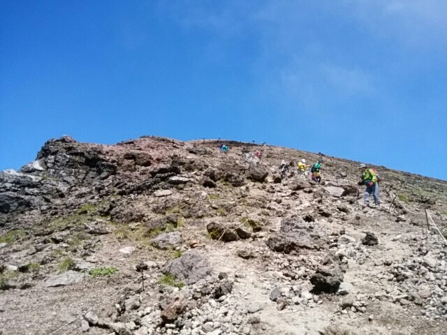
The climbing mountain road of Asahidake is linear when seen on the map, but since it is meandering in reality, it will consume more physical strength than it looks.
Passing Sugatami Pond and other sightseeing spots gradually increase in altitude, it is characterized by volcano gas, reddish brown soil and rocky areas turning into prominent areas.

From the refreshing mountain peak, you can look over Mt.Tomuraushi and Mt. Hakuundake of the same Daisetsuzan Natioal Park.
If the weather is okay, it is a 360 degree big panorama where Tokachi mountain can be seen.
The blue sky and green are beautiful and the outline of the mountain can be clearly seen.
This is a scenic spot where you can taste the ruggedness and elegance of nature at the same time.

How to go to the summit without using a ropeway
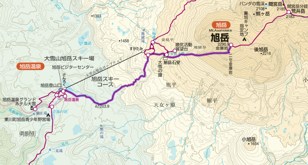
Distance:11.7 km
Total Time:9 hours and 5 minutes
Difficuly:★★★

Mt. Asahidake Trailhead (150 minutes) → Sugatami (姿見) 20 minutes → Sugatami Pond (姿見の池) 150 minutes → Mt.Asahidake (旭岳) 110 minutes → → Sugatami (姿見) 115 minutes → Mt. Asahidake Trailhead
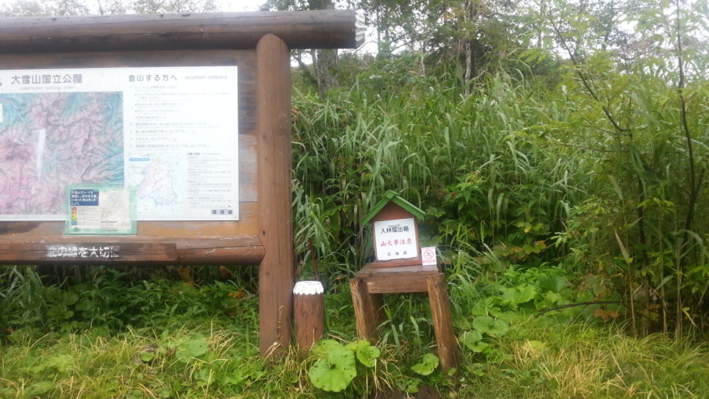
Trailhead at Asahidake is at the foot of Mt.Asahidake Ropeway Station.
In addition to the ropeway parking lot, you may use a public parking lot such as a visitor center.

You walk on the course of the trees, as you cross the sloping street of the rock, you arrive at Ashidake’s 1st station.
The hiking route is densely planted but it is an open space where there is sunlight and the sky is visible.
On the climbing road you can see small pretty flowers such as leiocarpa.

【Difficulty ★ ★ ★】 Tour around Asahidake

Course that runs longitudinally from Mt.Mamiya from Asahidake which is the main peak of Daisetuzan.
Even in the summer, snow will remain around the back of Mt.Asahidake’s route, and finally back to Sugatami this course will bring you a spectacular view of alpine plants and mountains.
However, there are places where the footing is bad, so let’s proceed carefully.
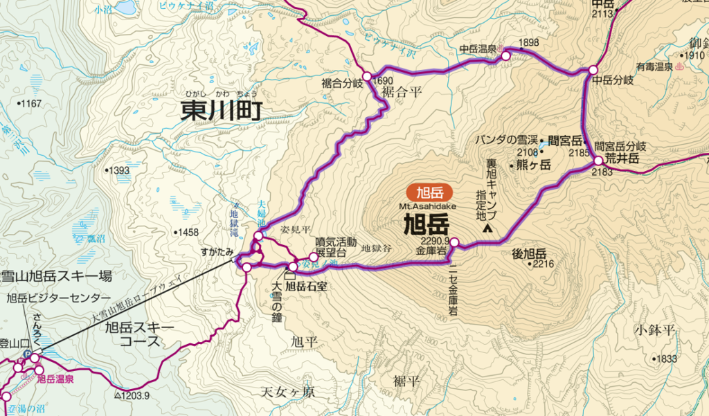
Distance:11.5 km
Total Time:7 hours and 40 minutes
Difficuly:★★★

Sugatami (姿見) 170 minutes→ Mt. Asahidake (旭岳) 60 minutes→ Mt. Mamiyadake branch (間宮岳分岐) 60 minutes→ Nakadake hot spring (中岳温泉) 60 minutes→ Susoaidaira (裾合平) 110 minutes→ Sugatami
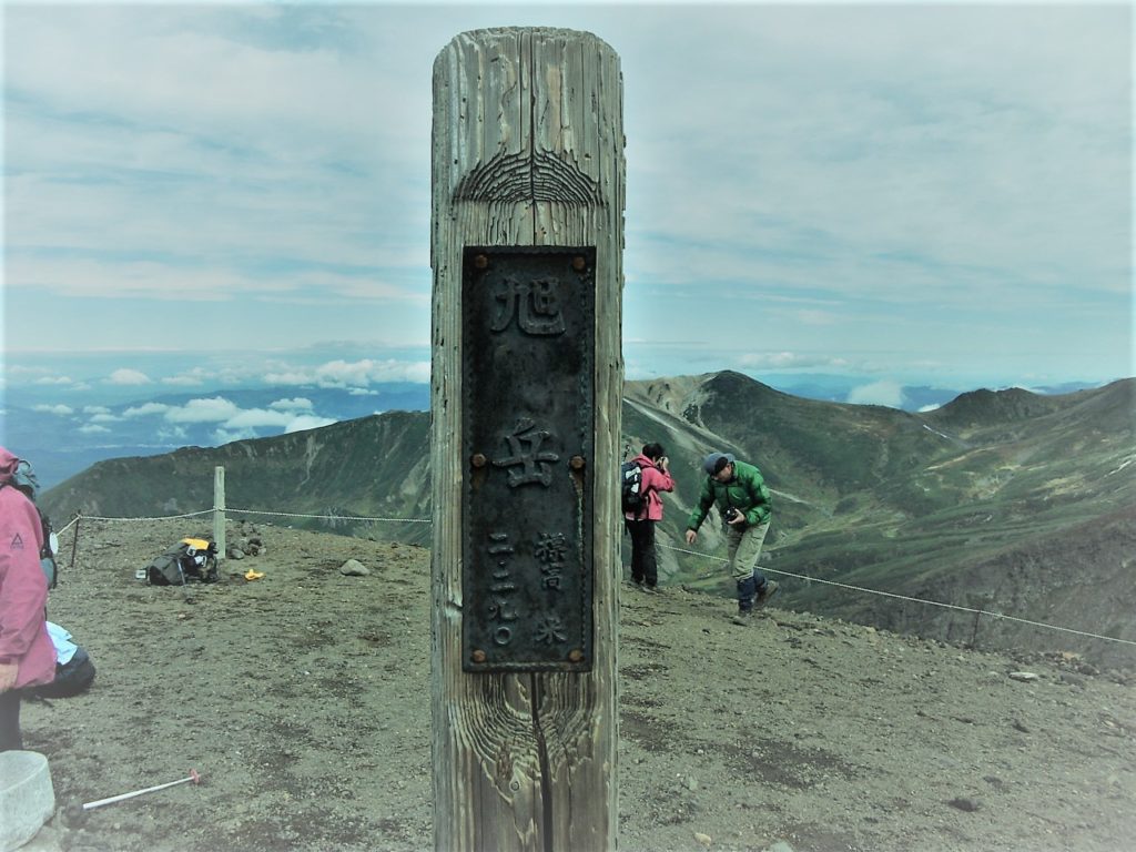
To the Sugatami station which is the start of the round trip course, I climb from the ropeway or climbing mouth and access it.
Until the summit the course goes through Sugatami Pond, Asahi-dake stones room and rocky road.
Beyond the Kinko-rock, you climb a steep hill to the last and you can see the summit of the mountain.
For the course to Asahidake summit top please refer to the course of 【Difficulty ★ ★】.
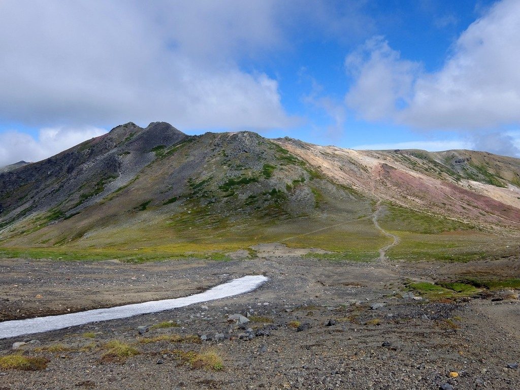
Route from Asahidake summit to the back Mt.Asahidake starts from downhill.
As steep slopes with many rocks are slippery, attention is necessary.
Hikage – yakubo Especially carefully in the summer as snow still remains.
Nakadake Onsen with its natural outdoor hot spring is the perfect spot for healing tired feet.
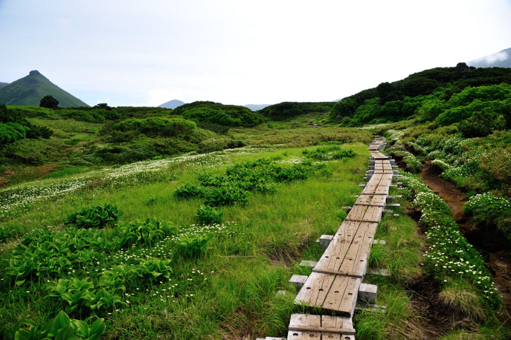
The route from Nakadake Onsen to Susoai-daira will walk along a refreshing blue sky and a nice view.
Along the wood road where the flower garden spreads in the summer, you can stroll while enjoying beautiful flowers such as white pentapetalum and pink Pedicularis.

Access to Mt.Asahidake · Parking information
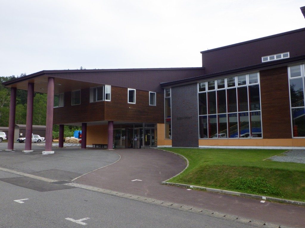
Asahi-dake ropeway which makes it easy to enjoy the dynamic view of Daisetsuzan.
Because it operates all season, you can get on board at your own schedule.
There are also souvenirs and local gourmet at the station.

料金(普通運賃):

June 1 – October 20 October 21 – May 31st
Round-trip ticket One way ticket Round-trip ticket One way ticket
Adult 2,900 JPY 1,800 JPY 1,800 JPY 1,200 JPY
Child 1,450 JPY 900 JPY 900 JPY 600 JPY

Business period: whole year
Number of parked cars: 150 ordinary cars and bikes, 10 or more medium-sized cars etc.
Parking fee: once a day / ordinary car / bike 500 yen, non-ordinary car 1,500 yen ※ parking fee for November – May free
Address: Asahidake Onsen Higashikawa-cho, Kamikawa-gun, Hokkaido
Phone number: 0166-68-9111

【How to access Asahidake Ropeway】

Access by Train / Bus
Sapporo Station → Super Kamui No. 1 → Asahikawa Station → Asahikawa Denkikidō Bus Ideyu → Get off at Asahidake (Ropeway Foothills)

How to access by car
Asahikawa Kita IC of Road Traffic Route → Route 37 → Route 1160 → Asahidake Ropeway

Asahidake Onsen Parking lot

The parking lot of Asahidake Onsen is 4 places in total including the parking lot in front of the Asahidake Visitor Center.
There is a chargeable and free place in the parking lot, and there are places where the presence or absence of the fee changes depending on the season.

Fee: November – May is free, other periods are charged
Number of parking units: 100 (free), 150 (charged)

Roundup of Mt. Asahidake

Mt. Asahi-dake is the highest mountain in Hokkaido belonging to Daisetsuzan National Park. Even tourists and families who do not climb mountain can enjoy powerful elegant scenery and autumn leaves from the ropeway. Regardless of course difficulty when walking Asahi-dake, it is important to firmly prepare winter clothes / shoes. Please enjoy yourself with nice animals and plants!

【Points to note when climbing】

· Please haiking with a solid training on climbing equipment. Mountain climbing shoes, thick socks, rain gear up and down, cold weather protection, head lamp, hat, zack, quick-drying clothes, food, water etc.
· There are several climbing routes, so there are many branches so maps and compasses are indispensable.
· Just in case, do not forget mountain climbing notification and mountain insurance!
· These courses will change difficulty level depending on climbing experience, physical strength, weather etc. Please make reference only, please make a reasonable plan according to your own physical fitness and enjoy climbing.
Mt.Meakandake (雌阿寒岳) | 100 Famous Japanese Mountains #001

Due to the influence of the earthquake that occurred on September 6, 2018, there is a risk that the risk of aftershocks, sediment disasters, etc. may be increased. Please pay attention to future aftershock activity and rainfall situation. (As of September 6, 2018)

What’s Kind of Mountain about Mt.Meakandake (雌阿寒岳)

Source: 阿寒湖畔エコミュージアムセンター

Elevation : 1,499 m
Location : Kushiro City Hokaidō, Japan
Mountans : Akan (阿寒)
Highest Temperature (June-August) : 14.9℃
Lowest Temperature (June-August) : 1℃

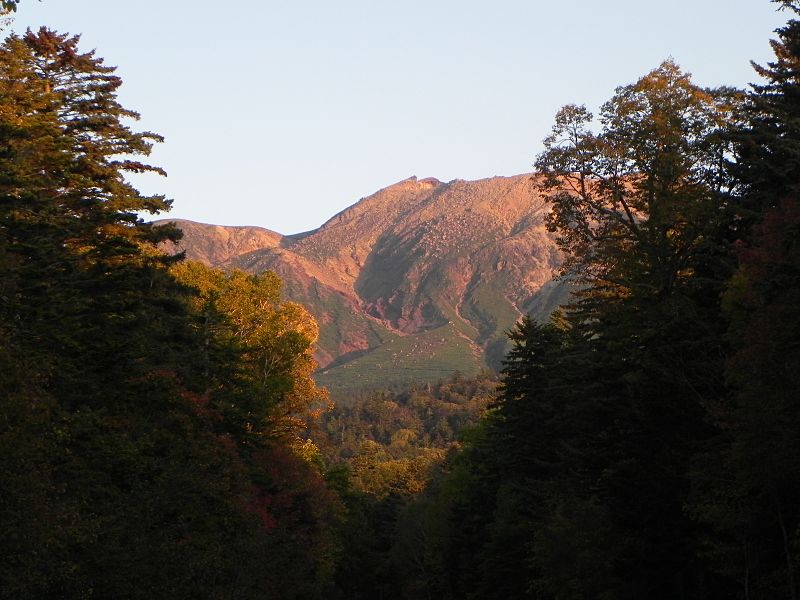
Mt.Meakandake (雌阿寒岳) is an active volcano with an altitude of 1,499 m located in the Akan Mountain Area between Kushiro City and Ashoro Town. “100 Fomaous Japanese Mountains” has also been selected, in Ainu language is also called “Ponmachineshiri”. Also, even in the mountain of Hokkaido the mountain trail is relatively well maintained, the view from the course is also a nice attractive mountain.

Powerful Crater Waching from The Top of Mt.Meakandake

Source: 阿寒湖畔エコミュージアムセンター

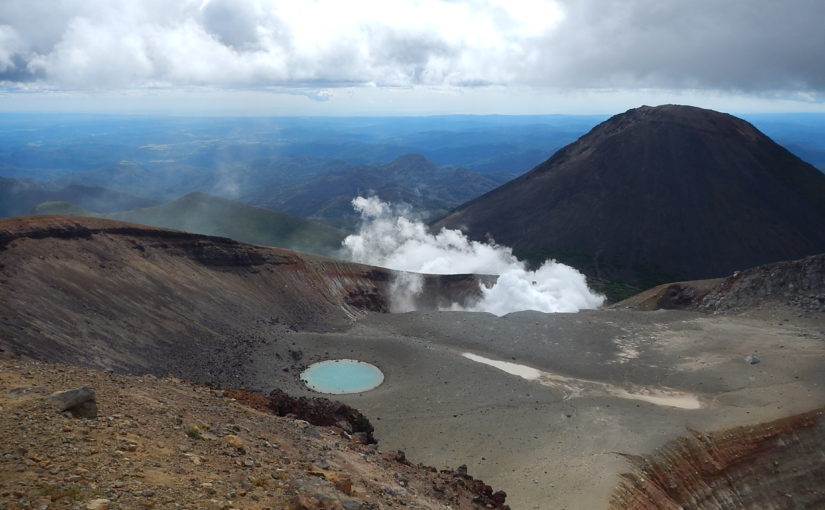
A magnificent view overlooking from Akan Lake is wonderful, but the crater which can be seen from the top of Mt.Meakan is a spot where you can experience the active lively volcano while smelling sulfur around.

Weather and Volcanic Activity of Akan-dake

Mt.Akan is an active volcano. Let’s prepare thoroughly so that you can check the weather information and the volcanic activity in advance and enjoy climbing safely.

Click here for weathet information of Akan

Click here for the volcanic activity of Akan 

Are There Bears at Mt. Akan?

Beers don’t seem to be witnessed much around Mt. Meaka.
But you must must be carefully. In order to avoid mutual unfortunate circumstances for both the bear and the human, let ‘s enjoy hiking with correct knowledge about the ecology and habits of the bears.

3 main hiking routes with peace of mind to beginners

Here, I will introduce Mt.Akan’s most common main hiking routes which is also recommended for beginner’s hikers.

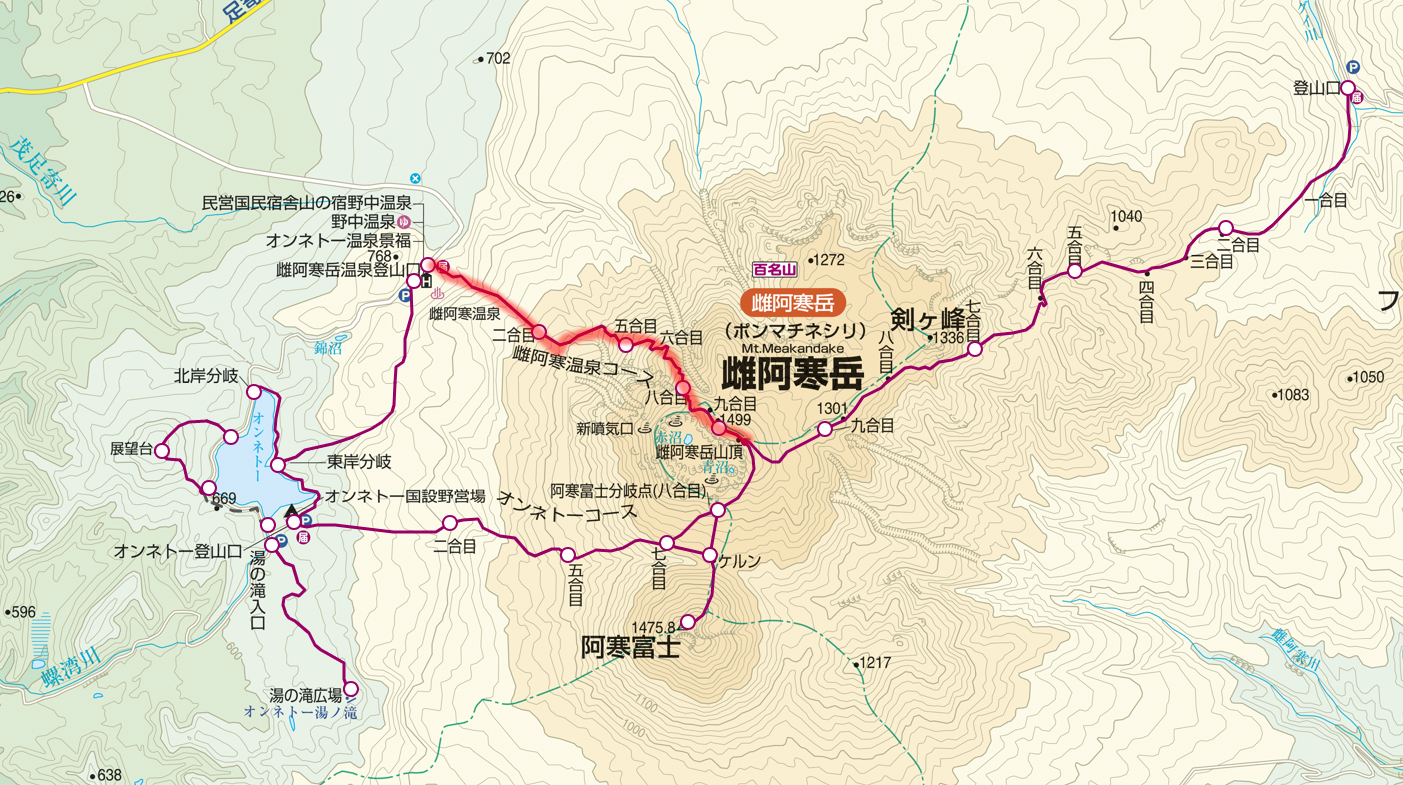
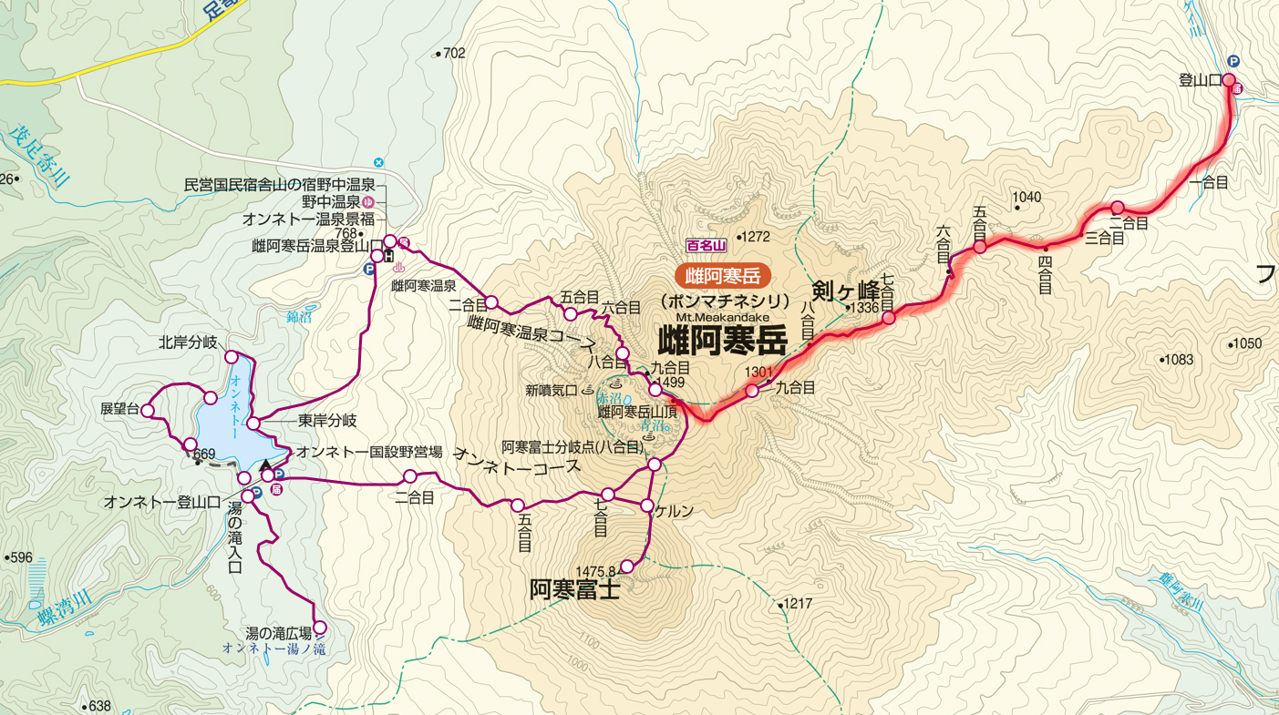
Meakan Hot Spring Course (雌阿寒温泉コース)

Source: ヤマプラ
Source: ヤマプラ

Distance:5.8 km
Total Time:3 hours and 40 minutes
Elevation Difference:794 m
Schedule:Day-hike
Difficuly:★☆☆☆☆

Meakan Hot Spring Trailhead (雌阿寒温泉登山口) 30 minutes → 2nd.Station (二合目) 40 minutes → 5th.station (五合目) 45 minutes → 8th.station (八合目) 25 minutes →the top of Mt. Meakan (雌阿寒岳山頂) 15 minutes → 8th.station (八合目) 25 minutes → 5th.station (五合目) 20 minutes → 2nd.Station (二合目) 20 minutes → Meakan Hot Spring Trailhead (雌阿寒温泉登山口)

Source: 阿寒湖畔エコミュージアムセンター

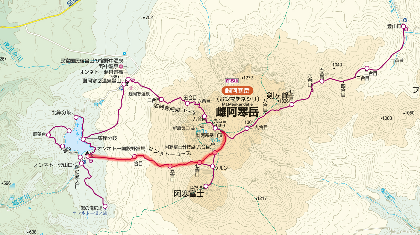
Onnetō Course (オンネトーコース)

Source: ヤマプラ
Source: ヤマプラ

Distance:8.1 km
Total Time:5 hours
Elevation Difference:857 m
Schedule:Day-hike
Difficuly:★☆☆☆☆

Onnetō Trailhead (オンネトー登山口) 30 minutes → 2nd.Station (二合目) 30 minutes → 5th.station (五合目) 60 minutes → 7th.station (八合目) 20 minutes → 8th.station Branch of Mt. Akanfuji (八合目 阿寒富士分岐) 40 minutes → the top of Mt. Meakan (雌阿寒岳山頂) 15 minutes → 8th.station Branch of Mt. Akanfuji (八合目 阿寒富士分岐) 15 minutes → 7th.station (七合目) 45 minutes → 5nd.Station (五合目) 20 minutes → 2nd.Station (二合目) 20 minutes → Meakan Hot Spring Trailhead (雌阿寒温泉登山口)

Source: 足寄町ホームページ
Source: 足寄町ホームページ

Onnetō Course departing from the campground and heading to the top, although it is steep, the distance is short and can climb in a short time. On the way, you can also go via Mt. Akanfuji if you have time to spare.

Akan Hot Spring Course (阿寒温泉コース)

Source: ヤマプラ
Source: ヤマプラ

Distance:12.3 km
Total Time:5 hours and a half
Elevation Difference:764 m
Schedule:Day-hike
Difficuly:★★☆☆☆

Meakandake Trailhead (雌阿寒岳登山口) 50 minutes → 859 m 45 minutes → 1000m 40 minutes → 1166m 30 minutes → 1332m 30 minutes → the top of Mt. Meakan (雌阿寒岳山頂) 20 minutes → 1332m 25 minutes → 1166m 25 minutes → 1000m 30 minutes → 859m 35 minutes → Meakandake Trailhead (雌阿寒岳登山口) 50 minutes

Source: Wikipedia
Source: Wikipedia

Although it is the longest distance among the three mountaineering routes of Mt. Meakandake, the gradient is relatively loose, and it is a route that can climb slowly while enjoying the powerful volcanic landscape.
On the way you can also enjoy alpine plants such as Arenaria merckioides.

About Mt. Akandake’s Winter · Snow Cover Season

Mt. Akandake’s climbing optimum season is from late May to late October. Since the temperature is sometimes below freezing even in June, let’s go for climbing with enough equipment! Snowy season is popular because it can enjoy different scenery. The pure white volcano is spectacular.

Access to Trailhead · Parking information

Public Transport

Kushiro Station, Kushiro Airport – (Bus: Akan Bus) – Akanko Onsen ━ (Taxi) ━ Meakandake Hot Spring Trailhead, Onetxō National Campsite, Lake Akan Mountain Trailhead

Click here for Akan Bus timetable and fare

Coming by a Car

① Meakan Hot Spring Public Parking Lot

National Route 240 – National Highway 241 – Prefectural Highway 664 – Meakan Hot Spring Public Parking Lot
For both Kushiro station and Kushiro airports, go north on Route 240 and continue on the road for a while and turn left on National Highway No. 241 which passed by Lake Akan.
Turn left to the prefectural highway No. 664 and go to Meakan Hot Spring, and the place you see on the left is Meakan Hot Spring Public Parking Lot. About 76.5 km to Meakan Hot Spring Public Parking Lot, required time 1 hour 16 minutes.

<Parking Lot Information>
Akan Onsen Public Parking Space (Free)
About 80 units can be stopped.
Address: Moashoro Ashoro Town Ashoro County, Hokkaido

② Onnetō National Parking Lot

National Highway 240 – National Highway 241 – Route 664 – Onnetō National parking lot
Both Kushiro Station and Kushiro Airport, go north on Route 240 and continue on the road for a while and turn left at National Highway No. 241 which passed by Akan Lake.
Turn left to the prefectural highway No. 664 ahead, head towards Meakan Hot Spring, Onnetō Lake over Onnetō The place that you can see on the left turning the tea house is Onnetō National parking lot.
It is approximately 79.8 km to Onnetō National parking lot, required time 1 hour 23 minutes.

<Parking Lot Information>
Onnetō National parking lot parking lot (free)
About 100 units can be stopped.
Address: Moashoro Ashoro-cho Ashoro-gun, Hokkaido

③ Akan Lake Trailhead Parking Lot

National Highway No. 240 – Lake Akan Trailhead Parking Lot
For both Kushiro Station and Kushiro Airport, go north on Route 240 and continue along the road for a while, then after passing Akan Lake, turn left immediately and after a while Lake Akan Trailhead Parking Lot.
Approximately 64.7 km to Lake Akan Trailhead Parking Lot, required time 1 hour 40 minutes.

<Parking Lot Information>
Lake Akan Trailhead Parking Lot (Free)
About four units can be stopped.
Address: Moashoro Ashoro Town Ashoro County, Hokkaido

Roundup of Mt.Akan

Mt.Akandake is one of the nine mountains “100 famous Japanese Mountains” in Hokkaido, which is lowest in altitude and less required for both difficulty and physical strength, so it is a mountain that is easy for beginners to challenge.
Let’s enjoy the natural environment of Akan by selecting the route that suits you!
Experienced people also recommend a route to climb via Mt.Akanfuji nearby.

【Points to note when climbing】

· Please haiking with a solid training on climbing equipment. Mountain climbing shoes, thick socks, rain gear up and down, cold weather protection, head lamp, hat, zack, quick-drying clothes, food, water etc.
· There are several climbing routes, so there are many branches so maps and compasses are indispensable.
· Just in case, do not forget mountain climbing notification and mountain insurance!
· These courses will change difficulty level depending on climbing experience, physical strength, weather etc. Please make reference only, please make a reasonable plan according to your own physical fitness and enjoy climbing.