Easy Trail Running to Mt.Koma in Oiso | Let’s enjoy both Hiking and the Beach in 1 day!

Do you like sea, or do you like mountains?
If you want a trail running that enjoys both mountains and oceans near Tokyo, I recommend Mt.Koma in Oiso.
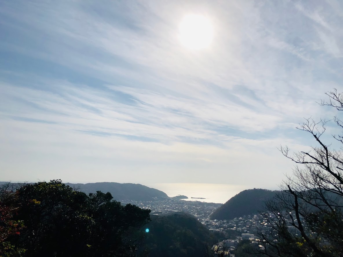
If you use the JR Shonan Shinjuku line to Oiso station you will arrive in about 1 hour from Shinjuku, the scenery you see from Mt.Koma crossing Oiso town and Hiratsuka city is a magnificent view, you can see Enoshima island and Mt.Fuji.
In the trail of about 5.7 km in length, you can enjoy trees unique to warm regions, and even after trail running you can swim at the beach at the beach.

JR Oiso station
JR Ooiso station
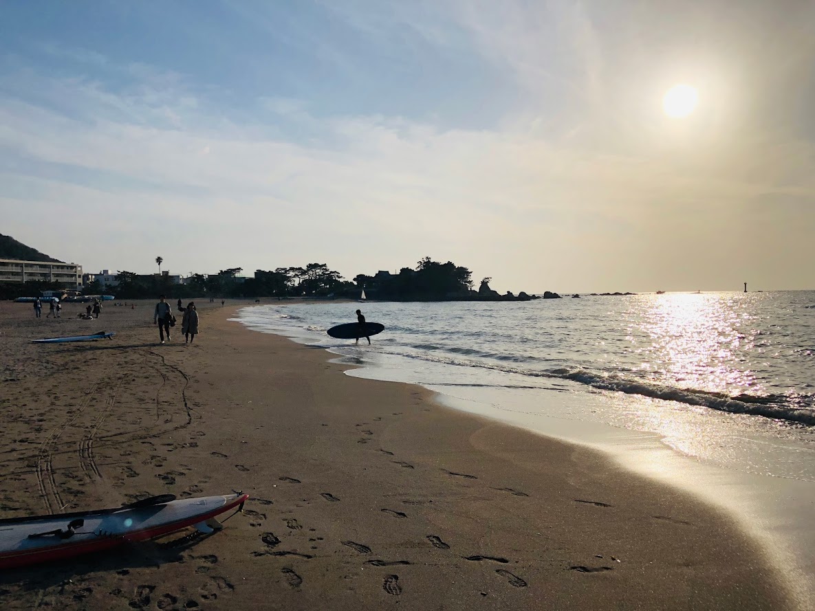
Oiso station is the station of JR The Tōkaidō Main Line in Kanagawa prefecture, there is “Oiso beach” near the station so if you bring swimsuit in the summer you can enjoy the swimming.

Mt.Koma nature trail

When you arrive at Oiso station, go right along the railway track, pass through under the guardrail and go up the Slope and you will find Takada Park, and the trail will start from the right back of this park.

The view from Takada Park is also wonderful.

Mountain trail to Mt.Koma

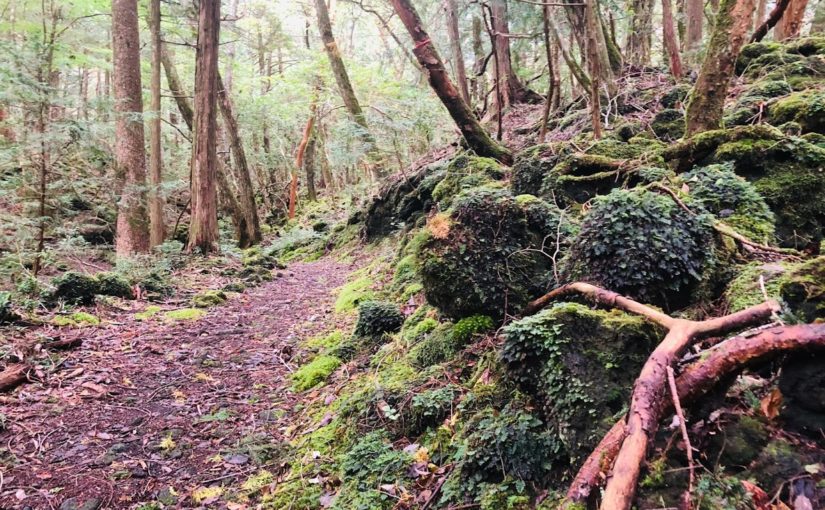
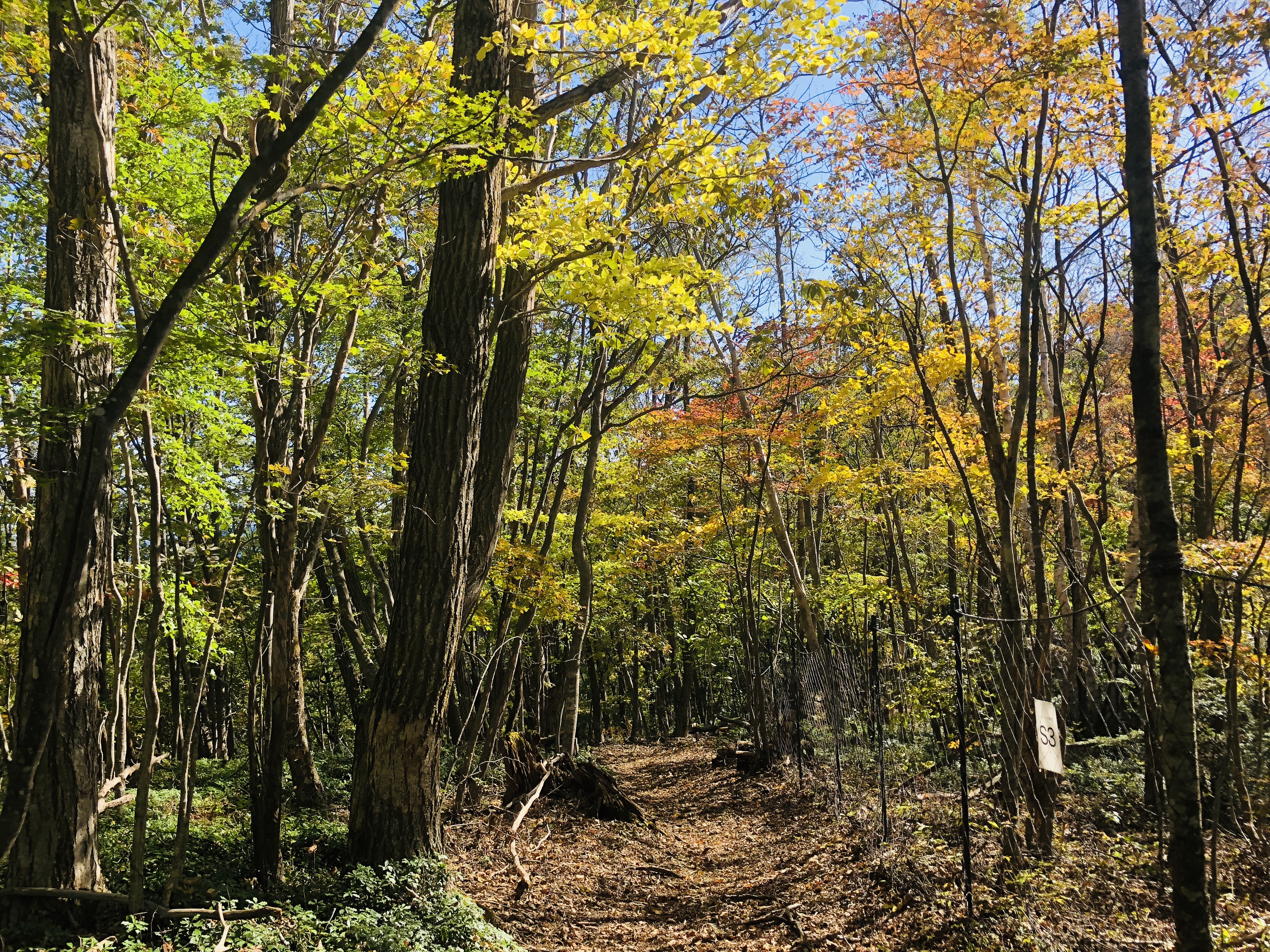
The trees live in warm areas such as evergreen trees and “Litsea coreana”, and it is a beautiful natural road.

You can enjoy a hydrangea trail in June.

A radio tower of Shonandaira

As you climb a gentle slope, you will see a radio tower on the left.
It is the ridgeline of “Shounandaira” and “Mt. Koma”, and turning to the left is “Shounandaira”.
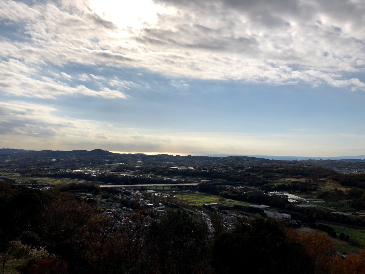
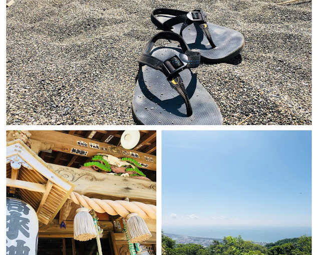
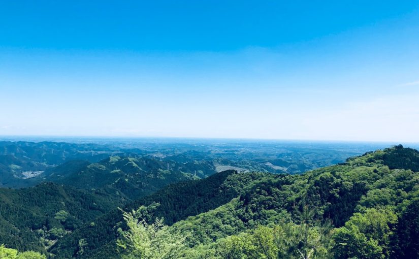
View from Shonandai


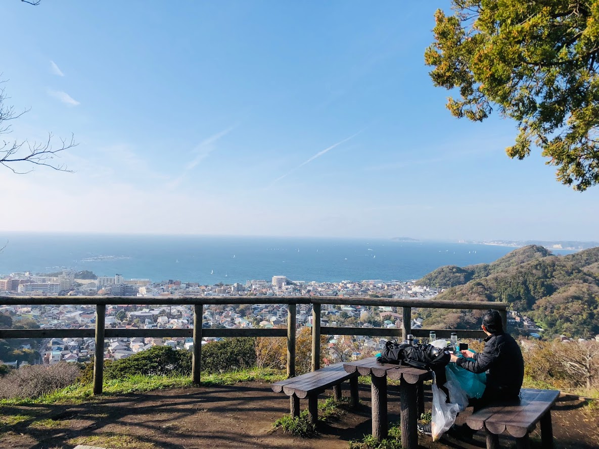
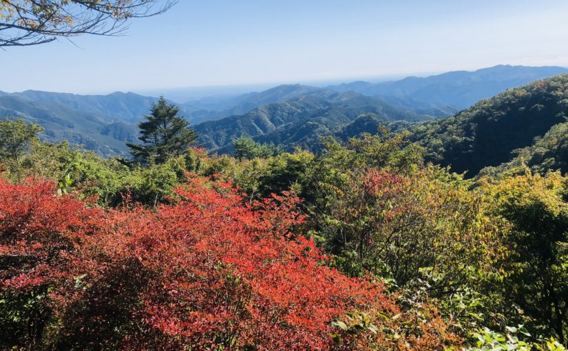
The 360-degree view from “Shounandai” is really wonderful overlooking Mt. Fuji, the Boso Peninsula and the mountains of Tanzawa.
“Shonandai” has a restaurant, you can enjoy fish cuisine caught locally while looking at magnificent scenery.

The sumitt of Mt.Asama

It goes via ‘Mt. Asama’ with big tree of enoki and shrine.

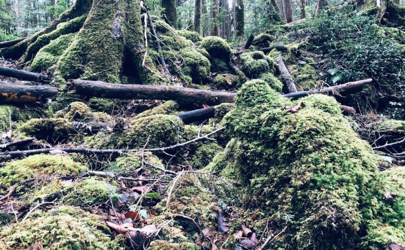
There is a quiet and peaceful trail surrounded by woods, resting places are dotted in some places.

The sumitt of Mt.Koma

There is no prospect of the mountaintop of Mt. Koma, but there is a mysterious atmosphere with remains of an ancient castle wall.
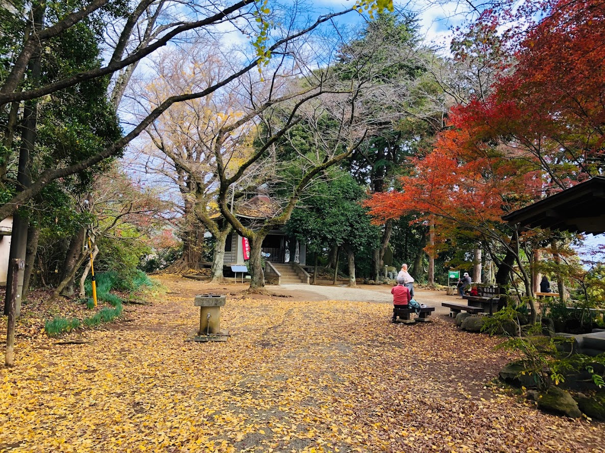
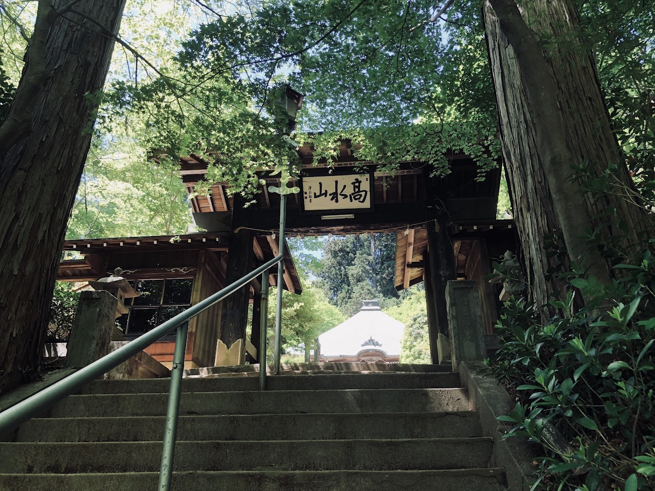
Takaku Shrine
Takaku Shrine

Torii of Takaku Shrine
It is a shrine founded in 717.
In the Kamakura period there were 24 temples in the mountains of Mt.Koma rising behind the temple.
Until the end of the Edo era the whole mountain was protected as a spiritual area of Temple.
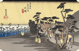
Pine trees

From the “Takaku Shrine”, when entering the national highway, rows of trees of pine and enoki are lining up. This area is famous as “Old Tokaido” continued to Osaka in the Edo period, and it is also the stage of Hiroshige’s “Oiso Toragaame” famous for “Ukiyo-e”.
Oiso Toragaame

Oiso Beach

It was the first Japanese beach in Japan that was established in 18th Meiji era.
It is a popular spot for families and couples. Moreover, it is around 10 minutes even if you walk from JR Oiso station.
Shower is also installed, so let’s bring swimsuit and enjoy the swimming!

If you are looking for tour guide of this trail running course please refer to the following.

Mt.Koma Private Hiking Tour in Ōiso

Trail Running to Kamakura Diabutu(Great Buddha) Hiking Course

Daibutsu Hiking Course is a trail packed with highlights that connects ‘Jouchiji Temple of Kitakamikura’ and the symbol of Kamakura ‘Great Buddha’ which stands on the grounds of Kotokuin Temple.

It is a course with a great relief and a running distance of about 3 km in total length. Please avoid leather shoes and heels.
This trail which is representative of Kamakura very popular from trail running beginners to advanced people.

If you have plenty of time you can enter the hot spring in the ocean view and relax and return home.

Kamakura is a popular tourist destination to arrive in about 1 hour from Shinjuku. You can see lots of old shrines, temples and Japanese garden and enjoy various types of Japanese restaurants.

JR Yokosuka Line “Kitakamakura station”
JR Yokosuka Line "Kitakamakura station"

area:
Kanagawa Prefecture South of Tokyo
Genre:
Trail Running
LEVEL:
Beginner
Traveling time (not including breaks):
3 hours 30 minutes
Distance:
About 8km
Maximum elevation difference:
100m
Access:
JR Yokosuka Line「北鎌倉駅 Kitakamakura  station」
 Return:
Enoshima-dentetu  Line「稲村ケ崎駅 Inamuragasaki  station」


※It is an outline of the approximate course, please note that it is not completely correct guidance.

There is a map of today’s course in front of the station.
a map of Hikking trails

Leave the station and turn to the left.
the Road in front of the KItakamakura staition

It goes through several temples by Jouchiji Temple for the purpose.
Gate of Toukeiji Tenple

Turn right at this sign.
sign

Jouchiji Temple is more attractive than nature’s famous Zen temple, nature is deep and wild
Jouchiji Temple

Admission fee 200 yen.Jouchiji Temple

Continue along the bamboo stuff on the side of Jodiji Temple.
the bamboo stuff on the side of Jodiji Temple

It turns into a mountain path from this neighborhood.
entrance of Daibutsu Hiking Trail

a mountain path

Probably it is a squirrel on the way of the trail, if you hear strange cries from the trees.
Daibutu Hikking trail

I will arrive at the Kuzuhara shrine after going on a steep slope for a while.
sighn of Daibutu Hikking trail

a pond of Kuzuharaoka Temple

Kuzuharaoka Temple
Aizuchiinari Temple
Kuzuharaoka Temple

In the park adjacent to the shrine, a bench is set up and it is ideal for taking a break.
In the park adjacent to the shrine

It is a view which can see the city of Kamakura.
the city of Kamakura view

Nearby there is a grave of Toshimoto Hino which is a god of Kuzuhara Oka Shrine.
a grave of Toshimoto Hino

Let’s follow the signs of Daibutu Hiking Course (大仏ハイキングコース).
the signs of Daibutu Hiking Course

It is a luxurious view with sea view.
sea view

There is a cafe “Ituki” on the trail.
a cafe "Ituki"a cafe "Ituki"
Daibutu Hiking trail

Koutokuin which there is a great Buddha is 400 meters away.
Daibutu Hiking trail

As you get off the stairs you have a tunnel so please go down the slope without going to the tunnel side.
the end of the Daibutu Hiking trail

Kotokuin entrance fee is 200 yen.
Kotokuin entrance
Kamakura Daibutu

It is a famous Kamakura Great Buddha.
Kamakura Daibutu

You can enter the inside of the Great Buddha with an admission fee of 20 yen.
the inside of the Great Buddha

the Great Buddha

There are many restaurants and souvenir shops around Kotokuin.
souvenir shop

Kamakura gelato is a popular gelato shop.
Kamakura gelatoKamakura gelatoTriple gelato is 520 yen.Kamakura gelato

Hase Temple is called the western paradore of Kamakura, a Hase-ji temple that is popular as a “flower temple” throughout the year.Hase Temple
the garden of Hase Temple
flowers of the Hase Temple
the Hase Temple
the Hase Temple
the Hase Temple
japanese garden of the Hase Temple
Cute jizo

Hydrangea was beginning to bloom at this time.
Hydrangea
Senju kannon
Hase Temple
Hase Temple
Cave of Hase Temple
Cave of Hase Temple

It is said that it will come true if you write a wish in an ema.
ema

You can also enjoy a beautiful Japanese garden.
beautiful Japanese garden of Hase Temple
Kresannsui is a garden style that expresses the landscape of mountain water with stones, sand, etc. without using water such as pond and sewage.
beautiful Japanese garden of Hase Temple

Next to Hase Sta. There is “Haseka Shokudo”.
Haseka Shokudo

We will have beer at “Hase Shokudou”.
beer at "Hase Shokudou".
Raw Shirasu bowls will be served at soy sauce.
Raw Shirasu bowls

You are going to the sea in a few minutes from Hase Sta.
Yuigahama Beach

Let’s go to the seaside (to the right) and go to the hot spring if you have time!
Yuigahama Beach

The first floor of Inamuragasaki Onsen is a restaurant.Inamuragasaki Onsen

Let’s relax at the hot spring in the ocean view.
hot spring in the ocean view

Enoshima Dentetsu Railway “Inamura Gasaki Station”Inamura Gasaki Station

If you are looking for tour guide of this trail running course please refer to the following.

Private Trail Running Tour in Kamakura Daibutsu Hiking Course

Kita-Kamakura Ten-en Trail Running

What is Kamakura’s Tenen Trail?

How about Kamakura trail running for only 1 hour by train from Tokyo?
Once serving as a holy trail for Shugendou priests, the Kamakura’s Tenen Hiking Trail along the so-called Kamakura Alps with its highest point Ohhirayama, 159.2meters(about 522 feet) above sea level, is the most popular hiking trail in Kamakura.
Hiker will be able to enjoy a view of Sagami Bay and Mt.Fuji, and visit cave tombs and other historic spots along the trail that about 5.5 kilometers or 3.4 miles stretching from Imaizumidai to Zuisenji.
This running route is accessible from several point: Hansobo 半蔵坊 on the premises of the Kenchoji Tenple(an admission fee of 300yen required to enter the tenple), the trail exit near Zuisenji.
It will take two to three hours to enjoy the trail.

Kamakura’s Tenen Trail ~ Okuzashiki of Kencho-ji Temple, To Hansobou

Here we will guide the trail in the direction heading from the Kenchoji Tenple to the Zuisenji Temple in kamakura.

First off is Kitakamakura station(East Entrance)Kitakamakura station(East Entrance)

area:
Kanagawa Prefecture South of Tokyo
Genre:
Trail Running
LEVEL:
Beginner
Traveling time (not including breaks):
2 hours 30 minutes
Distance:
About 7km
Maximum elevation difference:
100m
Access:
JR Yokosuka Line「北鎌倉駅 Kitakamakura  station」
 Return:

JR Yokosuka Line「鎌倉駅 Kamakura  station」

Before Kitami Kamakura Station, it is a famous scenic temple”Enkakuji Temple”.Enkakuji Temple

Kenzoji Temple
In addition, although it is natural, since the Ten-en course passes through the precincts of Kenchoji temple, an admission fee is required. (Pay 300 yen)entrance of Kenchoji temple
Gate of Kenchoji temple
本尊地蔵菩薩坐像 honzonjizou bosatu zazou
雲龍図 Unryuuzu
Beautiful japanese garden of Kenchouji
Flowers of Kenchouji
唐門 Karamon
Guide board to hiking course

When going to the direction length of Kencho-ji and passing too far, it becomes small diameter. It is a Hanzoubou road leading from here to Hanzoubou.
a Hanzoubou road leadinga Hanzoubou road leading

They are Hanzoubou Tengu! The Hanzoubou shrine is coming soon.Hanzoubou Tengu
Mural

Hanzoubou located at the far end of Kenchou temple, where the whole valley is in the precincts. When you climb up the curved stone steps, the statues of the Tengu line up, creating an atmosphere different from the Zen temple like the Kenchou Temple at the foot.From Hanzoubou View

Well, once you pass through the Hanzoubou, you enter the real mountain road. It is about 5 minutes from here to the winning dedicated observation deck. And about 2 hours to Zuisen temple.

Let’s follow the signs of Tenen-Hiking course.
the signs of Tenen-Hiking course

I will advance the violent path of up / down. Tenen Hiking trail

My mood is Indy Jones!Tenen Hiking trail
Tenen Hiking trail
Tenen Hiking trail
The destination zuisen temple is 3.2km away.Guide Bord
There are narrowing, undulations.Tenenn hikking trail
Let’s enjoy a trail like a sense of athletics!Tenenn hikking trail
Finally arrived. Go through the mountain road that continued from Hanzoubou to the top of Mt. Oohira! Ten-En is a sighty square.the top of Mt. Oohira view
flowes

You can purchase beer, soft drinks and snacks at the Ten-En resting place, if it openned.the Ten-En resting place
Tenen hiking trail
After running for about an hour the mountain path will end.end of Tenen hiking trail
It is Zuisenji temple right after exiting the road from the mountain road.an admission fee is required. (Pay 200 yen)

 Zuisenji templeThe stairs of Zisenji TempleIt is almost like a Japanese garden on the moon of Zuisenji Tenple.a Japanese garden of Zuisenji Tenple
a Japanese garden of Zuisenji Tenple

Onigawara
It is Kamakuraguu as he goes down the road for a while from Zuisen temple.Kamakuraguu
Apart from Kamakuraguu, there are many temples around here.many temples
After running for a while, the most famous Tutuokahachimanguu in Kamakura appears.Tutuokahachimanguu
Tutuokahachimanguu
Tutuokahachimanguu
Tutuokahachimanguu
There are many restaurants and souvenir shops around Tutuokahachimanguu.
We toast with German beer and sausage shop “Chouzume Ya”.German beer
sausage
The road that leads from Tutuokahachimanguu to Kamakura station is called “Komachi Street”, and many shops and shops line up.Komachi StreetIt is a popular Matcha ice cream shop “Kamakura Chacha”.Matcha ice cream shop "Kamakura Chacha"
You can choose the concentration of Matcha in your choice.Matcha ice cream

Eating out to Kamakura station is fun!Kamakura beerInarizushi

I arrived at Kamakura Station. Congratulations!

Do you need a guide for this hiking course?

If you are looking for guide of this hiking course, please refer to the following.

Trail Running Private Tour for Kamakura’s Tenen Hiking Trail

Kamakura Station

Takamizu Three Peeks Trail Running in Okutama, Tokyo

This is popular course of Okutama which walking in three peaks.
With about 4 hours of walking, It is a luxurious course that you can taste three mountain peaks, “Mt. Takizumi”, “Mt. Iwatakeishi” and “Mt. Sougaku”.

Easy access with public transportation is also GOOD!

It takes  about 1 hours and a half by train from Shinjuku to Okutamashinjuku station


area:

Western Tokyo(Ome city)
Genre:
Trail Running
LEVEL:
Beginner
Total runnig time (not including breaks):
runner:2 hours and 30 minutes
Distance:
About 9.4km
Maximum elevation difference:
573m
Access:
Forward:JR Ome Line「軍畑駅 Ikusabata station」
Return:JR Ome Line「御嶽駅 Mitake station」


JR 軍畑 Ikusabata station~高源寺 Kougenji Temple(about 30 minutes)

軍畑 Ikusabata Station to 高源寺 Kougenji Temple we walk on a general road where gentle climbing continues. The Hiramizo River flows on the right side of the road, making you feel cool. There is a toilet for 1 person in the Kougen temple.

Start from JR IkusabataJR Ikusabata station

Take the road sign in front of the station toward “Mt. Takamizu 高水山”.in front of Ikusabata station

You will cross a Railroad crossing.
Railway crossing of the Ome Line

Go down the slope and turn left.
Follow the road to the left

Let’s go straight ahead along the Hirakiga River.
Hirakiga River

When the sign of “Mt. Takizumi” appears, proceed to the left.
signpost toward "Mt. Takizumi 高水山"

Let’s proceed straight.
dousoshinn

Kougenji Temple is going to the right on the parting road of the photo.
Y-way

Arrive at Kougen temple
Kougenji temple

Kougenji Temple~Mt. Takamizu 高水山(about 60 minutes)

The altitude difference of Mt.Takamizu from the Kougenji temple is about 400 meters. Probably the first 30 minutes rise is a bit tough. Top of the Mt.Takamizu is surrounded by trees and the view is not good, but a benches and toilets are installed.

You will further climb the slope.
Wisteria flowers

This is the entrance of trail.
Mountain entrance

Finally to the mountain path.
mountain path

Let’s advance the cedar forest.
cedar forest

Be careful of the protruding root!the cedar tree root

Proceed to “Joufukuin Mt.Takamiz 常福院 高水山” direction.
「Joufukuin Mt.Takamiz 常福院 高水山」 direction

Arrive at 常福院 Joufukuin.
常福院 Joufukuin tenple

joufukuin main holl
Guardian dog
The guardian dog that sits on the left and right in front of 不動堂 Fudo-Do is a stone statue of Japanese dogs.
Even if you see it from the side or from the side it is a Japanese dog, the tail is wrapped like a Japanese dog, but the expression of the fangs and tortoise is like a wolf.
Although it is a Japanese dog, I feel that I am arranging for a wolf style somehow.
This is probably because the land is near the dog’s faith Musashi (Okutama, Chichibu), so that the characteristics of the wolves were added to the Japanese dog.

jizo

There is a toilets aside.Plaza

If you climb up a little, it is the top of Mt.takamizu.
the top of Mt.takamizu

Mt. Takamizu 高水山~Mt. Iwatakeishi 岩茸石山(About 35 minutes)

The mountain top of Mt.Iwatakeishi is the most prospective place in this course, You can see the mountains of Oku Musashi. Let’s have a good break at the summit of Mt.Iwakushiis.

A little downward continues from the top of the mountain.A little downward

Proceed to “Mt.Iwatkeishi 岩茸石山” direction.
The signpost "Mt.Iwatkeishi 岩茸石山"

A flat ridge walk continues

Observation from the gaps in the treesObservation from the gaps in the trees

One step to the summit of the mountainOne step to the summit of the mountain

It is the summit of the highest “Mt.Iwatakeishi” among the three mountains
the summit of "Mt.Iwatakeishi"

Mt. Iwatakeishi 岩茸石山~Mt.Sougaku 惣岳山(about 40 minutes)

The way from Mt. Iwatakeishi to Mt. Sougaku is very rich with climbing rocks and steep climbs on the way.There are no toilets at both the mountaintops of both Mt.Iwatakeishi and Mt.Sougaku.

You will go down the steep slopethe steep slope

Move the signpost towards Mt.Sougaku 惣岳山
signpost"Mt.Sougaku 惣岳山""

There is also a little rock climbing
a little rock climbing

Let’s walk while paying attention to the root of the tree
the root of the tree

Arrive at Mt.Sougaku
Top of Mt.Sougaku Top of Mt.Sougaku2

Mt. Sougaku 惣岳山~JR Mitae station(about 60 minutes)

Let’s get down to the downhill for about an hour with sufficient care, as the root of the tree overhangs and there are plenty of steep slopes.

I will go down the climbing road where the root of the tree is exposedgo down the climbing road

Turn the signpost toward “Mitake station 御岳駅”
signpost "Mitake station 御岳駅"

A little shrine

The mountain path is already over in the endbamboo trail

You go to Temple of JionjiJionji Temple

“Tamagawaya” near Otaki station is a popular soba restaurant.
Soba shop "Tamagawaya" Goodwill of Tamagawaya Interior of Tamagawaya

It’s a popular menu “Ten Zarumori”Ten Zarumori

Beer is also good, but recommendation is local sake “Sawanoi”local sake "Sawanoi"

Strange daruma dolls are also uniqueStrange daruma dolls Strange daruma dolls2

At the end, break the soup with sobathe soup with soba entrance of Tamagawaya

When you come to the main street there is the Tokyo Metropolitan Government Information Office.the Tokyo Metropolitan Government Information Office.

There is shower rental in this facility.shower rental
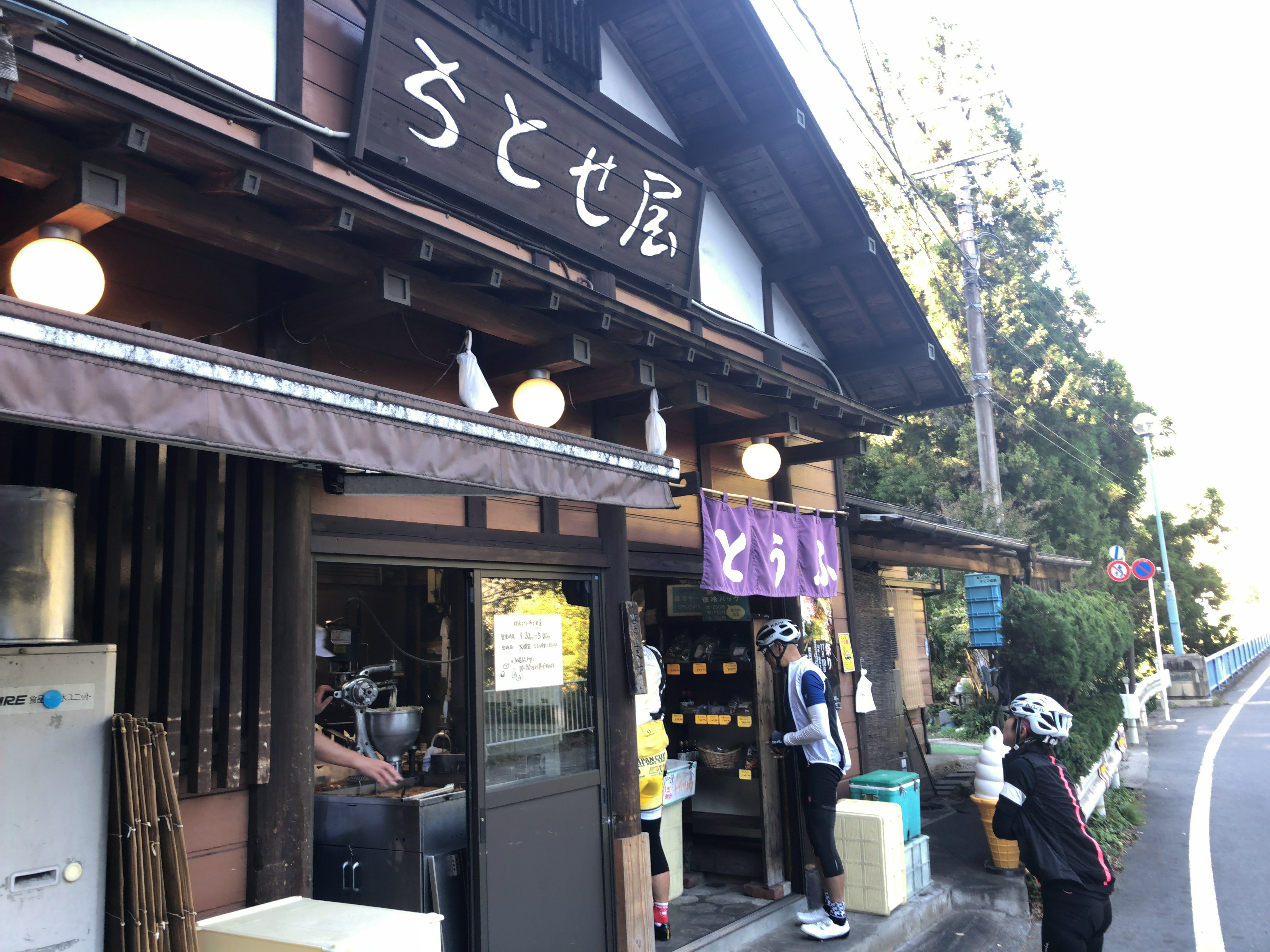
There are cafes, used outdoor goods stores, convenience stores, etc. along the street.used outdoor goods stores, convenience stores, etc. along the street.

Arrived at JR Mitake Station.

JR Mitake Station. Station home

Do you need a guide?

If you are looking for guide of this trail, please refer to the following.

Private Trail Running Tour of JPY3000 | Takamizu Three Peaks in Okutama Area

Trail Running To Mt.Sengen | Beach, Mountain And Sweets Can Be Enjoyed Simultaneously

Date of Mt.Sengen

Formal name: Sengen mount 仙元山
Difficulty of this trail: ★ ☆ ☆ ☆ ☆
Trail appearance rate: ★ ☆ ☆ ☆ ☆
Area: Hayama town, Kanagawa prefecture
Start: Kazahaya-bashi bus stop 風早橋バス停
Goul: Zushi station 逗子駅
Total distance: 10 km
elevation: 180 m
Total difference in elevation: 360 m
Walking time: 4 hours

Course Guide of Mt.Sengen

Trail of Mt.sengen
Trail of Mt.sengen
  1. Kazahaya-bashi bus stop 風早橋バス停
  2. Branch to church 教会への坂道分岐
  3. Mountain peak of Mt. Sengen 仙元山の山頂
  4. Branch of Mt.Oyama 大山方面の分岐
  5. MARLOWE Hayama store マーロウ葉山店
  6. Morido beach 森戸海岸
  7. Zushi beach 逗子海岸
  8. JR Zushi station JR逗子駅

Map of Mt.Sengen

the map of Sengen mount | Clicking the image will display the enlarged size with a new tab.

Access Guide of Mt.Sengen

Entrance of mt.sengen's trail
Entrance of mt.sengen’s trail

Shinjuku station as a departure place.

Shinjuku Station

JR Shonan Shinjuku Line (fast): 30 min

Yokohama Station

JR Yokosuka Line (Normal): 30 min

Zushi Station

Keihin Kyuko Bus: 7 min

Kazahaya-bashi bus stop

Transportation expense
2240 yen (round trip)

Advice of access

From Shinjuku Station you can use Zushi going to Shinjuku Shonan line.
If Keihin Kyuko is convenient, you can also get on the bus from Shin-Zushi station.
There are frequent buses to Kazahaya-bashi bus stop, so you can get on without having to wait much.

Features of “Mt.Sengen” Trail

The sumit of Mt.Sengen
The sumit of Mt.Sengen | If it is sunny, you can see Mt. Fuji.

Sengen mount is a low mountain that reaches the summit in about 20 minutes from the foot of mountain.
The view is excellent, and you can see Sagami Bay and Mt.Fuji from the summit at the same time.
It is not enough to stand on the summit so I added it to the course from Morito beach to Zushi beach.

As soon as we move in the direction of travel from Kazahaya-bashi bus stop, there is a Hayama tunnel.
Go to the intersection in front of this tunnel to the right, turn back the next signal and climb the “branch to church”.
When you walk a steep slope for a while it is Hayama church.

The trail of the Mt.Sengen’s trail starts from the left side of the church.
As you go along the ridge path surrounded by lucid trees, you will soon pass through the forest and arrive at the summit of Mt.Sengen.
There are benches, toilets and Juniperus chinensis trees on wide mountaintops, yachts floating on the sea of Sagami Bay, Enoshima and Mt.Fuji etc. can be seen.

If you fully enjoy the view, let’s go down the stairs by trail.
Once on the slope, it gets gentle again, goes down the stairs again and if you climb the steepest staircase in the course it is a peak of 189 m.

Nice view from the logging area

As soon as you cross the ridge after taking a rest, you will find “Branch to Mt.Oyama”.
Proceed on the right road, but let’s take a short rest there as you can see Mt.Fuji and the south west side from the logging area just above.

Go back to the bifurcation and go on a gentle slope.
As soon as you go to the right towards the Clean Center, you will have a branch to “Branch of the Cannon Mound and Jikkyo Temple”.
Go straight here and go down the next branch to the right.
After a while it will arrive at the observation deck where the sea can be seen, if you go down the groove style from here, it is a Jikkyo temple.
If you go between the private houses and go out to the national highway go to the right is the Hayama elementary school bus stop.
There is a MARLOWE Hayama store where the pudding is delicious in front of the bus stop.

To Morido beach, proceed to the left at the Mukaihara intersection and arrive at the coast, if you proceed along the sea as it is, you will find the Zushi beach.

Sweets and beaches after running…

Pudding of MARLOWE Hayama shop

MARLOWE Hayama shop

Continue making beaker pudding since its founding in 1984 is a popular product that can sell 2000 pieces a day. You can also eat in the cafe inside the store.

MARLOWE葉山
MARLOWE葉山

Business hours: 10 o’clock – 19 o’clock
Non-business day: Wednesday
Access: Hayama primary school bus stop in front
Tel: 046-875-0412

Morito Beach and Zushi Beach

Sunset of Morito beach

Morito Beach is a beach known as the shallow and calm waves of the beach that looks at Enoshima and Mt. Fuji. Morito shrine is enshrined in the beach.
The Zushi coast is a beautiful beach characterized by the shallow and calm waves in Zushi City, Kanagawa Prefecture.
There are many cafés and restaurants in the surrounding area, and there are many surfers and tourists crowded on holidays.

Beach combing at zushi beach

Do you need a guide?

If you are looking for guide of this trail running course, please refer to the following.

Private Trail Running Tour to Mt.Sengen Mountains and Beaches and Creme Caramel

Mt.Kobo (Kanagawa) | Easy Trail Running Course and Awesome view in Idyllic landscape

Date of Mt.Kobo

Formal name: Mount Kōbō 弘法山
Difficulty of this trail: ★ ☆ ☆ ☆ ☆
Trail appearance rate: ★ ☆ ☆ ☆ ☆
Area: hadano city, Kanagawa prefecture
Start: Hadano station on the Odakyū Electric Railway’s Odakyu Odawara Line 小田急線 秦野駅
Goal: Tsurumaki-Onsen station on the Odakyū Electric Railway’s Odakyu Odawara Line 小田急線 鶴巻温泉
Total distance: 7.3 km
elevation: 235 m
Walking time: 2 hours and 20 minutes

Course Guide of Mt.Kobo

An observatory stand on the summit of Mt. congen and autumn leaves
  1. Hadano station on the Odakyu Line 小田急線秦野駅
  2. Entrance of the trail ハイキングコース登山口
  3. Mt.Gongen 権現山
  4. Mt.Kōbō 弘法山
  5. Bifurcation of Zenba pass 善波峠への分岐
  6. Mt.Azuma 吾妻山
  7. Kobo-no-satoyu (hot spa) 弘法の里湯

Trail Map of Mt.Kobo

mt.kobo-map
Mt.kobo trail map | Clicking on the above image opens a separate tab and the enlarged image is displayed.

Features of Trail Running Course of Mt.Kobo

The summit of Mt. kobo has a well and you can drink natural water.

The trail running couorse of Mt.Kobo is a easy for hiking course with hot springs at end of the course, with a small mountains with an altitude of around 200 – 300 m that is easily accessible from Hadano Station on Odakyū Odawara Line.

This course is a perfect course for the beginner of hiker as a gradual slope continues.
If the weather is good, you can enjoy the view of Mount Fuji from the top of Mt.Gongen.
You can also enjoy the panorama overlooking Sagami Bay and Izu Peninsula.
Also, as the snow does not accumulate so much during the winter, you can enjoy running in a idyllic Satoyama landscape all year long.

Hot spring “Kobo – no – satoyu” at the end of the course is a natural hot spring that you can use on a day trip, enjoying an outdoor bath, you can relax slowly in a spacious tatami room on the 2nd floor,
This hot spring is in front of the Tsurumaki Onsen Station on the Odakyu Line, returning home is also easy.

“Kobo-no-satoyu” Official Website
http://spa-tokyo.net/z-k-tsurumakionnsen-koubounoyu/index.html

It is a wonderful course that you want to visit many times once you remember because you can enjoy running easily.

If it is fine, you can see from Mt.Gongen to Sagami Bay and the Izu peninsula.

After running you can enjoy natural hot springs

It is a dense hot spring with a component that warms the body very much with good quality hot water containing a lot of calcium.

Bathing fee
Weekday: 1000 yen a day
Two hours 800 yen
Saturday · Sunday · Holidays: 2 hours 1000 yen

Tel: 0463-69-2641

Business hours: 10 a.m. – 9 p.m.
(From December 28 to December 30 and January 1 to January 3, until 5:00 pm) Note: Reception is open 30 minutes before

Non-business day: Monday (next weekday in case of holiday), December 31
Access: 2 minutes on foot from Odakyu Line Tsurumaki Onsen Station

Access Guide of Mt.Kobo

Mt. kobo's trailhead is about 15 minutes walking from the north exit of Odakyu Odawara line hadano station.
Mt. kobo’s trailhead is about 15 minutes walking from the north exit of Odakyu Odawara line hadano station.

Shinjuku station as a departure place.

(On the way)
Shinjuku Station


Odakyu Line Rapid-Express (For Odawara): 68 min, 670 yen

Hadano Station

(On the way back)
Tsurumakionsen Station

Odakyu Line Rapid-Express (For Shinjuku): 65 min, 590 yen

Shinjuku Station

(Transportation expense)
1260 yen (round trip)

Do you need a guide?

If you are looking for guide of this running course, please refer to the following.

Mt.Kobo Easy Course in Idyllic landscape | Private Trail Running Tour JPY3000

A mysterious castle in the suicide forest ( 2018.11.03 )

When I went to Fuji’s Jukai on November 2, 2018, I found a stone wall like a castle wall in the forest of Jukai.

It seems to be the ruins of Motosu castle in the Kai era of the warring States era (1532 – 1555) later examined.
The country of Kai is the area of Yamanashi prefecture now, Motosu close to the border of the country of Kau Kai at that time Nakamichi Highway, there was a road Nakamichi, it seems there was a main castle as a key point to protected it.
I feel romance when thinking about a castle ruin which is about 400 years old or more.

Trail running at Sengen-one-ridge’s long down hill in Okutama

Course Date

Difficulty of this trail: ★ ☆ ☆ ☆ ☆
Trail appearance rate: ★ ★ ★ ★ ★
Start spot: Tomin-no-Mori Bus Stop 都民の森
Goul spot: Hossawa no taki iriguchi bus stop 払沢の滝入り口バス停
Total distance: 15.7 km
Total difference in elevation: 963 m

Course overview

Go through the pleasant forest of a single track with few ups and downs.

1). Hinohara-Tomin-no-Mori Bus Stop 檜原 都民の森

2). Sengen-One Ridge Parking 浅間尾根駐車場

3). Sengen-One Ridge 浅間尾根

4). Sengen-One Ridge Resting Place 浅間尾根休憩場

5). Hossawa no taki iriguchi bus stop 払沢の滝入り口バス停

Map of “Sengen-One” course

sengen one hiking course map
Clicking the image will display the enlarged size with a new tab.

Access

"Tomin-no-mori" is the entrance of a trail to Mt. Mitou popular with hikers. Hiking routes are stretched all around in this area, but let's proceed to "Kaze-hari-touge 風張峠" in this area.
“Tomin-no-mori” is the entrance of a trail to Mt. Mitou popular with hikers. Hiking routes are stretched all around in this area, but let’s proceed to “Kaze-hari-touge 風張峠” in this area.

JR Musashi-Itsukaichi Line End · From Musashi-Itsukaichi Station, take the West Tokyo bus to “Tomin-no-Mori Bus Stop 都民の森 バス停” for about 1 hour and 10 minutes.
On the way back, “the Hossawa no taki iriguchi bus stop払沢の滝入口 バス停” is used.
Or if you move to “Moto-shuku-yakubamae bus stop 本宿役場前 バス停”, the number of buses is large.
There is a free parking lot in “the Hossawa no taki iriguchi 払沢の滝入口”.

ADVICE

There is no public drinking fountain to the end of the course.
However, since there is a shop, vending machine, and toilet in the starting point “Tomin – no – Mori”, you can prepare here for running.
There is a lot of escape route to paved road called Hinohara – Kaidou in the way of Sengen – One, so beginners are safe course.

Features of “Sengen-One” course

The origin of the name of the ridge, "Sengen-One Ridge" is the highlight of the course.
The origin of the name of the ridge, “Sengen-One Ridge” is the highlight of the course.

This course is known to special people, you can down hill like crazy.
If you are thinking that “climing is the best part of trail running”, “You have ups and downs in life”, for such a trail runner, this course can not be recommended. (I’m sorry)
Because the bus carries you to a high place, the course is generally in descending and on the way it is a runable trail with a flat part of about 5 km.
Therefore this course will be the best course for your trail running debut in Tokyo.

First of all,
Depending on the signpost in “Tomin-no-mori” you will go to “Saiguchi-Touge 鞘口峠”
It’s just a fine climb up to your warm-up.
Let’s proceed from “Saiguchi-Touge 鞘口峠” to “Kaze-hari-Touge 風張峠”.
As you go about 1.5 km, if the signpost of “Sengen-One 浅間尾根” appears, proceed to “Sengen-One 浅間尾根” direction.
Let’s move carefully since there are parts where the trail around here is collapsing.

Once you leave the paved road and enter the trail again, the downhill of “Sengen-One Asama Ridge” will begin.
Because this trail is easy to run anyway, it is a satisfying course for those who want to run alone, those who want to enjoy at their own pace, both types of people.

Furthermore, since there are many escape routes and signs are substantial, I really recommend it for debuting trail running in Tokyo.

It is certainly inconvenient that the bus is indispensable to the starting point of the trail, but thanks to that, the course has few people crowded.
Moreover, it is mostly gentle downhill, mostly single track, you can monopolize luxurious course.
Perhaps you will face your face with your colleagues and say “Feel so good!”

After running…

Hinohara-Tofu Chitose-ya

Tofu store in front of “Hossawa no taki iriguchi bus stop”.
Tofu using Hinohara’s source water and Hokkaido soybean is a rich flavor.
We also recommend popular menu fried donuts and soy milk, both of which are 100 yen.

Do you need a guide for this trail running course?

If you are looking for guide of this trail, please refer to the following.

Private Trail Running Guide to Sengen Ridge | Beautiful Long Down Hill in Okutama

Mt.Fuji Aokigahara Jukai Trail Running

What you can experience at this Course :

・Mt. Fuji magnificent view
・Ice hole created about 1,000 years ago
・Mysterious and beautiful Aokigahara Jukai
・Hot spring while watching Mt. Fuji

Jukai’s running course :

jukai
jukai

The Aokigahara Jukai is a vast primitive forest spreading over Lake Motosu, Lake Saiko, Lake Shoujin, which is the foot of Mount Fuji.

On this day I started from the side of Lake Motosu, passed by Lake Shoujin, stopped by ice hole and the highlight looked at Lake Saiko from Kouyoudai.
I could completely relax at the goal’s hot spring, because in this hot spring I can soaking in a natural hot water while looking at the magnificent view of Mt.Fuji.

A landscape with 300 years old trees such as fir and beech growing on the lava flows is beautiful and you can enjoy a mysterious sight as if you landed on another planet that is not the earth.

If you believe that you get lost if you go to Jukai it is a mistake.
The hiking road is well maintained and easy to understand and it is not easy to get lost as it is installed along the national highway.
People who are likely to get lost are people who ignore hiking roads for the purpose of collecting mushrooms and wild plants.

There are some ancient ice holes in jukai.
The Narusawa ice hole which I visited that day is a natural cave that was created about 1,000 years ago and you can experience the world of ice with an average annual temperature of 3 degrees.
If you will visit at Jukai for trail running, you can cool down your body that burned for the running at this ice hole.

Also,
On Kouyoudai, you may be able to see the magnificent view of Mt.Fuji that is colored with autumn leaves. (If you visit in early November. )

Since the goal is a hot spring, you can take a return trip after healing the tired body slowly.

Difficulty of this course :

It is Beginners Level.
Although there are some ups and downs, it is a relatively flat road of about 15 km.
This course is recommended for your trail running debut.

Belongings :

· Shoes for trail running
It is okay if you do not have shoes for trail running.
However, please be aware that there are some uneven parts.

· Backpack for trail running
It is okay if you do not have a backpack for trail running.
However, a backpack that is easy for you to run is good.

·water

· Light snacks (rice balls, sandwiches, etc.)

· Clothes for cold weather
Windbreaker etc…

·towel

· Change clothes (if you will visit hot spring.)

· Others you need in the mountain …

Schedule of the day :

Mt. Fuji station (9:30) → departure from the bus (9: 50) → Lake Motosu (10:50) → trail entrance (11:10) → snack break (13: 00) → Narusawa ice hole (14: 00) → Kouyoudai (15: 00) → hot spring (15: 30)

Jukai Hiking Map :

Jukai Hiking Map | Click on the image above and you can see the enlarged version.
Recommended after running :
Fuji viewing hot spring Yurari | 富士眺望の湯 ゆらり

Address :
8532-5 Narusawa village South Tsuru County, Yamanashi Prefecture
Tel:
0555-85-3126
website:
https://www.fuji-yurari.jp/
Map:

Closed:
open 365 days per year
Business hours:
10: 00 ~ 22: 00 Reception is until 21:00
Usage fee:
(Rental bath towel with face towel)
■ 10: 00-19: 00
Weekday 1,300 yen Saturday, Sunday and public holidays 1,500 yen
■ 19: 00-22: 00
Weekday 1,100 yen Saturday, Sunday and public holidays 1,300 yen

Do you need a guide for this hiking course?

If you are looking for guide of this trail, please refer to the following.

Private Trail Running Guide to Aokigahara | Explore the Sea of Trees!

Oku-Musashi Nature Trail Runnig | Gentle trail from Kitamuki jizou to Mt. Hiwada

About Oku-Musashi Nature Trail

Oku-Musashi is a generic term for the mountains and hilly areas in the southwestern part of Saitama Prefecture.
Oku-Musashi Nature Trail is a natural sidewalk in there.
It is a hiking course of about 11 km in length connecting Kamakita Lake, Kitamuki jizou, Mt.Mooni, Mt.Takasasu-yama, Mt.Hiwada, Kinchakuda, Koma Pass, Mt.Tenran, which is a landmark of Oku-Musashi.
It is suitable for trail running because it is a trail that is easy to run with a relatively gentle slope.

Paved road on the way to Kitamuki jizou

Map of Oku-Musashi Nature Trail

Map of Oku-Musashi Nature Trail
↑ Click on the image to enlarge. Open link in a new tab.

Schedule of the day:

Seibu Lailway Musashiyokote Station(9:05)

Gojo Falls(9:45)

Kitamuki Jizoson(10:20)

Mt.Hiwada(11:20)

Kinchakuda(12:00)

Lunch break

Koma Pass(13:00)

Lake Miyazawa hot spring Kirari-bettei(13:30)

Gojo Falls was off limits on this day, I did not know whether I will come in the future or not.
The outlook from Mt. Hiwada is wonderful and Kinchakuda had a festival of Cluster amaryllis and it was very crowded.

Kinchakuda's Cluster amaryllis
Kinchakuda’s Cluster amaryllis

After trail running:

After the running is over, I ran from the end point of Koma Pass and got to a hot spring about 30 minutes.
This hot spring is named “Miyazawa Lake Spa Kiraku-bettei”, the bathing fee of the hot spring is 1000 yen.
From Hot Springs to Hanno Station is about ten minutes by bus.
Buses are about 1 to 2 per hour.

Miyazawa Lake Spa Kiraku-bettei