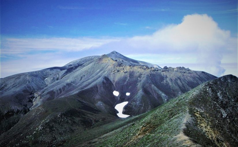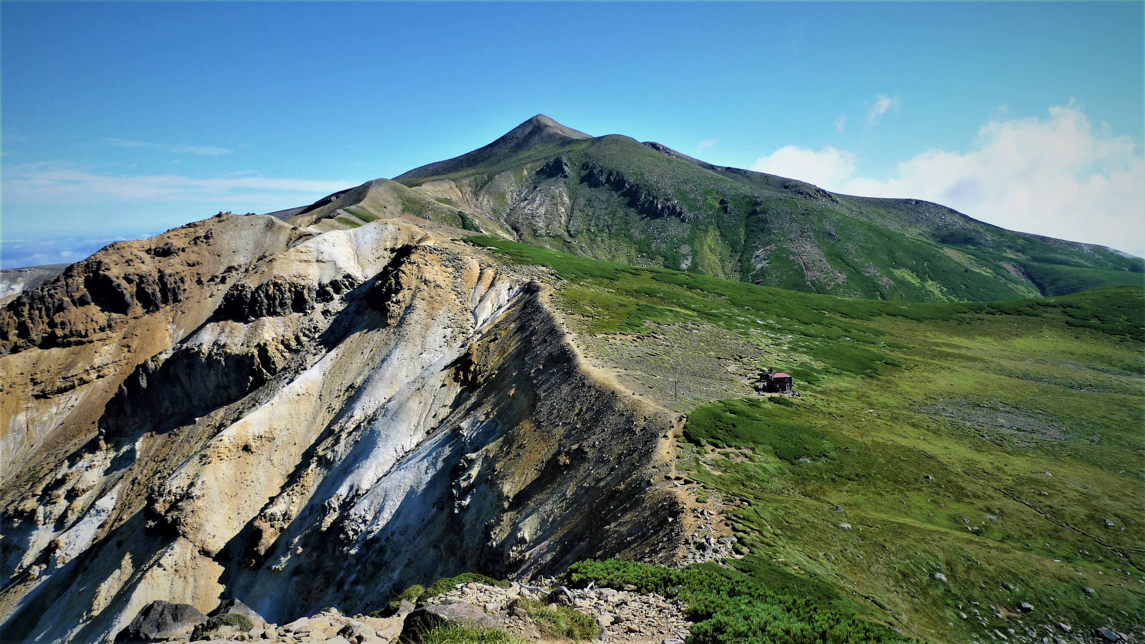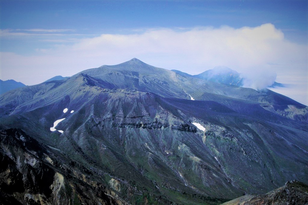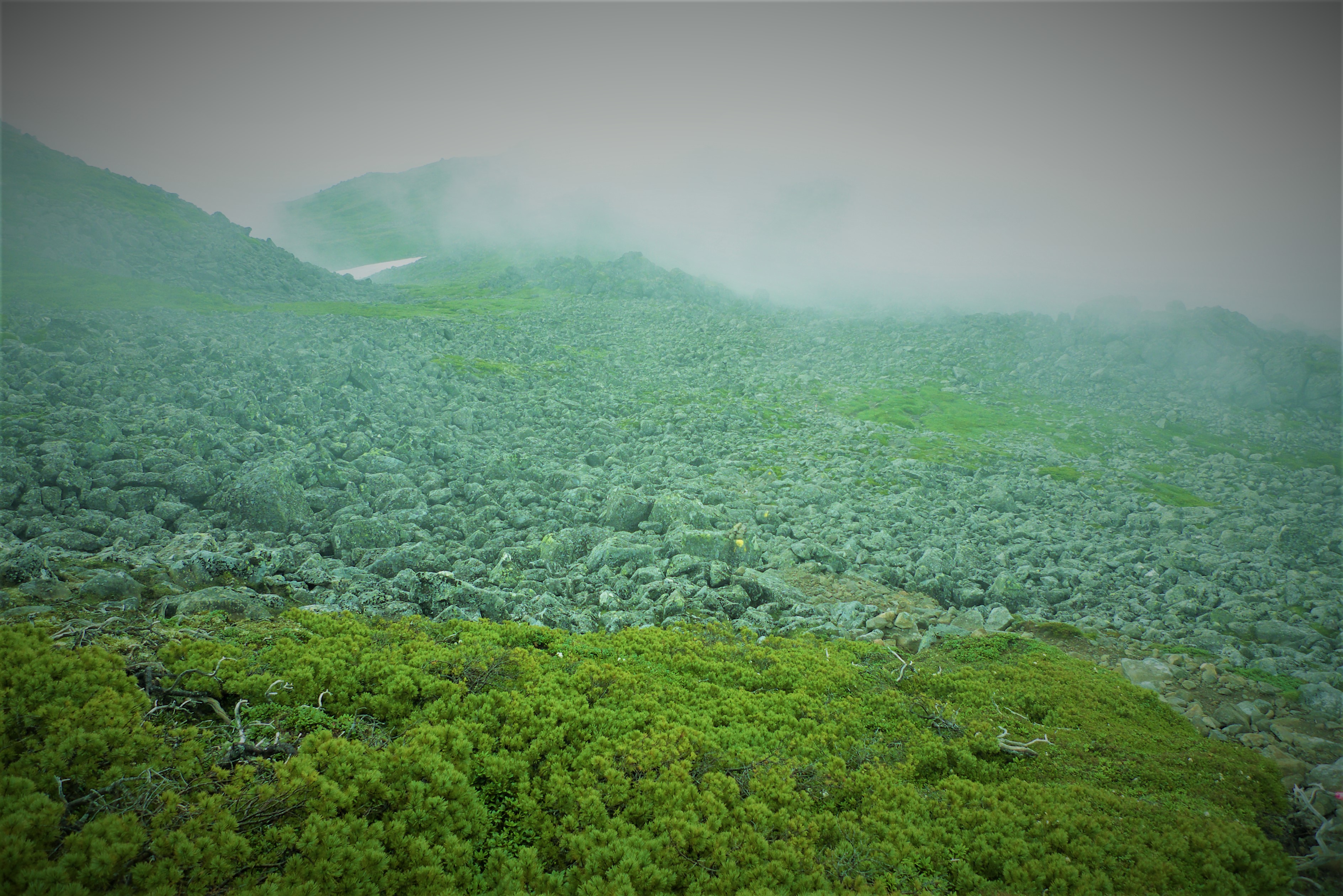
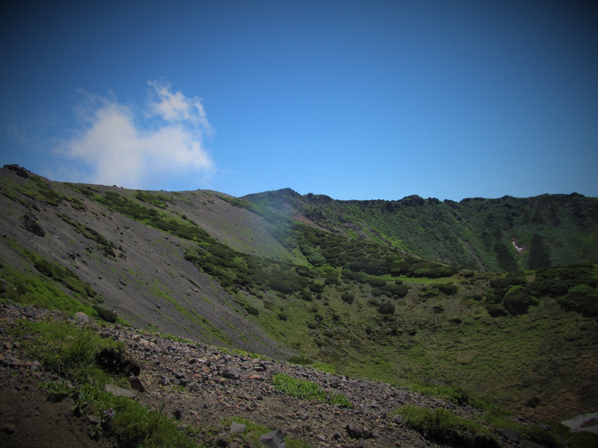
Walking through the alpine plants trail designated as national nature treasure
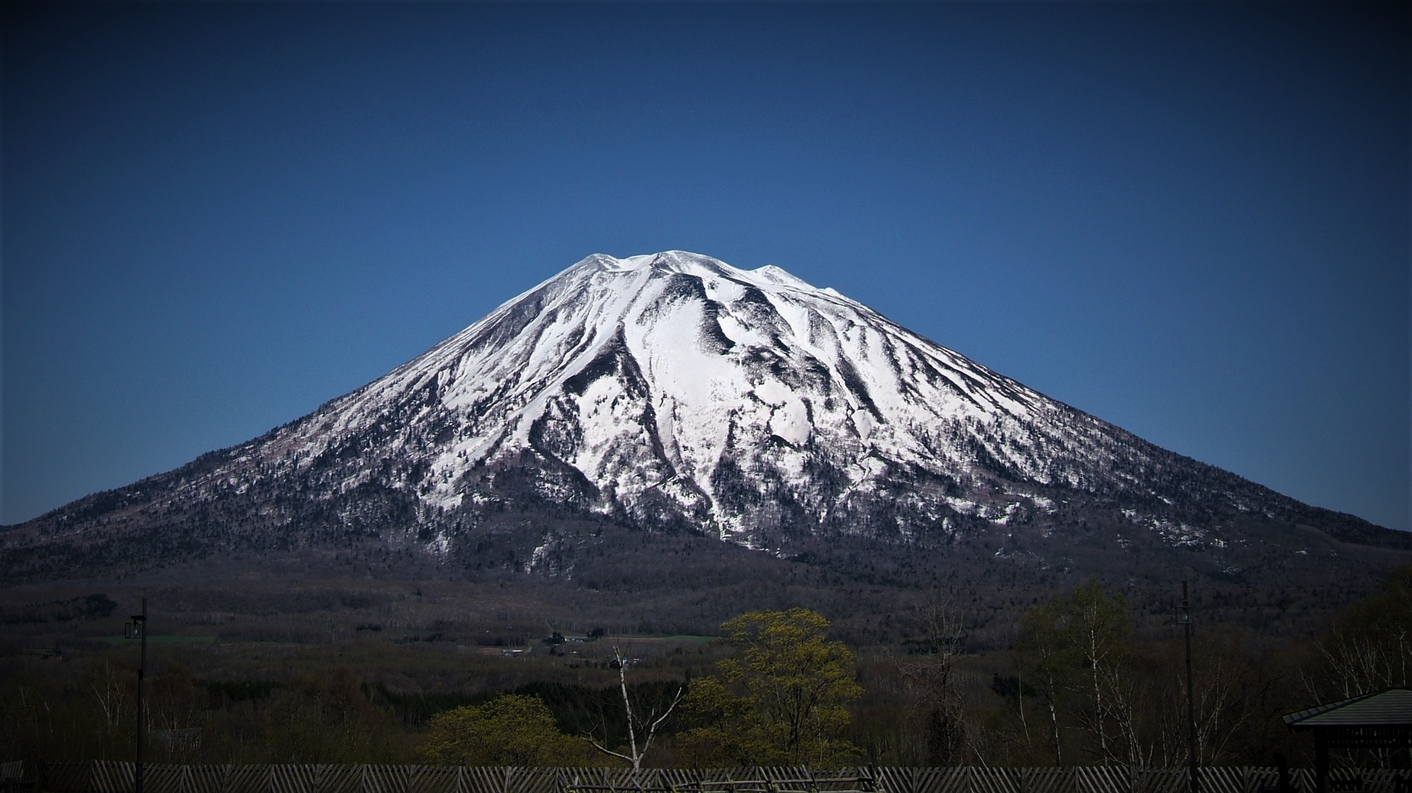
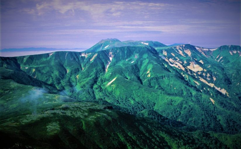
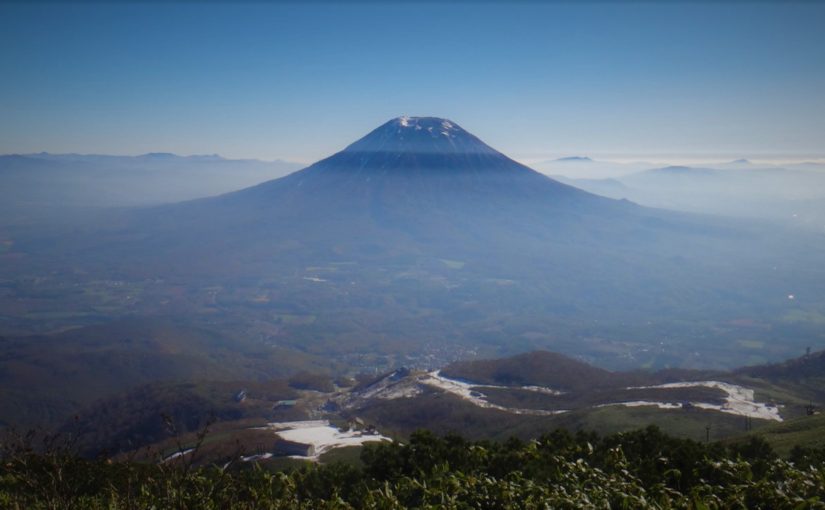
Mt.Yōtei (羊蹄山) is an independent mountain which have a conical shaped summit. It boasts a beautiful shape and size suitable for being called “Ezo-Fuji”. Once it was also called “Shiribeshi-yama”.
As Alpine plants are abundant, the trail is designated as a national nature treasure, and if you choose Kucchan Course you will proceed through the nature trail.
The top of the mountain is a crater, hikers go around here. Snow will also disappear in mid-July, alpine plants will bloom.
Detailed Data of Mount Yōtei (羊蹄山)
AREA: Makkari village Niseko cho / Kyōgoku cho / Kimobetsu cho, Hokkaido
HIGHEST POINT: 1898 m, Mt. Yōteizan
LEVEL OF COURSE: ★★☆
PLAN: a trip for 1 nights and 2 days
DURATION: 1st day: 4 hours and 50 minutes, 2nd day: 4 hours and 50 minutes
DISTANCE: About 17 km
DIFFERENCE OF ELEVATION: 1668 m
ENDURANCE: ★☆☆
DIFFICULTY LEVEL: ★★☆
BEST SEASON: July to September
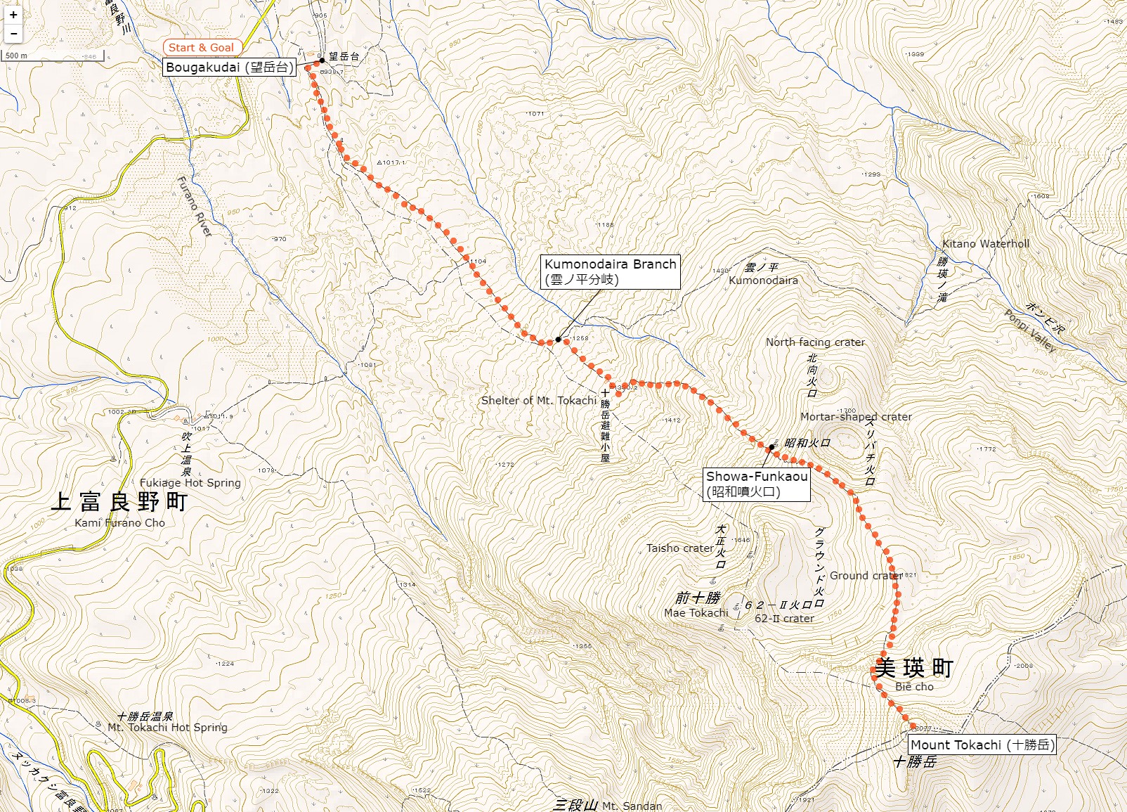
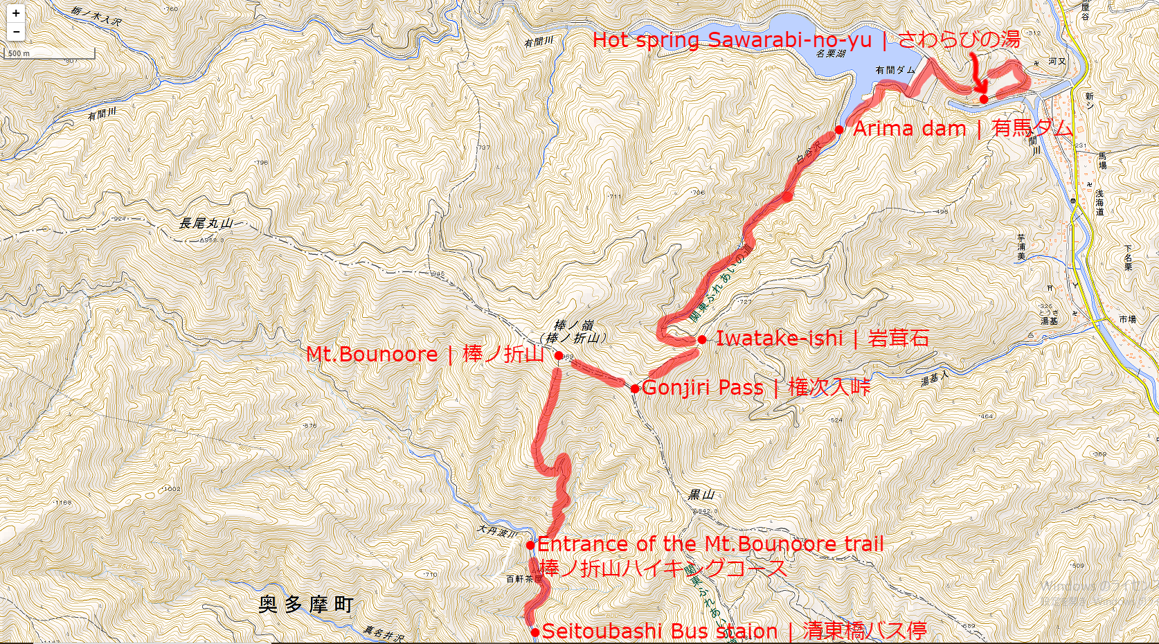
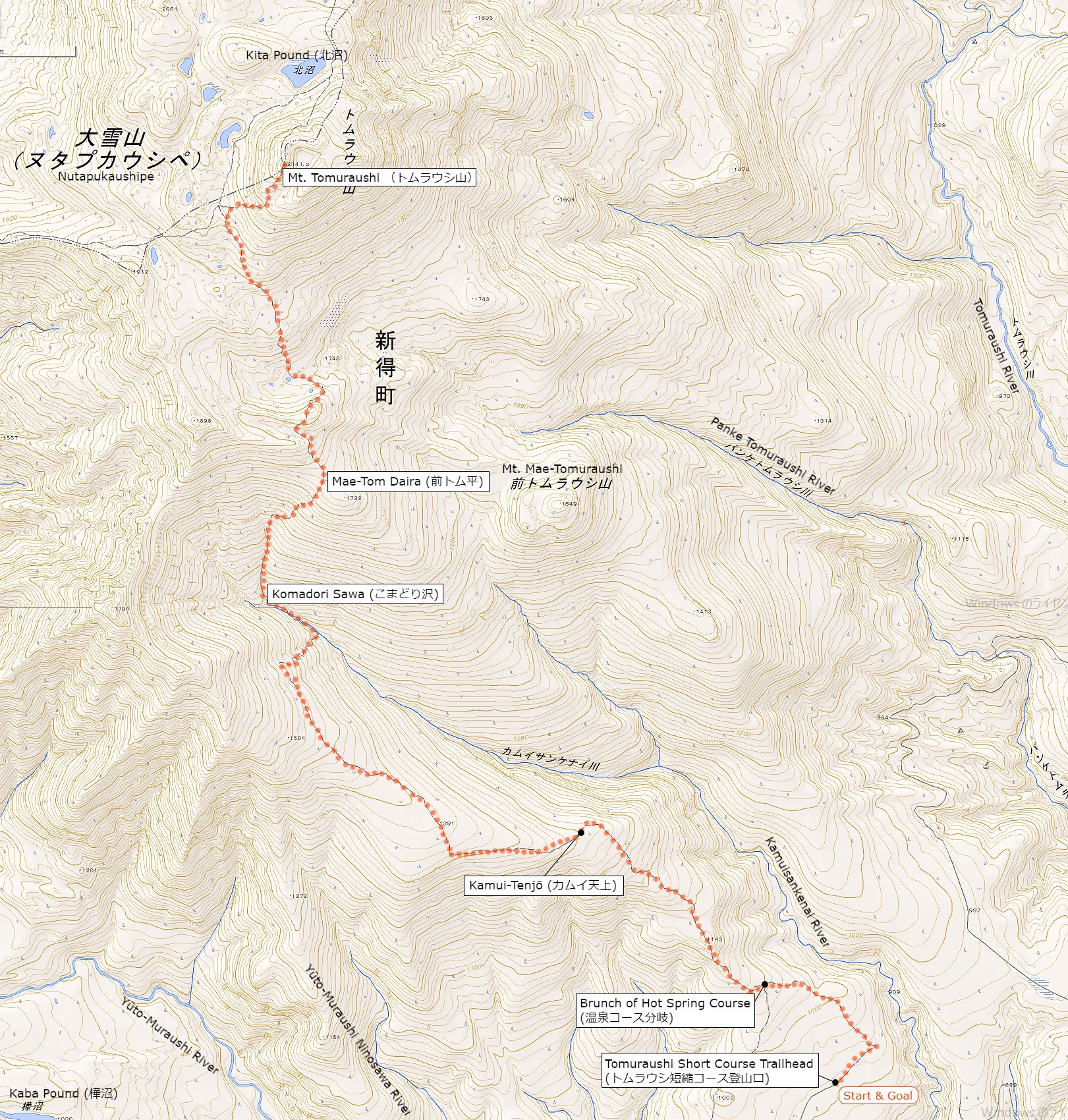
Mt. Yōtei’s Hiking Course Map
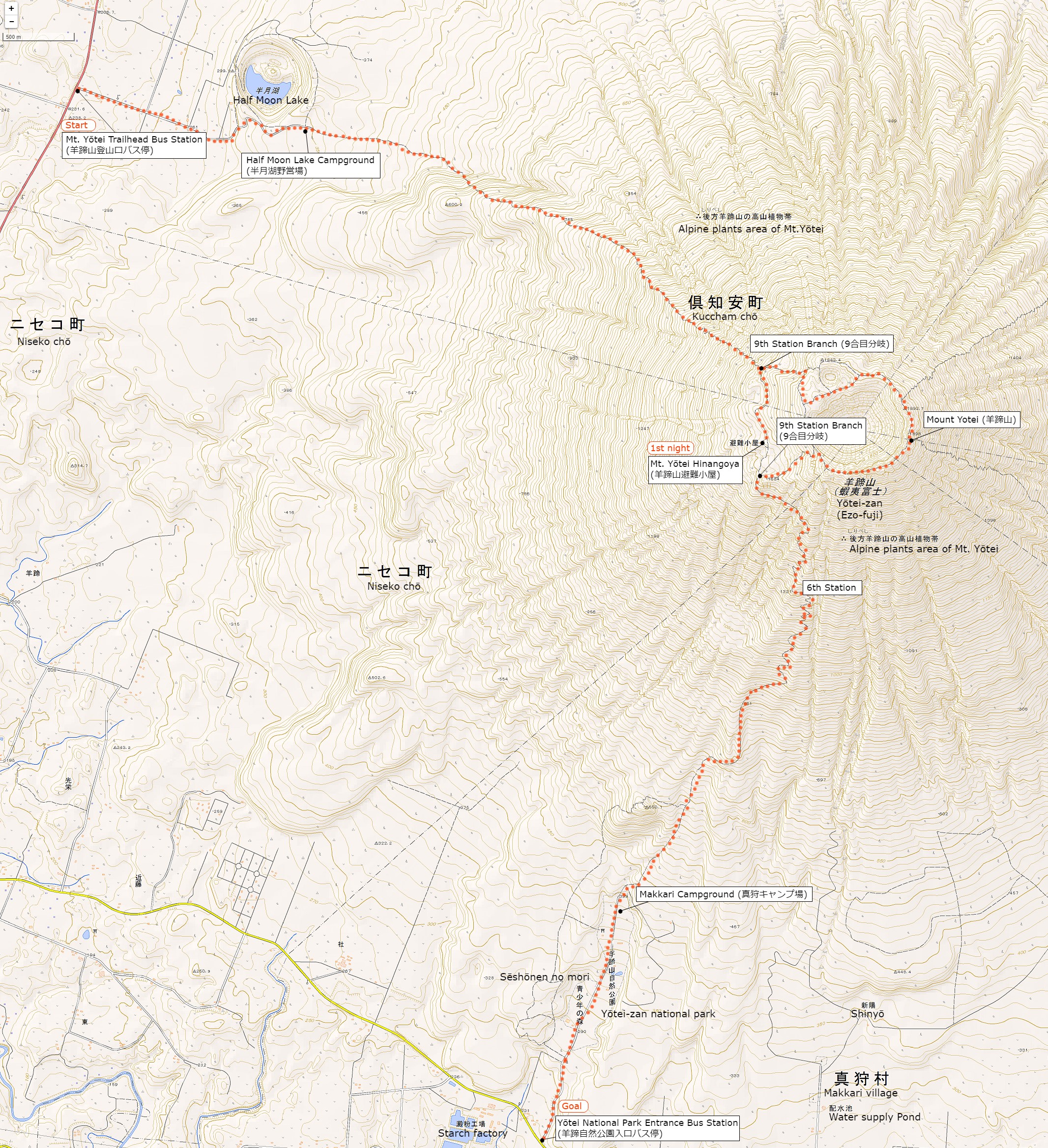
The source of above the three maps are “Digital Japan Web System” of The Geospatial Information Authority of Japan. The maps were edited a author of this blog.
In Japanese: これらの3枚の地図は国土地理院の電子国土Webシステムから配信されたものをこのブログの著者が加工したものである。
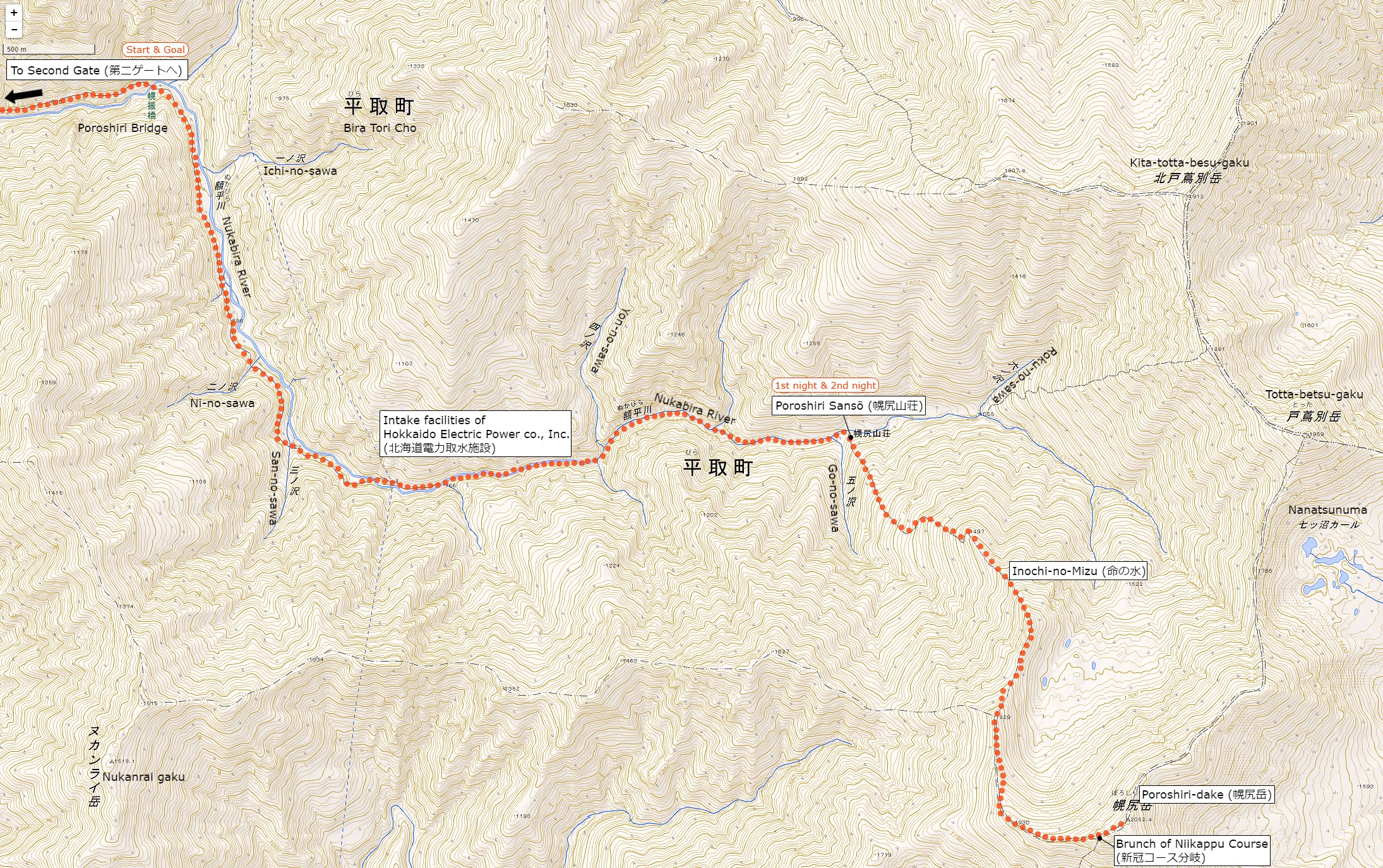
How to travel to Mt. Poroshiridake’s Trailhead (Second Gate)
the total amount: about 890 JPY
The Way There
Kucchan Station (倶知案駅)
↓
Niseko Bus / Dōnan Bus (about 10 minutes): 230 JPY
↓
Yōtei Trailhead Bus Station (羊蹄登山口バス停)
The Way Back
Yōtei National Park Entrance Bus Station (羊蹄自然公園入口バス停駅)
↓
Dōnan Bus (about 30 minutes): 660 JPY
↓
Kucchan Station (倶知案駅)
Inquire:
Niseko Bus (ニセコバス) 0136-44-2001
Dōnan Bus Kucchan Sales Official (道南バス倶知案営業所) 0136-22-1558
By Car:
From Chitose (Chitose) via Shikotu Lake (支笏湖), take Route 276 via Bifue Tōge (美笛峠) to Mt. Yōtei Trailhead (羊蹄山登山口)
Paking Lot Infomation:
Half Moon Campground (半月湖キャンプ場) has a parking lot (about 15 units)
Lodging Facility:
Yōtei-zan Hinangoya (羊蹄山避難小屋)
Newly built mountain lodge in 2013.
Water and meals are not provided, but you can rent shruffs and blankets.
Tel: 0136-23-3388 (Kucchan Chō Tourism Division)
Opening: Mid-June to Mid-October
Fee: 1000 yen per night, rest 300 yen, blanket 200 yen, sleeping bag 300 yen
Capacity: about 20 people
Hot Springs After Hiking
Makkari Hot Spring (まっかり温泉)
Official Web Site: http://www.makkarionsen.com/
A hot spring looking up Mt.Yōtei from the south. From the outdoor bath you can see the Makkari Course where you came down.
Tel: 0136-45-2717
Adress: 174-3 Midorioka Makkari village, Hokkaido
Opening hour: 10:30 am – 9:00 pm
Closed: Monday (If it is a holiday the next day)
Fee: 500 JPY
Access: 30 minutes from Makkari village Bus Stop (真狩村バス停) on foot