Walking while enjoying the scenery created by active volcanoes
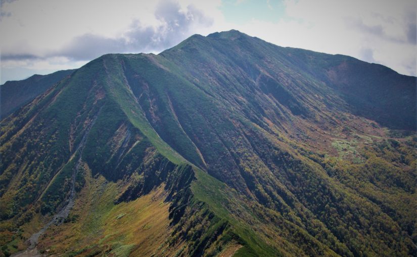
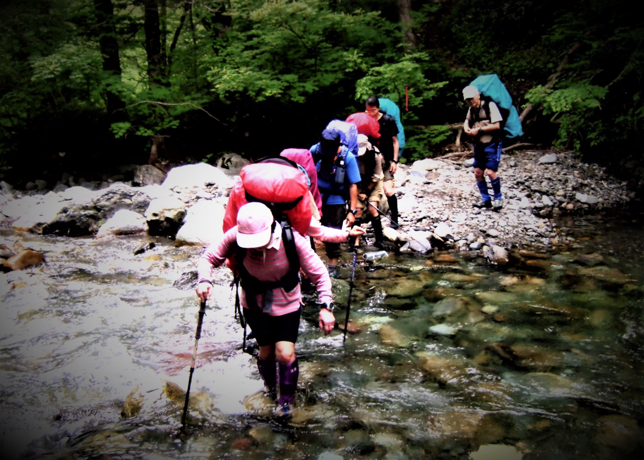
Mt.Poroshiri (幌尻岳) which is also selected as “100 famous japanese mountains” at the highest peak of Hidaka Range. Mt.Poroshiri, which is said to be the most difficult mountain of “100 famous japanese mountains” is a mountain for skilled hikers where difficult trails like dozens of wading across rivers and climbing steep slopes follow.
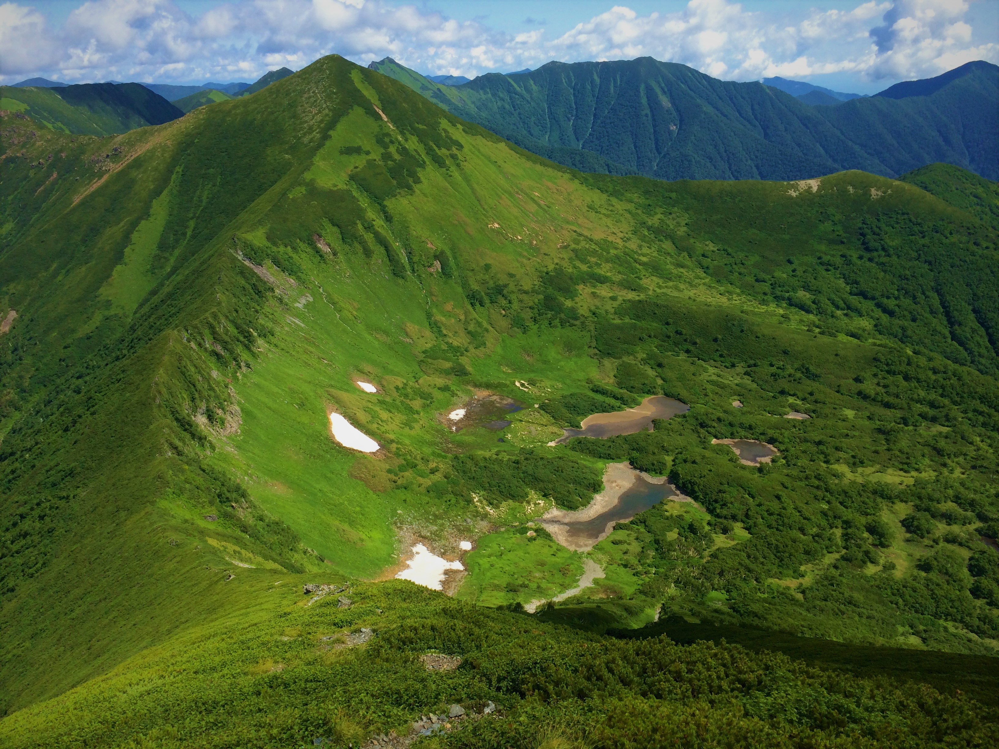
However, it is must-sees for the superb ridgeline that extends beyond the difficult trail and “Nanatsunuma” selected for “Japan’s top 100 geological selections”! You can see various animals on the ground where the flower garden spreads. In this article I will introduce representative courses and spots of Mt.Poroshiri.
Detailed Data of Mount Poroshiri-dake (幌尻岳)
AREA: Niikappu cho Biratori cho, Hokkaido
HIGHEST POINT: 2052 m, Mt. Poroshiridake
LEVEL OF COURSE: ★★★
PLAN: a trip for 2 nights and 3 days
DURATION: 1st day: 4 hours and 40 minutes, 2nd day: 7 hours and 10 minutes, 3rd day: 4 hours and 20 minutes
DISTANCE: About 23 km
DIFFERENCE OF ELEVATION: 1522 m
ENDURANCE: ★★☆
DIFFICULTY LEVEL: ★★★
BEST SEASON: July to September
Mt.Tomuraushi’s Hiking Course Map
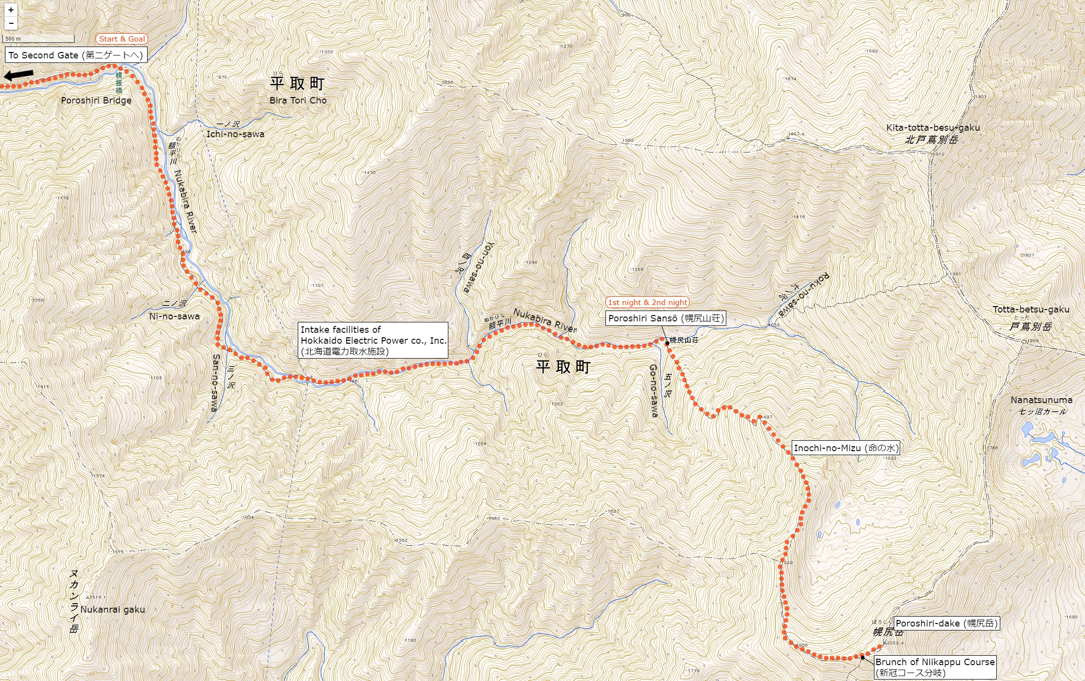
The source of above the three maps are “Digital Japan Web System” of The Geospatial Information Authority of Japan. The maps were edited a author of this blog.
In Japanese: これらの3枚の地図は国土地理院の電子国土Webシステムから配信されたものをこのブログの著者が加工したものである。
How to travel to Mt. Poroshiridake’s Trailhead (Second Gate)
the total amount: about 1310 JPY
Tomikawa Station (富川駅)
↑
Dōnan Bus (about 1 hour): 1310 JPY
↓↑
Toyonuka sansō (とよぬか山荘)
↓
Shuttle Bus (one way, about 1 hour): Round trip fare 4000 JPY
↓↑
Second Gate (第2ゲート)
From Toyonuka sansō, traffic to general vehicles is prohibited.
Hikers use a private shuttle bus.
From the 2nd gate is a walk only.
Inquire:
South Hokkadō Bus Biratori Sales Office (道南バス平取営業所) 01457-2-2311
Furenai Kōtsū (振内交通) 01457-3-3021
Biratori Taxi (平取ハイヤー) 01457-2-3181
Toyonuka sansō (とよぬか山荘) 0145-7-33568
By Car:
From Biratori cho Honcho (平取町本町) toward Hidaka (日高) 40 minutes, after Furenai city (振内市街), there is a sign of “Poroshiri Trailhead” (幌尻岳登山入り口) in the branch of Niseu (仁世宇). From there about 20 minutes you arrive at Toyonukasō (とよぬか山荘).
Paking Lot Infomation:
Toyonukasō has public car park (about 50 units)
Lodging Facility:
Poroshiri sansō (幌尻山荘)
At Mountain lodge where reservation is not without meals. There is no meal or bedding so let’s prepare yourself. The reservation reception starts from April 1.
Tel: 01457-3-3838
Opening: June 1 to September 30
Fee: 1500 (without meals)
Hot Springs After Hiking
Biratori Hot Spring Yukara (びらとり温泉 ゆから)
Official Web Site: http://www.biratori-onsen.com/
The lily’sa habitat is right next to and is a hot spring accommodation that is perfect for healing tiredness of hiking.
Day bathing is also possible.
Tel: 01457-2-3280
Adress: 92-6 Nibutani Biratori cho, Hokkaido
Opening hour: 10:00 am – 9:30 pm
Closed: open all year arond
Fee: 420 JPY
Access: Immediately from Biratori Onsen Mae Bus Stop (平取温泉前バス停)