One Day Hike in Miura Peninsula Kanagawa, Japan
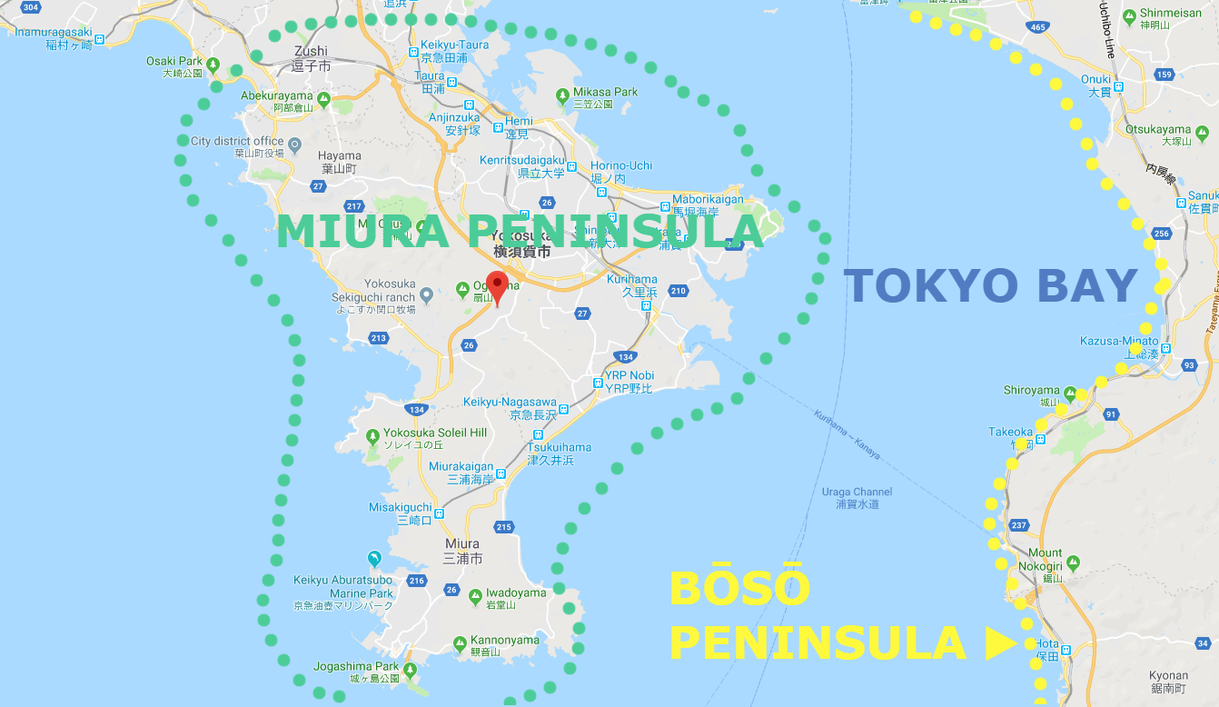 Miura Peninsula, the part of Kanagawa Prefecture to the south of Tokyo, just out into the Pacific Ocean and, together with the Bōsō Peninsula, forms Tokyo Bay.
Among them, Miura Reef Route, the last remnants of untouched coast provide probably the great walking course close to Tokyo, and are excellent for the less adventurous walker.
The Keihin Kyūkō Line (from Shinagawa) and its associated branches serve most areas, with JR Yokosuka Line an alternative in some cases.
Guide for hiking of Miura Reef Route
Area: Miura city, Kanagawa prefecture, Japan
Access: From Keihin Kyūkō Miura Kaigan Station, board a Keihin Kyūkō Bus bound for Cape Tsurugi (Tsurugizaki, 劒崎) for 20 minutes, get off at Tsurugizaki
Start: Tsurugizaki Bus Stop 劒崎バス停
Goal: Miyakawa-cho Bus Stop 宮川町バス停
Difficulty of this trail: ★ ☆ ☆ ☆ ☆
Trail appearance rate: ★ ☆ ☆ ☆ ☆
Total distance: 10.3 km
Total difference in elevation: 40 m
Walking time: 3 hours
Point of interest: Rugged coastline and sea views, Cape Tsurugi Lighthouse, Caves, Dwellings of the Yayoi people, and Seaweed cultivation.
Note: At high tide, the route may be impassable, if not dangerous.
Approximate times of high and low tides can be found on website below.
https://www.tidetime.org/asia/japan/miura.htm
Access to Miura Reef Route
From Shinagawa Station, take a Keihin Kyūkō Line (京浜急行線) limited express (tokkyū, 特急) or a slightly faster and more comfortable rapid limited express (Kaisoku tokkyū, 快速特急) bound for Misaki-guchi (三崎口). The last part of the journey actually runs along the Keihin Kurihama Line (京浜久里浜線), but no transfer is needed. Get off at Miura-kaigan (三浦海岸) Station, the second from last stop.
Rapid limited expresses take just over 1 hour to reach Miura kaigan; limited expresses take 1 hour and 14 minutes; and other, slower trains considerably longer. The fare in all cases is 740JPY.
Please check the latest timetable, because the timetable and fare are sometimes changed.
Timetable and Route Serch “HyperDia”
http://www.hyperdia.com/sp/index.html.en
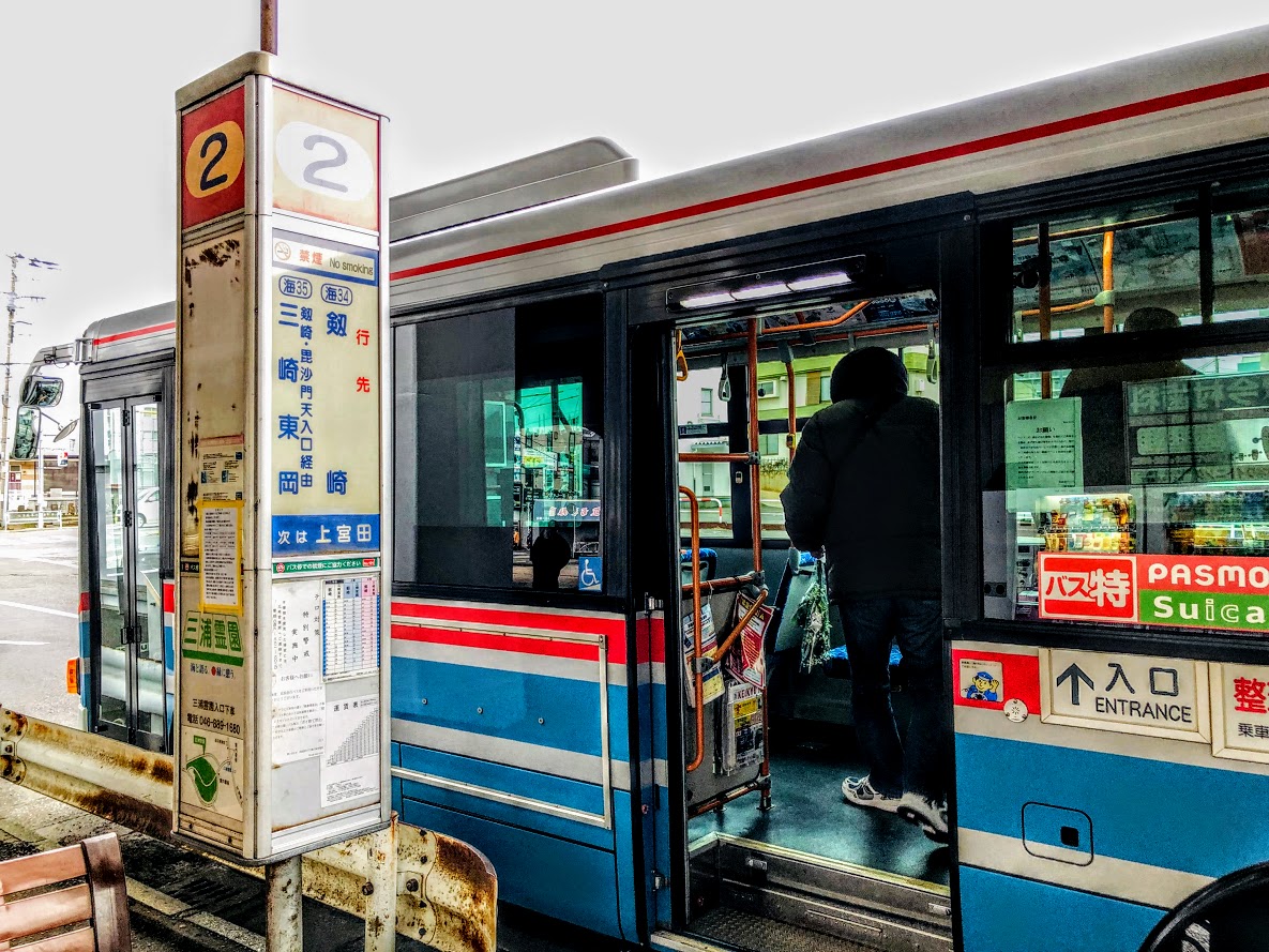
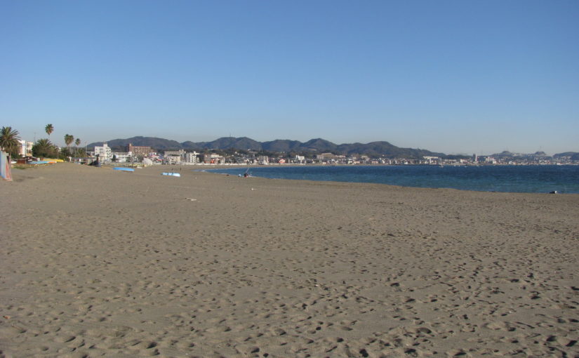
Leave the station by the only exit, walk slightly to the right to Bus Stand No. 2, and board a bus bound for Cape Tsurugi (Tsurugizaki, 劒崎). The Bus route runs along the shoreline, providing good views of this beach that is popular with windsurfers.
After about 20 minutes, get off at Cape Tsurugi (Tsurugizaki, 劒崎) which is the terminus of this line. The fare is 290JPY.
Maps of Miura Reef Route
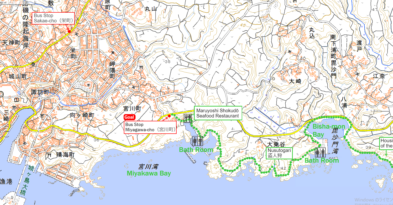
Miura Reef Route (the Miura Gansho no michi, 三浦 岩礁の道) is part of The Kantō Fureai Trail (Knatō Fureai no michi, 関東ふれあいの道) that the Japanese government’s Ministry of the Environment manages.
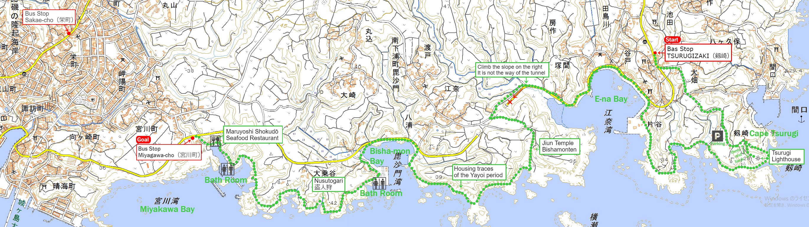
The source of above the three maps are “Digital Japan Web System” of The Geospatial Information Authority of Japan. The maps were edited a author of this blog.
In Japanese: これらの3枚の地図は国土地理院の電子国土Webシステムから配信されたものをこのブログの著者が加工したものである。
From Tsurugizaki Bus Stop (劒崎バス停) to Bisha-mon Bay (毘沙門湾)
Click here for a map of the latter half.
Walk along the road in the same derection as the bus wast traveling. You can find a small signboard with the direction of the Tsurugizaki lighthouse on the left side as you go about 50 meters.
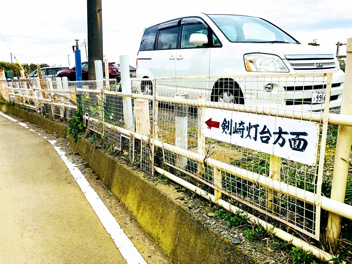
After turning to the left according to the direction of signboard, the road of Daikon radish field continues. After a while you can see the lighthouse for the direction of travel, if the weather is good you can see Mt.Fuji when you look back on the road.
On this road, the track carrying Daikon radish is coming and going, the black kite is slowly flying in the sky. On the other side of the lighthouse is the sea, behind which there is the Bōsō peninsula. You will find the road to the Maguchi port on the left side, but ignore that road. When you walk toward the lighthouse, there is a parking lot on the right side, there is the bath room too.
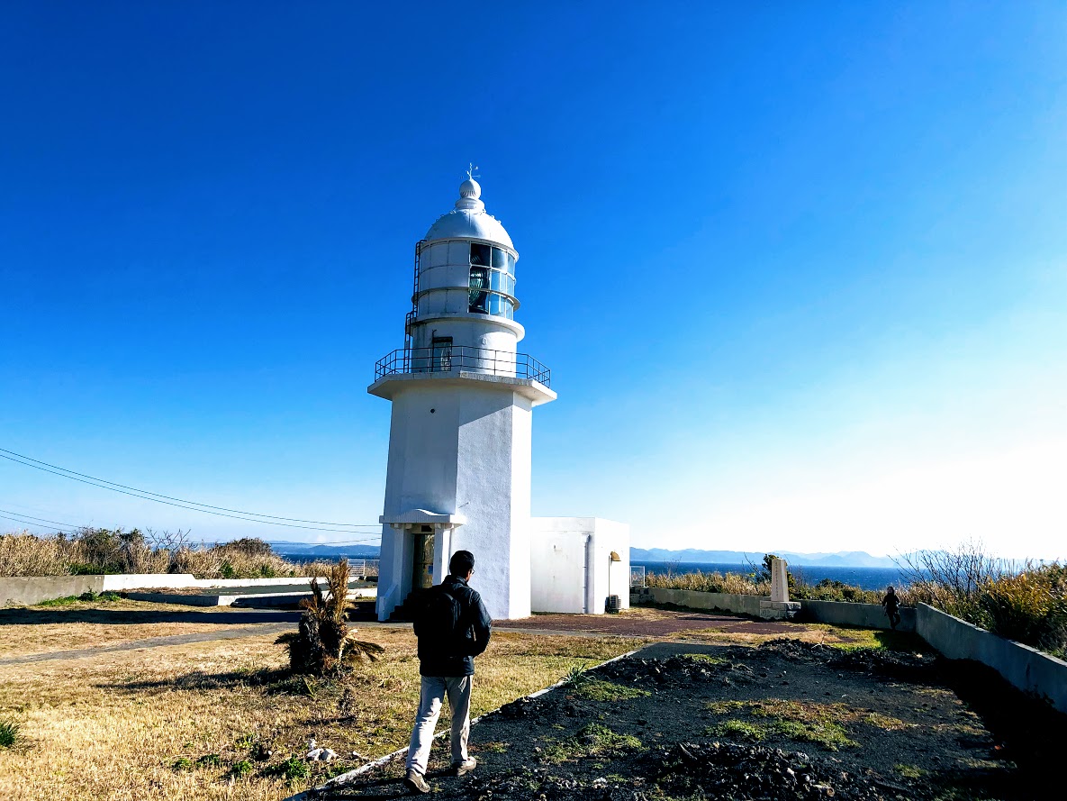
There is a branch to the lighthouse where you have gone a little from the parking lot. The path to the lighthouse is on the right side and the left is on the beach, the lighthouse will arrive in about 1 minute.
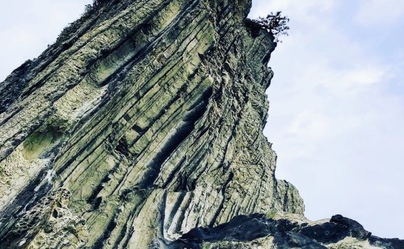
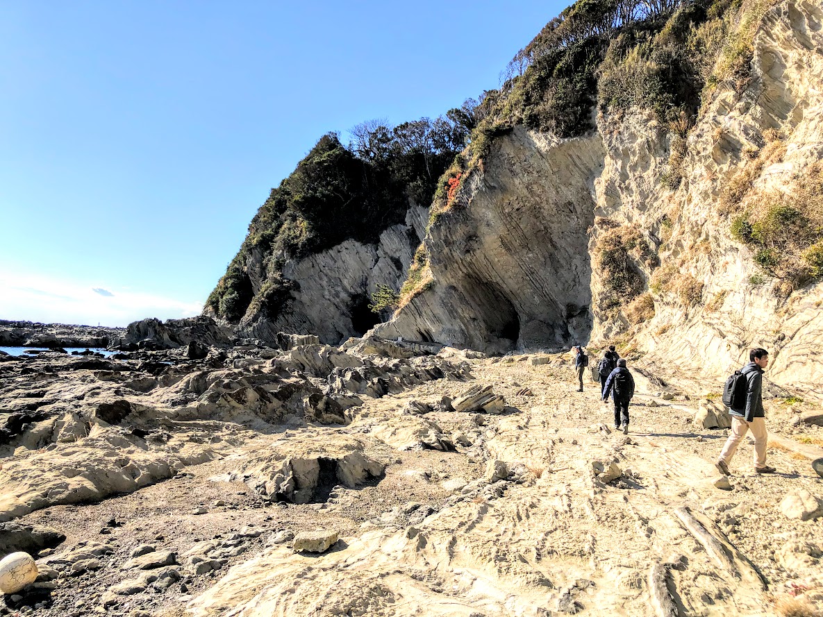
Go back to the lighthouse and go down the road on the left and you will come to a small beach. As you go to the right along the coast, rocky road will continue for a while. There are some dangerous places that will injure if you fall, choose a place that you can easily walk on and take care.
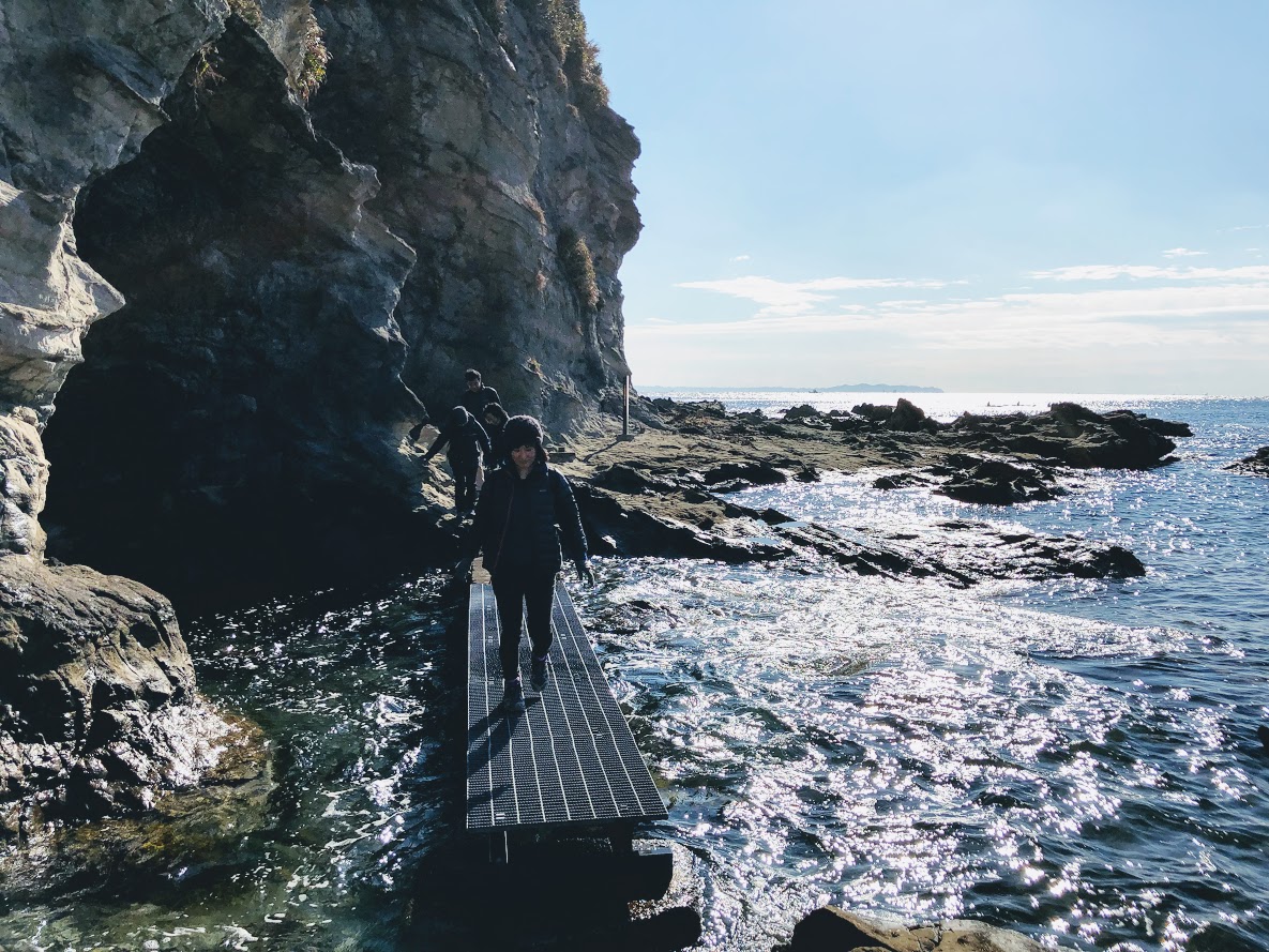
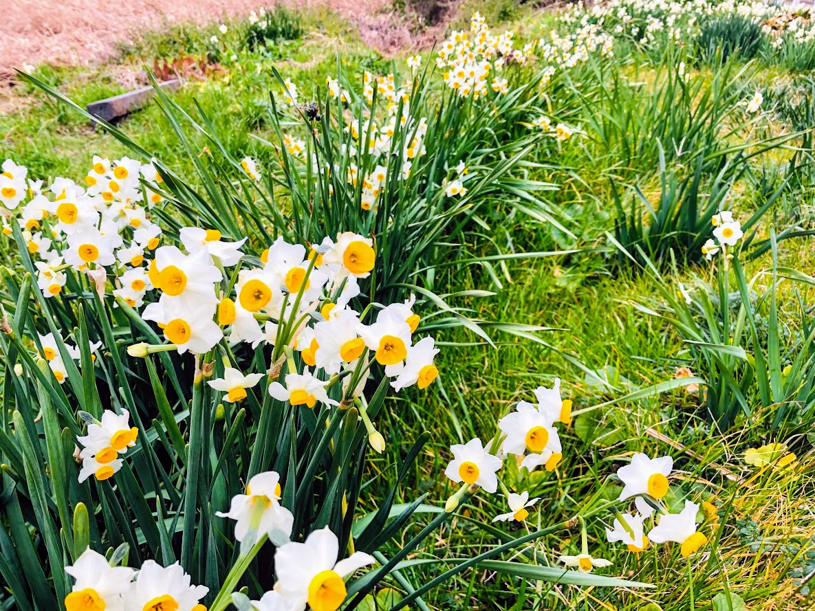
You advance along the rocky road along the coast until Ena Bay. Once from Ena Bay, go to the prefectural road and proceed a quiet fishing village. There is a convenience store on the way and you can buy snacks and drinks. Ena Bay is a small tidal flat and you can see various kinds of crab and shellfish in the summer. In winter you can see a white daffodil blooming on the shore.
There is a branch on the slope along the paved road along Ena Bay.
Let’s go to the right slope, not the road of the left tunnel.
Let’s not miss a signbourd on the left side as you climb up the slope. Turn left at the sign and go straight to the old Jiun Temple. Once it passes through the temple, the reef route will start again.
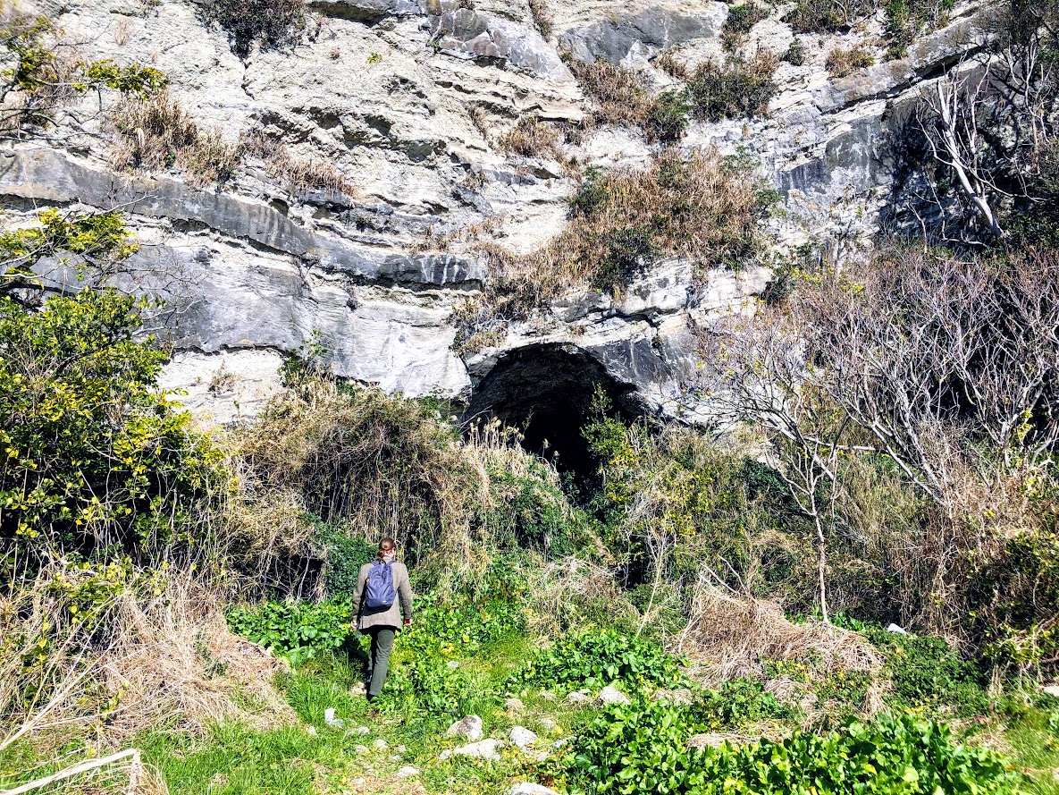
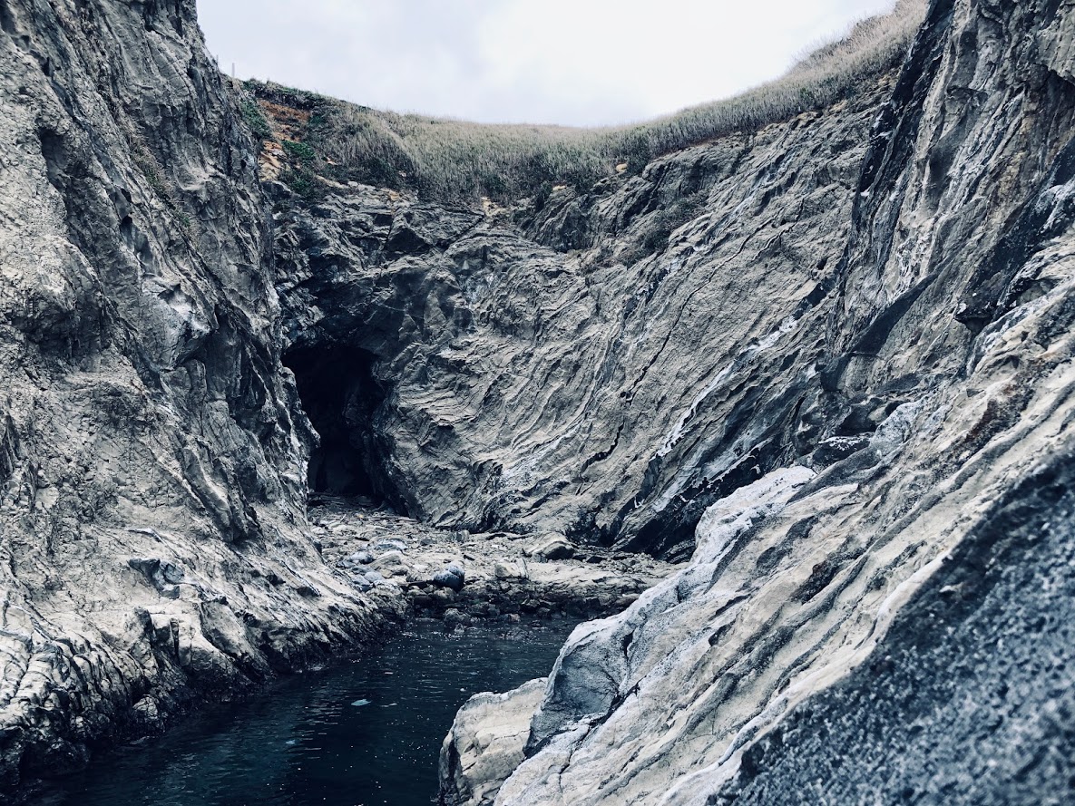
You will have a big cave as you go along the rocky road for a while.
This is the residence of the Yayoi era you can enter inside.
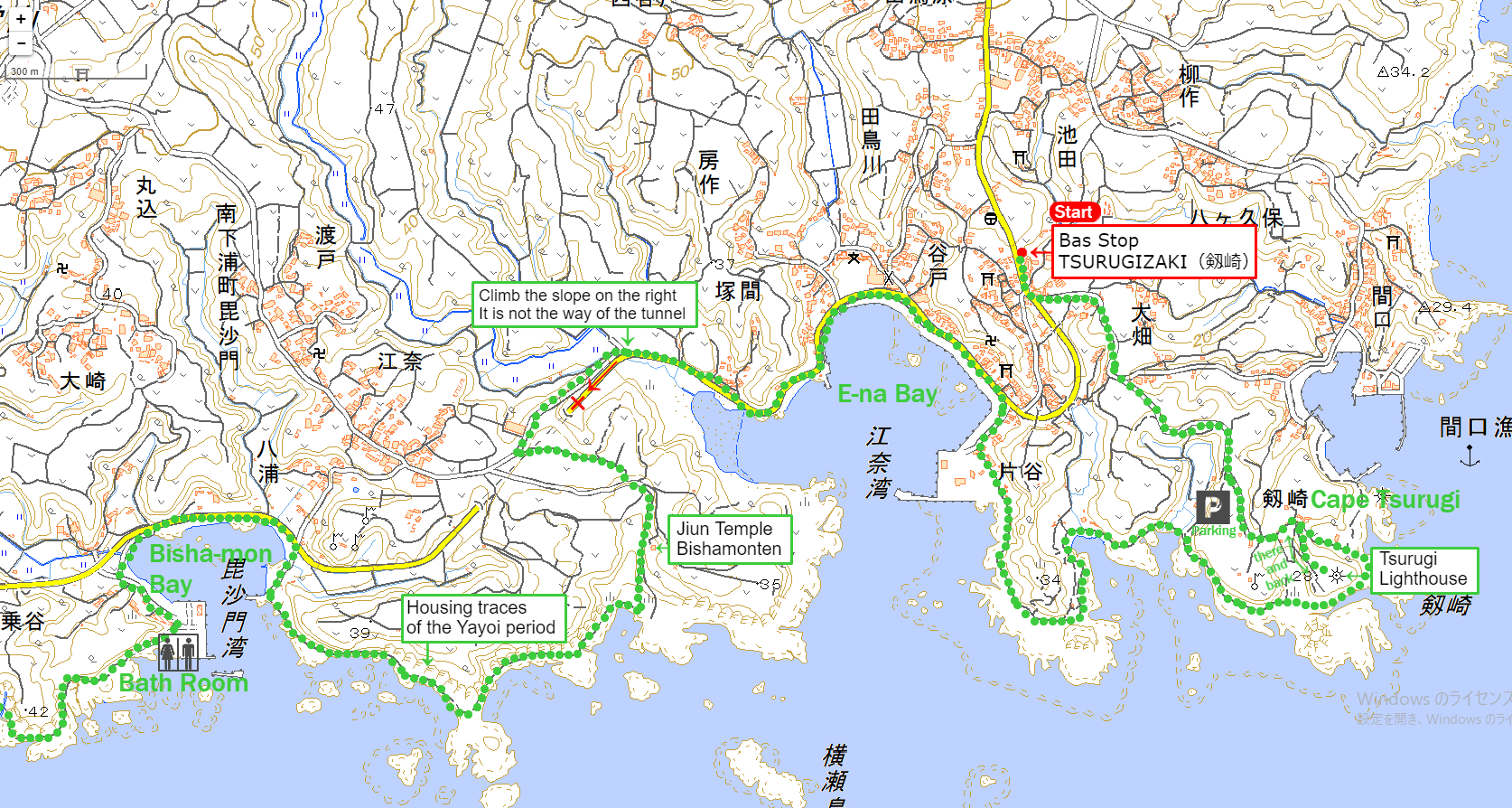
From Bisja-mon Bay (毘沙門湾) to Miyagawa-cho Bus Stop (宮川町バス停)
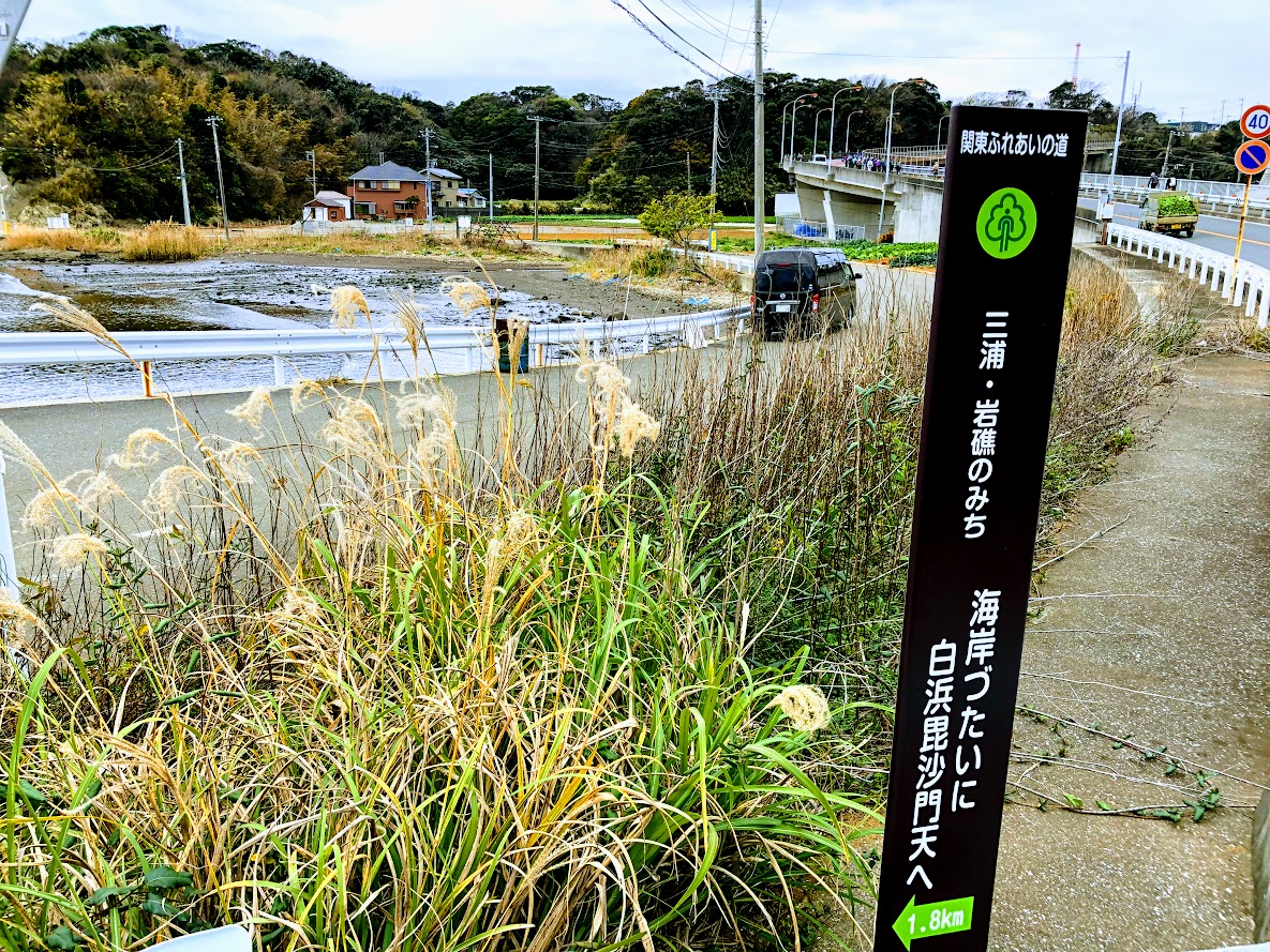
When you arrive at Bisha-mon Bay you will walk the prefectural road again paved for a while. Let’s not miss the signbord of The Kantō Fureai Trail on the left side, find the signbord and follow the arrow and turn left.
Go through the small fishing port. There is a bath room although it is not very clean in the fishing port.
If you pass this a bath room, the reef route will start again.
While enjoying the strange and beautiful rocks scattered by the wind and wave, You will arrive at a splendid cliff called Nusutogari.
Nusuto (盗人) means a thief in Japanese, gari (狩) means arresting.
It is said that a thief who fled to this cliff was unable to move due to fear on the cliff, and this name comes from that legend.
Pass through some big caves from Nusutogari and you will arrive at Miyagawa Bay, the end of the reef route. This fishing port has a clean a bath room.
Pass through some big caves from Nusutogari and you will arrive at Miyagawa Bay, the end of the reef path.
This fishing port has a clean a bath room.
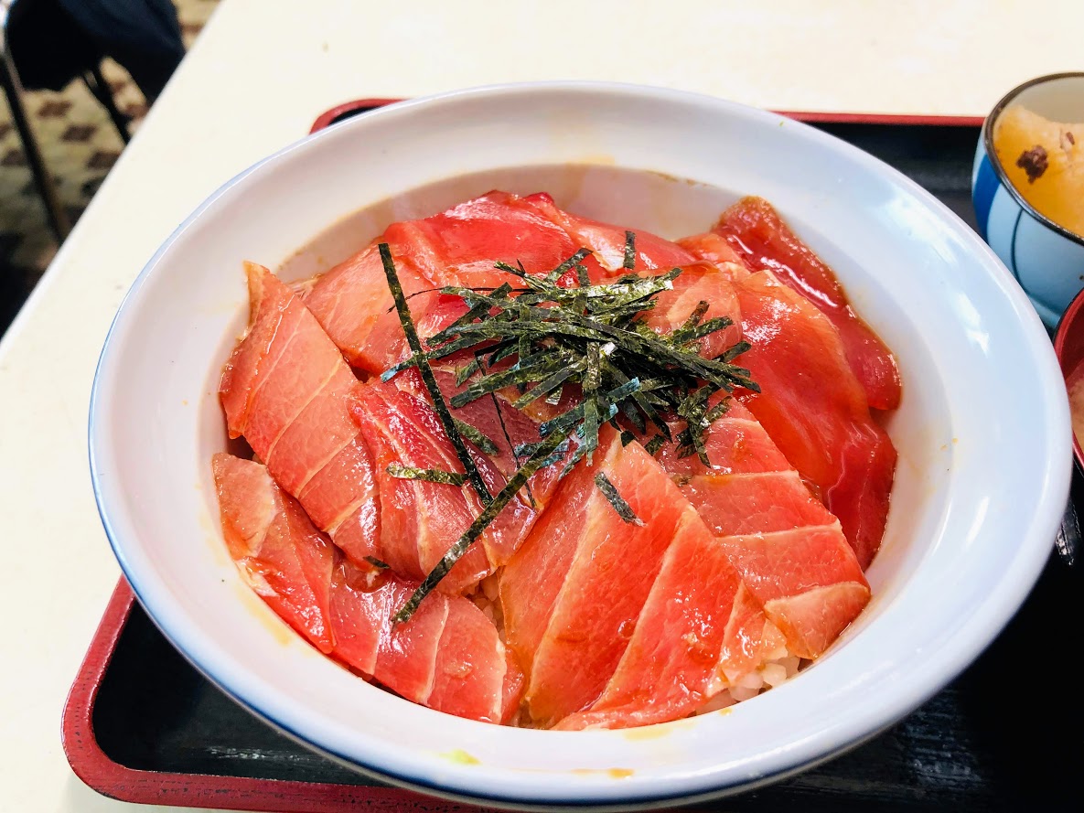
Also, we recommend a seafood restaurant with a delicious seafood specialties called “Marayoshi Restaurant”.
Miyagawa-chō Bus Stop is a few meters to the left following the crossroad where you climbed the slope that continues from this restaurant.
It is not frequent on buses, it is about one in one hour.
If you have too much time on your hands I recommend walking to Sakae-cho Bus Stop.
It is about 15 minutes on foot to Sakae-cho Bus Stop.
Do you need a guide for this hiking course?
If you are looking for guide of this hiking course, please refer to the following.