About Mt.Iwatono
Mt. Iwasaki is a low mountain with an altitude of 563m at the prefectural border of Yamanashi and Tokyo area.
I think that there are probably no people who get lost in such a low mountain, but I write down on this blog in the sense of reflection on myself.
This mountain was a mountain where I was interested for a long time, because when I headed from the Chuo Line to the Kawaguchiko area by train, the mountain rocks were always conspicuous.
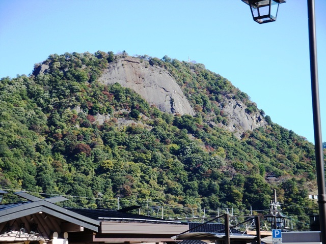
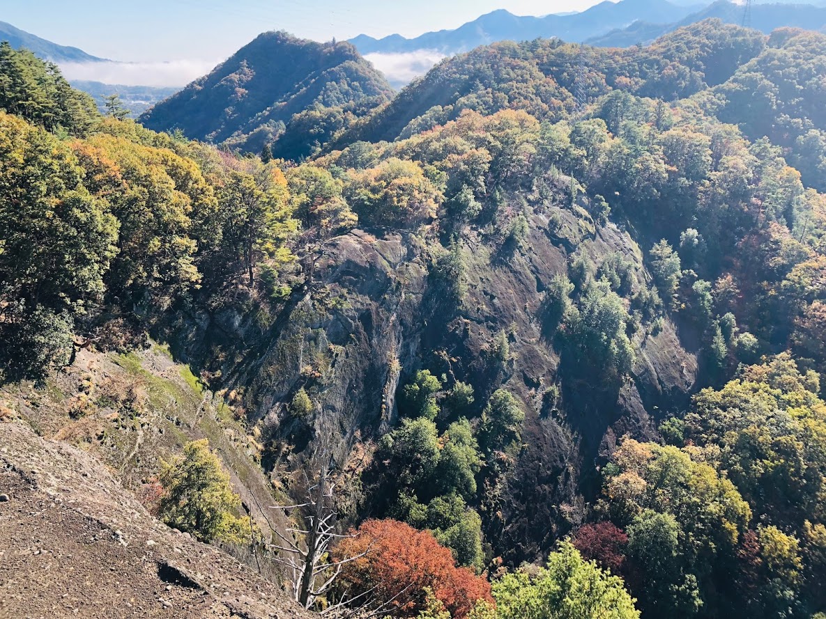
At the summit of Mt.Iwadono during the Warring States period there was a castle of Mr. Oyamada, which seems to be an important castle related to Mr. Takeda’s destruction.
Certainly cliff walls are quite overlooked and I think that this steep cliff plays the role of a natural castle wall, so that it worked well when it was attacked by enemies.
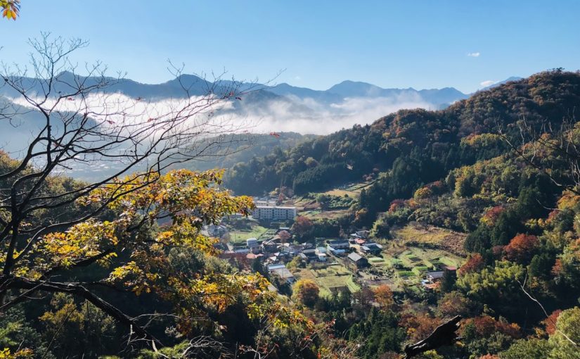
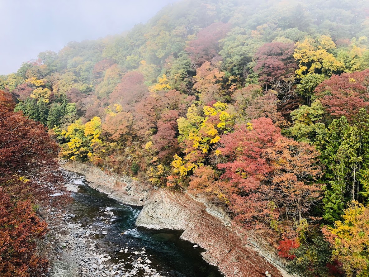
About Autumn Leaves
It was November 10, 2018 that I visited.
It will be the peak of the autumn leaves in middle of next week. They will be turning red and yellow.
Perhaps because the temperature drops around the water field, the area of Katsura river has already reached the peak of the autumn leaves.
Road closure due to collapse of the trail, and the detour route thereby
Arriving at JR Otsuki station, I was listening to the information on the trail at the tourist information office in front of the station, so the information that the east route is blocked was obtained in advance.
On this day I began climbing from Asari.
After that we went down the east course from the summit of Mt.Iwatono and when we arrived at Nigioka town we planned to go to Mt.Momokura next door.
But I quickly changed this schedule for the detour.
Detailed information was also listed on the website of Otsuki Tourist Association below.
http://otsuki-kanko.info/blog/view/28054
How I got lost in a Japanese mountain
On this day I started climbing from the Asari direction opposite to the usual route, it seems that I mistook a trail at a branch heading from Mt.Tenjin from a cliff called Chigo-otoshi.
As a result I seem to have entered the wrong trail for Okuyama.
I was in Sasazuka if I noticed, I was on the way to Tozura Pass, Mt. Takanomaru.
Apparently I was fascinated the view from Chigo-otoshi and overlooked the signboard.
As a result, I went out to the paved road of the Tozura Pass, descended on the paved road as it was, visited the original plan Saruhashi bridge and went home.
Refrections
This time, I was got lost in the morning, and although it was a regular climbing trail so it was not particularly dangerous.
But since I started hiking it is actually the second time for me to get lost.
I got lost in another mountain before, and I was very dangerous then.
The following is the tweet at that time.
Two days ago, I was distressed at the highest “Mt.Kumotori” in Tokyo.
I was able to get back to the regular route at last by wandering the slope of the mountain for about two hours, this picture was taken at that time.
I learned about that advance preparation is very important. pic.twitter.com/b20xR2aKog— Tokyo Sampomaster (@Sampomaster1) May 30, 2018
Since that time I took a “map reading classroom” and received a hands-on lesson with compass and 25000 maps.
Nonetheless yesterday I was fascinated to see the scenery from the top of the cliff called a Chiogo-otoshi, and as a result I neglected to check the current position and the direction of travel.
From now on I will pay attention to the following 3 points and I will be careful not to get lost after that.
- I will check the branch on the map beforehand and check my current location and direction of travel.
- If I do not understand my current location, I will go back to where I can see it.
- Be sure to activate the GPS application before entering the trail.
In the first place I would not get lost if I had just launched the GPS application, I wrote this blog in reflection.
Perhaps I do not think there is such a foolish person like me, but independent hiking is more likely to get lost compared to the group.
If you like hiking alone, please take care.