I went to “Nishimura fruit parlor” at shibuya with my wife the other day.
“Nishimura fruit parlor” is a delicious parfait shop located in front of Dogenzaka in Shibuya.
It is a place that is easy to visit near the station so it seems to be useful for rainy days.
It was Thursday afternoon so I put it in line.
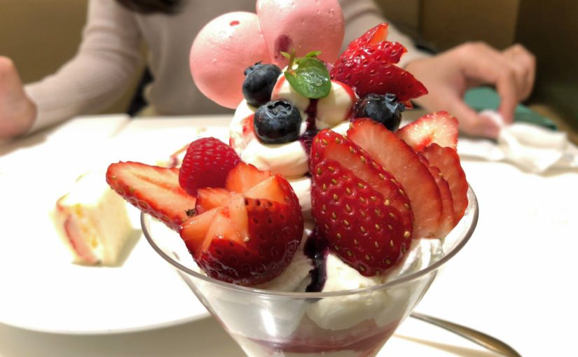
My wife is a strawberry parfait, I ordered a strawberry fruit sandwich.
Strawberry fruit sandwich 900 Yen (excluding tax)
I am not eating sweet things so much, but I thought that the clean sweetness sandwiches are easy to eat and eat as a meal.
My wife’s fruit parfait was also delicious.
Difficulty of this trail: ★ ★ ☆ ☆ ☆
Trail appearance rate: ★ ★ ☆ ☆ ☆
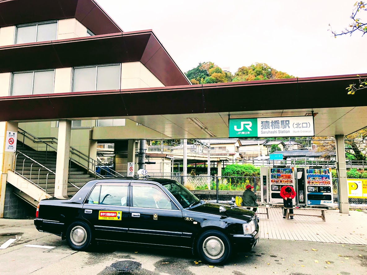
Start: Saruhashi station 猿橋駅
Goul: Saruhashi station 猿橋駅
Total distance: 13 km
elevation: 1003.4 m
Total difference in elevation: 683 m
Walking time: 4 and a half hours
Course Guide of Mt.Momokura
Trail of momokura mount
Saruhashi Station 猿橋駅
Fukusenji temple 福泉寺
Mt.Momokura 百蔵山
Bus Stop “Entrance of Mt.Momokura’trail” 百蔵山登山口バス停
Yutando Spa 湯立人鉱泉
Saruhasih bridge 猿橋
Saruhashi Station 猿橋駅
Map of Mt.Momokura
the map of momokura mount | Clicking the image will display the enlarged size with a new tab.
Access Guide of Mt.Momokura
North gata of saruhashi station
Shinjuku station as a departure place.
Shinjuku Station
↑
JR Chuo Line: 53 min
↓ Takao Station
↑
JR Chuo Main Line: 32 min
↓ Saruhashi Station
Transportation expense
2640 yen (round trip)
Advice
The dangerous place on this course is a steep slope that has gone a little from the top of the mountain.
It is very slippery so let’s slowly proceed while grasping the tree in front of your eyes.
Of course climbing shoes are necessary.
If you plan to go to the next Mt.Ogi it will take at least 4 hours to Torisawa station.
Features of “Mt. Momokura” course
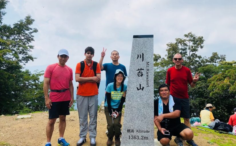
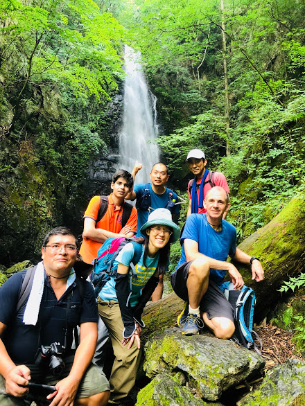
group photo of the summit
Mt.Momokura is popular with hikers as it can be accessed directly from Saruhashi station.
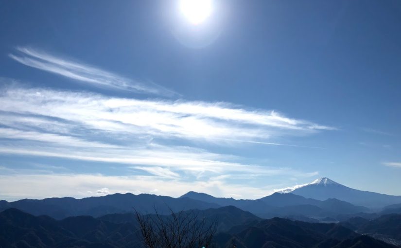
It is also popular that you can enjoy the wonderful view of Mount Fuji from the top of the mountain.
There are five hiking routes on this mountain, but on this blog I will introduce a route from Saruhashi station along Kazuno river to Fukusenji temple to the summit.
After going down the mountain, I will introduce a hot spring with a mysterious atmosphere called Yutando Spa and a bridge with a splendid view called Saruhashi Bridge.
Start from Saruhashi station and cross Katsura river and you can see Mount Momokura.
If you go straight ahead, it is the shortest course, but turn left and proceed along Kazuno river.
Mount Momokura on the right from the river road and Mount Iwadono on the left are the best views.
When you return to the road again from the river road, you will arrive at the small and beautiful Fukusenji temple.
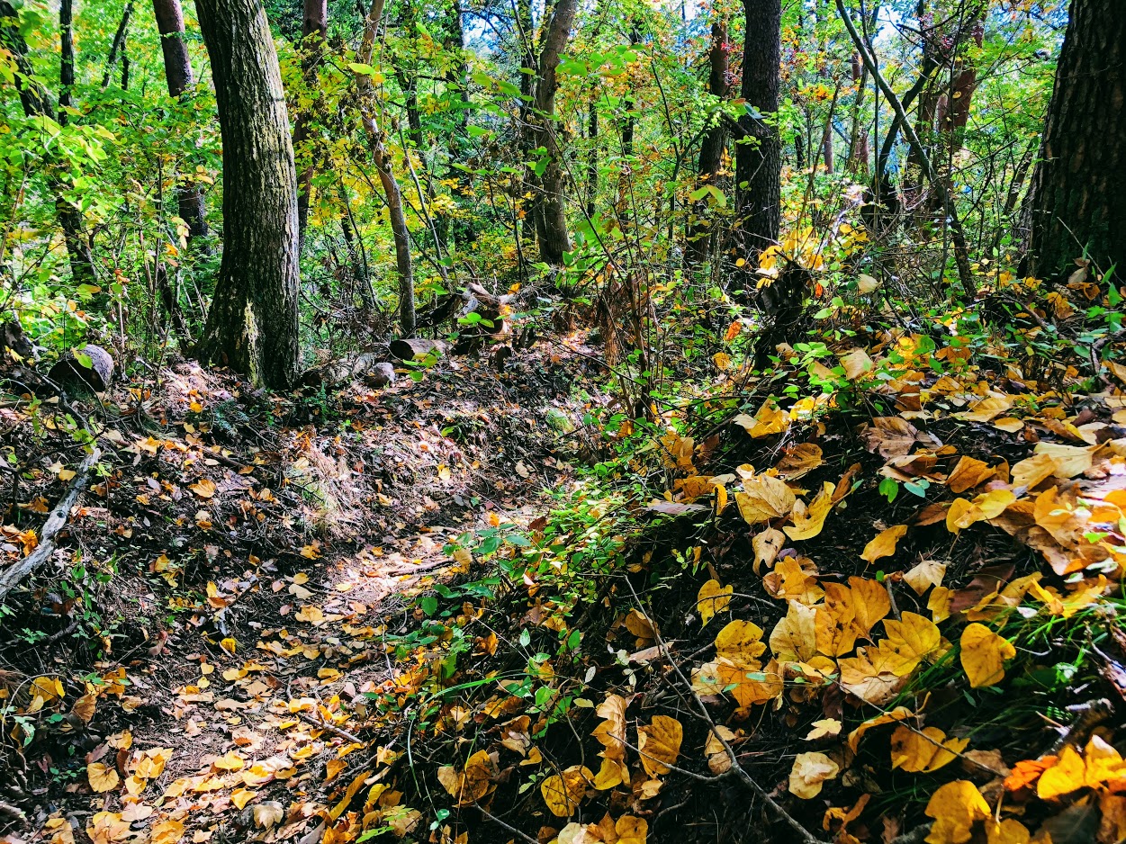
As soon as you follow the road that turns left before the temple, you will arrive at the trail soon.
Iwadono mounts and settlements watching from the trail are also good views.
After passing the small shrine in the trail you will be on the ridge road.
We arrive at the top of Mt.Momokura in about 2 hours from the temple at the foot.
The summit is a large square, all the hikers are facing in the same direction and enjoying lunch.
That’s right, they are facing the direction of Mt.Fuji.
From the summit of Mt.Momokura, we can enjoy the magnificent view of Mt.Fuji which are chosed as “beautiful Mt.Fuji 12 scenery” if the weather is good.
When stepping a little from the top of the mountain, a steep slope will appear, please proceed carefully not to fall.
You will arrive at Bus Stop “Entrance of Mt. Momokura ‘trail” in about an hour.
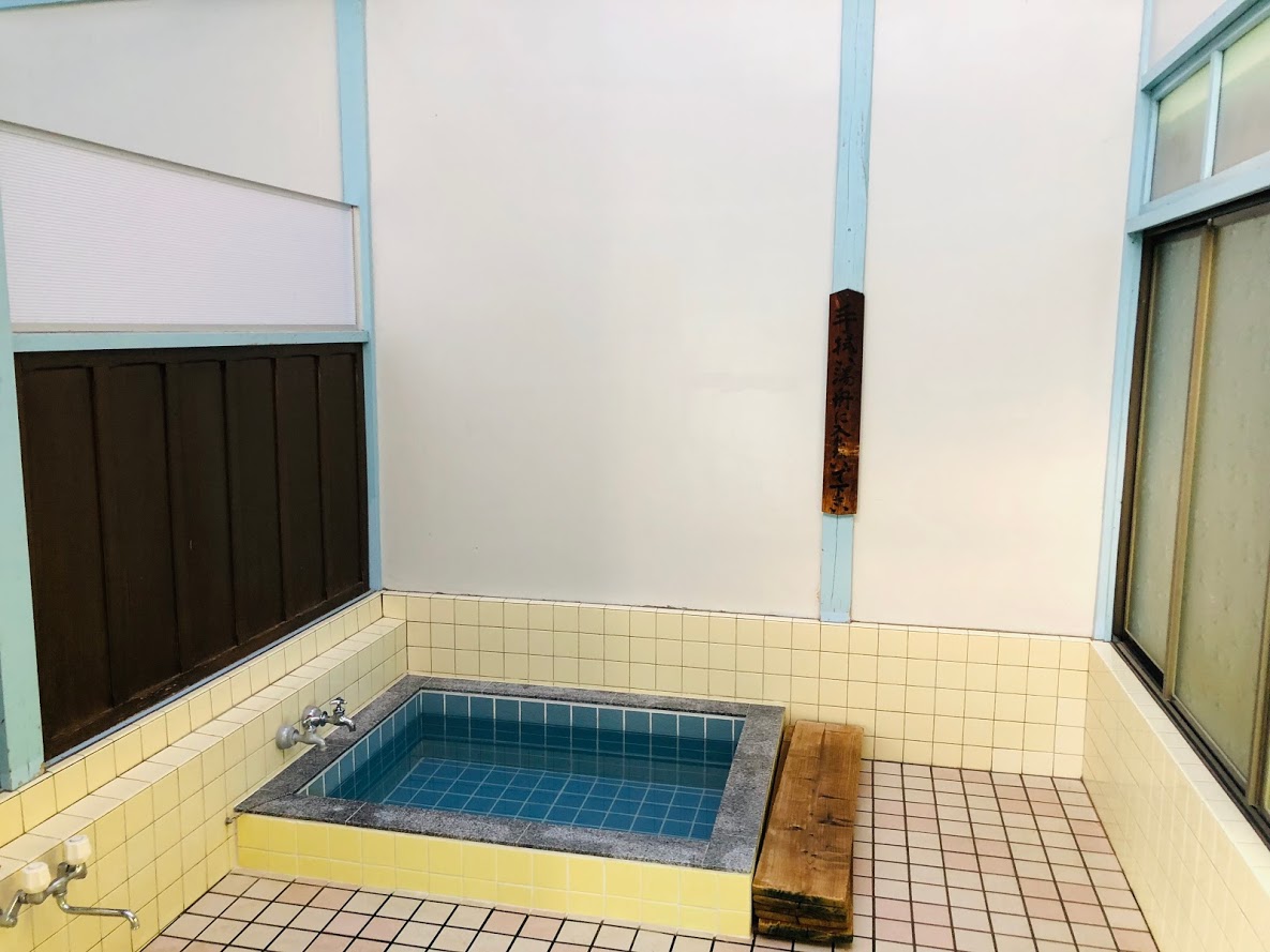
The last destination is Yurando Spa, which is a mysterious spa like an ordinary private house.
Currently it is open only on weekends and offers shower and natural hot spring at 1000 yen.
In addition, you can enjoy pickles and japanese tea made by grandma in the wide room of tatami mat.
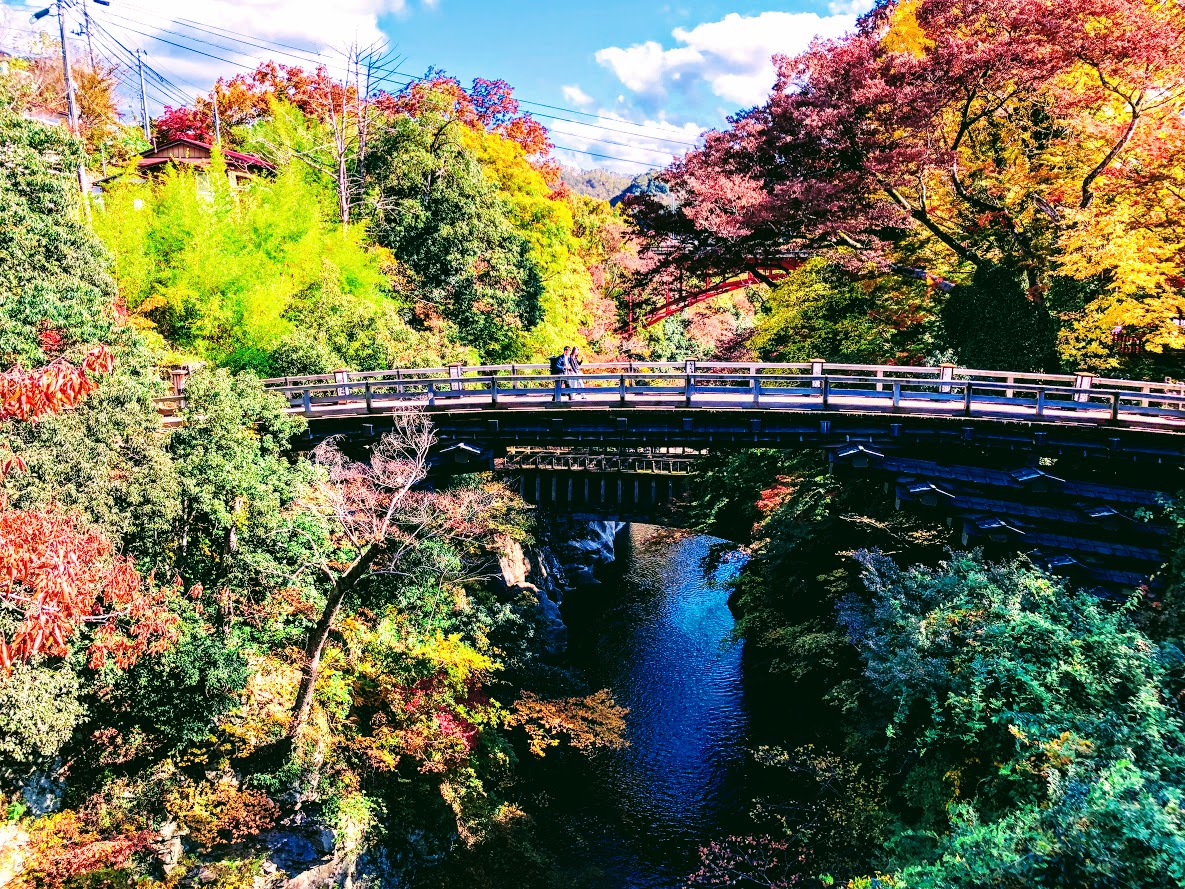
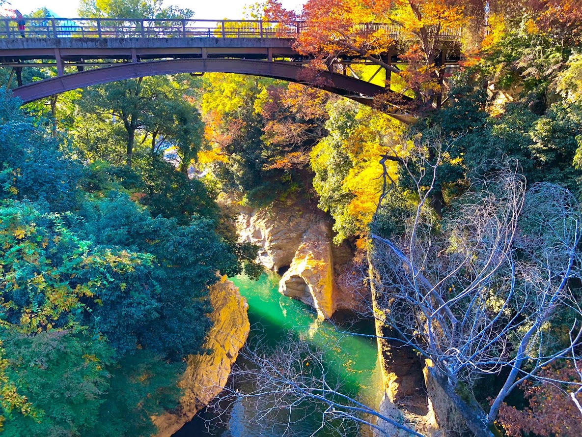
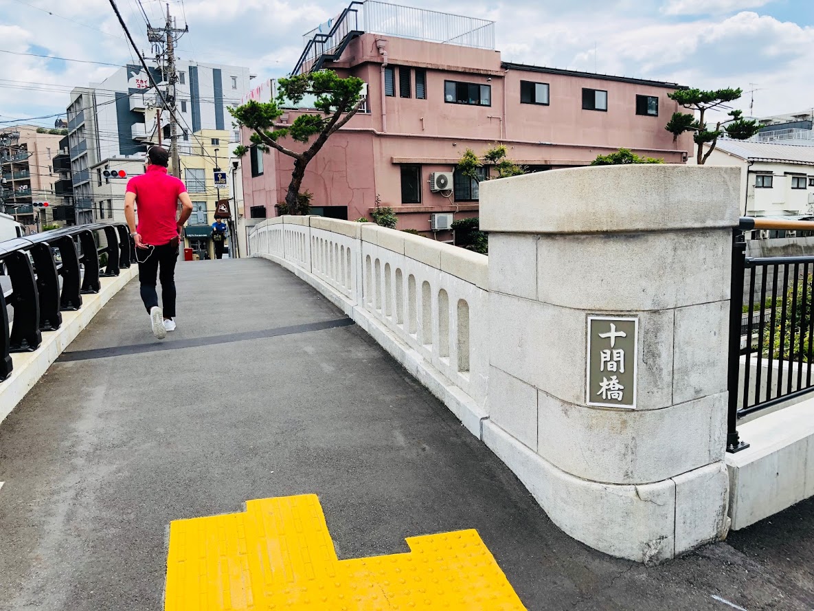
If you have time, I recommend visiting “Saruhashi Bridge” which became famous as a strange bridge in the Edo period.
After Hiking…
Yutando Kosen 湯立人鉱泉
Yutando Sapa
Yutando Sapa may not be considered a hot spring as it is apparently an ordinary private house.
But this mysterious Spa is a mysterious spa that has been going on since 300 years ago.
Business hours: 12 o’clock – 17 o’clock
Business days: only on Saturdays and Sundays
Access: 15 minutes on foot from Sarikebashi Station North Exit
Tel: 0554-22-0622
Saruhashi Bridge
saruhashi bridge
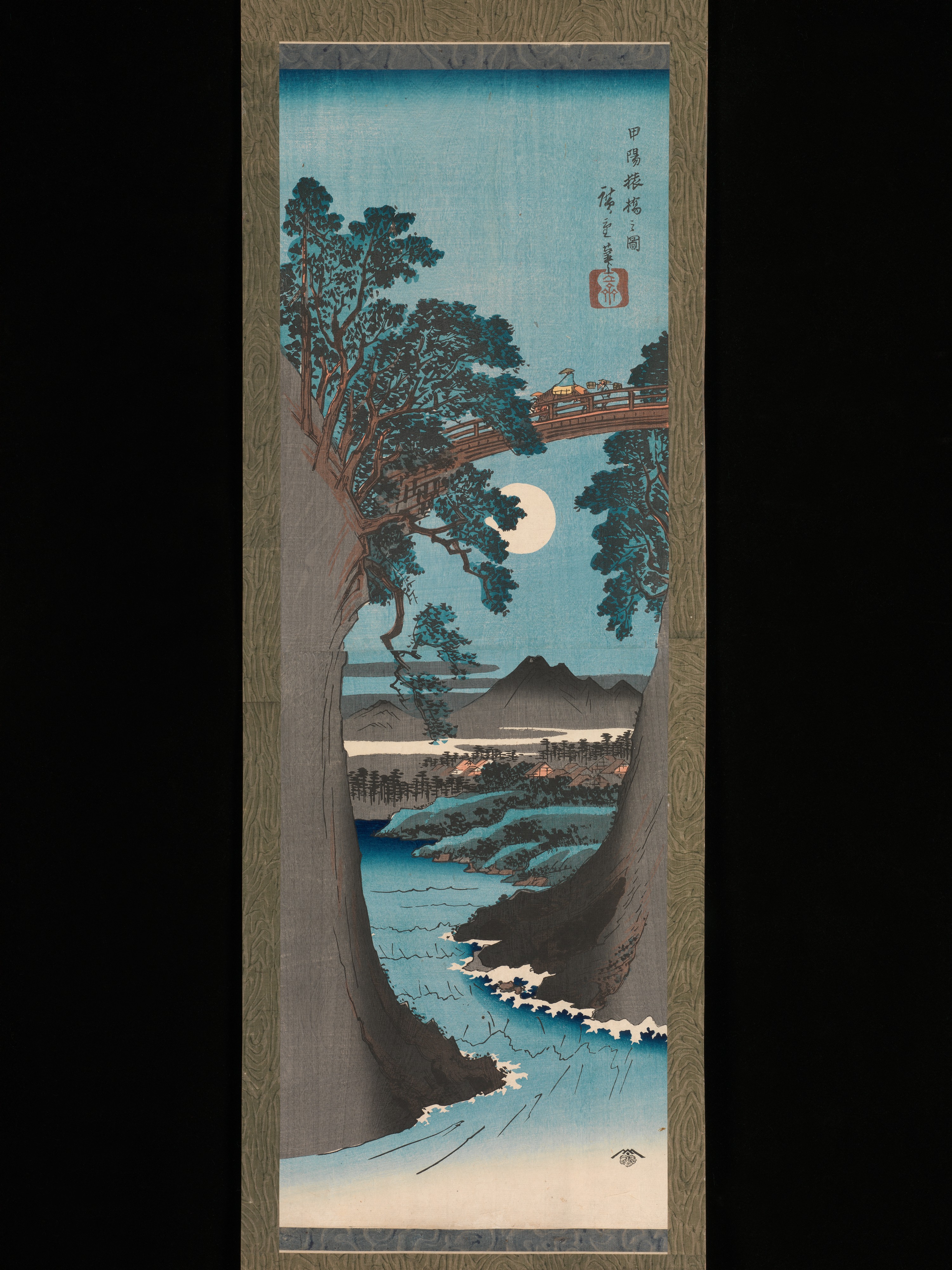
The bridge with an unusual structure became the theme of the picture of Ukiyo painter Hiroshige Utagawa.
Saruhashi called the 3 most strange bridge in the Edo Period.
The carpenters could not make a stepladder because the valley was deep, they supported the bridge with reinforcing material that protruded from both sides.
Hiroshige Utagawa visited this bridge in 1841 and sketched and later released Kōyō_Saruhashi_no_zu(甲陽猿橋之図).
Using a vertically long screen, fresh composition while keeping the natural landscape and lyricism, is said to be the best masterpiece of Hiroshige.
Kōyō_Saruhashi_no_zu(甲陽猿橋之図). Utagawa Hiroshige (Japanese, Tokyo (Edo) 1797–1858 Tokyo (Edo)Valley seen from Saruibashi
Do you need a guide?
If you are looking for guide of this hiking or Trail running course, please refer to the following.
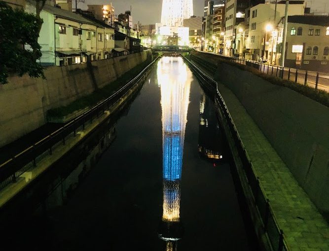
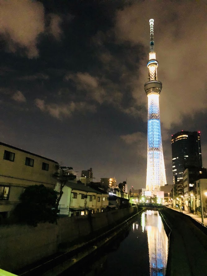
Jukkenbashi Bridge is the name of the bridge in Sumida Ward, Tokyo.
In Kanji, I write “十間橋”, It is about 5 minutes on foot from Tokyo Metro Oshima station.
You can see the Tokyo sky tree from the bridge.
In the night, it reflects upside down the Tokyo sky tree to the surface of the river.
If you take a picture of Tokyo Sky Tree, you can say that this bridge is the most instagrammable.
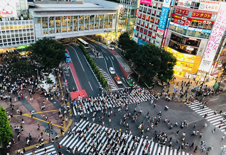
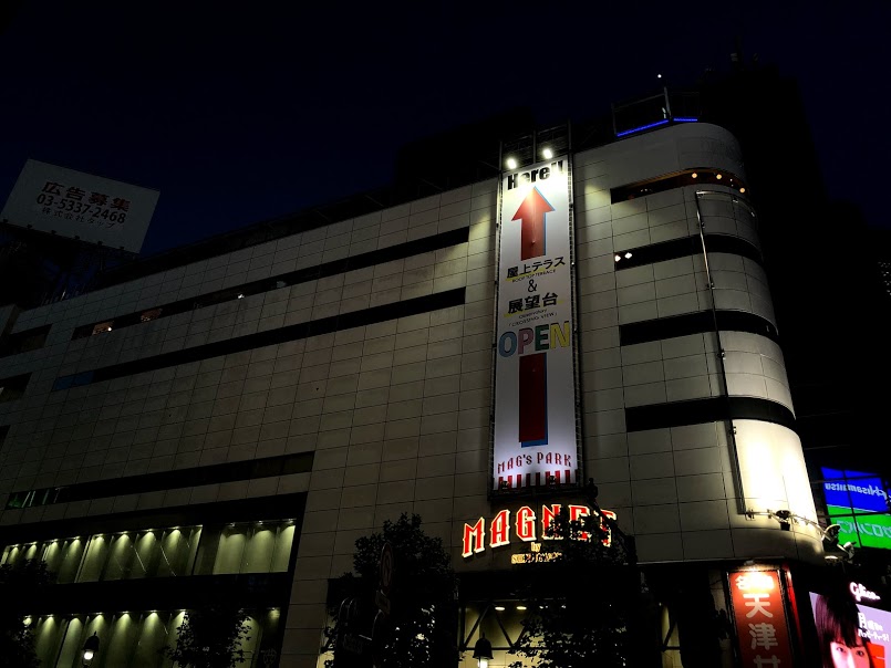
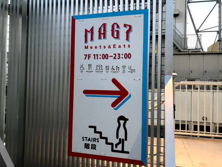
“MAGNET by SHIBUYA 109” is a commercial building one minute walk from Shibuya station.
Mainly selling fashion for young men, food court on the 7th floor.
The rooftop of this building is open for free, and you can take a photo from almost directly above Shibuya Crossing.
You can reach the rooftop from the back door of food court on the 7th floor.
When you come to Shibuya, please go to this rooftop and shoot your best picture.
The time zone I visited was PM 6 o’clock and it was very empty so it is recommended!
Please note that it is not a building of SHIBUYA 109 famous for female fashion, but a commercial building that sells fashion for men.
Store Information
Address : 1-23-10 Jinnan, Shibuya-ku, Tokyo
Tel: 03-3477-5111
website: https://www.shibuya109.jp/MAGNET/mag7
Access : 1 minute on foot from JR Shibuya station
Closed: January 1
Business hours : 10: 00 ~ 21: 00
7F MAG7 11: 00 ~ 23: 00
Rooftop MAG’s PARK 11: 00 ~ 23: 00
※ There are cafe and restaurants where some business hours are different.
Take the bus from Ome Line Okutama Station.
Take one of the West Tokyo buses “東日原 | Higashi-Nippara” or “鍾乳洞 | Shounyu-dou” and get off at “川乗橋 | Kawanori-bashi”.
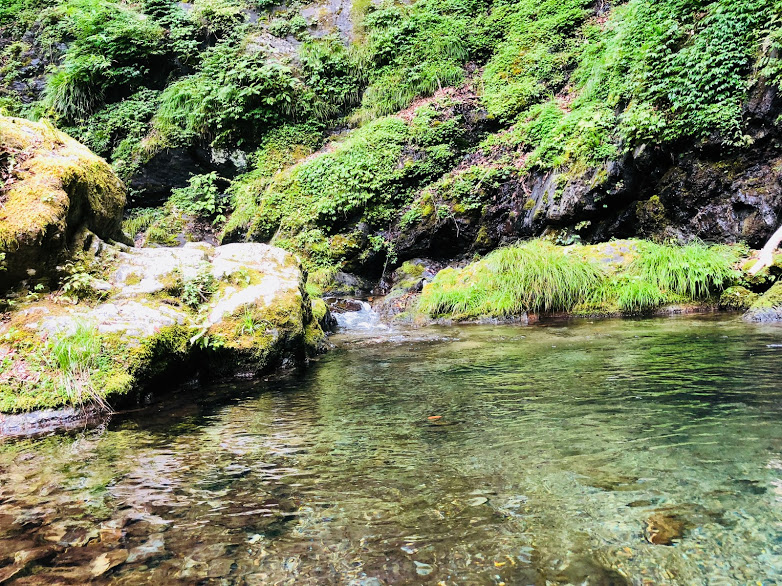
It was a very hot days in Tokyo, so this time we have been to a hike of Mt. Kawanori walking along the cool a valley.
Mt.Kawanori is located in Okutama, Tokyo and is a mountain at the border with Saitama Prefecture.
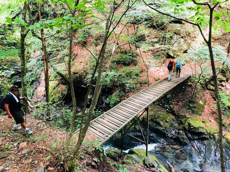
The hiking course starting from Kawanori Bridge is Mt. Kawanori’s most popular climbing course.
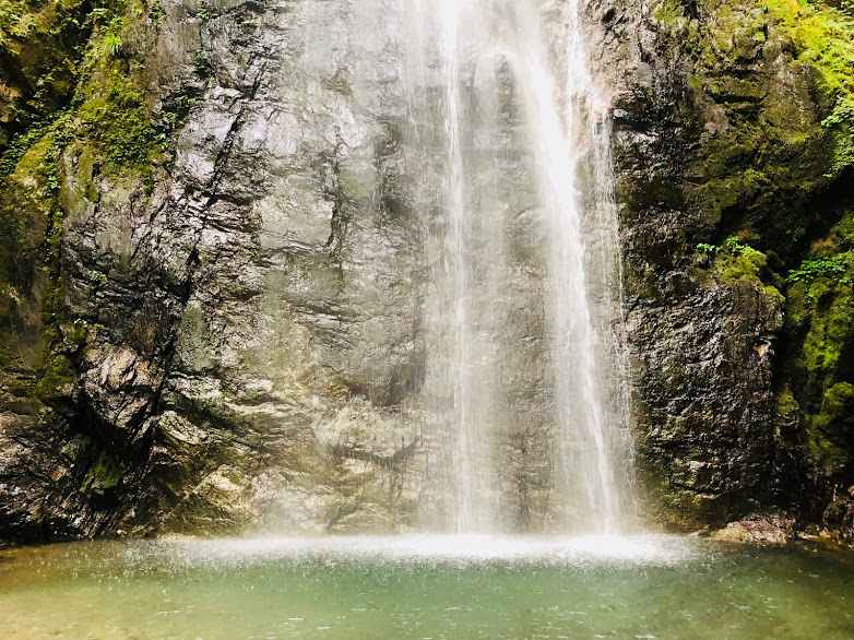
This course is recommended on a hot summer as it walks along a valley and passes through Hyakuhiro Waterfall , which is about 40 m in height.
The waterfall is very cool and you can forget the hot summer for a while.
Under the waterfall is very instagrammable because it is very powerful.
This climbing course is hard as the altitude difference is more than 1000 m.
Because it is a popular mountain, the mountain trail is maintained to some extent,
Even if you are a beginner of mountain climbing it is easy to challenge if you accompany the experienced.
The altitude is 1363 m and the running time is about 5 and a half hours are scheduled.
Even though it is along a valley, It was hard because it was a hot summer exceeding 30 degrees this day.
Also, it is easy to slide around Hyakuhiro waterfall, so it is necessary to be careful as it is a course where a slide accident happens in the past.
Let’s challenge with a non-slippery shoes and adequate moisture, Carry a good behavioral diet.
WHAT TO BRING:
• Non-slippery athletic shoes (climbing shoes if possible)
• Sufficient water (1.5 liters was not enough on this day)
• Behavioral diet (sandwich, rice ball etc …)
• Sunscreen (if you use them)
• Trekking Poles (if you use them)
• Change clothes (if entering a hot spring after hiking)
SCHEDULE FOR THIS DAY:
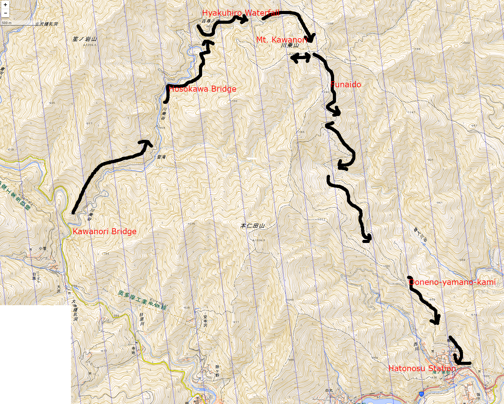
Okutama Station(8:25)→Bus departure time(8:35)→Arrival of Kawanori Bridge(08:50)→Hosokura Bridge(9:50)→Hyaku-hiro Waterfall(10:40)→Mt.Kawanori(12:40)→Funaido(13:30)→Ooneno-yamano-kami(15:00)→Hatonosu station(15:30)
Map of the hiking course
↑Click the image to open a map expanded with new tab↑
AFTER THE HIKE:
We have dissolved at “Hatonosu station”.
Me and the other person got off at the second JR Kabe station from Ome Station towards Shinjuku, and went to the hot spring “Umeno-yu”.
The bathing charge of “Umeno-yu” was 860 yen.
If you are looking for tour guide of this hiking course please refer to the following.