東京の武蔵五日市に位置し、新宿から1時間半ほどでアクセス可能な日の出山ハイキングコースをご紹介します。
このコースのお薦めポイントは、コースのほとんどが緩やかな下りである点です。
最初の30分程のつらい上り坂を耐えてしまえば、あとの大部分は風の心地よい尾根道で癒しのダウンヒルを体験できます。
そのうえ、ゴールには温泉が待っています。
ハイキングコースのビギナーにこそ味わっていただきたい極上トレイル!
この記事ではコース途中にある蒟蒻づくしが味わえるコンニャクショップ「いっすい」も併せてご紹介します。
ハイキングコース地図:
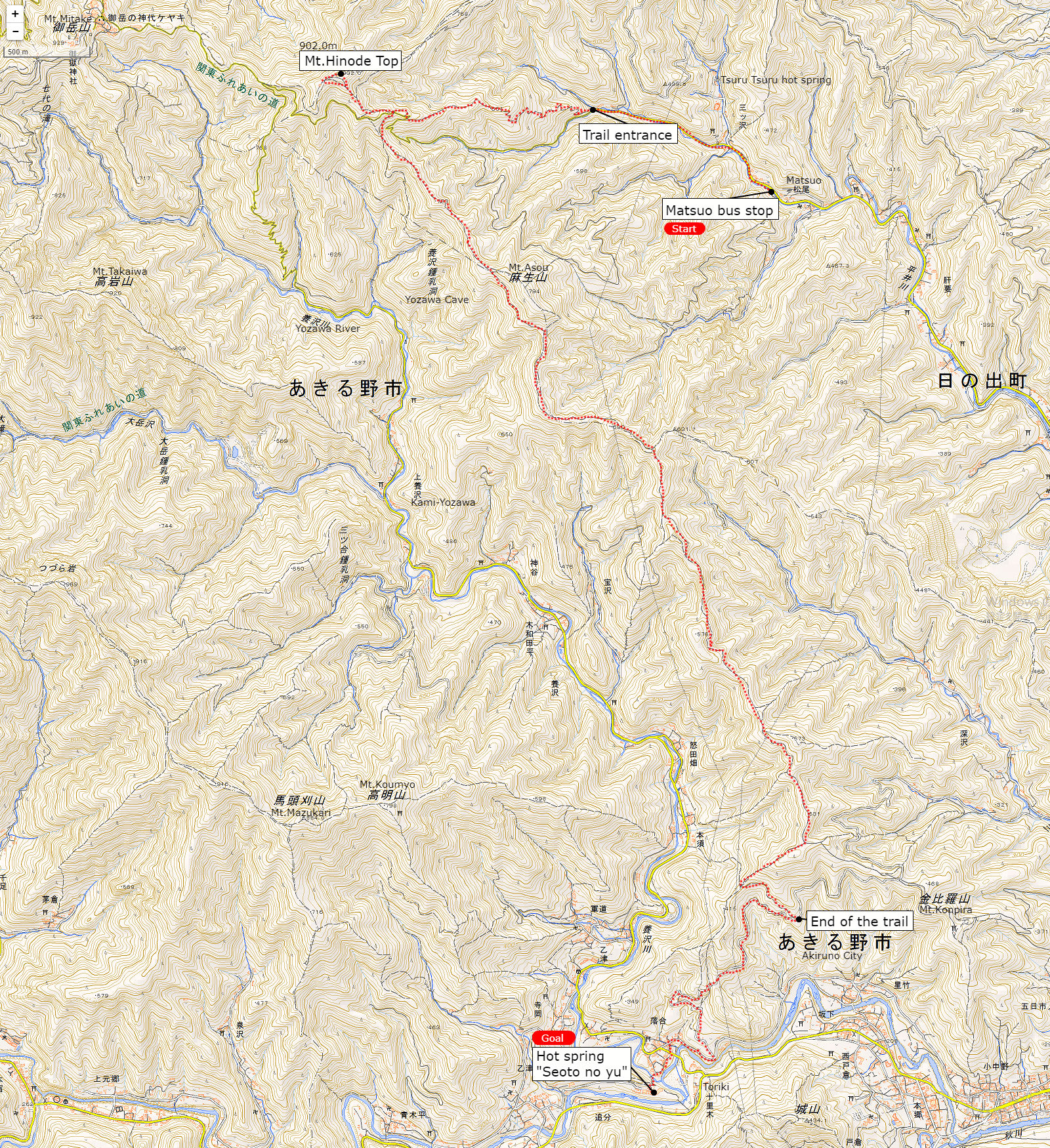
※上記の地図は正確ではありません、実際に出かける際は登山地図等で詳細なルート情報をご確認ください。
- エリア:
- 東京西部 (武蔵五日市市)
- ジャンル:
- ハイキング
- レベル:
- 初心者
- 総歩行時間 (休息時間を含まない):
- 4時間半
- 距離:
- 約 8.4 km
- 累計高低差:
- 700m
- アクセス:
- 行き:「武蔵五日市駅」から西東京バス「松尾行」か「つるつる温泉行」にて「松尾バス停」下車
- 帰り:西東京バス「十里木バス停」より「武蔵五日市駅行」で終点下車
武蔵五日市駅にてバスに乗り換えます。

3番バス乗り場の「松尾行 」か「つるつる温泉行」

「松尾 」か「日の出山登山口」で下車

松尾駅の前では可愛い山羊が出迎えてくれます。

小川に沿って緩やかな坂を上ります。

標識に沿って左の道、「日の出山」方面へ

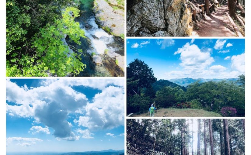
心地よい木陰の道が続きます。

可愛らしいカエルのモニュメントが設置された橋を渡るといよいよ登山口です。

ここから日の出山登山道がスタートします。

序盤の急な坂道です、ここさえ耐えれば全般的に緩やかな下りです。


こちらが「金毘羅尾根・武蔵五日市」方面への分岐です、今は無視して上りましょう、この分岐には後ほど戻ってきます。

標識が示す「日の出山」の方向に進みましょう!

頂上に近づくに従い階段が急峻になります。

ここが最後のひと踏ん張り。

日の出山山頂に到着です!

奥多摩方面には御岳山や天気が良ければ富士山も見えます。


遅い朝ご飯を頂きました、下の写真は私の一押しのカレーメシです。

先ほどの分岐に戻り「金毘羅尾根・武蔵五日市駅」方面へと下ります。
ここから極上のダウンヒルの始まりです。

多少のアップダウンはあるものの概ね緩やかな下りが美しい直ぐ林と尾根道の間を延々と続きます。

コースではところどころで見晴らしの良いポイントが現れます。
そよ風が心地よい!

「金毘羅尾根」の標識に従って進みましょう。


下記の標識が現れたら左折します。
「横根峠を経て瀬音の湯 (2.7km) 養沢方面」

ここでトレイルの終了です。

このサインを右です。

蒟蒻ショップ「いっすい」です。

たった300円でヴァラエティに富んだ蒟蒻料理が味わえます。

こちらの狭い路地を左方向に進みます。

キャンプ場の上をまたぐ橋を渡れば直ぐに温泉です。

ゴールの温泉に到着です。

入浴料金は900円


この施設はレストランも併設していて東京産の豚を使ったとんかつや、お蕎麦を頂けます。

日本庭園を眺めながらラタンチェアーで居眠りも気持ちいいです。

休憩所でビールを飲むことも可能です。お茶は無料でした。

帰りの十里木バス停は10分程歩きます。

十里木バス停から武蔵五日市駅へは15分程で到着します。

武蔵五日市の駅前にはハイカーやランナー向けのカフェ「東京裏山ベース」があります。シャワーや各種グッズ、イベント情報など山で遊ぶヒントが満載です。

モバイル機種の充電も出来ます。

武蔵五日市駅
