【Introduction】
Hello!
I am a native Japanese living in Tokyo.
I introduce hiking trails and running spots in Tokyo for those traveling to Tokyo under the name of "Tokyo Sampomaster".
blog : https://sampomaster.com
twitter : https://twitter.com/Sampomaster1
YouTube : https://www.youtube.com/channel/UC38T5PQ3bUZ8aC3qAScvuTQ
【Hiking trail】
Although it is not well known, there are many mountains that are suitable for hiking in Tokyo.
If you are staying in Tokyo for a week, why not try going to the countryside near Tokyo for one day?
A beautiful valley, an old shrine and a relaxing hot spring will heal you and will surely be unforgettable memories.
【Running spots】
If you are a runner, why do not you visit the sightseeing areas of Tokyo by running?
There are many facilities equipped with shower and hot spring for runners in Tokyo.
The experience of running through the Imperial Palace, traditional temples and shrines with your own feet is a wonderful memory that you can not change anything.
If you do not mind, I will undertake free guides as well.
English is still not very good, but I will try my best so please feel free to contact us!
info@sampomaster.com
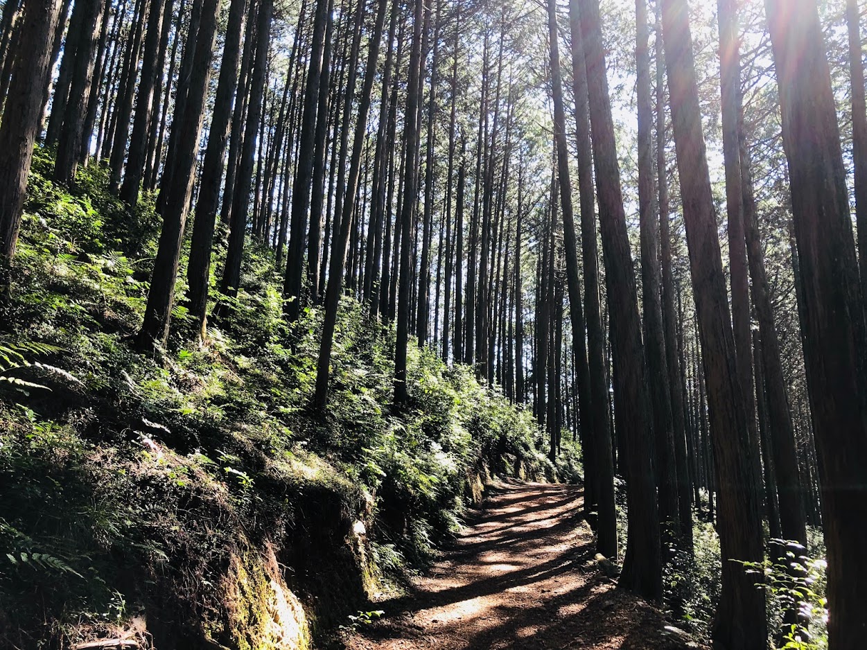
Oku Musashi nature sidewalk (Okumusashi shizen hodō, 奥武蔵自然歩道) is a natural sidewalk in Saitama Prefecture.
A trail with a total length of 11 kilometers can be enjoyed by several low mountains followed by lakes, seasonal plants and various animals.
The low mountains of about 300 m in altitude can be said to be a nature trail suitable for beginner hikers.
Tour details
Price : 3000 yen per person
Distance : 11 km
Private Tour (Your family and friends are OK.)
Difficulty : ★☆☆☆☆
Language : English, Japanese
Meeting place : Ikebukuro Station
Meeting time : negotiable
Hike to Oku Musashi nature sidewalk
Trails are well maintained and there are few dangerous places.
Oku Musashi Nature Trail is a course generally departing from Hanno station, but I recommend a course from Musashiyokote Station.
Because there are few hikers in this trail, you can enjoy quiet and peaceful forests and flowers.
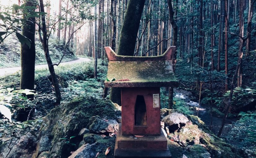
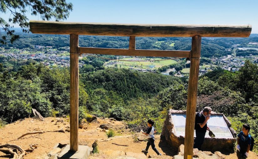
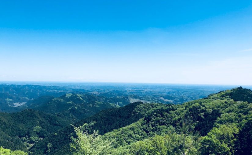
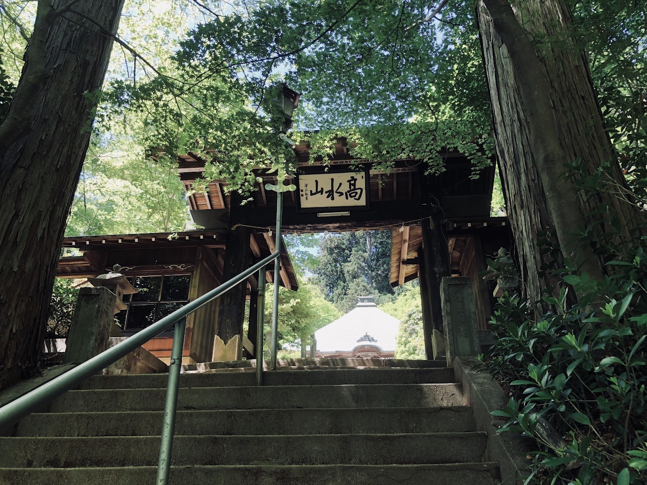
At the summit of Mt. Hiwada you can see a superb mountain view and a lovely shrine.
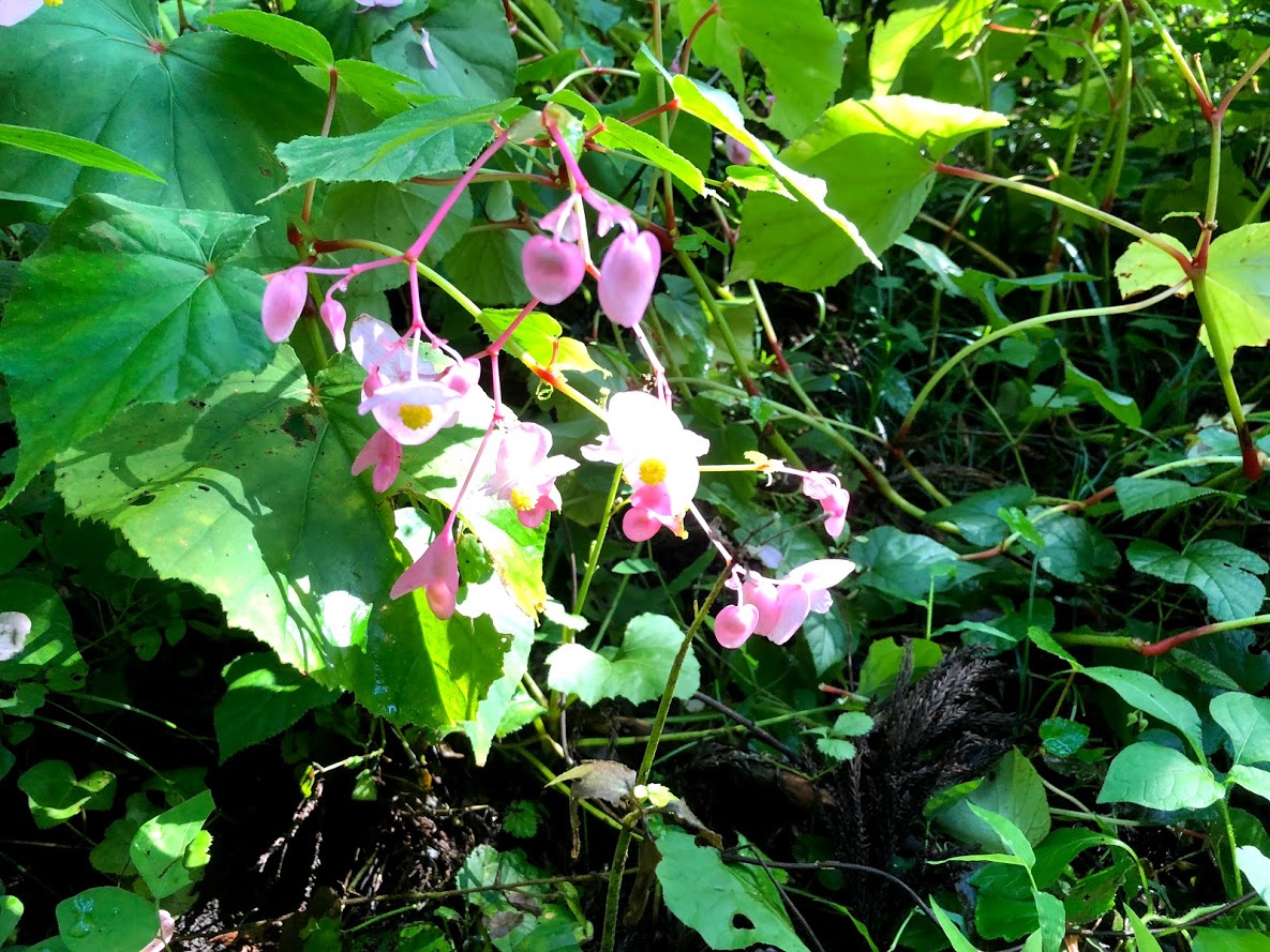
It is also possible to walk while watching various beautiful flowers depending on the season, and chose a hot spring for the goal.
Why not try escaping the bustle of Tokyo and heal your mind and body with simple hikes?
Please read and give me consent before booking for this tour.
Hiking is an inherently dangerous activity that can lead to serious injuries including but not limited to slip and fall injuries, fractures, snake bite, heat exhaustion, poison oak, ticks and frostbite. By participation in this event/hike you agree to not hold these organizers liable for any harm that may come to you, your guests, or your property. Always remember to let the event organizer know if you are leaving the group. Stay on the trail, never hike alone and use your own common sense.
Booking Now
[contact-form-7 id=”4332″ title=”Guide For Hiking to Oku-Musashi Nature”]
Oku-Musashi is a generic term for the mountains and hilly areas in the southwestern part of Saitama Prefecture.
Oku-Musashi Nature hiking course is a natural sidewalk in there.
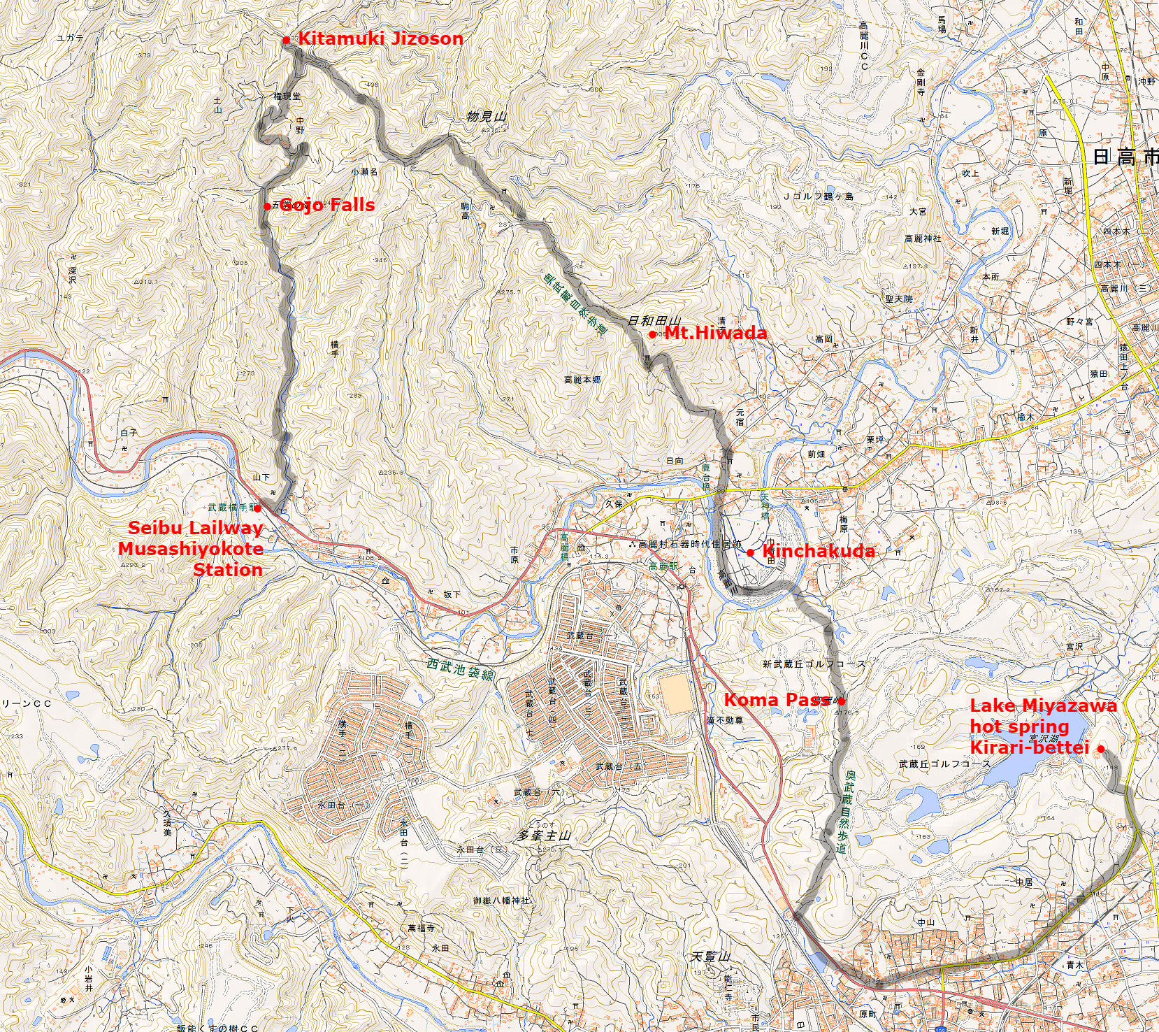
It is a hiking course of about 11 km in length connecting Kamakita Lake, Kitamuki jizou, Mt.Mooni, Mt.Takasasu-yama, Mt.Hiwada, Kinchakuda, Koma Pass, Mt.Tenran, which is a landmark of Oku-Musashi.
It is suitable for beginner of a hiker because it is a trail that is easy to walking with a relatively gentle slope.
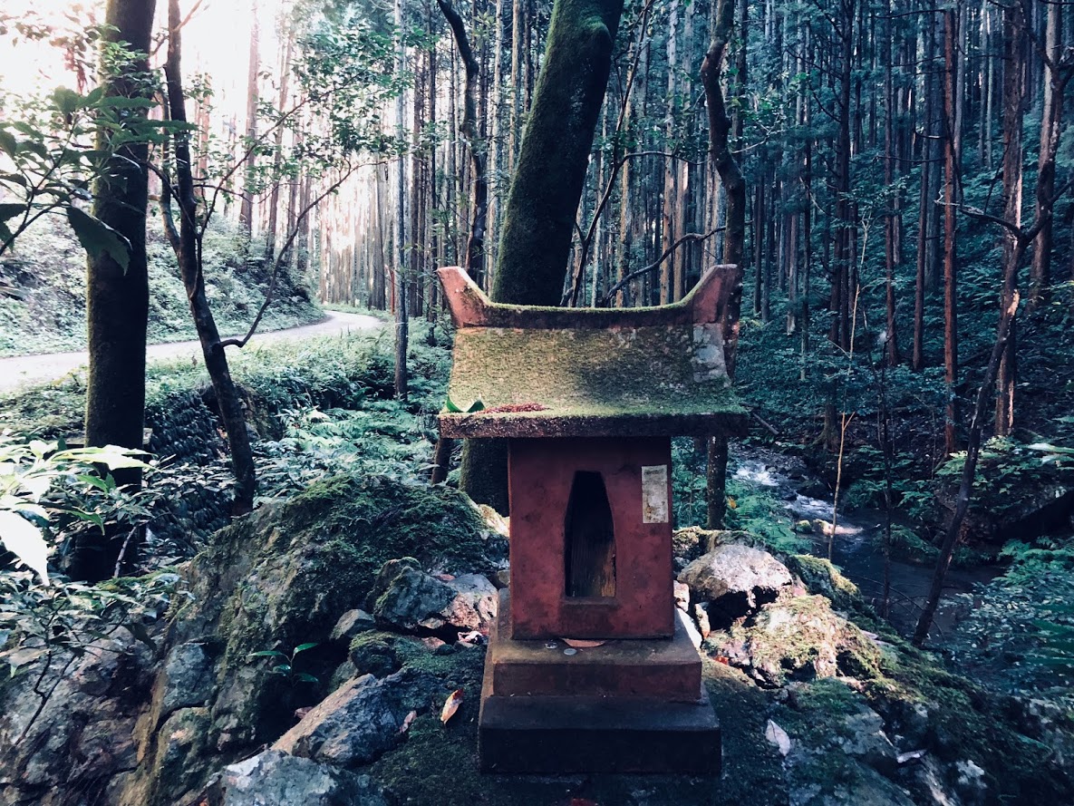
Paved road on the way to Kitamuki jizou
Map of Oku-Musashi Nature Hiking Route
↑ Click on the image to enlarge. Open link in a new tab.
Schedule of the day:
Seibu Lailway Musashiyokote Station(9:05)
↓
Gojo Falls(9:45)
↓
Kitamuki Jizoson(10:20)
↓
Mt.Hiwada(11:20)
↓
Kinchakuda(12:00)
↓
Lunch break
↓
Koma Pass(13:00)
↓
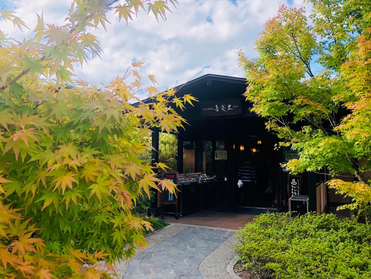
Lake Miyazawa hot spring Kirari-bettei(13:30)
Gojo Falls was off limits on this day, I did not know whether I will come in the future or not.
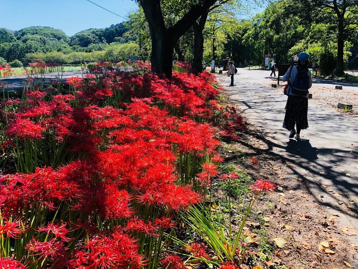
The outlook from Mt. Hiwada is wonderful and Kinchakuda had a festival of Cluster amaryllis and it was very crowded.
Kinchakuda’s Cluster amaryllis
After Hiking:
After the running is over, I ran from the end point of Koma Pass and got to a hot spring about 30 minutes.
This hot spring is named “Miyazawa Lake Spa Kiraku-bettei”, the bathing fee of the hot spring is 1000 yen.
From Hot Springs to Hanno Station is about ten minutes by bus.
Buses are about 1 to 2 per hour.
Miyazawa Lake Spa Kiraku-bettei
Do you need a guide?
If you are looking for guide of this trail, please refer to the following.
This is popular course of Okutama which walking in three peaks.
With about 4 hours of walking, It is a luxurious course that you can taste three mountain peaks, “Mt. Takizumi”, “Mt. Iwatakeishi” and “Mt. Sougaku”.
Easy access with public transportation is also GOOD!
It takes about 1 hours and a half by train from Shinjuku to Okutama
JR 軍畑 Ikusabata station~高源寺 Kougenji Temple(about 30 minutes)
軍畑 Ikusabata Station to 高源寺 Kougenji Temple we walk on a general road where gentle climbing continues. The Hiramizo River flows on the right side of the road, making you feel cool. There is a toilet for 1 person in the Kougen temple.
Start from JR Ikusabata
Take the road sign in front of the station toward “Mt. Takamizu 高水山”.
You will cross a Railroad crossing.
Go down the slope and turn left.
Let’s go straight ahead along the Hirakiga River.
When the sign of “Mt. Takizumi” appears, proceed to the left.
Let’s proceed straight.
Kougenji Temple is going to the right on the parting road of the photo.
The altitude difference of Mt.Takamizu from the Kougenji temple is about 400 meters. Probably the first 30 minutes rise is a bit tough. Top of the Mt.Takamizu is surrounded by trees and the view is not good, but a benches and toilets are installed.
You will further climb the slope.
This is the entrance of trail.
Finally to the mountain path.
Let’s advance the cedar forest.
Be careful of the protruding root!
Proceed to “Joufukuin Mt.Takamiz 常福院 高水山” direction.
Arrive at 常福院 Joufukuin.
The guardian dog that sits on the left and right in front of 不動堂 Fudo-Do is a stone statue of Japanese dogs.
Even if you see it from the side or from the side it is a Japanese dog, the tail is wrapped like a Japanese dog, but the expression of the fangs and tortoise is like a wolf.
Although it is a Japanese dog, I feel that I am arranging for a wolf style somehow.
This is probably because the land is near the dog’s faith Musashi (Okutama, Chichibu), so that the characteristics of the wolves were added to the Japanese dog.
There is a toilets aside.
If you climb up a little, it is the top of Mt.takamizu.
The mountain top of Mt.Iwatakeishi is the most prospective place in this course, You can see the mountains of Oku Musashi. Let’s have a good break at the summit of Mt.Iwakushiis.
A little downward continues from the top of the mountain.
Proceed to “Mt.Iwatkeishi 岩茸石山” direction.
A flat ridge walk continues
Observation from the gaps in the trees
One step to the summit of the mountain
It is the summit of the highest “Mt.Iwatakeishi” among the three mountains
The way from Mt. Iwatakeishi to Mt. Sougaku is very rich with climbing rocks and steep climbs on the way.There are no toilets at both the mountaintops of both Mt.Iwatakeishi and Mt.Sougaku.
You will go down the steep slope
Move the signpost towards Mt.Sougaku 惣岳山
There is also a little rock climbing
Let’s walk while paying attention to the root of the tree
Formal name: Sengen mount 仙元山
Difficulty of this trail: ★ ☆ ☆ ☆ ☆
Trail appearance rate: ★ ☆ ☆ ☆ ☆
Area: Hayama town, Kanagawa prefecture
Start: Kazahaya-bashi bus stop 風早橋バス停
Goul: Zushi station 逗子駅
Total distance: 10 km
elevation: 180 m
Total difference in elevation: 360 m
Walking time: 4 hours
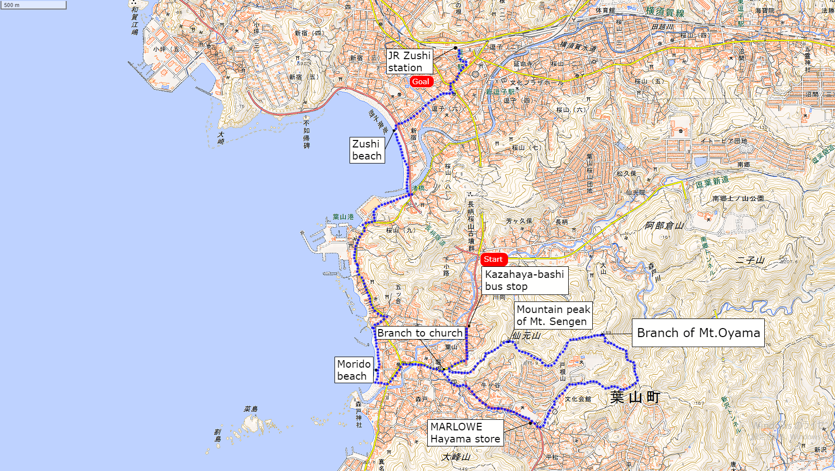
Course Guide of Mt.Sengen
Trail of Mt.sengen
Kazahaya-bashi bus stop 風早橋バス停
Branch to church 教会への坂道分岐
Mountain peak of Mt. Sengen 仙元山の山頂
Branch of Mt.Oyama 大山方面の分岐
MARLOWE Hayama store マーロウ葉山店
Morido beach 森戸海岸
Zushi beach 逗子海岸
JR Zushi station JR逗子駅
Map of Mt.Sengen
the map of Sengen mount | Clicking the image will display the enlarged size with a new tab.
Access Guide of Mt.Sengen
Entrance of mt.sengen’s trail
Shinjuku station as a departure place.
Shinjuku Station
↑
JR Shonan Shinjuku Line (fast): 30 min
↓ Yokohama Station
↑
JR Yokosuka Line (Normal): 30 min
↓ Zushi Station
↑ Keihin Kyuko Bus: 7 min
↓
Kazahaya-bashi bus stop
Transportation expense
2240 yen (round trip)
Advice of access
From Shinjuku Station you can use Zushi going to Shinjuku Shonan line.
If Keihin Kyuko is convenient, you can also get on the bus from Shin-Zushi station.
There are frequent buses to Kazahaya-bashi bus stop, so you can get on without having to wait much.
Features of “Mt.Sengen” Trail
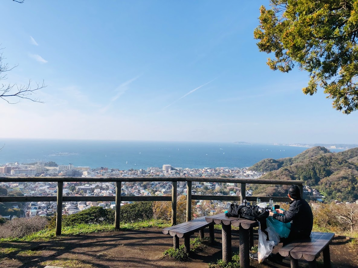
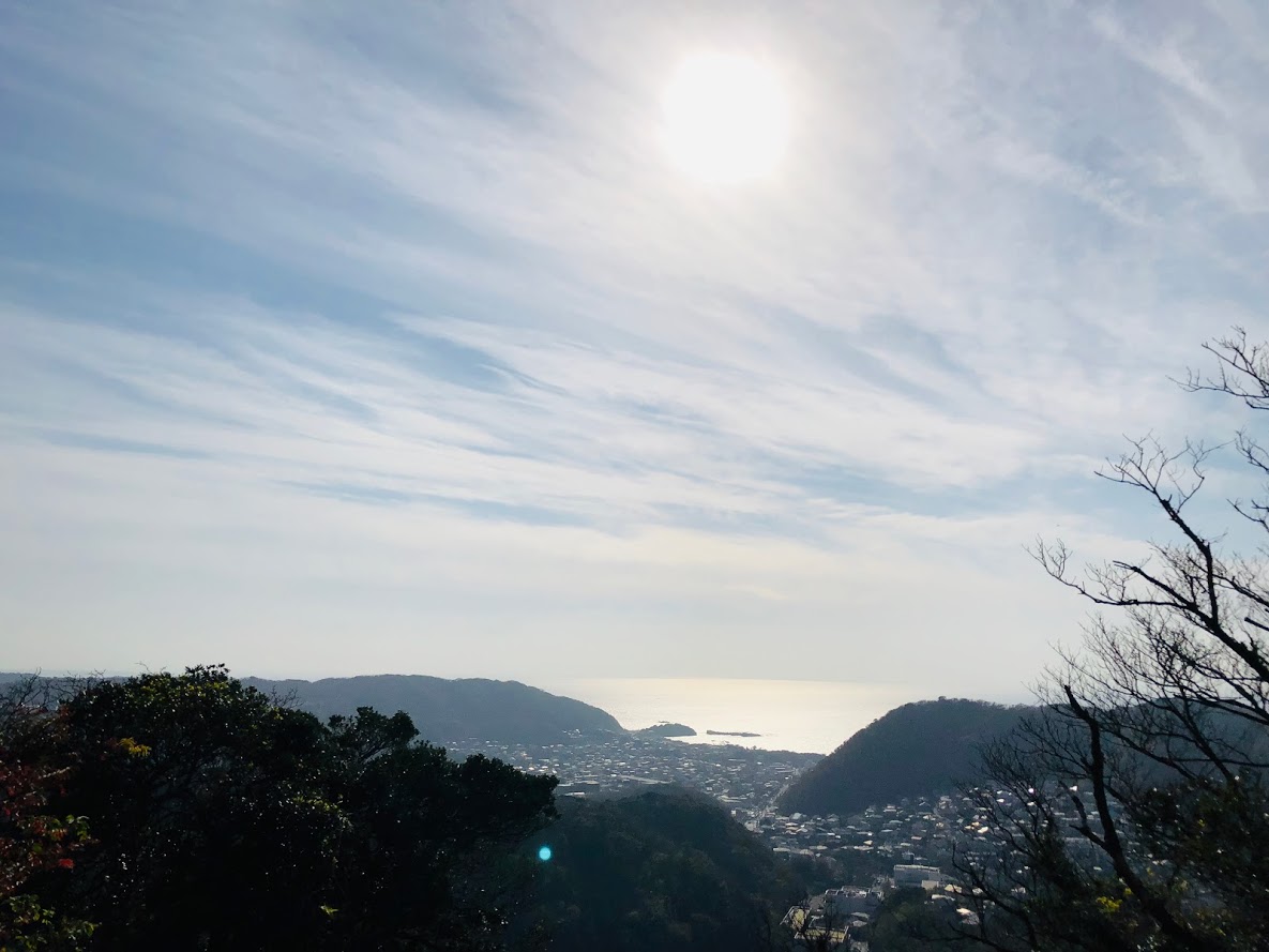
The sumit of Mt.Sengen | If it is sunny, you can see Mt. Fuji.
Sengen mount is a low mountain that reaches the summit in about 20 minutes from the foot of mountain.
The view is excellent, and you can see Sagami Bay and Mt.Fuji from the summit at the same time.
It is not enough to stand on the summit so I added it to the course from Morito beach to Zushi beach.
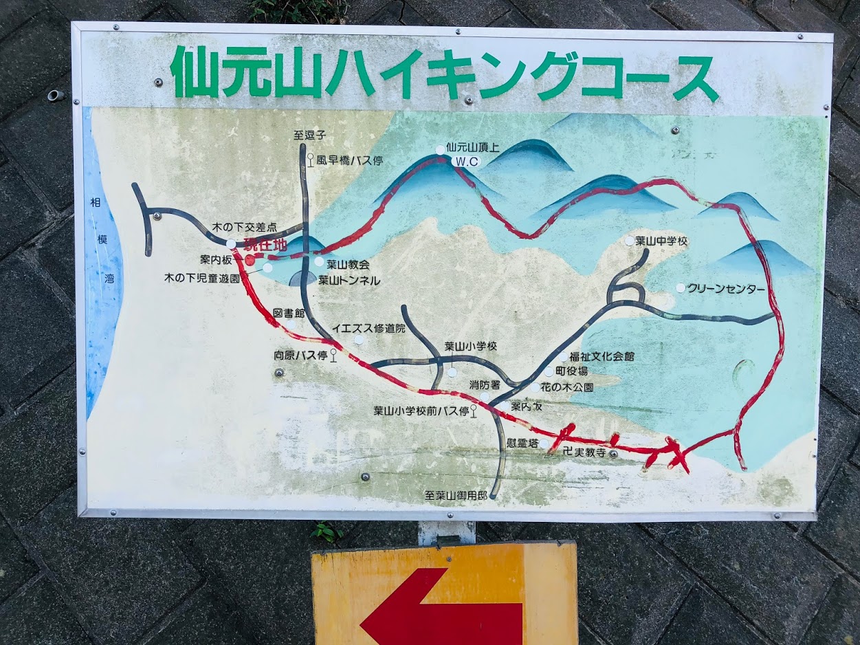
As soon as we move in the direction of travel from Kazahaya-bashi bus stop, there is a Hayama tunnel.
Go to the intersection in front of this tunnel to the right, turn back the next signal and climb the “branch to church”.
When you walk a steep slope for a while it is Hayama church.
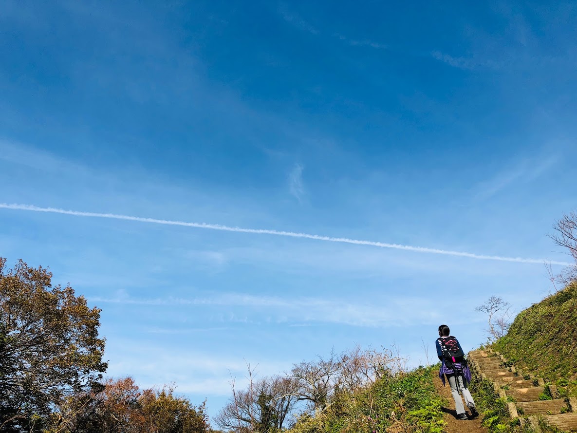
The trail of the Mt.Sengen’s trail starts from the left side of the church.
As you go along the ridge path surrounded by lucid trees, you will soon pass through the forest and arrive at the summit of Mt.Sengen.
There are benches, toilets and Juniperus chinensis trees on wide mountaintops, yachts floating on the sea of Sagami Bay, Enoshima and Mt.Fuji etc. can be seen.
If you fully enjoy the view, let’s go down the stairs by trail.
Once on the slope, it gets gentle again, goes down the stairs again and if you climb the steepest staircase in the course it is a peak of 189 m.
Nice view from the logging area
As soon as you cross the ridge after taking a rest, you will find “Branch to Mt.Oyama”.
Proceed on the right road, but let’s take a short rest there as you can see Mt.Fuji and the south west side from the logging area just above.
Go back to the bifurcation and go on a gentle slope.
As soon as you go to the right towards the Clean Center, you will have a branch to “Branch of the Cannon Mound and Jikkyo Temple”.
Go straight here and go down the next branch to the right.
After a while it will arrive at the observation deck where the sea can be seen, if you go down the groove style from here, it is a Jikkyo temple.
If you go between the private houses and go out to the national highway go to the right is the Hayama elementary school bus stop.
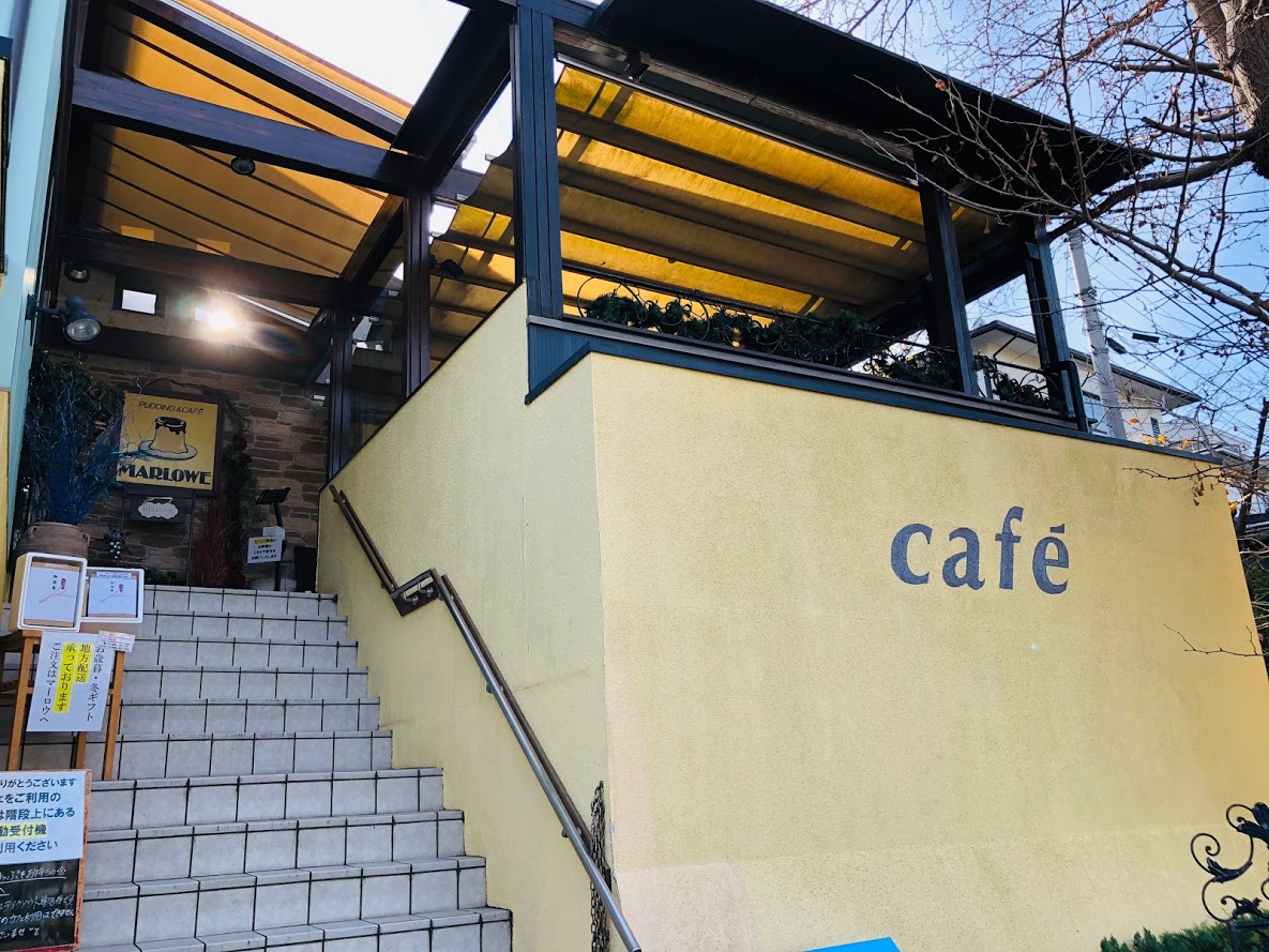
There is a MARLOWE Hayama store where the pudding is delicious in front of the bus stop.
To Morido beach, proceed to the left at the Mukaihara intersection and arrive at the coast, if you proceed along the sea as it is, you will find the Zushi beach.
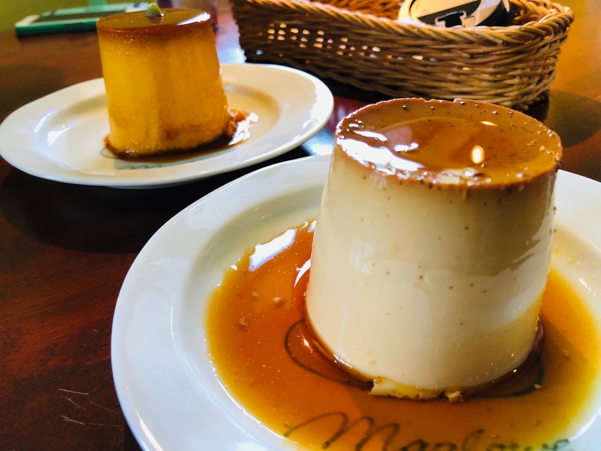
Sweets and beaches after running…
Pudding of MARLOWE Hayama shop
MARLOWE Hayama shop
Continue making beaker pudding since its founding in 1984 is a popular product that can sell 2000 pieces a day. You can also eat in the cafe inside the store.
MARLOWE葉山
Business hours: 10 o’clock – 19 o’clock
Non-business day: Wednesday
Access: Hayama primary school bus stop in front
Tel: 046-875-0412
Morito Beach and Zushi Beach
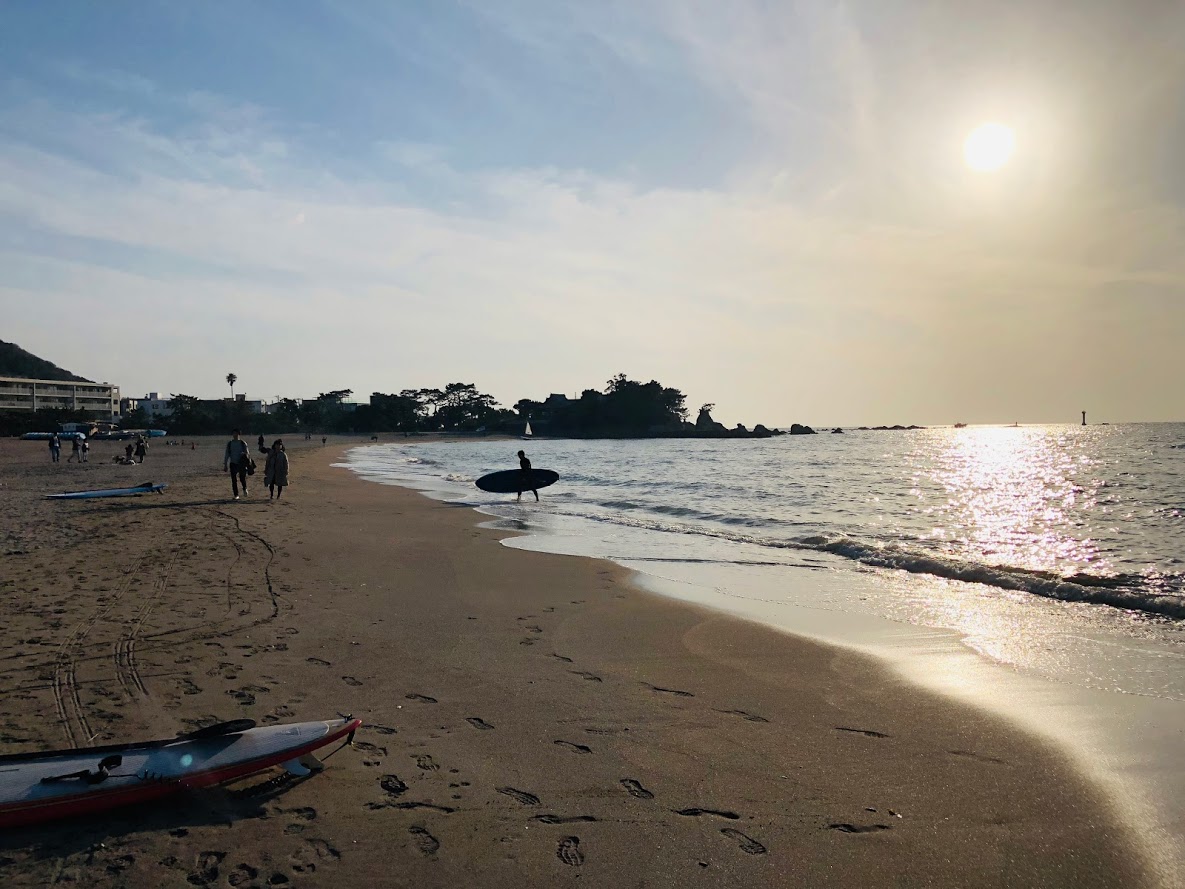
Sunset of Morito beach
Morito Beach is a beach known as the shallow and calm waves of the beach that looks at Enoshima and Mt. Fuji. Morito shrine is enshrined in the beach.
The Zushi coast is a beautiful beach characterized by the shallow and calm waves in Zushi City, Kanagawa Prefecture.
There are many cafés and restaurants in the surrounding area, and there are many surfers and tourists crowded on holidays.
Beach combing at zushi beach
Do you need a guide?
If you are looking for guide of this trail running course, please refer to the following.
Mt. Senge in Hayama is a low mountain with an altitude of 89 m.
You can walk the beautiful green trail while feeling the wind from the pleasant sea.
It is a simple mountain that everyone can climb, so if you are in shortage of exercise you will get a good exercise.
Also Hayama is a beach town, so there are plenty of fancy cafés and restaurants.
Why not relax with delicious cakes and coffee after a pleasant hike?
Tour details
Price : 3000 yen per person
Distance : 6.3 km
Private Tour (Your family and friends are OK.)
Difficulty : ★☆☆☆☆
Language : English, Japanese
Meeting place : Hotel pick-up or Zushi Station (depends on your preference)
Meeting time : negotiable
A Secret Trail to Mt.Sengen
This trail is easy to running with the signposts also being maintained. Let’s walk slowly as there are steep stairs.
Although it is not well known, Hayama, famous as a beach area, has many trails suitable for running.
This Mt.Sengen is one of them, and you can enjoy a pleasant green trail and an open beach at the same time.
The goal of Morido coast is a lovely beach with beautiful sand and cute shrine.
Fuji and the sunset will be visible through the ocean, so if the weather is nice, you will see a wonderful view.
It is about one hour one way by bus and train from Tokyo.
Even the highest peak is a small mountain of 189 m so sneakers are okay, of course the trail running shoes are better though.
If the weather is nice, you can enjoy spectacular views of Suruga Bay and Mount Fuji at the top of the mountain. It was a pity this day, but it was slightly hazy.
Because it is a moderate walking time for 2 hours, if you are a traveler you can get a good exercise to heal the tiredness of the trip.
Please escape the bustle of Tokyo and relax on the beach with a quiet trail.
Sunset of Morito beach
Hayama is a famous spot for marine sports such as surfing and sailing.
For that reason there are plenty of fresh fish dishes and stylish cafes.
“CAFE MARLOWE” at the end of this trail is famous for the original Creme Caramel, a cafe with a calm atmosphere founded in 1984.
Please read and give me consent before booking for this tour.
Trail running is an inherently dangerous activity that can lead to serious injuries including but not limited to slip and fall injuries, fractures, snake bite, heat exhaustion, poison oak, ticks and frostbite. By participation in this event/hike you agree to not hold these organizers liable for any harm that may come to you, your guests, or your property. Always remember to let the event organizer know if you are leaving the group. Stay on the trail, never hike alone and use your own common sense.
Booking Now
[contact-form-7 id=”4275″ title=”Private Trail Running Tour to Mt.Sengen | Mountains and Beaches and Creme Caramel”]
“Sento run” refers to a running style that puts luggage in the japanese public bath and enjoying running, of course, after running, you can relax with a bath by taking a shower.
This group aims to slow and relax “Sento run” with the public baths in various places in Tokyo.
Therefore, it may be a bit unsatisfactory event for runner who aims to shorten the time at marathon contest, please understand that point in advance.
The manager is not good at English, but I’d like to spread the goodness of the japanese public bath as well as possible to the world, please do not hesitate to join foreigners and Japanese people!
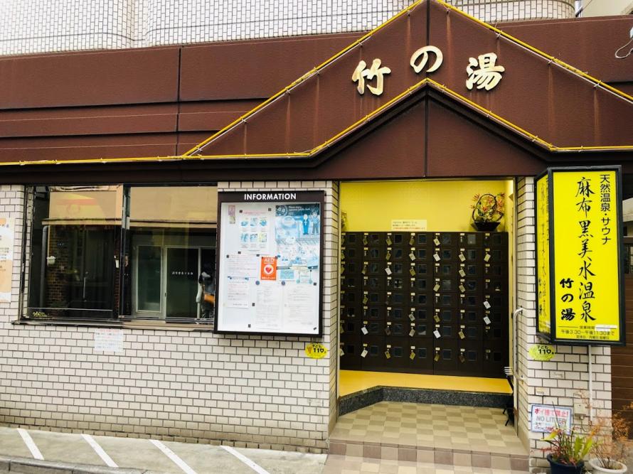
Information on “Azabu Black Water Hot Spring Take-no-yu”
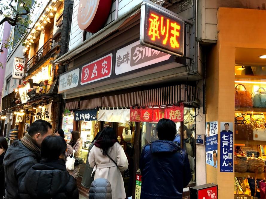
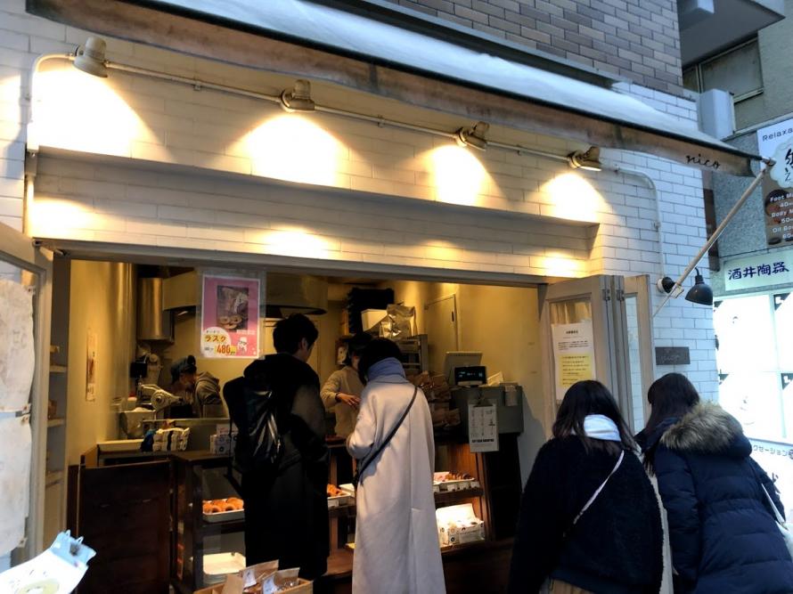
In the running course of this day we are going to cross the intersection of Azabu Juban 1 chome where Japanese sweets ‘parlors’ famous shops are concentrated.
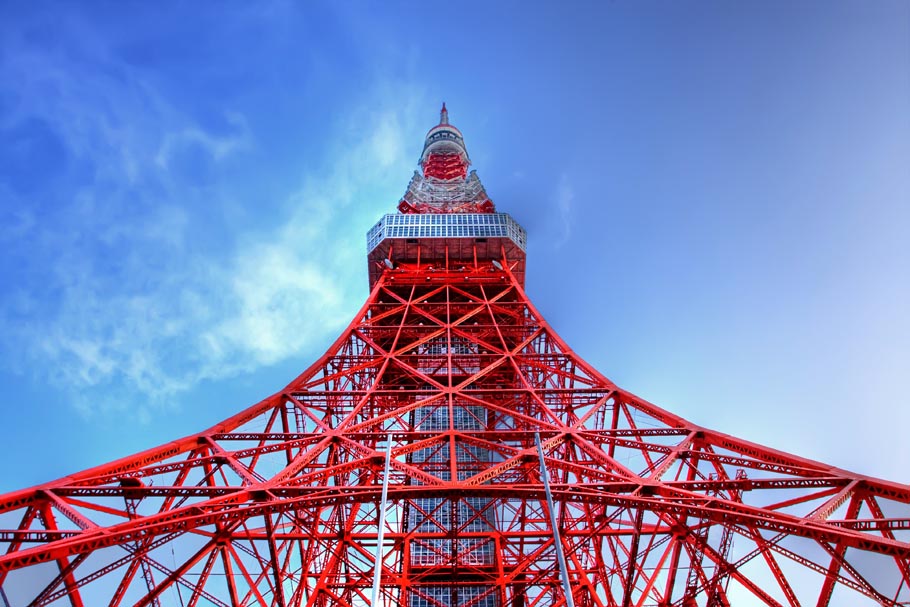
We are assuming a course of about 10 km coming back to Tokyo Tower via Shiba Park and Zojoji Temple.
For this crossroad, including the popular “Naniwa-ya total head office” for bake-fire, “Mame-gen”, “nico donut”
There are many popular shops of sweets that can be walk and eat.
Let us supplement the sugar which was lost by running by using these famous stores as our runner as aid station!
Information on running courses
In the running course of this day we are going to cross the intersection of Azabu Juban 1 chome where Japanese sweets ‘parlors’ famous shops are concentrated.
We are assuming a course of about 10 km coming back to Tokyo Tower via Shiba Park and Zojoji Temple.
For this crossroad, including the popular “Naniwa-ya total head office” for bake-fire, “Mame-gen”, “nico donut”
There are many popular shops of sweets that can be walk and eat.
Let us supplement the sugar which was lost by running by using these famous stores as our runner as aid station!
MEETING PLACE
Let’s meet at 15: 15 near the ticket gate of the Toei Oedo Line “Azabu Juban” station.
Please note that the Azabu Juban train station also has a Nan-boku line, the ticket gate of Nan-boku line and the ticket gate of Oedo line are connected by the underground passage.
If you do not understand please contact the following e-mail.
↓ info@sampomaster.com
ENTRY FEE:
free
※ The bathing charge is 460 yen.
* Hand towel set (+ 100 yen) includes face towel and body soap · rinse in shampoo.
WHAT TO BRING:
running shoes
Running Wear
towel
After running
After running we are planning a drink,
participation in that is your choice.
DISCLAIMER:
These organizers are not professional or trained leaders and are not medically trained to handle emergencies.
By participation in this event/run you agree to not hold these organizers liable for any harm that may come to you, or your property. Always remember to let the event organizer know if you are leaving the group.
Formal name: Mount Kōbō 弘法山
Difficulty of this trail: ★ ☆ ☆ ☆ ☆
Trail appearance rate: ★ ☆ ☆ ☆ ☆
Area: hadano city, Kanagawa prefecture
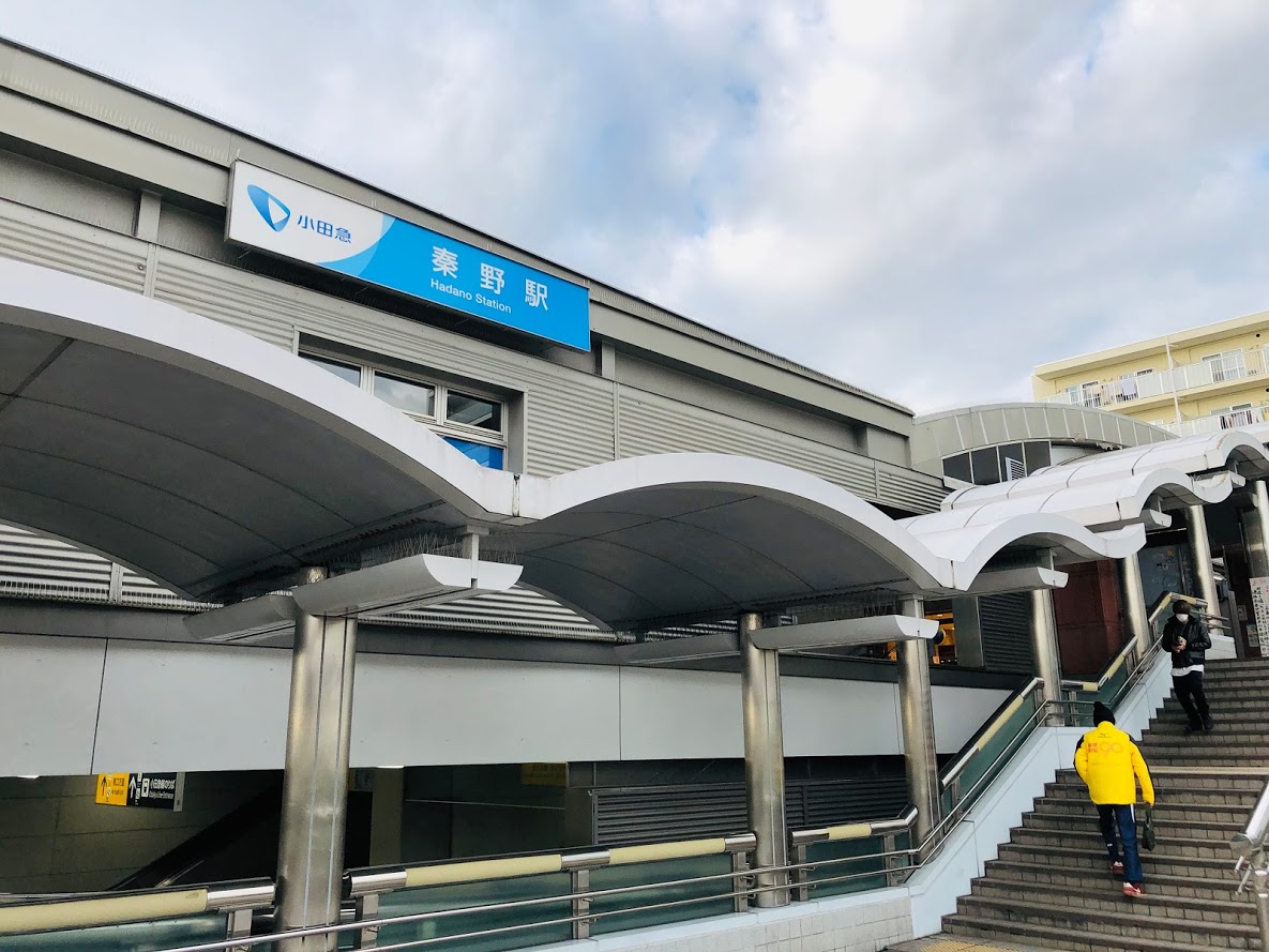
Start: Hadano station on the Odakyū Electric Railway’s Odakyu Odawara Line小田急線 秦野駅
Goal: Tsurumaki-Onsen station on the Odakyū Electric Railway’s Odakyu Odawara Line 小田急線 鶴巻温泉駅
Total distance: 7.3 km
elevation: 235 m
Walking time: 2 hours and 20 minutes
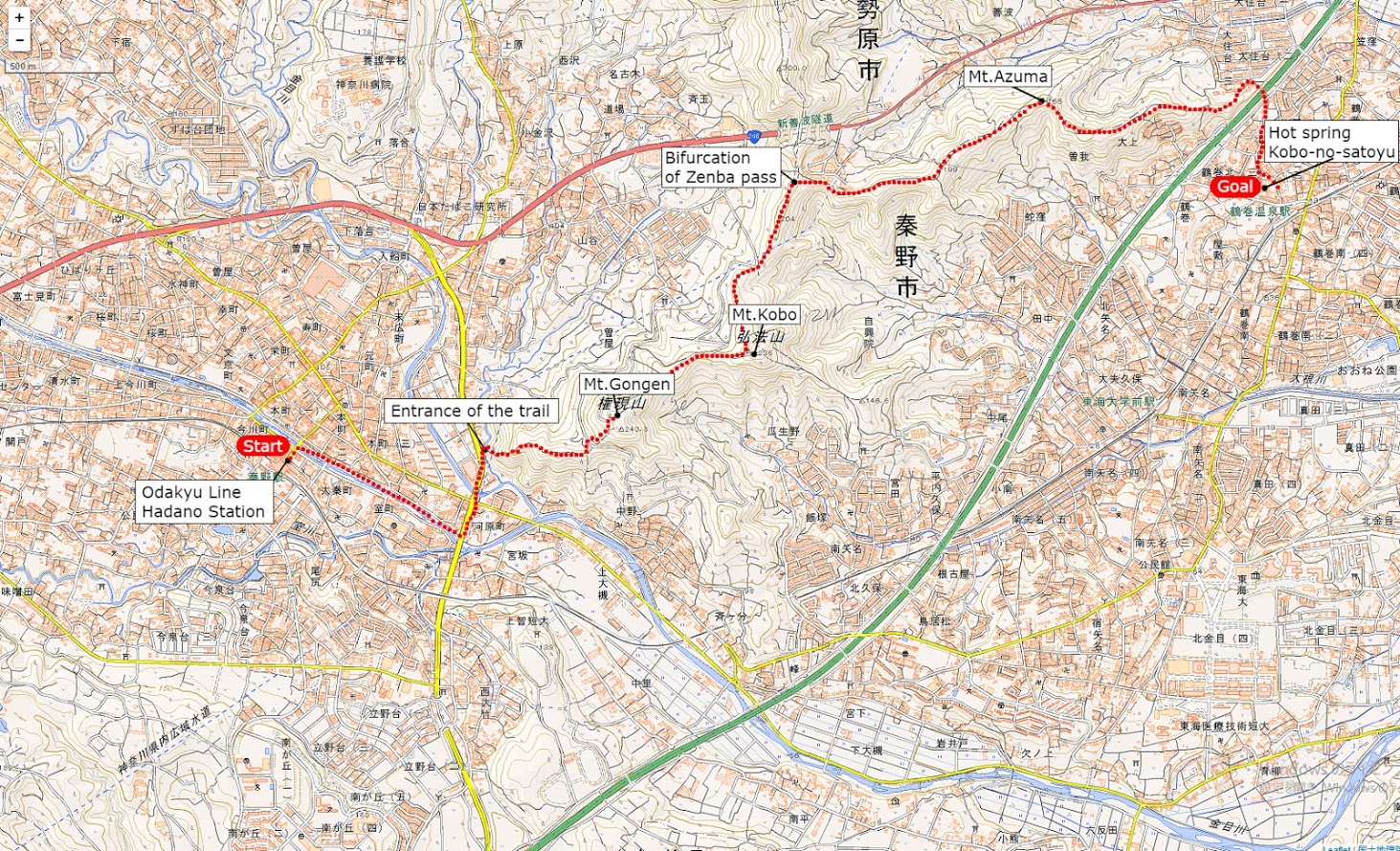
Course Guide of Mt.Kobo
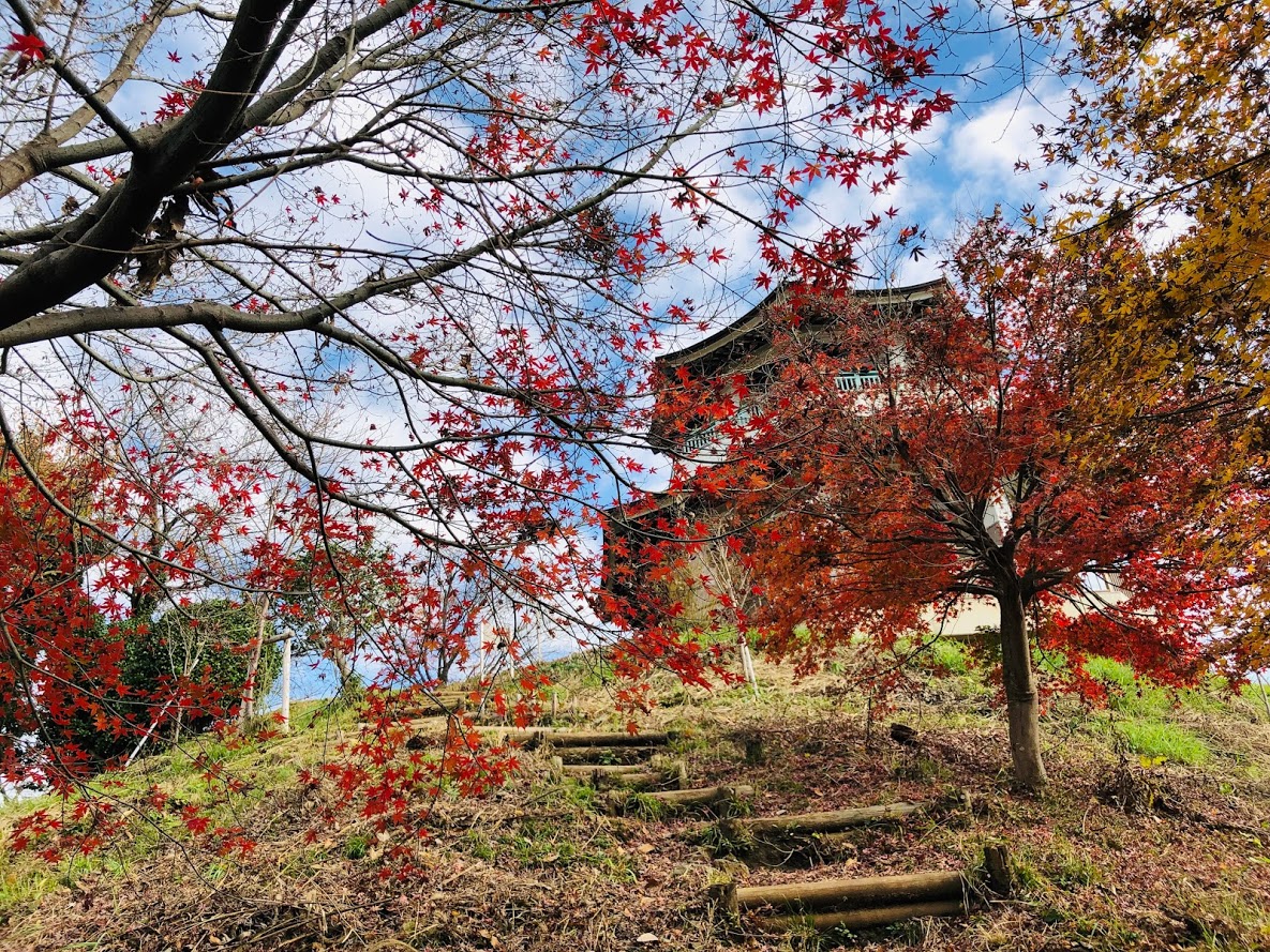
An observatory stand on the summit of Mt. congen and autumn leaves
Hadano station on the Odakyu Line 小田急線秦野駅
Entrance of the trail ハイキングコース登山口
Mt.Gongen 権現山
Mt.Kōbō 弘法山
Bifurcation of Zenba pass 善波峠への分岐
Mt.Azuma 吾妻山
Kobo-no-satoyu (hot spa) 弘法の里湯
Trail Map of Mt.Kobo
Mt.kobo trail map | Clicking on the above image opens a separate tab and the enlarged image is displayed.
Features of Trail Running Course of Mt.Kobo
The summit of Mt. kobo has a well and you can drink natural water.
The trail running couorse of Mt.Kobo is a easy for hiking course with hot springs at end of the course, with a small mountains with an altitude of around 200 – 300 m that is easily accessible from Hadano Station on Odakyū Odawara Line.
This course is a perfect course for the beginner of hiker as a gradual slope continues.
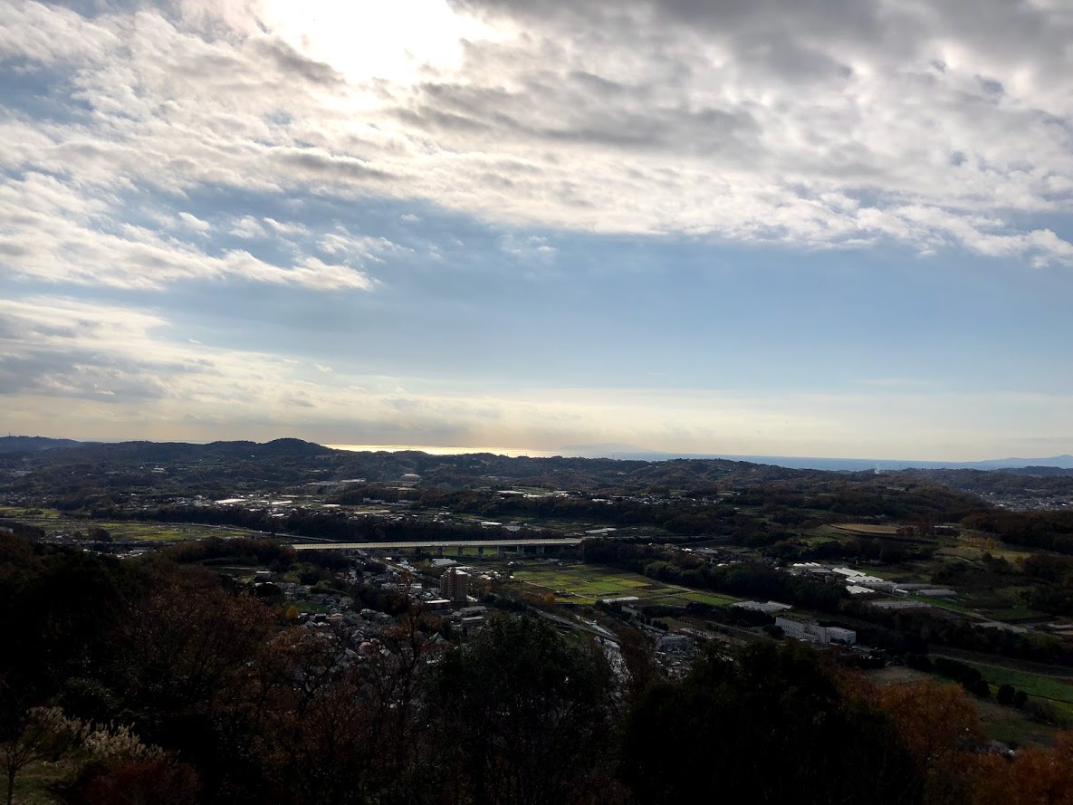
If the weather is good, you can enjoy the view of Mount Fuji from the top of Mt.Gongen.
You can also enjoy the panorama overlooking Sagami Bay and Izu Peninsula.
Also, as the snow does not accumulate so much during the winter, you can enjoy running in a idyllic Satoyama landscape all year long.
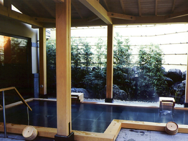
Hot spring “Kobo – no – satoyu” at the end of the course is a natural hot spring that you can use on a day trip, enjoying an outdoor bath, you can relax slowly in a spacious tatami room on the 2nd floor,
This hot spring is in front of the Tsurumaki Onsen Station on the Odakyu Line, returning home is also easy.
This trail is a course that includes three mountains, Mount Asama, Gongen Mountain and Kōbō Mountain.
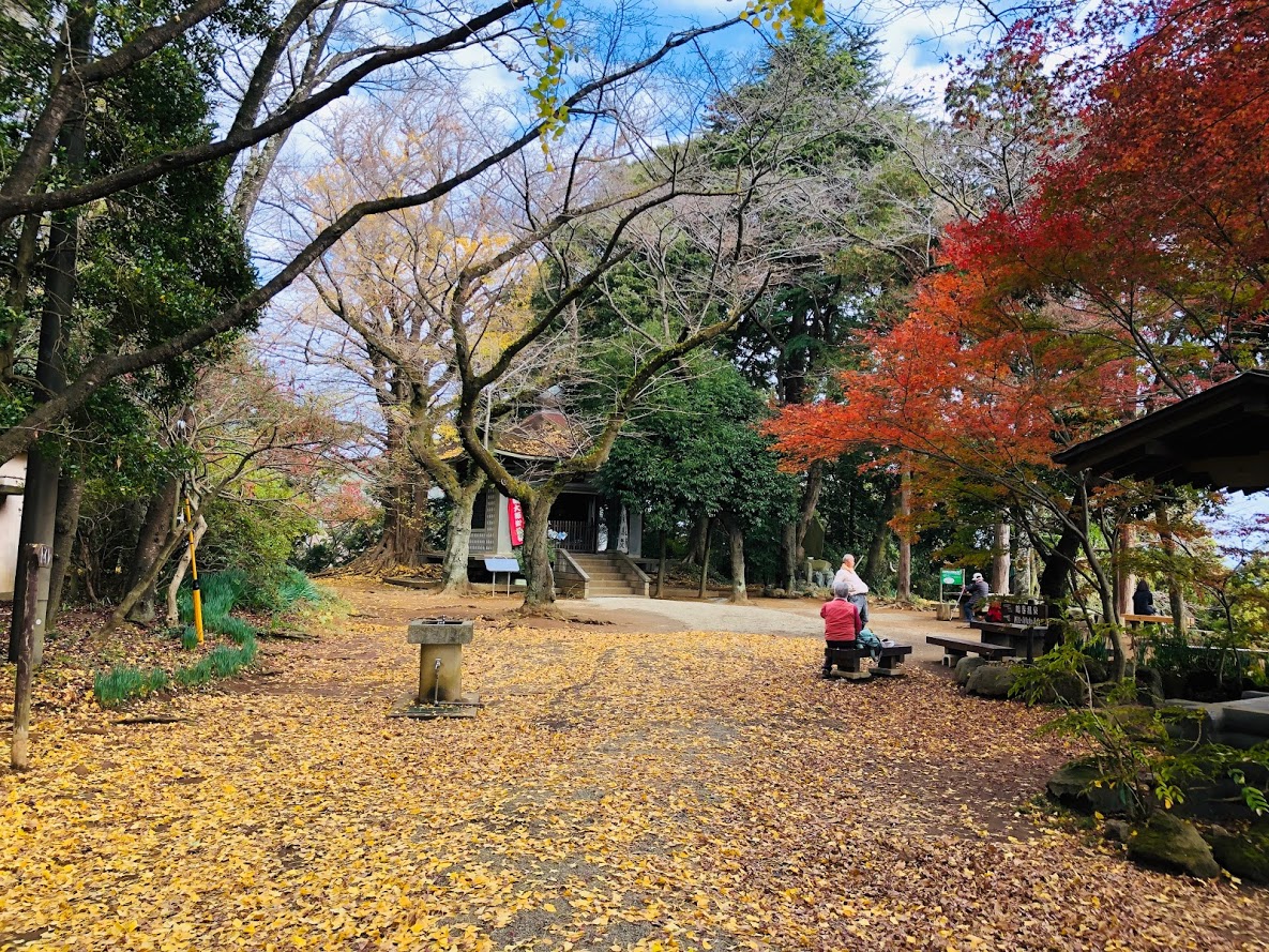
Kōbō Mountain park is selected as “50 Kanagawa’s scenic spot”, “Kanagawa’s 50 sightseeing spots”, “Kanagawa’s flower sights 100 selections”, “Kanto’s Fujimi Hundred Sceneries”.
Furthermore, it is a popular trail called “Kōbō Mountain park · Azuma mountain course”, and many people visit throughout the year.
Kōbō Mountain Park is also famous as a cherry blossoming spot and there are over 2000 cherry trees in the whole park. When cherry blossoms blossom, Baba road becomes a cherry blossom tunnel and the summit pink color. Especially the weekend in full bloom, it is crowded with people from Ohanami.
There are many other places of interest such as Shakado, a festival of Kobo Daishi Festival, a monument of Masuda-yusu, a milk well and a bell tower.
Tour details
Price : 3000 yen per person
Distance : 7.3 km
Private Tour (Your family and friends are OK.)
Difficulty : ★☆☆☆☆
Language : English, Japanese
Meeting place : Hotel pick-up or Hadano Station (depends on your preference)
Meeting time : negotiable
Hike to Mt.Kobo Course
This trail is well maintained and you can walk very easily.
There are three mountains, but all mountains are low about 200 m above sea level.
Trails are well maintained and there is no dangerous place.
Shoes for trail running are better, but running shoes are fine as well.
However, since there is a steep slope in the first half and the second half, let’s walk carefully after rain or when the ground is wet.
The total walking time is around 2 and a half hours.
Even the highest peak is a small mountain of 189 m so sneakers are okay, of course the trail running shoes are better though.
Hot spring “Kobo – no – satoyu” at the end of the course is a natural hot spring that you can use on a day trip, enjoying an outdoor bath, you can relax slowly in a spacious tatami room on the 2nd floor,
This hot spring is in front of the Tsurumaki Onsen Station on the Odakyu Line, returning home is also easy.
Please read and give me consent before booking for this tour.
Trailrunning is an inherently dangerous activity that can lead to serious injuries including but not limited to slip and fall injuries, fractures, snake bite, heat exhaustion, poison oak, ticks and frostbite. By participation in this event/hike you agree to not hold these organizers liable for any harm that may come to you, your guests, or your property. Always remember to let the event organizer know if you are leaving the group. Stay on the trail, never hike alone and use your own common sense.
Booking Now
[contact-form-7 id=”4220″ title=”Private Hiking Tour to Mt.Kobo | Easy Course and Awesome view in Idyllic landscape”]
The course which goes from “高尾山 Mt. Takao” to “陣馬山 jimbayama” is a very popular course that you can enjoy historical temples and various types of tea houses and is a popular course for many hikers.
As we arrive within one hour by train from Shinjuku, good access is possible,The climbing mouth is directly connected when you get off the station, and there are hot spring facilities at the station.
area:
Hachioji City, Tokyo
Genre:
Hiking
LEVEL:
Intermediate
Traveling time (not including breaks):
About 5 hours
Distance:
About 15km
Maximum elevation difference:
857m
Access:
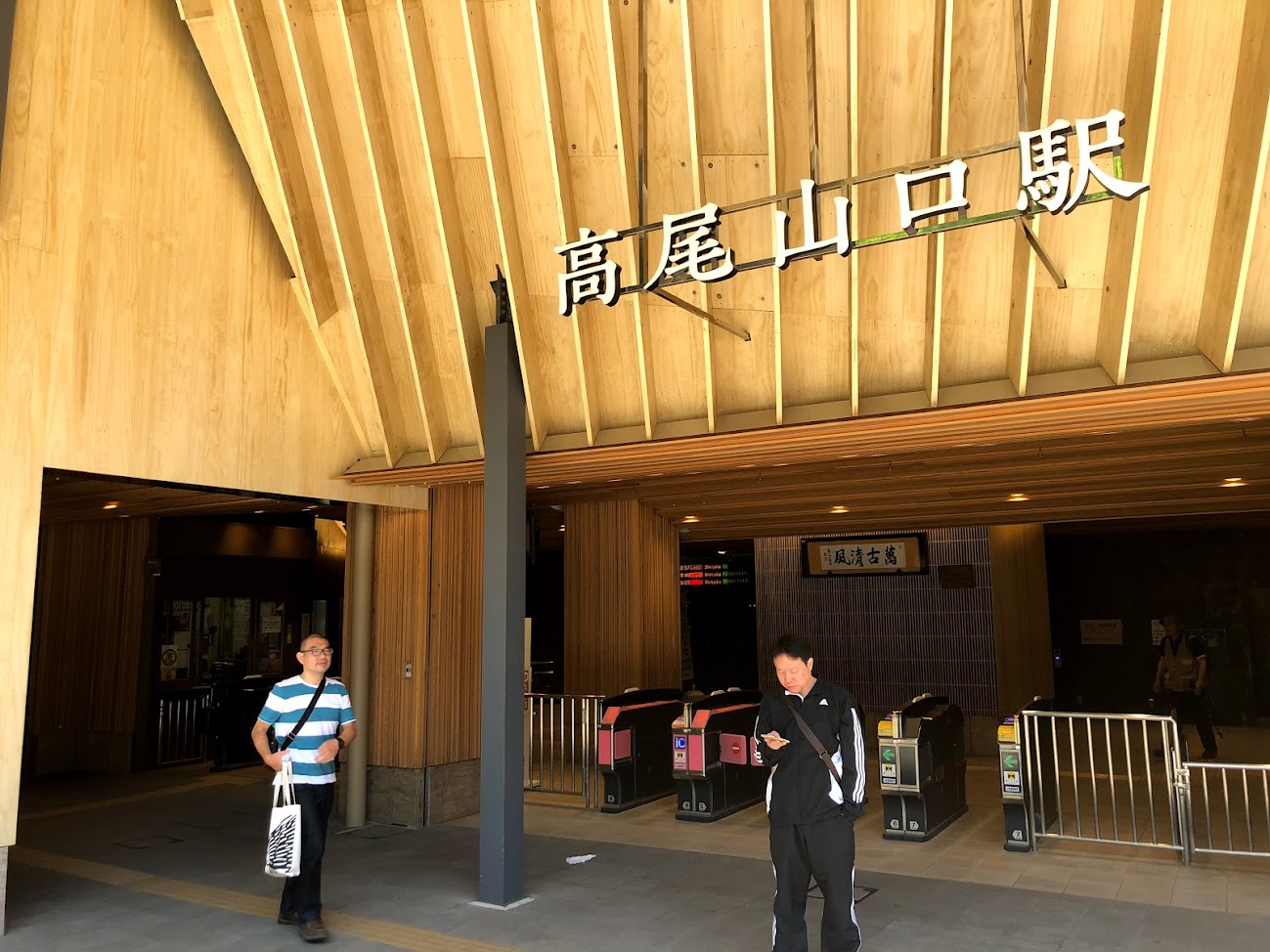
Forward:JR Chuo Line「高尾山口 Tkaosan-guchi station」
Return:JR Chuo Line「高尾山 Takaosan station」
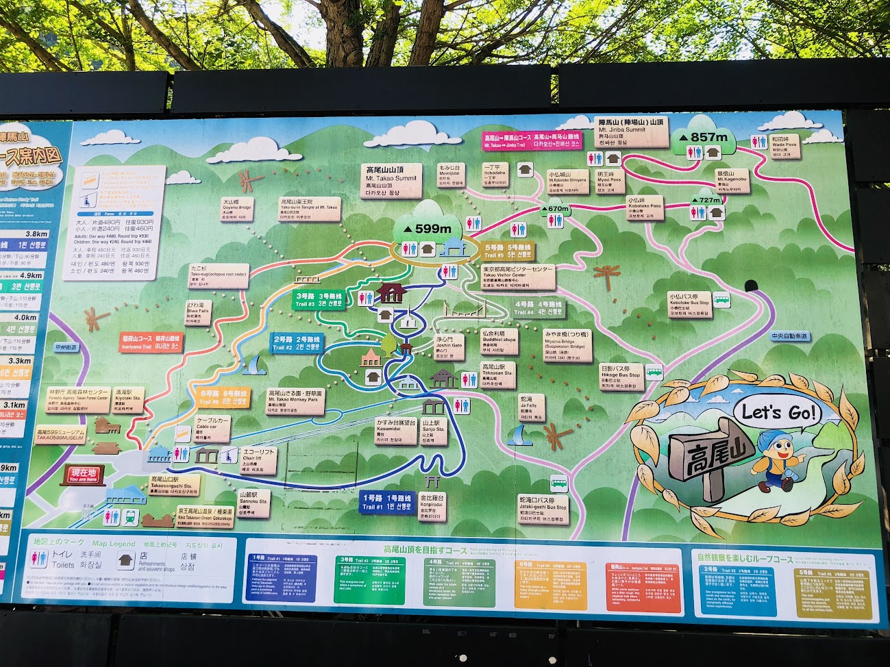
※This is a rough overview of the course.The mountain trail is not an accurate map.If you want to know the exact mountain trail, please refer to the map on the market.
Although there are many routes leading to the summit of Mt. Takao, “No. 1 Road” is connected to the Yakuin House, the summit, and you can enjoy worship and history.
There are sightseeing spots such as shops and stone garden on the way, so you can slowly aim for mountaintop while enjoying Mt. Takao.
Heading towards the sign “Mt. Takao · Vistor Cenrer”
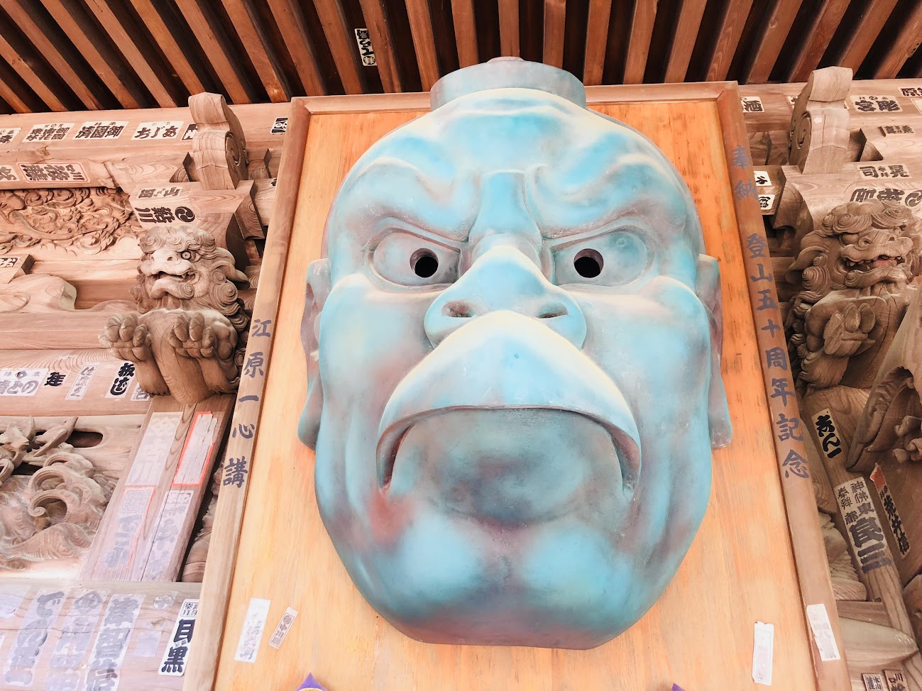
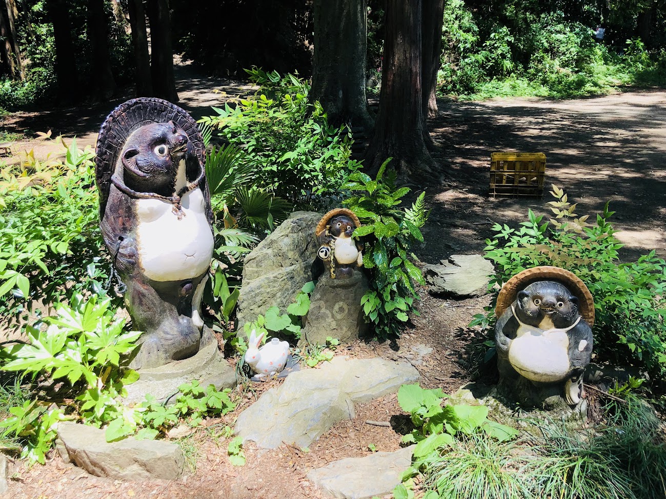
You can enjoy various statues and monuments on the way to the summit.
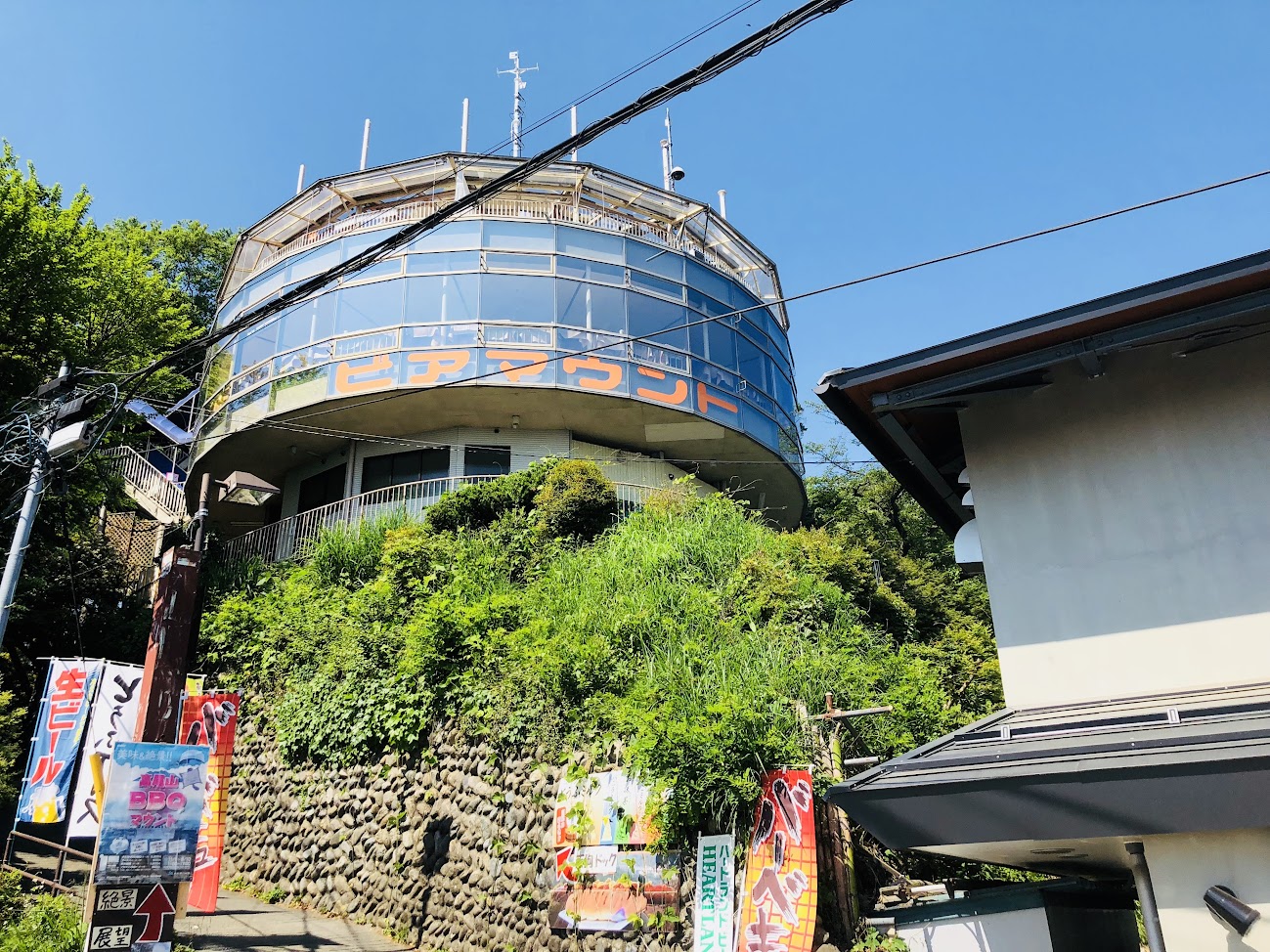
You can enjoy all-you-can-eat buffet while enjoying the night view at “Takao beer mount” on the way.
It may be good to use for launch after running!
Duration: June 15, 2018 (Friday) to October 15 (Monday) 2018
There are lots of restaurants dealing with souvenir and snacks.
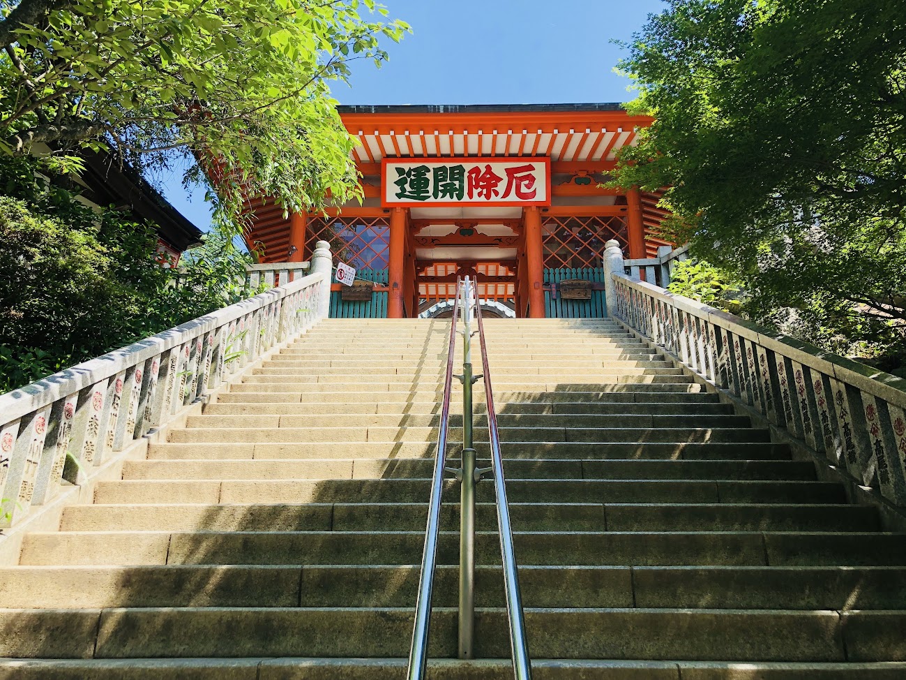
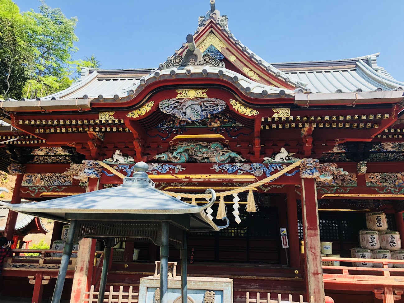
”薬王院 Yakuouin” was opened by high priest Buddhist bodhisattva by Emperor Shomu in the Tenpyo 16th year (744) years ago from now.
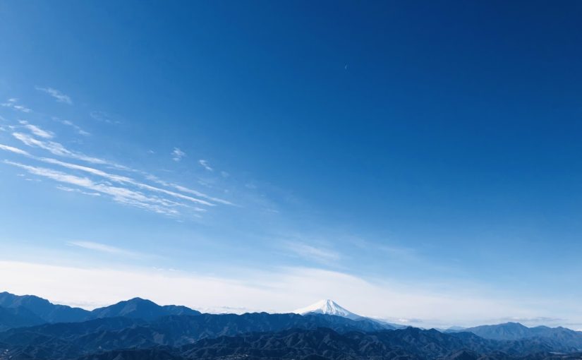
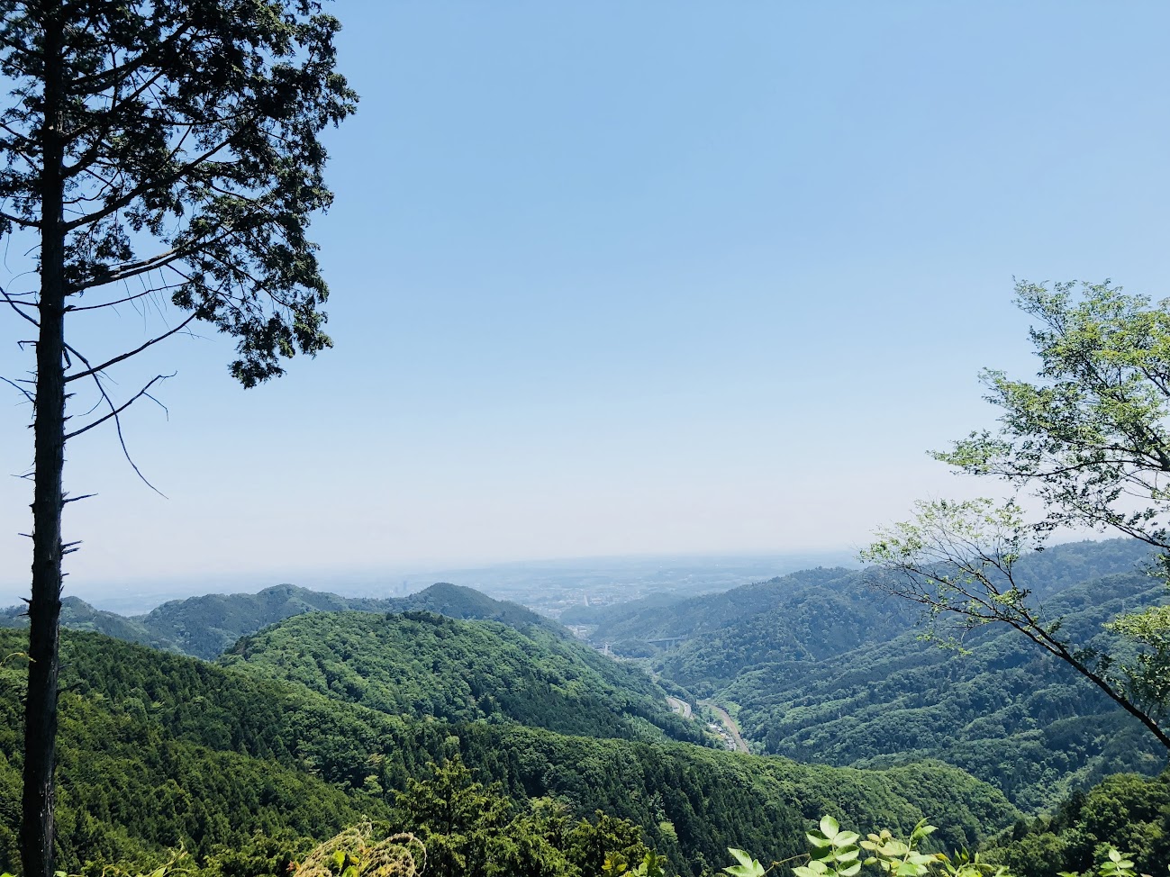
At the summit of Mt. Takao, if the weather is nice, Mt. Fuji can be seen, and many climbers take a meal break.
There are many restaurants offering snacks such as buckwheat and curry rice.
Hiker may buy onigiri etc. before departure and take breakfast here may be just right.
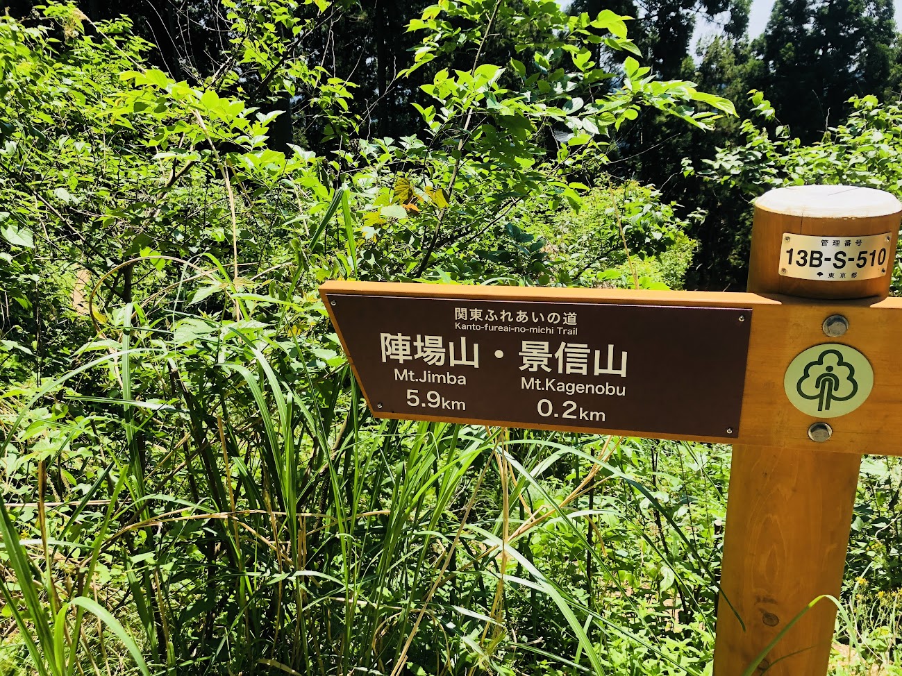
The guide board is written as 5 hours to “陣馬山 Mt.Jimba” of the destination.
Let’s start with Mt. Kobotoke Shiroyama!
Various snacks and drinks are sold at Mt. Kobotoke Shiroyama, and if the weather is nice, you can enjoy your meal with the best view.
I enjoyed the shaved ice this day!
When You take a rest, You will head to Kobotoke Pass and Mt. Kagenobu.
Mt.Kagenobu tea house is only open on Saturdays and Sundays until around 3 pm
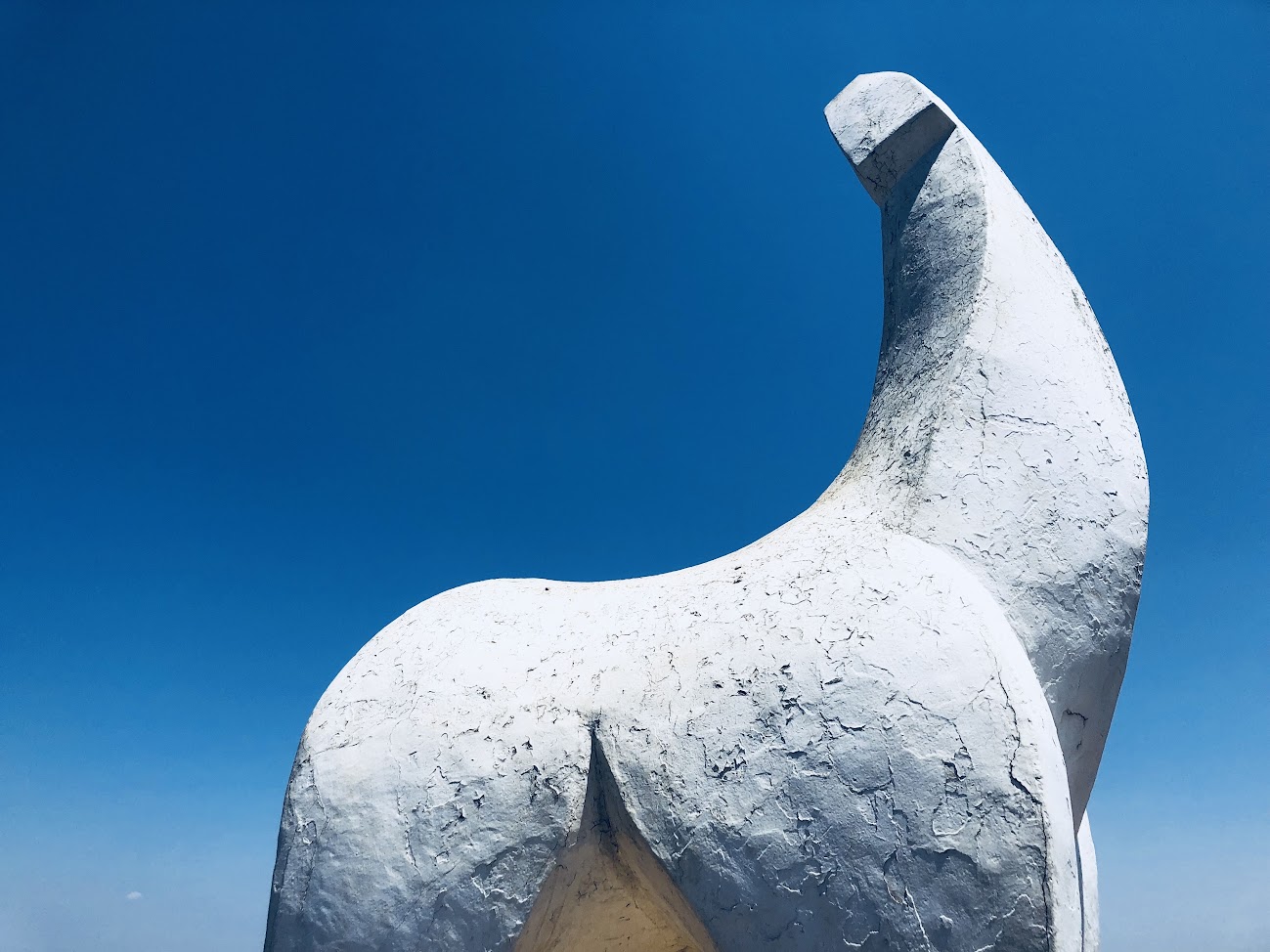
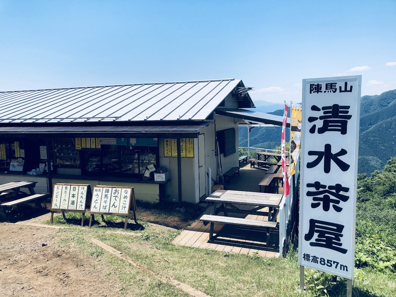
It is finally arriving at Mount Jinjimayama which is the destination.
There is a monument of White horse Statue on the summit of Mt.
There is a wide lineup from snacks such as soba noodles and noodles to alcohol, soft drinks and ice cream at “Shimizu tea shop” at the summer mountain mountain mountain.
Drinking beer while drinking in sense of accomplishment is the best!
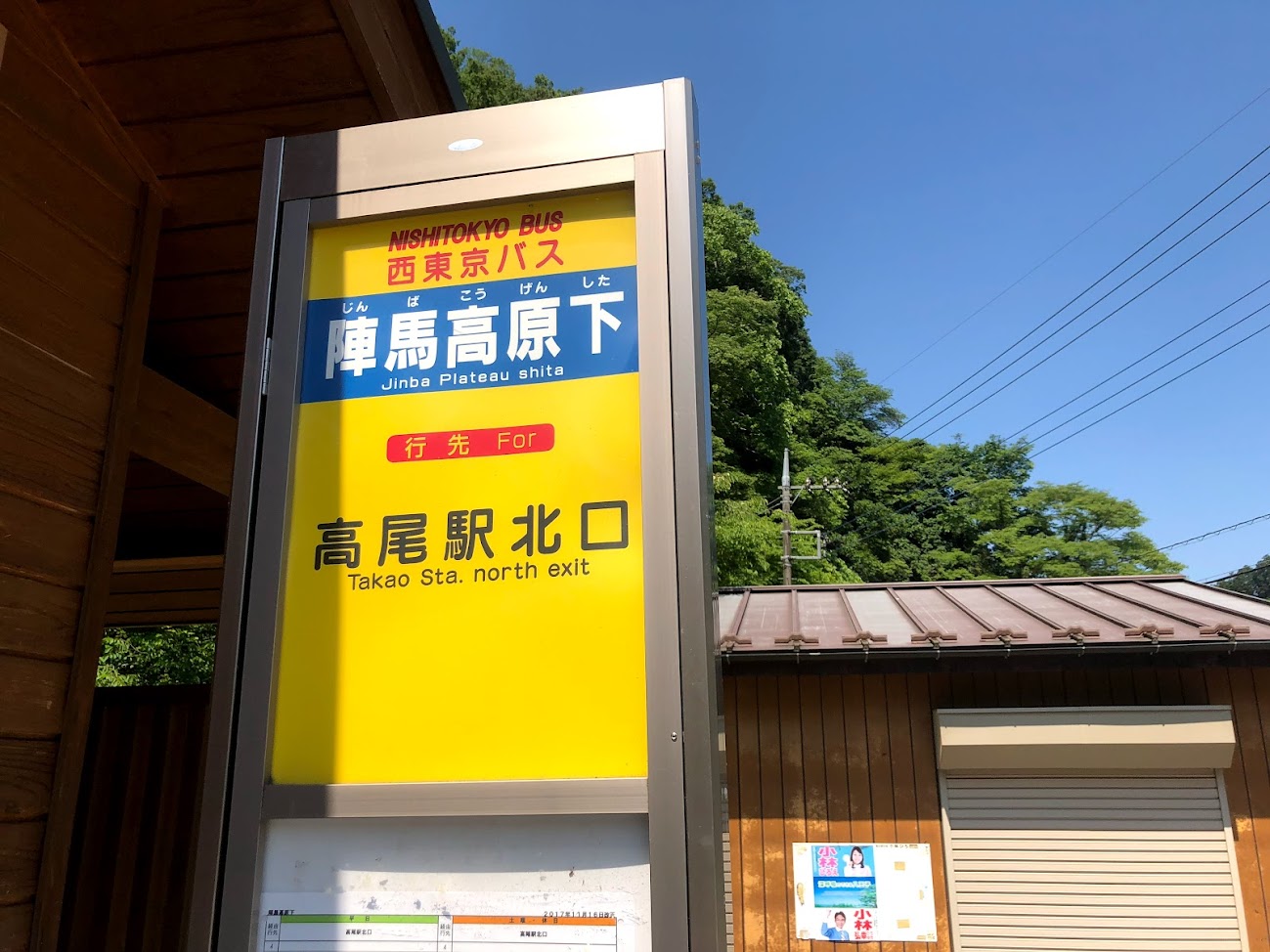
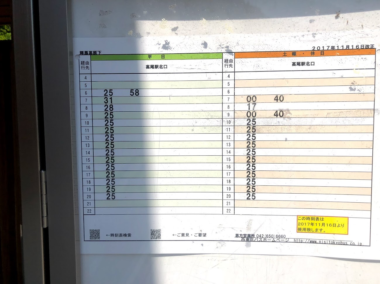
A steep descent continues to the bus stop “陣馬高原下 Jinbakougenshita”.
Washing your face in a creece will heal your tiredness.
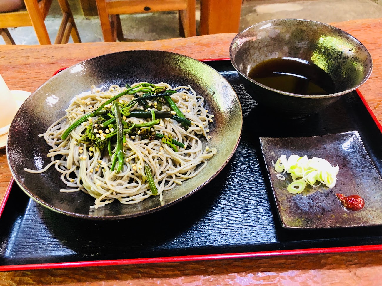
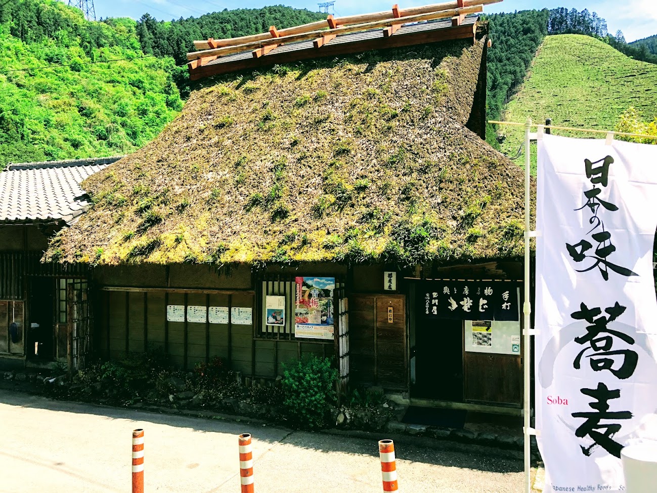
You can have soba with freshly picked vegetables on “Jinba Soba Yamashita”.
“甘酒 amazake” is a sweet drink made by mixing glutinous rice (koji) into glutinous rice.
Only one bus will come almost in an hour.Let’s eat also soba slowly and wait!
Do you need a guide?
If you are looking for guide of this course, please refer to the following.


 There are cafes, used outdoor goods stores, convenience stores, etc. along the street.