Hike To Mt.Sengen | Beach, Mountain And Sweets Can Be Enjoyed Simultaneously

Date of Mt.Sengen

Formal name: Sengen mount 仙元山
Difficulty of this trail: ★ ☆ ☆ ☆ ☆
Trail appearance rate: ★ ☆ ☆ ☆ ☆
Area: Hayama town, Kanagawa prefecture
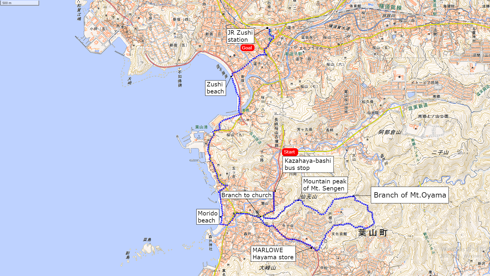
Start: Kazahaya-bashi bus stop 風早橋バス停
Goal: Zushi station 逗子駅
Total distance: 10 km
elevation: 180 m
Total difference in elevation: 360 m
Walking time: 4 hours

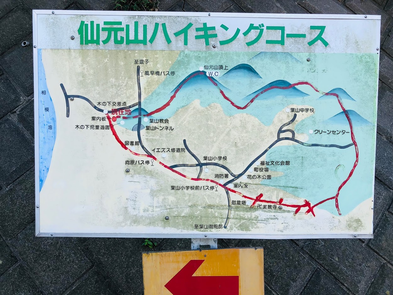
Course Guide of Mt.Sengen

Trail of Mt.sengen
Trail of Mt.sengen
  1. Kazahaya-bashi bus stop 風早橋バス停
  2. Branch to church 教会への坂道分岐
  3. Mountain peak of Mt. Sengen 仙元山の山頂
  4. Branch of Mt.Oyama 大山方面の分岐
  5. MARLOWE Hayama store マーロウ葉山店
  6. Morido beach 森戸海岸
  7. Zushi beach 逗子海岸
  8. JR Zushi station JR逗子駅

Map of Mt.Sengen

the map of Sengen mount | Clicking the image will display the enlarged size with a new tab.

Access Guide of Mt.Sengen

Entrance of mt.sengen's hiking course
Entrance of mt.sengen’s hiking course

Shinjuku station as a departure place.

Shinjuku Station

JR Shonan Shinjuku Line (fast): 30 min

Yokohama Station

JR Yokosuka Line (Normal): 30 min

Zushi Station

Keihin Kyuko Bus: 7 min

Kazahaya-bashi bus stop

Transportation expense
2240 yen (round trip)

Advice of access

From Shinjuku Station you can use Zushi going to Shinjuku Shonan line.
If Keihin Kyuko is convenient, you can also get on the bus from Shin-Zushi station.
There are frequent buses to Kazahaya-bashi bus stop, so you can get on without having to wait much.

Features of “Mt.Sengen” hiking course

The sumit of Mt.Sengen
The sumit of Mt.Sengen | If it is sunny, you can see Mt. Fuji.

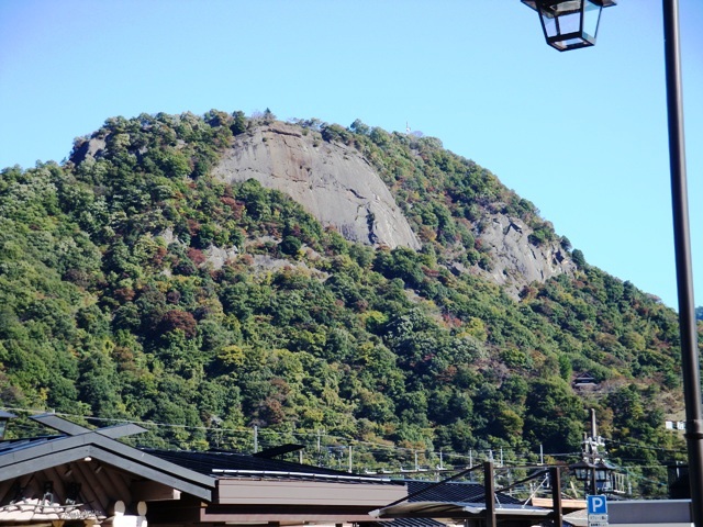
Sengen mount is a low mountain that reaches the summit in about 20 minutes from the foot of mountain.
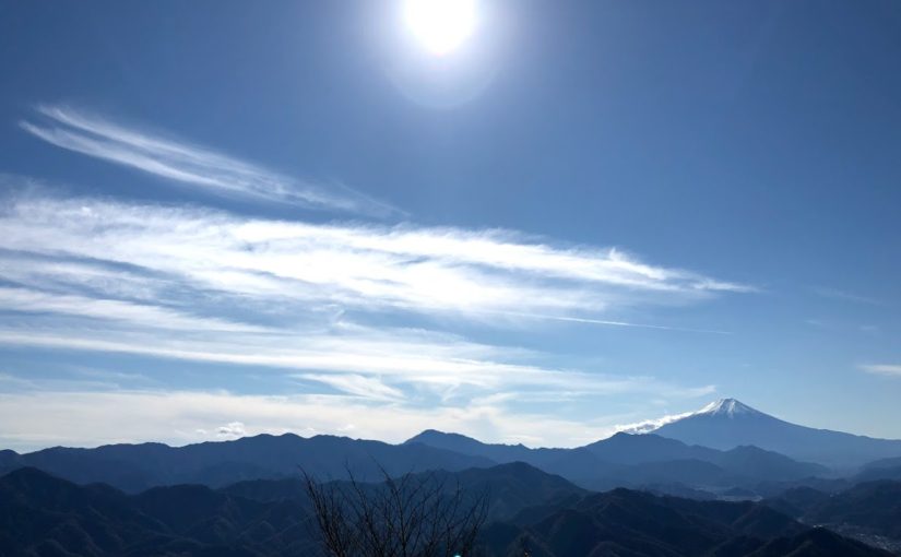
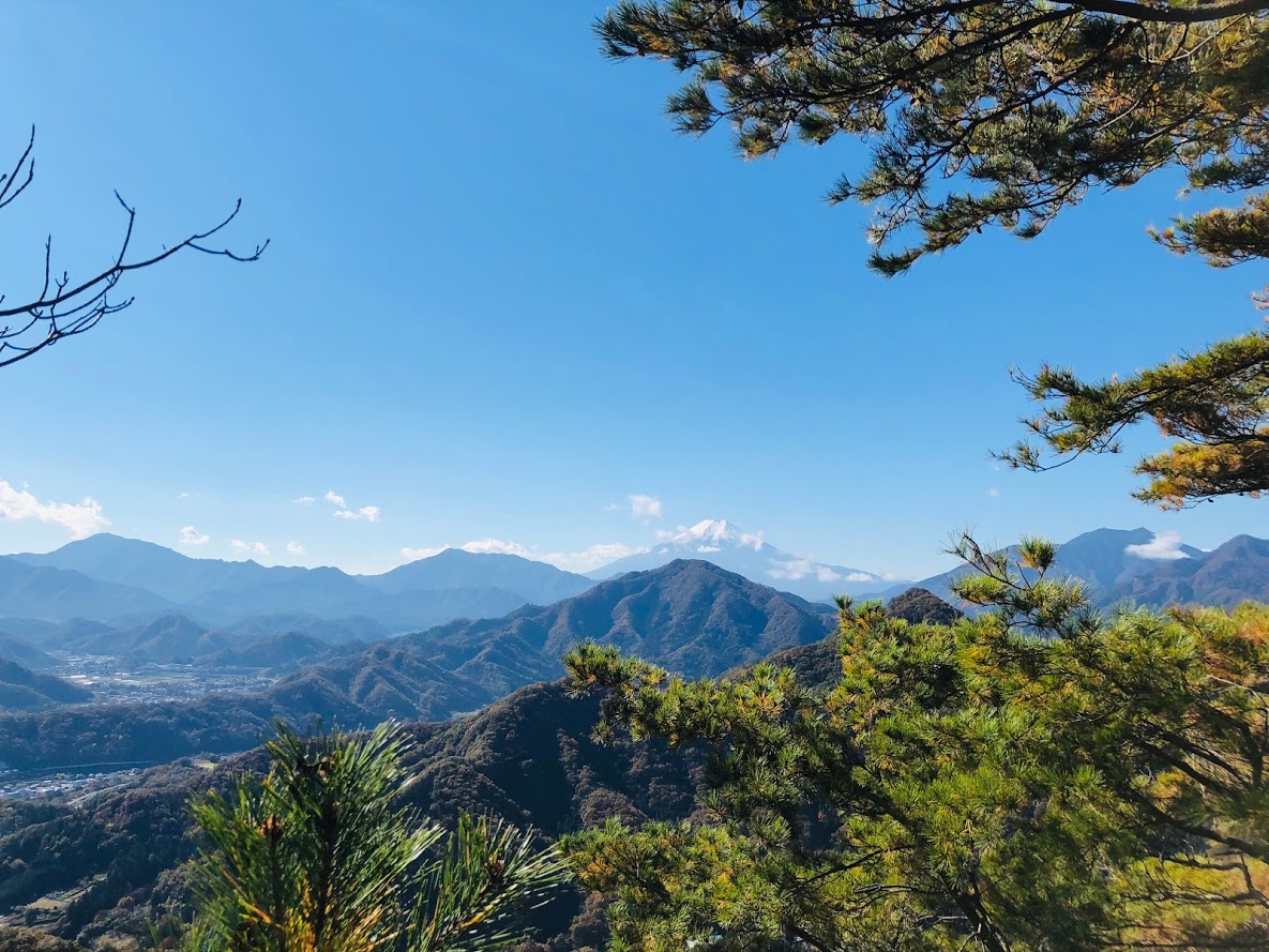
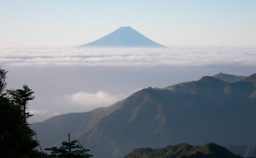
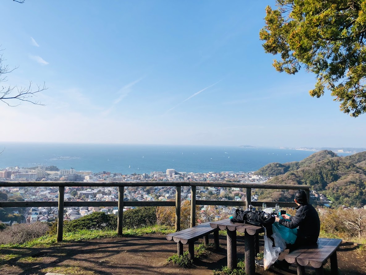
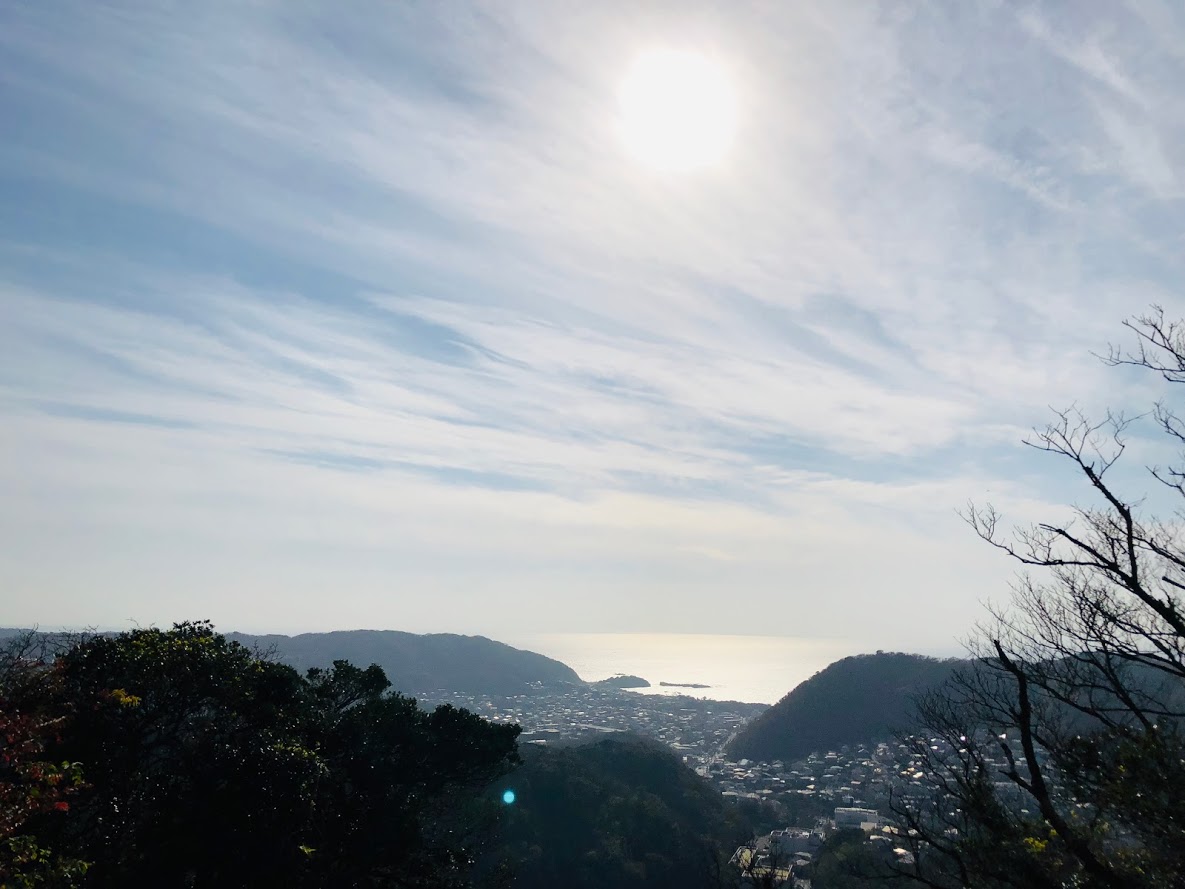
The view is excellent, and you can see Sagami Bay and Mt.Fuji from the summit at the same time.
It is not enough to stand on the summit so I added it to the course from Morito beach to Zushi beach.

As soon as we move in the direction of travel from Kazahaya-bashi bus stop, there is a Hayama tunnel.
Go to the intersection in front of this tunnel to the right, turn back the next signal and climb the “branch to church”.
When you walk a steep slope for a while it is Hayama church.

The trail of the Mt.Sengen hiking course starts from the left side of the church.
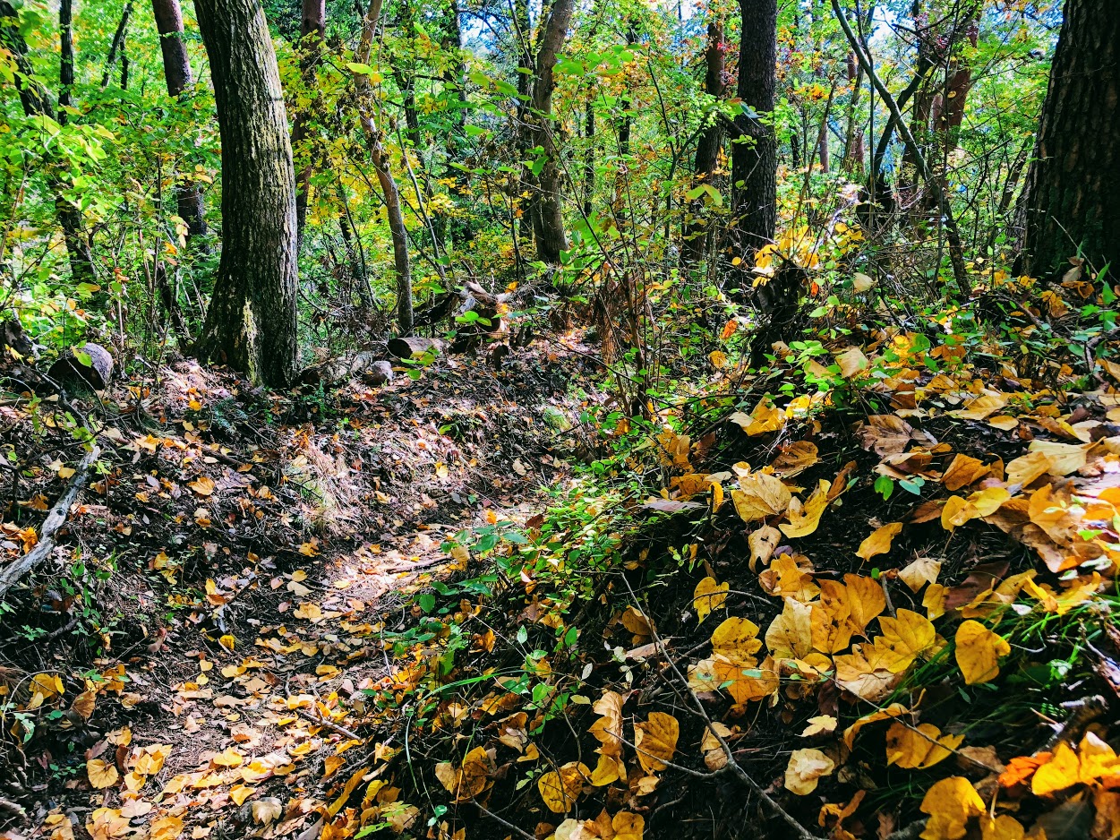
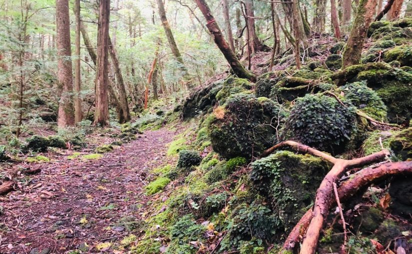
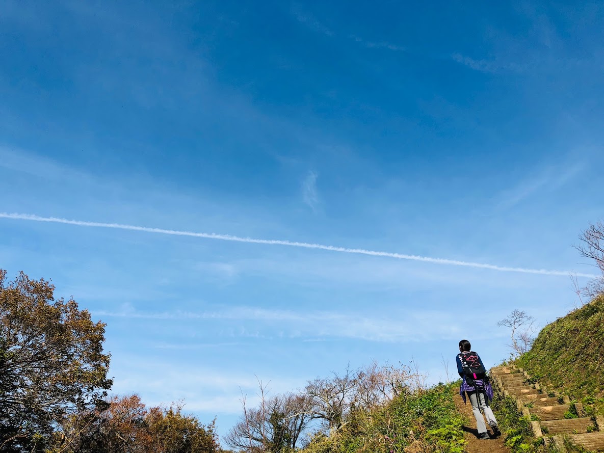
As you go along the ridge path surrounded by lucid trees, you will soon pass through the forest and arrive at the summit of Mt.Sengen.
There are benches, toilets and Juniperus chinensis trees on wide mountaintops, yachts floating on the sea of Sagami Bay, Enoshima and Mt.Fuji etc. can be seen.

If you fully enjoy the view, let’s go down the stairs by hiking course.
Once on the slope, it gets gentle again, goes down the stairs again and if you climb the steepest staircase in the course it is a peak of 189 m.

Nice view from the logging area

As soon as you cross the ridge after taking a rest, you will find “Branch to Mt.Oyama”.
Proceed on the right road, but let’s take a short rest there as you can see Mt.Fuji and the south west side from the logging area just above.

Go back to the bifurcation and go on a gentle slope.
As soon as you go to the right towards the Clean Center, you will have a branch to “Branch of the Cannon Mound and Jikkyo Temple”.
Go straight here and go down the next branch to the right.
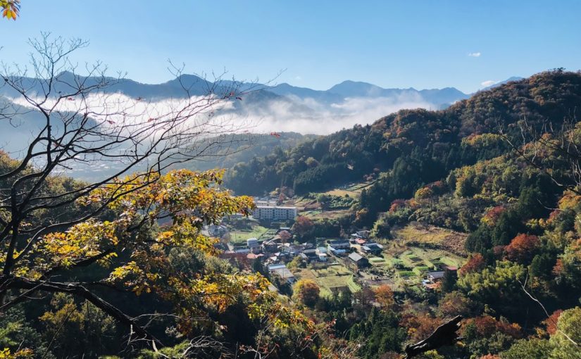
After a while it will arrive at the observation deck where the sea can be seen, if you go down the groove style from here, it is a Jikkyo temple.
If you go between the private houses and go out to the national highway go to the right is the Hayama elementary school bus stop.
There is a MARLOWE Hayama store where the pudding is delicious in front of the bus stop.

To Morido beach, proceed to the left at the Mukaihara intersection and arrive at the coast, if you proceed along the sea as it is, you will find the Zushi beach.

Sweets and beaches after hiking…
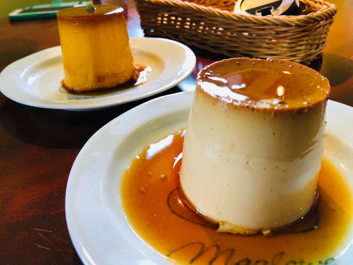
Pudding of MARLOWE Hayama shop

MARLOWE Hayama shop

Continue making beaker pudding since its founding in 1984 is a popular product that can sell 2000 pieces a day. You can also eat in the cafe inside the store.

MARLOWE葉山
MARLOWE葉山

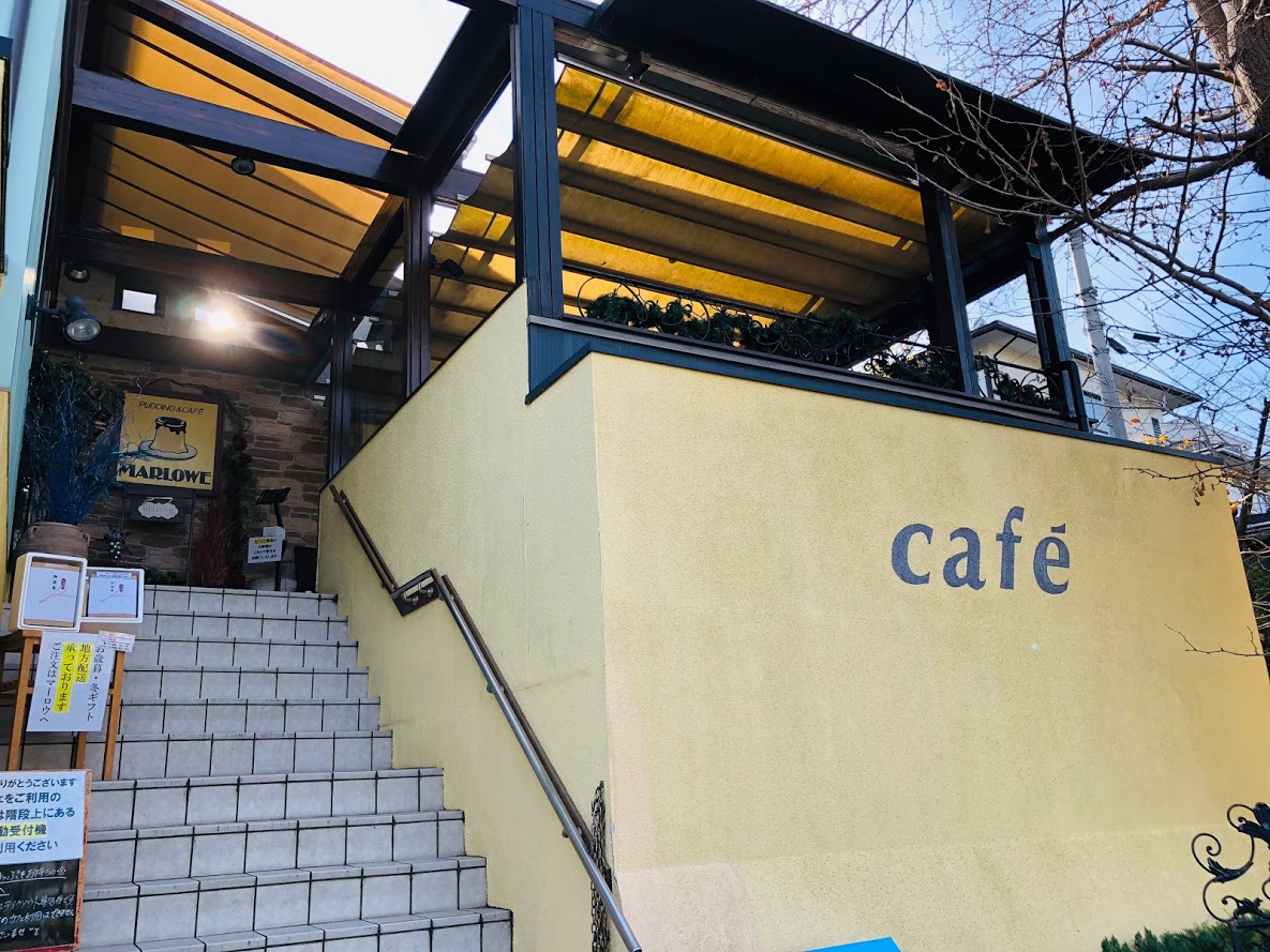
Business hours: 10 o’clock – 19 o’clock
Non-business day: Wednesday
Access: Hayama primary school bus stop in front
Tel: 046-875-0412

Morito Beach and Zushi Beach

Sunset of Morito beach

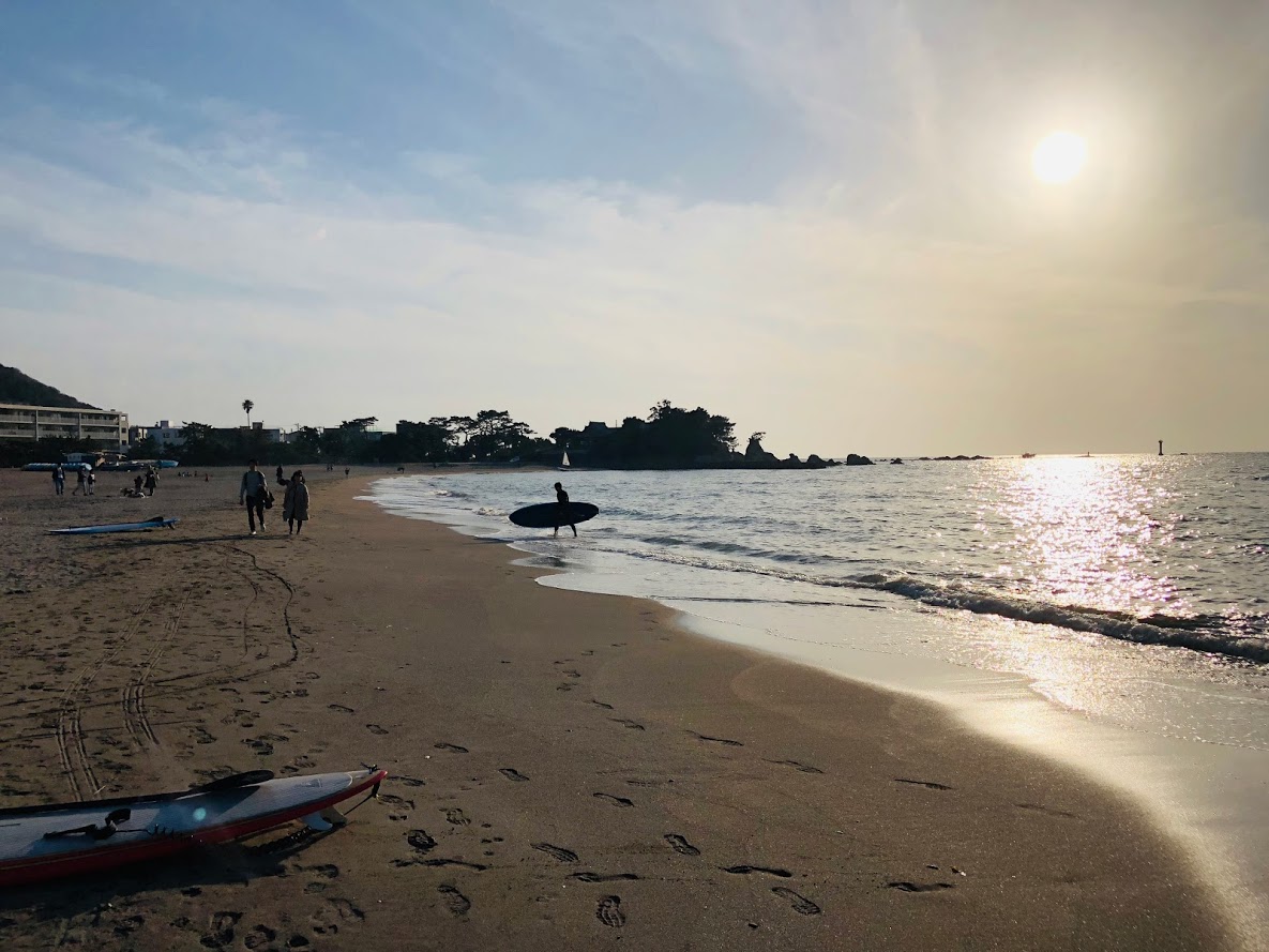
Morito Beach is a beach known as the shallow and calm waves of the beach that looks at Enoshima and Mt. Fuji. Morito shrine is enshrined in the beach.
The Zushi coast is a beautiful beach characterized by the shallow and calm waves in Zushi City, Kanagawa Prefecture.
There are many cafés and restaurants in the surrounding area, and there are many surfers and tourists crowded on holidays.

Beach combing at zushi beach

Do you need a guide?

If you are looking for guide of this hiking course, please refer to the following.

Private Hiking Tour to Mt.Sengen | Mountains and Beaches and Creme Caramel

Saruhashi Bridge with a beautifully strange legend is recommended tourist spot in Yamanashi

About Saruhashi “the monkey bridge”

The scenic spot “Saruhashi Bridge” crosses the deep and beautiful valley of Kake River.
This bridge, together with “The Kintaikyo Bridge” and “Kisonokakehashi”, was chosen as Japan’s three largest Strange bridge, its length of 30.9 m, its width of 3.3 m and its height of 31 m did not use bridge pier at all and sharply towering shore It is supported by the 4 layers of reinforcement that overhang from.

The 4 layers of reinforcement wood supported Saruhashi
The 4 layers of reinforcement wood supported Saruhashi.

Although the origin of the unusual structure of Saruhashi Bridge is not certain, Shirako (志羅呼) of the landscape guru who came from Kudara ‘s era of Emperor Suiko (About 600 AD) took over the construction of this bridge. However, the construction of this bridge has failed many times becouse of a deep valley.
Although he attempted various methods, he did not go well and gave up the construction of the bridge.
But one day he witnessed a lot of monkeys connected each other and they crossed river and reached the other side, then he came up an idea with the structure of this bridge.
And finally Saruhashi Bridge was built in the valley of this Kake river.
It seems that the origin of the name of Saruhashi “the monkey bridge” was also attached from this legend.

Saruhashi Bridge Railings
A bridge of monkeys drawn on the railings of Saruhashi Bridge

According to the records, since there is a description of Saruhashi bridge in Goindokou’s journal “Rinkoku Zakki”, you can see that this bridge certainly existed 500 years ago.

The valley beauty of Saruhashi Bridge which were also loved by Culture people

The beauty of the valley of the Kake River from the view of Saruhashi

The scenery of the Saruhashi crossing a beautiful valley that changes every season is called one of the most scenic beauty of the Koshu Highway which was developed by the Edo Five Routes, many writers and painters visited.
Among them, Ukiyo-e artist Hiroshige Utagawa is very moved by this scenery and draws “Koyo Saruhashi no zu”.

The current Saruhashi was restored faithfully in 1986 based on the data of Kaei 4 (1851).
After the Meiji era, new bridges are built one after another with the Saruhashi Bridge in between, and now you can look at the historic bridge at the same time with a steeply and beautiful landscape.

Utagawa (Ando) Hiroshige Ukiyoe “Koyo Saruibashi no zu”

Utagawa (Ando) Hiroshige Ukiyoe "Koyo Saruibashi no zu"
Utagawa (Ando) Hiroshige Ukiyoe “Koyo Saruibashi no zu”

Hiroshige “Koyo Saruhashi no zu”, published in 1842, relies on several sketches and his own memories for the scenery of the monkey bridge that he stopped on his way to Kofu for the production of the festival’s painting It is a very large painting created on.
Once, Hiroshige saw this beautiful scenery and said, “I can not speak, I can not draw in a picture.”
Such Nishiki-e of Saruhashi is said to be the highest masterpiece among works of Hiroshige.

Yatsusawa Power Plant No. 1 Aqueduct Bridge

Yatsusawa Power Plant No. 1 Aqueduct Bridge

Another story that can be seen from Saruhashi

This bridge is a water bridge built to supply water to the Yatsusawa Power plant that was built in 1912 (Meiji 45).
It is made of reinforced concrete, and red bricks similar to those of Komabashi power generation facilities are used for both Sluice gates of the bridge.
A very innovative design that takes advantage of the characteristics of the material is blending in the beauty of the valley.

Access information to Saruhashi

By car: 15 minutes from the Central Expressway Otsuki IC, turn left at the “New Saruhashi west” signal on Route 20

By train: 15 minutes on foot from Saruhashi Station on JR Chuo Main Line

By Central Highway Bus: 10 minutes on foot from Saruhashi Bus Stop

Hike to Mt.Momokura | The most accessible mountain to get the great view of Mt.Fuji from Tokyo

Course Date of Mt.Momokura

Difficulty of this trail: ★ ★ ☆ ☆ ☆
Trail appearance rate: ★ ★ ☆ ☆ ☆
Start: Saruhashi station 猿橋駅
Goul: Saruhashi station 猿橋駅
Total distance: 13 km
elevation: 1003.4 m
Total difference in elevation: 683 m
Walking time: 4 and a half hours

Course Guide of Mt.Momokura

trail of momokura mount
Trail of momokura mount
  1. Saruhashi Station 猿橋駅
  2. Fukusenji temple 福泉寺
  3. Mt.Momokura 百蔵山
  4. Bus Stop “Entrance of Mt.Momokura’trail”  百蔵山登山口バス停
  5. Yutando Spa 湯立人鉱泉
  6. Saruhasih bridge 猿橋
  7. Saruhashi Station 猿橋駅

Map of Mt.Momokura

the map of momokura mount
the map of momokura mount | Clicking the image will display the enlarged size with a new tab.

Access Guide of Mt.Momokura

North gata of saruhashi station

Shinjuku station as a departure place.

Shinjuku Station

JR Chuo Line: 53 min

Takao Station

JR Chuo Main Line: 32 min

Saruhashi Station

Transportation expense
2640 yen (round trip)

Advice

The dangerous place on this course is a steep slope that has gone a little from the top of the mountain.
It is very slippery so let’s slowly proceed while grasping the tree in front of your eyes.
Of course climbing shoes are necessary.
If you plan to go to the next Mt.Ogi it will take at least 4 hours to Torisawa station.

Features of “Mt. Momokura” course

group photo of the summit

Mt.Momokura is popular with hikers as it can be accessed directly from Saruhashi station.
It is also popular that you can enjoy the wonderful view of Mount Fuji from the top of the mountain.
There are five hiking routes on this mountain, but on this blog I will introduce a route from Saruhashi station along Kazuno river to Fukusenji temple to the summit.
After going down the mountain, I will introduce a hot spring with a mysterious atmosphere called Yutando Spa and a bridge with a splendid view called Saruhashi Bridge.

Start from Saruhashi station and cross Katsura river and you can see Mount Momokura.
If you go straight ahead, it is the shortest course, but turn left and proceed along Kazuno river.
Mount Momokura on the right from the river road and Mount Iwadono on the left are the best views.

When you return to the road again from the river road, you will arrive at the small and beautiful Fukusenji temple.
As soon as you follow the road that turns left before the temple, you will arrive at the trail soon.
Iwadono mounts and settlements watching from the trail are also good views.
After passing the small shrine in the trail you will be on the ridge road.

We arrive at the top of Mt.Momokura in about 2 hours from the temple at the foot.
The summit is a large square, all the hikers are facing in the same direction and enjoying lunch.
That’s right, they are facing the direction of Mt.Fuji.
From the summit of Mt.Momokura, we can enjoy the magnificent view of Mt.Fuji which are chosed as “beautiful Mt.Fuji 12 scenery” if the weather is good.

When stepping a little from the top of the mountain, a steep slope will appear, please proceed carefully not to fall.
You will arrive at Bus Stop “Entrance of Mt. Momokura ‘trail” in about an hour.
The last destination is Yurando Spa, which is a mysterious spa like an ordinary private house.
Currently it is open only on weekends and offers shower and natural hot spring at 1000 yen.
In addition, you can enjoy pickles and japanese tea made by grandma in the wide room of tatami mat.
If you have time, I recommend visiting “Saruhashi Bridge” which became famous as a strange bridge in the Edo period.

After Hiking…

Yutando Kosen 湯立人鉱泉
Yutando Kosen 湯立人鉱泉

Yutando Sapa

Yutando Sapa may not be considered a hot spring as it is apparently an ordinary private house.
But this mysterious Spa is a mysterious spa that has been going on since 300 years ago.

Business hours: 12 o’clock – 17 o’clock
Business days: only on Saturdays and Sundays
Access: 15 minutes on foot from Sarikebashi Station North Exit
Tel: 0554-22-0622

Saruhashi Bridge

saruhashi bridge
saruhashi bridge

The bridge with an unusual structure became the theme of the picture of Ukiyo painter Hiroshige Utagawa.

Saruhashi called the 3 most strange bridge in the Edo Period.
The carpenters could not make a stepladder because the valley was deep, they supported the bridge with reinforcing material that protruded from both sides.
Hiroshige Utagawa visited this bridge in 1841 and sketched and later released Kōyō_Saruhashi_no_zu(甲陽猿橋之図).
Using a vertically long screen, fresh composition while keeping the natural landscape and lyricism, is said to be the best masterpiece of Hiroshige.

Kōyō_Saruhashi_no_zu
Kōyō_Saruhashi_no_zu(甲陽猿橋之図). Utagawa Hiroshige (Japanese, Tokyo (Edo) 1797–1858 Tokyo (Edo)
Valley seen from Saruibashi

Do you need a guide?

If you are looking for guide of this hiking or Trail running course, please refer to the following.

Private Hiking Tour | Mount Momokura where the view of Mt.Fuji is beautiful

I found two wild monkeys on a private house. ( 2018.11.15 )

When I visited Momokura mountain in Yamanashi prefecture to see the autumn leaves,
I came across two monkeys by chance.
The monkeys on the roof noticed me and ran away soon.

After that I saw more than 10 monkeys but I could not shoot.
The villagers were driving away the monkeys with a firecracker.
It seems that the monkeys come many times from this morning aiming for the radish of the field.

The village grandmother said that “radish is the most sweet season now”.
The monkeys will know the delicious season of radish.

A mysterious castle in the suicide forest ( 2018.11.03 )

When I went to Fuji’s Jukai on November 2, 2018, I found a stone wall like a castle wall in the forest of Jukai.

It seems to be the ruins of Motosu castle in the Kai era of the warring States era (1532 – 1555) later examined.
The country of Kai is the area of Yamanashi prefecture now, Motosu close to the border of the country of Kau Kai at that time Nakamichi Highway, there was a road Nakamichi, it seems there was a main castle as a key point to protected it.
I feel romance when thinking about a castle ruin which is about 400 years old or more.

樹海の中の謎の城 ( 2018.11.03 )

2018年11月2日に富士の樹海にトレイルランニングに出かけた際に、樹海の森の中でお城の城壁のような石垣を発見しました。

後ほど調べたところ天文年間(1532年~1555年)の甲斐・本栖城の遺跡のようです。
甲斐の国は現在の山梨県に相当する地域で、当時甲斐国境に近い本栖には中道街道があり、それを守る要衝として本栖城があったようです。
約400年以上前の城跡と思うとロマンを感じます。

I got lost in the japanese low mountain named Mt.Iwatono. ( 2018.11.10 )

About Mt.Iwatono

Mt. Iwasaki is a low mountain with an altitude of 563m at the prefectural border of Yamanashi and Tokyo area.
I think that there are probably no people who get lost in such a low mountain, but I write down on this blog in the sense of reflection on myself.
This mountain was a mountain where I was interested for a long time, because when I headed from the Chuo Line to the Kawaguchiko area by train, the mountain rocks were always conspicuous.

Mt.Iwatono seen from the center line

At the summit of Mt.Iwadono during the Warring States period there was a castle of Mr. Oyamada, which seems to be an important castle related to Mr. Takeda’s destruction.
Certainly cliff walls are quite overlooked and I think that this steep cliff plays the role of a natural castle wall, so that it worked well when it was attacked by enemies.

登山道から顔を出す富士山
Mt. Fuji seen from the mountain path (I’m lost on this point, but I have not noticed yet.)

About Autumn Leaves

It was November 10, 2018 that I visited.
It will be the peak of the autumn leaves in middle of next week. They will be turning red and yellow.
Perhaps because the temperature drops around the water field, the area of Katsura river has already reached the peak of the autumn leaves.

浅利集落付近の桂川
浅利集落付近の桂川

Road closure due to collapse of the trail, and the detour route thereby

Arriving at JR Otsuki station, I was listening to the information on the trail at the tourist information office in front of the station, so the information that the east route is blocked was obtained in advance.
On this day I began climbing from Asari.
After that we went down the east course from the summit of Mt.Iwatono and when we arrived at Nigioka town we planned to go to Mt.Momokura next door.
But I quickly changed this schedule for the detour.

Detailed information was also listed on the website of Otsuki Tourist Association below.
http://otsuki-kanko.info/blog/view/28054

How I got lost in a Japanese mountain

On this day I started climbing from the Asari direction opposite to the usual route, it seems that I mistook a trail at a branch heading from Mt.Tenjin from a cliff called Chigo-otoshi.
As a result I seem to have entered the wrong trail for Okuyama.
I was in Sasazuka if I noticed, I was on the way to Tozura Pass, Mt. Takanomaru.
Apparently I was fascinated the view from Chigo-otoshi and overlooked the signboard.
As a result, I went out to the paved road of the Tozura Pass, descended on the paved road as it was, visited the original plan Saruhashi bridge and went home.

Refrections

This time, I was got lost in the morning, and although it was a regular climbing trail so it was not particularly dangerous.
But since I started hiking it is actually the second time for me to get lost.
I got lost in another mountain before, and I was very dangerous then.
The following is the tweet at that time.

Since that time I took a “map reading classroom” and received a hands-on lesson with compass and 25000 maps.
Nonetheless yesterday I was fascinated to see the scenery from the top of the cliff called a Chiogo-otoshi, and as a result I neglected to check the current position and the direction of travel.

見とれてしまった稚児落としからの景色
I was fascinated by the view from the Chigo-otoshi.

From now on I will pay attention to the following 3 points and I will be careful not to get lost after that.

  1. I will check the branch on the map beforehand and check my current location and direction of travel.
  2. If I do not understand my current location, I will go back to where I can see it.
  3. Be sure to activate the GPS application before entering the trail.

In the first place I would not get lost if I had just launched the GPS application, I wrote this blog in reflection.

Perhaps I do not think there is such a foolish person like me, but independent hiking is more likely to get lost compared to the group.
If you like hiking alone, please take care.


紅葉の岩殿山をハイキングからの道迷い(2018年11月10日)

岩殿山について

岩殿山は山梨県と東京都の県境にある標高563mの低山です。
おそらくこんな低い山で道に迷う方はいらっしゃらないと思いますが自戒の意味でこのブログに書き記します。
この山は普段中央線から河口湖方面へ向かう電車の中から岩肌を露出したその姿がひと際目立ち、以前から気になっていた山でした。
戦国時代にはその山頂に小山田氏の居城があり、武田氏滅亡に関わる重要な城であったようです。
なるほど切り立った断崖絶壁が見渡しがよく、天然の城壁の役割を担うことで敵に攻め込みに対しても有利の働いたのだろうと思います。

登山道から顔を出す富士山
登山道から顔を出す富士山(この時点で道迷いは発生しているが本人は気づいていない)

紅葉について

私が訪れたのが2018年11月上旬の10日だったので、山肌は既に紅葉が始まっており、おそらく来週半ばで見ごろを迎える様子がうかがえました。
やはり水場は周辺温度が下がるためでしょうか、桂川のほとりは既に紅葉のピークを迎えていました。

浅利集落付近の桂川
浅利集落付近の桂川

崩落による通行止めと迂回路

大月駅に到着し、駅前の観光案内所で登山道の情報を聞いていたため、東ルートが通行止めの情報は事前に得ていました。
この日私は浅利方面から登りはじめ岩殿山頂から東コースを下り賑岡町岩殿方面へ下山、そのまま百蔵山へ縦走する予定でしたが急遽予定を変更しました。
下記の大月市観光協会のホームページにも詳しい情報が記載されていました。http://otsuki-kanko.info/blog/view/28054

道迷い発生の経緯

通常のルートとは逆の浅利方面から登り始め、稚児落としから天神山への分岐で間違えて奥山方面に入ってしまっていたようです。
気が付いたら私は笹平にいて、トズラ峠、高ノ丸へと向かう道へ入り込んでいました。
どうやら稚児落としからの景色に見とれて天神山への看板を見落としたようです。
トズラ峠の舗装路に出て、この日はそのまま舗装路を下り、当初スケジュールの最終目的地として予定していた猿橋を見学して帰路につきました。

反省点

今回は道迷い発生が午前中で、道に迷ったとはいえ正規の登山道だったので特に危険はなかったのですが、登山を始めて実は道迷いはこれで二度目です。
以前も別の山で迷って、その時は危うく命を落としけました。
それを機に以来私は「地図読み教室」に通い実地授業も受けたのにも関わらず、昨日は稚児落としの景色に見とれ現在地と進行方向の確認を怠っていたのが第一の原因でした。

見とれてしまった稚児落としからの景色
見とれてしまった稚児落としからの景色

今後は下記の点に十分注意して以後道迷いを起こさないよう気を付けます。

1.地図上の分岐はあらかじめチェックして現在地と進行方向を確認

2.現在地がわからなくなった時点でわかる位置まで引き返す。

3.登山の前にGPSアプリは必ず起動する。

そもそも3.のGPSアプリの起動さえしっかりしていれば大抵の道迷いに対応できたはずです、次回の山登りの際は気を付けようと自戒の念を込めてこのブログを書きました。

私のような迂闊な人間はいらっしゃらないと思いますが、単独行はちょっとした見落としが危険な道迷いにつながります。
皆様もどうぞお気をつけてください。


Hiking Autumn Leaves Mt.Iwatono and Mt. Momokura Tours ( 2018.11.17 )

Date:

Saturday, November 17, 2018

09:45 until 15:30

Tours summary:

This hiking course is a popular course where you can easily access from Tokyo as the start and goal are stations.
Mt.Iwatono can experience a thrilling rocky place.
From the summit of Mt. Momokura, we can enjoy the magnificent view of Mt.Fuji which are chosed as “beautiful Mt. Fuji 12 scenery” if the weather is good.
This day may be the best season of autumn leaves as it is in mid November.
In the end you can go home after you soaked in the hot spring at the foot of the mountain slowly and healed the fatigue. (Hot springs are optional)

Entry Fee:

free

Difficulty:

Physical strength: ★ ★ ★ ☆ ☆
hiking Difficulty: ★ ★ ☆ ☆ ☆
Travel distance: 12 km
Walking time: 4 and a half hours

Belongings:

· Shoes for trail running

· Backpack for trail running

·water

· Light snacks (rice balls, sandwiches, etc.)

· Warmth of warmth

·towel

· Change clothes (if entering a hot spring)

· Others you need in the mountain …

Schedule of the day:

Otsuki Station 9: 41 → Iwadono Castle Site entrance 9: 54 → Observatory 10: 20 → Houka-dai 10: 27 → Shichisha-gongen 10: 39 → Entsu Temple 10: 51 → Momokura mountain climbing mouth 11: 08 → Mount Momokura 12 : 38 (lunch break 24 minutes) → citizen ground 13: 45 → Saru-bashi station 14: 09

MEETING POINT:

I am waiting at 9:45 at of JR Otuki station ticket gate.

After running:

After going down the mountain, we will stop by the hot spring ‘Yutando-kousen’.
The bathing fee is 1000 yen. It is attractive that you can take a rest in a spacious room after taking a bath in a hot spring with a history of over 300 years.
If you are visiting a hot spring, I recommend taking clothes in clothes,
If you do not visit, I will introduce the way to Saruhashi Station station as it is.

Waiver of Liability/Disclaimer: Please read before signing up for this event.

These organizers are not professional hikers or trained leaders and are not medically trained to handle emergencies. Please carry a personal medical emergency kit and any medications you need. Trail Running is an inherently dangerous activity that can lead to serious injuries including but not limited to slip and fall injuries, fractures, rattlesnake bite, heat exhaustion, poison oak, ticks and frostbite. By participation in this event/hike you agree to not hold these organizers liable for any harm that may come to you, your guests, or your property. Always remember to let the event organizer know if you are leaving the group. Stay on the trail, never hike alone and use your own common sense.

Organizer information · Inquiries

Secretariat

Tokyo Hiking Group

Inquiry

mail to …

Booking

If you wish to participate please let us know your name and number of people.
Reservation is here >>

Natural mushroom specialty store at the foot of Mt. Fuji ‘Yama-raku’ in Yamanashi

About natural mushroom specialty shop “San-raku”

Natural mushroom specialty store at the foot of Mt. Fuji 'Yama-raku' in Yamanashi
Natural mushroom specialty store at the foot of Mt. Fuji ‘Yama-raku’ in Yamanashi

I will introduce my recently discovered favorite natural mushroom specialty store.

This shop is a specialty shop of natural mushrooms, unusual mushrooms that are not available at supermarkets are sold side by side at the shop front. I also examined it later, it seems to be introduced on TV many times so far.

Natural mushroom specialty store at the foot of Mt. Fuji 'Yama-raku'
Quote source: http://www.at-s.com/sbstv/program/sokoshiri/2011/11/20111123_1.html

I bought a mushroom pack for mushroom soup, a woman clerk kindly taught me how to cook, and finally gave me a recipe printed on paper.

When I stop by at the foot of Mt.Fuji from now on, I definitely want to visit this shop again.

Store details


Adress:〒401-0320
8532-95 Narusawa village Minamitsuru gun, Yamanashi prefecture
Access:
In the case of a drive, it is located near the roadside station “Narusawa” along National Route 139 and the hot spring “Yurari”.
In the case of hiking, the shop is in the place where you came out of the trail of Kouyoudai and passed to National Route 139.
TEL:080-3515-5142
FAX:0555-85-2338

How to make natural mushroom soup

Natural mushroom specialty store at the foot of Mt. Fuji 'Yama-raku' in Yamanashi
Natural mushroom specialty store at the foot of Mt. Fuji ‘Yama-raku’ in Yamanashi

The following is a recipe of natural mushroom soup that I was taught by a clerk of “San-raku” of a mushroom specialty shop.

Natural mushroom
Natural mushroom
  1. Please immerse in thin salt water for 20 minutes, this is to remove insects just in case. Wipe each mushroom with a damp cloth or with kitchen paper towel and only do this as need to remove dirt and debris.
  2. Gently rinse the saltwater with tap water to remove dirt.
  3. Cut the mushrooms and put it in a boiling pot and boil for a while.
  4. When the pot boils, ash will appear and carefully remove it.
  5. Seasoning is okay with your preference, I seasoned with miso or soy sauce because I am Japanese.
    Since natural mushrooms get good soup stock, adding other seasonings and seasonings is unnecessary.
    Please enjoy the grace of nature.