Mount Shari (斜里岳) | 100 Famous Japanese Mountains #005

Hike to the mountain called On-nepuri “big mountain” in Ainu language

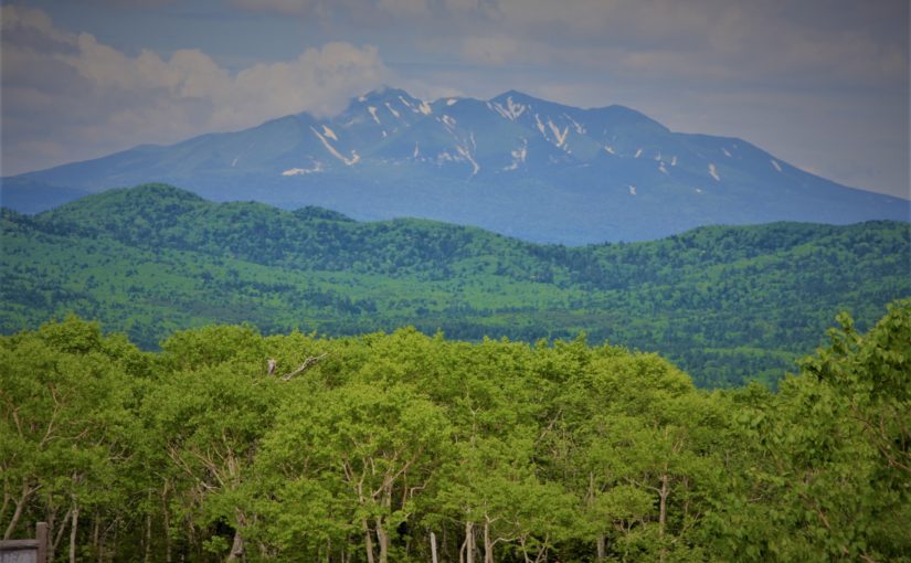
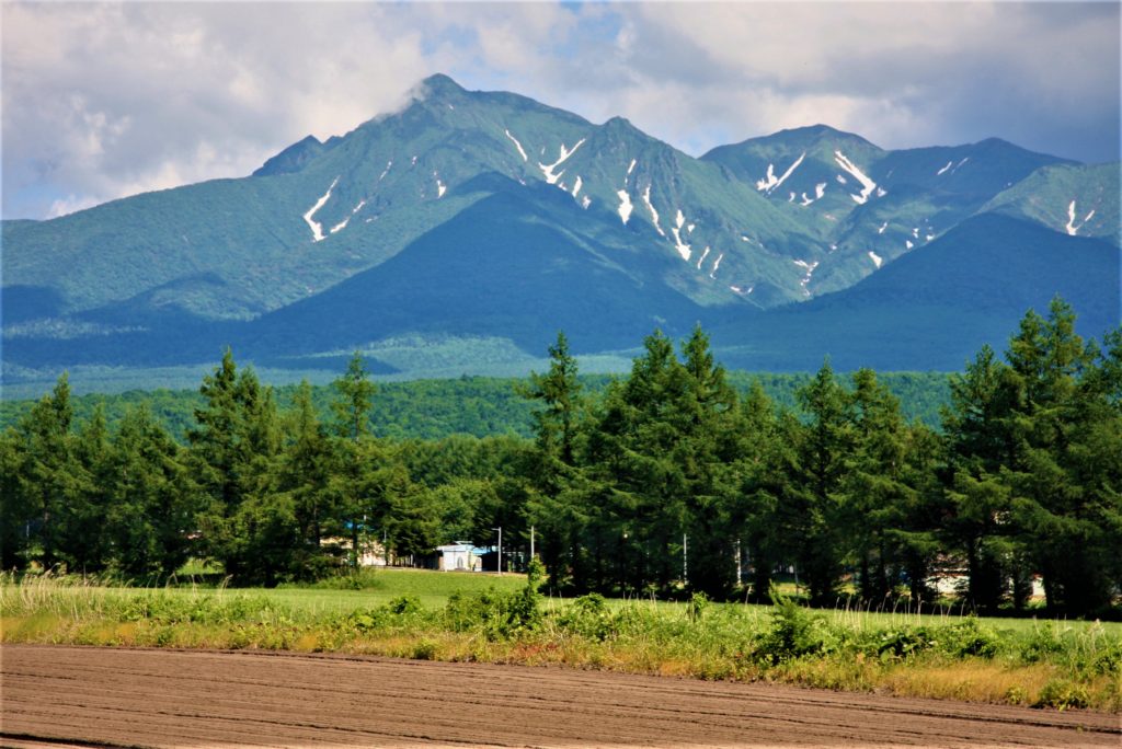
Mt.Sharidake's view from Kiyosato cho, this is a big mountain connected to the south Mt.shari and Mt.Onnebetsu, Mt.Unabetsu.
Mt.Sharidake’s view from Kiyosato cho, this is a big mountain connected to the south Mt.shari and Mt.Onnebetsu, Mt.Unabetsu.

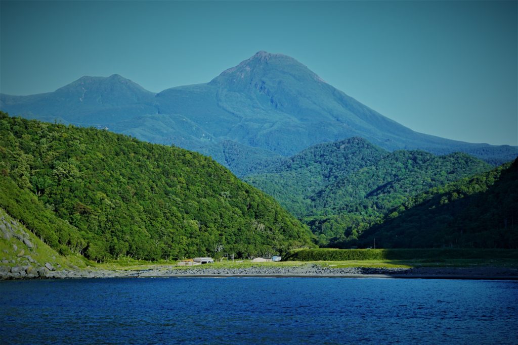
Mt. Shari (斜里岳) is a volcano at the bottom of Shiretoko Peninsula in Hokkaido.
It is a beautiful mountain of independent peak like Mt. Fuji.
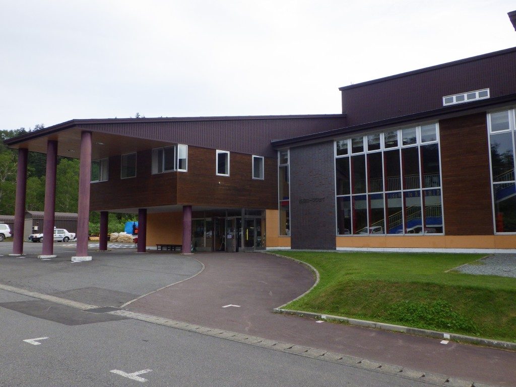
In this article I will introduce the Kiyosato course which most hikers choose.
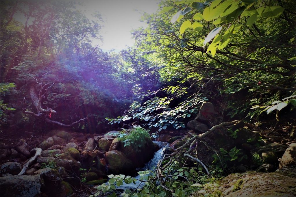
In this course you will cross the small waterfalls of Ichiosawa River left and right to Kami-Futamata, you can enjoy river trekking.
You can also see the Shiretoko mountain ranges and Akan mountain ranges from the summit. You go down a new road while looking to the wonderful view of Mt.Shari.


Detailed Data of Mount Shari (斜里岳)

Walking while enjoying a beautiful waterfalls such as Seven-fold waterfall (七重の滝).

AREA: Shari cho Kiyosato cho, Hokkaido
HIGHEST POINT: 1547 m, Mt. Shari
LEVEL OF COURSE: ★★★
PLAN: day hike
DURATION: 7 hours and 20 minutes
DISTANCE: About 10 km
DIFFERENCE OF ELEVATION: 867 m
ENDURANCE: ★★☆
DIFFICULTY LEVEL: ★★☆
BEST SEASON: July to September


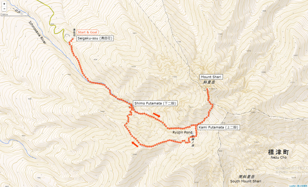
Mt.Rausu’s Hiking Course Map

the Kiyosato course (清里コース) | Click on the image above to open the enlarged image in a separate tab.

The source of above the three maps are “Digital Japan Web System” of The Geospatial Information Authority of Japan. The maps were edited a author of this blog.
In Japanese: これらの3枚の地図は国土地理院の電子国土Webシステムから配信されたものをこのブログの著者が加工したものである。


How to travel to Rishiri Island

the total amount: about 8000 JPY

Kiyosato cho Station

Taxi (about 30 minutes): 4000 JPY

Seigaku sou

Inquire:

Kiyosato Taxi (清里ハイヤー) 0152-25-2538

By Car:

From Memanbetsu via Route 39 and Route 334 about 70 km

Paking Lot Infomation:

40 units at Seigaku sou


Lodging Facility and Hotel:

Seigaku Sou (清岳荘)

A lodge located nearby trailhead. Let’s ask them because they provide information on Mt.Shari even if you are not a guest.

Tel: 0152-25-4111

Opening: late June to late September

Fee:
2050 JPY / per 1 person (staying without meals)
300 JPY / Bedding rental

Maximum Capacity: 50 people

Adress: Kōnan Kiyosato cho, Hokkaido

Access: 30 minutes from Kiyosato Station by car


Hot Springs After Hiking

Papasu Land Sattsuru (パパスランド さっつる)

There are the hot spring facility with foot baths and open-air baths, normal inside bathes. Local vegetables and special products are also on sale.

Opening hour: 10:00 am – 21:00 pm

Closed: No holiday

Fee: 390 JPY

Access: 10 minutes from Sattsuru Station (札弦駅) on foot.

北鎌倉 天園ハイキングコース

天園ハイキングコースとは?

東京から約1時間で行ける鎌倉で緑の美しいトレイルをハイキングしてみてはいかがでしょうか?
かつて修験道の修行僧達が修行の場として利用した標高159.2mの大平山周辺に広がるのが鎌倉アルプスで最も人気の天園ハイキングコースです。
ハイカーは相模湾と富士山の展望を同時に楽しめ、洞窟のお墓や歴史的に貴重な観光スポットを約5.5kmの今泉台から瑞泉寺へと続くハイキングコースで体験することが出来ます。
トレイルの入り口は建長寺を通って半蔵坊を抜けるルートから開始し(入園料は300円です。)、瑞泉寺が出口となります。約2時間から3時間の手軽で楽しいお勧めハイキングルートですよ。

天園ハイキングコース詳細情報

エリア:

神奈川県
ジャンル:
ハイキング
レベル:
初心者
総歩行時間:
2時間半
距離:
約7km
累計標高差:
100m
アクセス:
(行き)JR 横須賀線「北鎌倉駅 」
(帰り)JR 横須賀線「鎌倉駅 」

天園ハイキングコース(建長寺~瑞泉寺)ガイド

鎌倉の建長寺から瑞泉寺に向かう天園ハイキングコースのルートをいかにご案内いたします。

まずは北鎌倉駅の東口を出ます。
Kitakamakura station(East Entrance)

北鎌倉駅を出るとまず有名な円覚寺があります。
Enkakuji Temple

しばらく進むと建長寺があります、建長寺は入園料300円です。
entrance of Kenchoji temple
Gate of Kenchoji temple
本尊地蔵菩薩坐像 honzonjizou bosatu zazou
雲龍図 Unryuuzu
Beautiful japanese garden of Kenchouji
Flowers of Kenchouji
唐門 Karamon
Guide board to hiking course

建長寺を過ぎると半蔵坊へと続く小道が現れます。
a Hanzoubou road leadinga Hanzoubou road leading

半蔵坊の天狗達が現れたら半蔵坊はすぐ上です。
Hanzoubou Tengu
Mural

谷全体が境内である半蔵坊の曲がりくねった石段を上ると通常の禅寺の雰囲気とは異なる独特の雰囲気が味わえます。
From Hanzoubou View

半蔵坊を過ぎるといよいよ天園ハイキングコースのトレイルがスタートします、
ここが約2時間程のハイキングルートの起点となります。

「天園ハイキングコース」の標識に従って進みましょう。
the signs of Tenen-Hiking course

上下に凸凹とした道を進みます。Tenen Hiking trail

気分はインディージョーンズです!
Tenen Hiking trail
Tenen Hiking trail
Tenen Hiking trail
目的地である「瑞泉寺3.2km」の看板が出現。
Guide Bord

狭くうねった岩場は子供たちには最高の遊び場です、アスレチック気分で楽しみましょう。

Tenenn hikking trail

半蔵坊からのトレイルを抜けて大平山の頂上にたどり着きます、ここはランチ休憩にピッタリな広場があります。シートを持ってくることをお勧めします!
the top of Mt. Oohira view
flowes

天園休憩所ではおでんやビール、ところてんなどの軽食が買えます。(この日はお休みでした。)the Ten-En resting place
Tenen hiking trail

1時間程歩くとトレイルは終了です。
end of Tenen hiking trail

トレイルの出口を右折すると直ぐに瑞泉寺です、入場料は200円です。

 Zuisenji templeThe stairs of Zisenji Temple

瑞泉寺のお庭はまるで月面のような不思議な岩庭です。

a Japanese garden of Zuisenji Tenple

Onigawara

瑞泉寺を少し過ぎると鎌倉宮があります。
Kamakuraguu

この辺りは他にもたくさんのお寺があります。
many temples

暫く歩くと鎌倉で最もポピュラーな鶴岡八幡宮が登場します。
Tutuokahachimanguu
Tutuokahachimanguu
Tutuokahachimanguu
Tutuokahachimanguu

鶴岡町万宮から鎌倉駅までは無数のお土産屋さんや飲食店が軒を連ねる小町踊りがあるので食べ歩きも楽しいです。
この日はドイツビールと手作りソーセージが美味しい「腸詰屋」で乾杯!German beer
sausage
Komachi Street

抹茶専門店は外国人に人気です。Matcha ice cream shop "Kamakura Chacha"

抹茶の濃さが5段階で選べます。Matcha ice cream

Kamakura beerInarizushi

鎌倉駅に到着です、お疲れさまでした!Kamakura Station

Mount Rausu (羅臼岳) | 100 Famous Japanese Mountains #004

World Heritage Shiretoko’s highest peak hiking course

Shiretoko (知床) was added to the UNESCO Wold Heritage List on July 17, 2005.

Mount Rausu (羅臼岳) is The farthest desolate spot where the untouched nature remains.
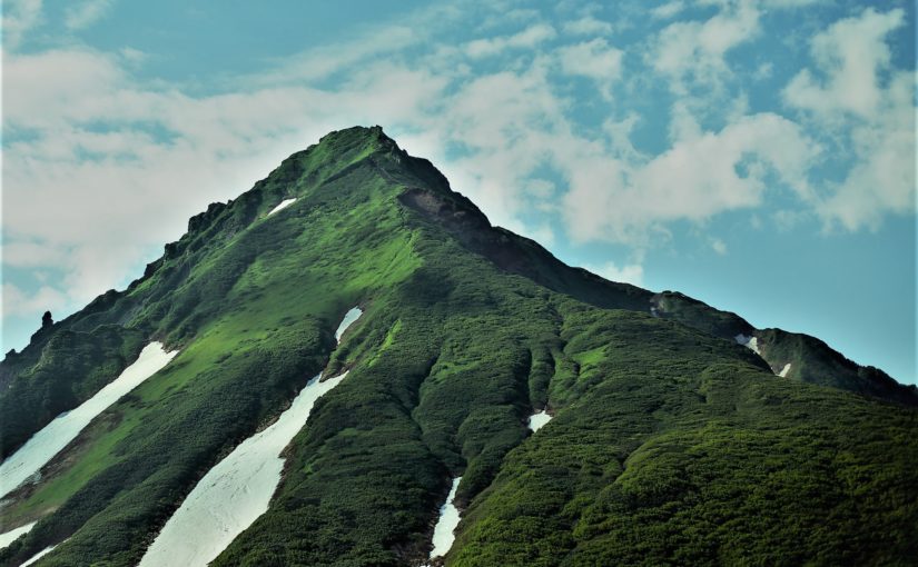
Mt.Rausu, the highest mountain of Shiretoko National Park (知床国立公園), is a bell-shaped mountain with huge and strange stacked lava domes on summit.
There are three hiking routes, the most popular trail is the course from Iwaobetsu hot spring (岩尾別温泉).
From the mountaintop with many rocky places it is an superb prospect such as views of Kunashirijima and Mount Shari.


Detailed Data of Mount Rausu (羅臼岳)

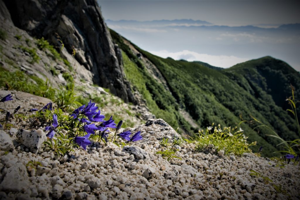
Alpine plants such as Campanula bloom during the short summer.

AREA: Shari cho Rausu cho, Hokkaido
HIGHEST POINT: 1660 m, Mt. Rausu
LEVEL OF COURSE: ★★★
PLAN: day hike
DURATION: 8 hours and 20 minutes
DISTANCE: About 12 km
DIFFERENCE OF ELEVATION: 1440 m
ENDURANCE: ★★★
DIFFICULTY LEVEL: ★★☆
BEST SEASON: July to September


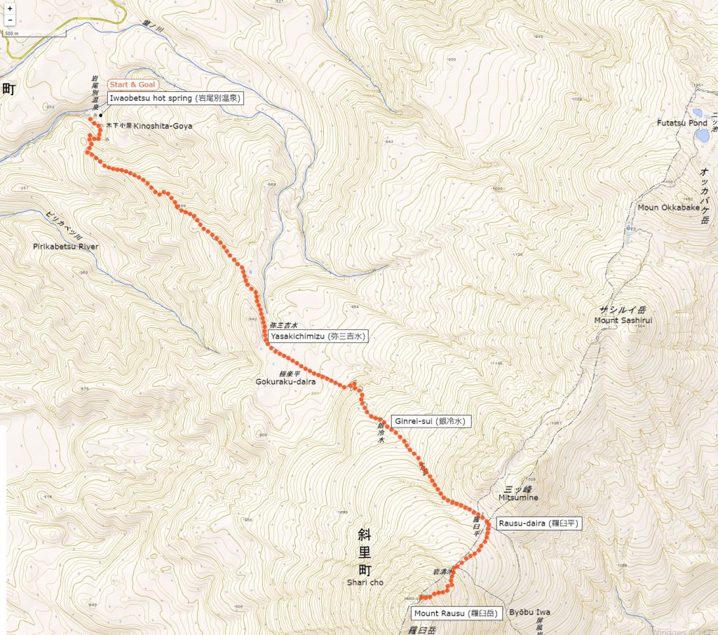
Mt.Rausu’s Hiking Course Map

the course from Iwaobetsu hot spring (岩尾別温泉) | Click on the image above to open the enlarged image in a separate tab.

The source of above the three maps are “Digital Japan Web System” of The Geospatial Information Authority of Japan. The maps were edited a author of this blog.
In Japanese: これらの3枚の地図は国土地理院の電子国土Webシステムから配信されたものをこのブログの著者が加工したものである。


How to travel to Rishiri Island

the total amount: about 34000 JPY

Shiretoko Shari Station

Taxi (about 1 hour 20 minutes): 17000 JPY

Iwaobetsu Hot Spring

Inquire:

Shari Taxi (斜里ハイヤー) 0152-23-2100

Utoro Kankō Taxi (ウトロ観光ハイヤー) 0152-24-2121

By Car:

From Abashiri via Route 244 and Route 344 about 90 km

Paking Lot Infomation:

30 units for Hotel Chinohate guests,
5 units for Kinoshita Goya


Lodging Facility and Hotel:

Kinoshita Lodg (Kinoshita Goya, 木下小屋)

A lodge located right next to trailhead with beds without meals.
There is a natural hot spring in the lodge.

Tel: 0152-24-2824

Opening: late June to late September

Fee:
2500 JPY / per 1 person (a bed without meals, reservation required)
500 JPY / Bathing and resting only

Maximum Capacity: 30 people

Adress: Iwaubetsu Onne-betsu village Shari cho, Hokkaido

Access: 1 hour and 20 minutes from Shiretoko Shari Station by car

Hotel Chinohate (Iwabetsu-insen chinohate, 岩別温泉地の果て)

Mt. Rausu Hotel which many travelers use as base for hiking and Shiretoko sightseeing.
The open air bath surrounded by virgin forest can also be used for day trip.

Tel: 0152-24-2331

Official HP: https://iwaobetu.com/


Hot Springs After Hiking

Iwaobetsu Hot Spring Open Air Bath (Iwaobetsu Onsen Yaten Buro, 岩尾別温泉野天風呂)

A unisex hot spring a bit behind from “Iwao Betsu Hot Spring”.
You can wild experience in a mossy rocky natural hot bath.

Opening hour: 24 hours

Closed: No holiday

Fee: Free

Access: 1 hour and 20 minutes from Shiretoko Shari Station by car

日の出山ハイキングコースガイド(東京武蔵五日市市)


東京の武蔵五日市に位置し、新宿から1時間半ほどでアクセス可能な日の出山ハイキングコースをご紹介します。

このコースのお薦めポイントは、コースのほとんどが緩やかな下りである点です。
最初の30分程のつらい上り坂を耐えてしまえば、あとの大部分は風の心地よい尾根道で癒しのダウンヒルを体験できます。
そのうえ、ゴールには温泉が待っています。

ハイキングコースのビギナーにこそ味わっていただきたい極上トレイル!
この記事ではコース途中にある蒟蒻づくしが味わえるコンニャクショップ「いっすい」も併せてご紹介します。

ハイキングコース地図:

日の出山ハイキングコース | クリックすると別タブに拡大版開きます。


※上記の地図は正確ではありません、実際に出かける際は登山地図等で詳細なルート情報をご確認ください。

エリア:
東京西部 (武蔵五日市市)
ジャンル:
ハイキング
レベル:
初心者
総歩行時間 (休息時間を含まない):
4時間半
距離:
約 8.4 km
累計高低差:
700m
アクセス:
行き:「武蔵五日市駅」から西東京バス「松尾行」か「つるつる温泉行」にて「松尾バス停」下車
帰り:西東京バス「十里木バス停」より「武蔵五日市駅行」で終点下車

武蔵五日市駅にてバスに乗り換えます。
Musashi Ginkokichi station

3番バス乗り場の「松尾行 」か「つるつる温泉行」
"松尾行 Matsuo Line" or "つるつる温泉行 Tsuru Tsuru Onsen Line" at No. 3 bus stop

「松尾 」か「日の出山登山口」で下車"日の出山登山口 Hinodeyama Tozanguchi"

松尾駅の前では可愛い山羊が出迎えてくれます。
A cute little goat

小川に沿って緩やかな坂を上ります。
the stream

標識に沿って左の道、「日の出山」方面へ
the sign for "hinodeyama miyakesan"

心地よい木陰の道が続きます。
The path of peaceful sunflower leaves continues

可愛らしいカエルのモニュメントが設置された橋を渡るといよいよ登山口です。
pretty frog figurines

ここから日の出山登山道がスタートします。
Mt.HInode Hiking trail entrance

序盤の急な坂道です、ここさえ耐えれば全般的に緩やかな下りです。
A steep mountain road1 A steep mountain road2

こちらが「金毘羅尾根・武蔵五日市」方面への分岐です、今は無視して上りましょう、この分岐には後ほど戻ってきます。
a branch to "Mt.Konpira Musashiituka Station"

標識が示す「日の出山」の方向に進みましょう!
The sign "日の出山 Mt, Hinode".

頂上に近づくに従い階段が急峻になります。
A steep staircase

ここが最後のひと踏ん張り。
the last staircase to the top

日の出山山頂に到着です!
the summit of the Mt.Hinode

奥多摩方面には御岳山や天気が良ければ富士山も見えます。
"Mt.mitake" and weather permitting "Mt. Fuji" can be overlooked. Top of the Mt.Hinode Top of the Mt.Hinode2

遅い朝ご飯を頂きました、下の写真は私の一押しのカレーメシです。
curry rice" (instant curry)

先ほどの分岐に戻り「金毘羅尾根・武蔵五日市駅」方面へと下ります。
 proceed to "Mt.Konpira Musashiituka Station"

ここから極上のダウンヒルの始まりです。
the beginning of a long down road

多少のアップダウンはあるものの概ね緩やかな下りが美しい直ぐ林と尾根道の間を延々と続きます。
 there is only a little uphill

コースではところどころで見晴らしの良いポイントが現れます。
そよ風が心地よい!
some nice views

「金毘羅尾根」の標識に従って進みましょう。
"Kinrara Mt. Konpira"a comfortable slope too flower

下記の標識が現れたら左折します。
「横根峠を経て瀬音の湯 (2.7km)  養沢方面」
sign as a landmark towards "瀬音の湯(2.7km) Shionenoyu"

ここでトレイルの終了です。
the end of the mountain trail

このサインを右です。
sign

蒟蒻ショップ「いっすい」です。
konnyaku shop

たった300円でヴァラエティに富んだ蒟蒻料理が味わえます。
Various kinds of konnyaku

こちらの狭い路地を左方向に進みます。
turn this yellow sign

キャンプ場の上をまたぐ橋を渡れば直ぐに温泉です。
bridge

ゴールの温泉に到着です。
the hot springs

入浴料金は900円
shioneno-yu shioneno-yu2

この施設はレストランも併設していて東京産の豚を使ったとんかつや、お蕎麦を頂けます。
meals such as pork cutlets and soba

日本庭園を眺めながらラタンチェアーで居眠りも気持ちいいです。
a rattan's chair

休憩所でビールを飲むことも可能です。お茶は無料でした。
a tatami mat

帰りの十里木バス停は10分程歩きます。
brigde

十里木バス停から武蔵五日市駅へは15分程で到着します。
"十里木 Toriki Bus Stop"

武蔵五日市の駅前にはハイカーやランナー向けのカフェ「東京裏山ベース」があります。シャワーや各種グッズ、イベント情報など山で遊ぶヒントが満載です。
Tokyo Urayama Base

モバイル機種の充電も出来ます。
charge the mobile phone

武蔵五日市駅
武蔵五日 Musashiitukaichi Station

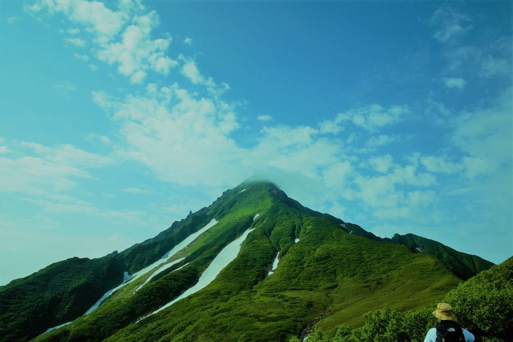
Mount Rishiri (利尻山) | 100 Famous Japanese Mountains #003

A Mountain of Northernmost Island in Japan

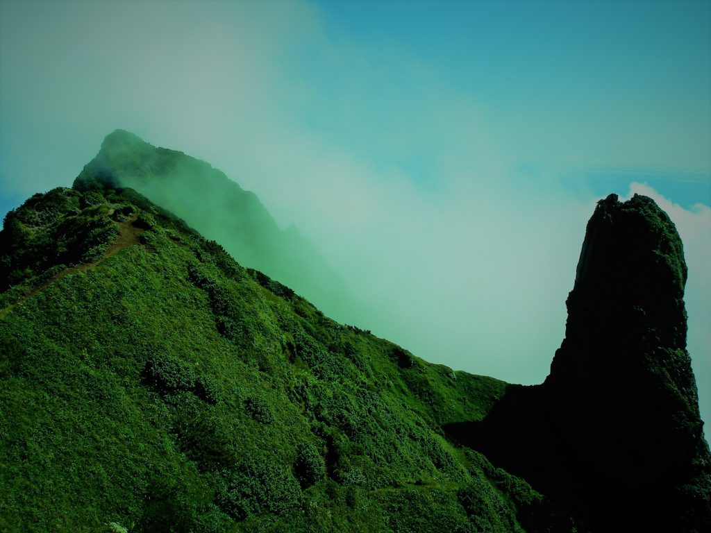
Candle rock of Mt. Rishiri | Sharp figure is beautiful.

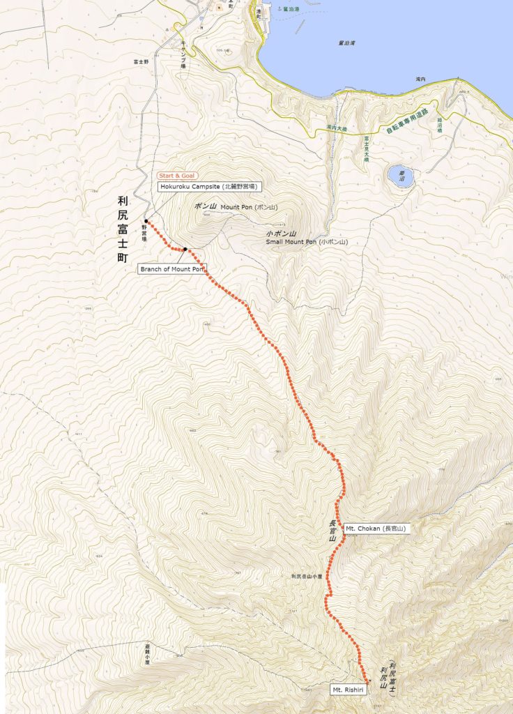
Mt.Rishiri’s hiking course is the Oshi-domari Course (鴛泊コース) 12 kilometers back and forth from Hokuroku Campsite (北麓野営場).
It is a long course of steep slope without water field except there is Kanro-sen Spring (甘露泉) which was chosen as “100 famous Japanese water picks” just after Trailhead.
Alpine plants bloom plofsely on the ridge and many plants named “rishiri” such as narcissiflora, botan – kinbai, rishiri – gentian, rishiri – genge, rishiri – papaver, rishiri – ōgi etc are also seen.


Detailed Data of Mount Rishiri (利尻山)

Walk the ridge of the treasure house of alpine plants.

AREA: Rishirifuji cho Rishiri gun, Hokkaido
HIGHEST POINT: 1719m North ridge of Mt. rishiri
LEVEL OF COURSE: ★★★
PLAN: Day-hike
DURATION: 8 hours and 50 minutes
DISTANCE: About 12 km
DIFFERENCE of ELEVATION: 1499 m
ENDURANCE: ★★★
DIFFICULTY LEVEL: ★★☆
BEST SEASON: July to September


Mt.Rishiri’s Hiking Course Map

the Oshi-domari Course (鴛泊コース) | Click on the image above to open the enlarged image in a separate tab.

The source of above the three maps are “Digital Japan Web System” of The Geospatial Information Authority of Japan. The maps were edited a author of this blog.
In Japanese: これらの3枚の地図は国土地理院の電子国土Webシステムから配信されたものをこのブログの著者が加工したものである。


How to travel to Rishiri Island

the total amount: about 8680 JPY

Wakkanai Airport

Souya Bus (about 35 minutes): 600 JPY

Wakkanai Port

Heart Land Ferry (1 hour and 40 minutes): 2140 JPY

Oshidomari Port

Taxi (about 10 minutes): 1600 JPY

Hokuroku Campsite

There is also a way from Sapporo to Wakkanai. Buses between Sapporo and Wakkanai travel 6 times a day (reservation required)
About 5 hours 50 minutes, 6200 JPY
For inquiries, please contact Sōya Bus (011-241-0241)

Inquire:

Sōya Bus Wakkanai office 0162-33-5515

Heart Land Ferry Wakkanai office 0162-23-8010

Fuji Tax 0163-82-1181

By Car:

When riding on a ferry, the length of the vehicle is less than 3 m and 10470 JPY. You can go to Trailhead’s Hokuroku Campsite.

Paking Lot Infomation:

Parking lot in Hokuroku Campsite. (About 30 units)


Lodging Facility:

Hokuroku Campsite (Rishiri Hokuroku Yaējō, 利尻北麓野営場)

A campground renewed in 2013,
Popular campground for early rising hikers.

Tel: 0163-82-2394

Opening: May 5 – October 15

Fee:
500 JPY / per 1 person
5000 JPY / 1 Camping Cabin house (bed without meals)

Adress: Oshidomari Fuji cho Rishirifuji cho, Hokkaido

Access: 2 km from Rishiri Fuji Onsen Bus Stop, 4 km from Oshidomari Port


Hot Springs After Hiking

Rishiri Fuji Onsen & Hot Spring Heated Pool “Yūei-Kan”

Web-site: Official Site

Tel: 0163822388

Closed: No holiday from May to October, Monday from November to April

Fee:
500 JPY / per 1 person

Adress: Jiei cho Oshidomari Fuji cho Rishirifuji cho, Hokkaido

Access: Near Rishiri Fuji Onsen on foot

高水三山ハイキングコース | 3つの寺と神社をめぐる週末冒険コース

高山三山ハイキングルートは奥多摩エリアで人気の登山道です。
たった4時間程度で高水山、岩茸石山、惣嶽山の三つのピークを踏める贅沢なコースです。

東京の中心地から簡単にアクセスできるのもGoodです!
(新宿からだと大体1時間半で到着します。)

shinjuku station


エリア:東京西部 (青梅市)

ジャンル:ハイキング
レベル:ビギナー
総歩行時間:約3時間45分
距離:約 9.4km
累計標高差:573m
アクセス:
行き:JR 青梅線軍畑駅
帰り:JR 青梅線御嶽駅

JR 軍畑 軍畑駅~高源寺(約30分)

軍畑駅から高源寺までは平溝川の心地よいせせらぎを聞きながら快適なな上り坂が続きます。高源寺には一人用のトイレがあります。

青梅線軍畑をスタート
JR Ikusabata station

高水山の標識に従って改札を左方向に進みます。
in front of Ikusabata station

すぐに踏切があるので左折して渡りましょう。
Railway crossing of the Ome Line

踏切を渡ったら坂を下り、突き当りを左折します。
Follow the road to the left

平溝河沿いの舗道をまっすぐ進みましょう。
Hirakiga River

高水山の標識が現れたら標識に従い左折します。
signpost toward "Mt. Takizumi 高水山"

暫くまっすぐ進みましょう。
dousoshinn

高源寺は下記の写真の分岐を右方向です。
Y-way

最初の目的地である高源寺に到着です。
Kougenji temple

高源寺~高水山(約60分)

高源寺から高水山までの高低差はだいたい400メートルです。ここから30分間はちょっとだけしんどい急坂が続きます。 高水山山頂の展望はあまり良くないですがトイレやベンチが設置されています。

高源寺横から伸びる坂道を進みます。
Wisteria flowers

ここが登山口です。
Mountain entrance

ここから登山道がスタートします。
mountain path

スギ林を進みます。
cedar forest

木の根に注意して進みましょう。
the cedar tree root

常福院 高水山の標識に従って進みます。
「Joufukuin Mt.Takamiz 常福院 高水山」 direction

常福院に到着です。
常福院 Joufukuin tenple

joufukuin main holl
Guardian dog
不動院の右サイドに鎮座する狛犬です。
尾っぽは日本犬ように丸まっている狛犬ですがどことなく狼のような面影を備えています。(隣接する秩父が狼を信仰していることと関係があるのでしょうか?)

jizo

寺院の裏にトイレがあります。
Plaza

少し上るとそこが高水山の山頂です。
the top of Mt.takamizu

高水山~岩茸石山(約35分)

次の目的地である岩茸石山はこのコースで最も展望の良いスポットで、奥武蔵や秩父の山々が見渡せます。ランチ休憩には最適ですよ。

此処から少し下って進みます。
A little downward

岩茸石山の標識に従って進みましょう。
The signpost "Mt.Iwatkeishi 岩茸石山"

比較的平坦な道が続きます。
A flat ridge walk continues

木々の間から隣の山々が垣間見えます。
Observation from the gaps in the trees

もう少しで次の山頂です。
One step to the summit of the mountain

ついに岩茸石山の山頂に到着です!
the summit of "Mt.Iwatakeishi"

岩茸石山~惣岳山(約40分)

岩茸石山から惣岳山へのルートは大きな岩を登ったり急な坂道を下る険しいトレイルです。
(岩茸石山と惣岳山にはトイレがありません。)

直ぐに急な斜面を下ります。
the steep slope

惣岳山の標識に従って進みましょう。
signpost"Mt.Sougaku 惣岳山""

ロッククライミングをしてるかのように岩を掴んで進みます。
a little rock climbing

飛び出した木の根に注意しながら進んでください。
the root of the tree

最後のピークである惣岳山に到着です。
Top of Mt.Sougaku Top of Mt.Sougaku2

惣岳山~JR御岳駅(約60分)

疲れによって足が上がりにくくなるため、最後の下りは特に注意しながら進みましょう。

木の根が飛び出したトレイルを進みます。
go down the climbing road

御岳駅まで1.5kmの標識です。
signpost "Mitake station 御岳駅"

A little shrine

竹藪が現れたらもうすぐ登山道が終了です。
bamboo trail

ゴールは慈恩寺です。
Jionji Temple

玉川屋は人気の蕎麦屋です。
Soba shop "Tamagawaya" Goodwill of Tamagawaya Interior of Tamagawaya

天ざる盛
Ten Zarumori

ビールもいいのですが奥多摩の地酒「澤乃井」もお勧めです。local sake "Sawanoi"

ふと視線を感じて振り向くと無数の奇妙なダルマが飾られていました。
Strange daruma dolls Strange daruma dolls2

最後は蕎麦湯で締めます。
the soup with soba entrance of Tamagawaya

国道に出ると東京都御岳案内所があります。
the Tokyo Metropolitan Government Information Office.

シャワーのレンタルもしています。
shower rentalThere are cafes, 中古のアウトドアショップやカフェが立ち並びます。
used outdoor goods stores, convenience stores, etc. along the street.

JR御岳駅に到着です。

JR Mitake Station. Station home

塩の湯 | 丸の内イルミネーション銭湯ランがお勧め!

四谷「塩湯」について

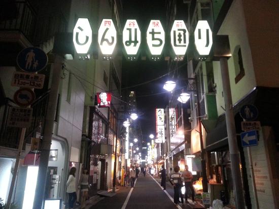
銭湯でさっぱりしたらしんみち通りの焼き鳥屋さんのビールで乾杯!ランニングの後の一杯は格別です。

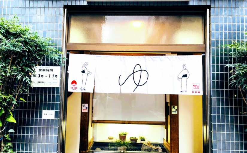
「塩湯」はJR四ツ谷駅から歩いて3分のしんみち通り脇にある公衆浴場です。
男女分かれた入り口、傘用の木製下駄箱、券売機ではなく番頭さん等
ノストラジックな昭和的たたずまいが映画の中にタイムスリップしたような感覚を味わえます。
銭湯ランナーに対しても寛容で、多くのランナーが気軽に利用しています。
(皇居ランが出来る銭湯で日曜営業しているのはここだけかと思われます。)
浴室には見事な富士山が描かれ、入浴後は脱衣所でコーヒー牛乳を飲ほしたくなること間違いなしです。

塩湯詳細情報

住所 :東京都新宿区三栄町1−1 塩湯アパート

電話:  tel:03-3351-9179

公式サイト: http://www.1010.or.jp/map/item/item-cnt-327

料金: 460円

休日: 月曜
営業時間 : 15:00~23:00

アクセス:
中央線「四ツ谷」駅下車、徒歩3分

塩湯の銭湯ランのモデルコース

塩の湯からのお薦めランニングコースは皇居周辺を含んだ皇居ランです。
また皇居周辺は国会議事堂や日比谷公園、武道館etc…多くの観光スポットが点在しているのでランニングついでに立ち寄ってみるのもオススメですよ!
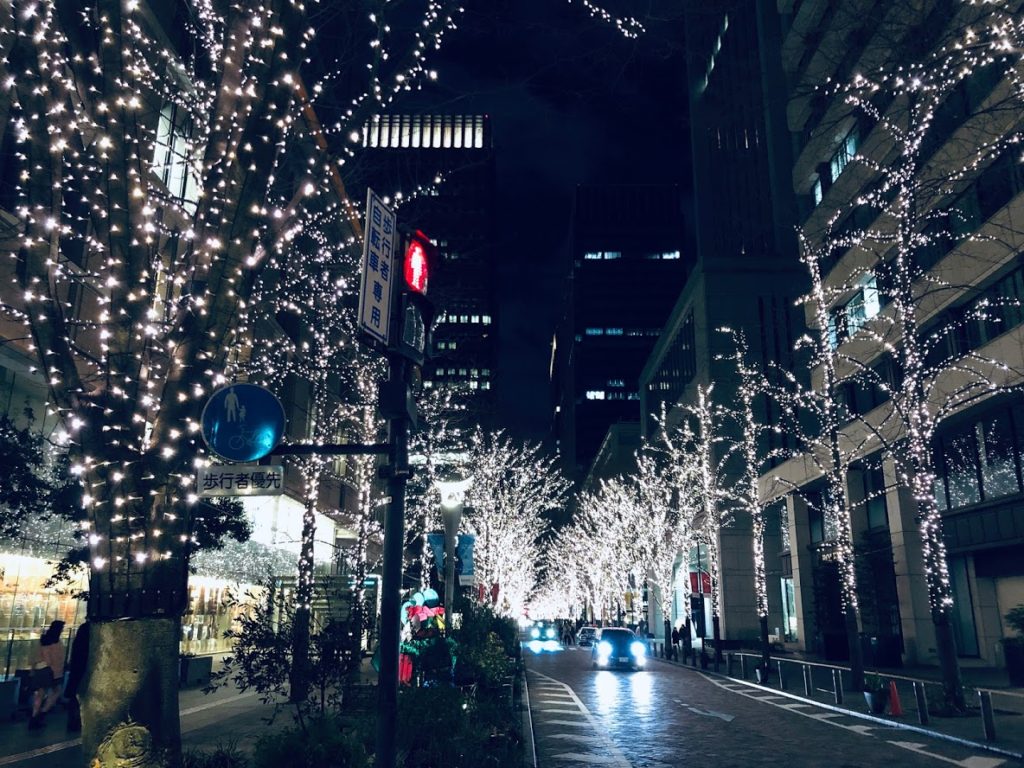
なかでも私がお勧めしたいのは季節限定(例年11月初旬~2月中旬)の丸の内中通りで開催されるイルミネーションランがお勧めです。
丸の内イルミネーションは今年で17年目を迎える東京・丸の内エリアの街を彩る冬の風物詩。約1.2kmの丸の内仲通を200本を越える街路樹がシャンパンゴールドのLED約100万球で彩られます。

丸の内イルミネーション:2018年は11月8日(木)~2019年2月17日(日)まで開催していました。

ランニングの受付方法

塩の湯をランステーションとしてこの銭湯を利用する場合は下記の手順をご参照ください。

① 靴を靴箱に入れて受付の券売機で460円のチケットを購入し、受付の店員さんに「ランニングで利用したいです。」と伝えましょう。
② 更衣室で着替えて、荷物は更衣室のロッカーに入れましょう。
③ 更衣室のロッカーのカギを受付に渡しましょう、ロッカーキーの番号は覚えておくか携帯電話のメモに残しておきましょう。
④ ランニングを楽しみましょう。
⑤ 戻ったら受付に先ほど書いたロッカーキーの番号を伝えて、ロッカーの鍵を受け取ります。
⑥しっかり体を洗って入浴しましょう。

Daisetsuzan National Park Mt. Asahidake (旭岳) | 100 Famous Japanese Mountains #002

Mt.Asahidake (旭岳) which is the main peak of Daisetsuzan National Park spreads view.
It is the highest mountain in Hokkaido, but you can go to the fifth stop on a ropeway.
For that reason it is a popular mountain ranging from beginners to experts with various hikers.
The scenery around Mt.Asahidake is really wonderful and it shows us various scenes depending on the four seasons.
In this article I will introduce three recommended hiking courses, from a walk course for beginners to a course for advanced hikers.
Furthermore, I will introduce all your doubts, including ropeway, hot springs and access information.

Due to the influence of the earthquake that occurred on September 6, 2018, there is a risk that the risk of aftershocks, sediment disasters, etc. may be increased. Please pay attention to future aftershock activity and rainfall situation. (As of September 6, 2018)

What’s Kind of Mountain about Mt. Asahidake (旭岳)

Elevation : 2,291 m
Location : Higashikawa town kamikawa-gun Hokaidō, Japan
Mountans : Daisetsuzan National Park (大雪山国立公園)
Highest Temperature (June-August) : 10.6 ℃
Lowest Temperature (June-August) : -2.3 ℃

Mt.Asahidake, which has a magnificent landscape of nature, is the highest mountain in Hokkaido.
It is the main peak of Daisetuzan National Park with more than 2,000 meters of mountains, and many hikers and tourists gather from all over the country every year.
It is also one of Mt.Asahidake’s attractions that you can easily enjoy superb views by using the ropeway and that there is a lot of hot springs nearby.

Mt. Asahidake which can enjoy various views throughout the year

Mt.Asahidake can enjoy various landscapes every season.
Colorful alpine plants are in full bloom in summer, bright autumn leaves spread in autumn.
In the winter it is also possible to see rare scenery such as “Sunpillar” where the sun shines vertically and “Diamond dust” which shines brightly as sunlight reflects on countless ice particles.

High altitude Asahidake is an area where many alpine plants are in full bloom.
A beautiful flower community that peaks in late July is also called “Kamiminimara (god ‘s garden)” in Ainu language.
Because Hokkaido has a high latitude and Asahi-dake is a high place, the temperature will be low even in the summer, so it is one of the attractions that you can enjoy both flower garden and snowy river at the same time. Blue sky and green color are added there, and Asahidake become a more gorgeous landscape.

Mt.Asahi-dake is also famous as the earliest leaves spot in Japan, at the end of August the mountain starts preparing autumn leaves.
While the fresh green of summer still remains, the spectacle that stains in red and yellow such as Sorbus matsumurana and Geum pentapetalum is a beautiful figure.
In September’s long weekend which is the peak of autumn leaves, many tourists come from abroad to see the best view.

Sugatami Pond Shining Blue

If you visit Mt.Asahidake please be sure to visit “Sugatami Pond”. There you can see superb veiw of Mt.Asahidake from the altitude of 1,600 m so it is a popular photo spot.
Also, the appearance of Asahidake reflected on the blue shining water surface is a mysterious sight.
You can get there from the ropeway “Kyoto” station in about 30 minutes on foot.
Therefore it is a place recommended for tourists as well as full-scale climbers.

Easy to get to the elevation of 1,600 m by riding the ropeway
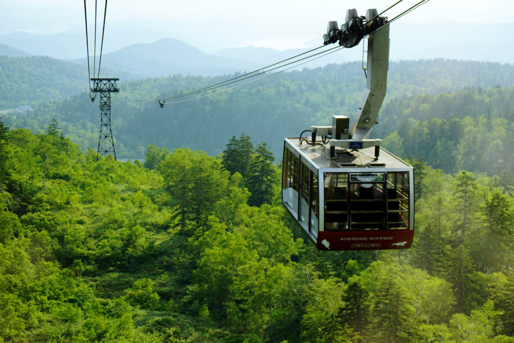
The reason that many tourists gather at Asahidake may be because you can easily enjoy a superb view by riding the ropeway.
With the ropeway which is the only service in Japan to the alpine zone, you can access up to 5th station in 10 minutes. As you can ride the ropeway and enjoy a spectacular view of Daisetsuyama including Asahikake, it is familiar to a wide range of people from mountaineering experts to families.

Click here for the operation status and fee of the ropeway

Let’s bring a map of Daisetuzan National Park

English Map of Daisetuzan National Park (Amazon)

How is the weather in Daisetuzan?

Let’s CHECK the local weather before going to Asahidake.

Click here for weathet information of Mt. Asahidake

Notes on Asahidake hiking and mountain climbing

Even when you enjoy light walks such as hiking at Asahidake as well as climbing it is necessary to pay attention to clothes and shoes.
Nobody can predict what kind of happening will happen if walking in nature.
For that reason, let’s prepare firmly and go mountains.

Even at easy-walking courses let’s go with sneakers or climbing shoes!

Asahi-dake has various courses ranging from easy-walking courses to full-scale climbing courses.
Easy walking courses have well meintained climbing paths, but there are also some gravel roads and so on, so it is recommended to go shoes with sneakers or climbing shoes.
If you have high heel shoes or sandals, you may suffer feet or injure you.
Also, Daisetuzan area has a lot of rain, so it is safe to have waterproof function in addition to easy walking.
People planning to go to the summit, be sure to wear climbing shoes.

Brown bears are in the surrounding mountains! Let’s confirm the information just in case

The season when hiking is fun for human beings is also easy to encounter brown bears asking for food. There are not many sightings of brown bear at Asahidake, but many brown bears inhabit the mountains of the surrounding Daisetsuzan. Especially when you are hike longitudinally, you need to be careful, check the brown bear information in advance or take measures against bear with bells etc in advance.

Brown appearance information (Japanese)

【Difficulty ★】 Feel free to explore by riding the ropeway

Distance:1.7 km
Total Time:45 minutes
Difficuly:★☆☆

Sugatami Pond Ropeway Station (姿見駅) 15 minutes → 3rd observation platform (第三展望台) 25 minutes → Sugatami observation platform (姿見展望台)  → Sugatami Pond Ropeway Station (姿見駅)

Start from Asahi-dake ropeway station.
The year round ropeway is easy to move because it is connected from the altitude of 1100 m to the Sugatami station of the terminal station.
Even if you are not confident in your physical strength, you can easily go by riding a ropeway.

Popular ropeway arrives at Sugatami station in about 10 minutes.
Beyond the forest limits you can enjoy a large panorama of lush green mountains from the train window. In autumn we can see the autumn leaves neatly.

After enjoying the spectacular view from the ropeway, we will arrive at Sugatami station. From here we will enter the walk course on the boardwalk.
Since Mt.Asahidake can be seen also from Sugatami station, it may be good to look at the mountain of Mt.Asahidake slowly first.

As you walk around the observation deck around the boardwalk, you can see two adjacent ponds called “couple pond” (夫婦池). It is the “suribachi pond” (擂鉢池) that has a deep shape like a mortar and the “mirror pond” (鏡池) that has a loose shape. On sunny days the blue sky appears on the surface of the water and you can enjoy the magnificent mountain scenery.

After walking for a while from the couple pond, you arrive at “Sugatami Pond” (Mimi pond). Behind Sugatami Pond, Mt.Asahidake of overwhelming scale feeling is near, and magnificent scenery spreads.
On a sunny day the lake shines on the emerald green and reflects Mt.Asahidake like a mirror, so please take a look when you visit.

【Difficulty ★ ★】 From the ropeway to the summit

There are two ways to aim at the top of the Asahidake mountain: a way to climb using the ropeway and a way to access from Asahidake Trailhead. Most of the climbers seem to use a ropeway in many cases.
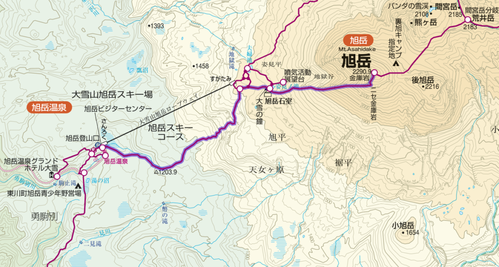
Distance:5.1 km
Total Time:4 hours and 55 minutes
Difficuly:★★☆

Sugatami (姿見) 20 minutes → Sugatami Pond (姿見の池) 150 minutes → Mt.Asahidake (旭岳) 110 minutes → Sugatami Pond (姿見の池) 15 minutes → Sugatami (姿見)

You go to the Sugatami station on the ropeway and start climbing from there towards the summit.
Movement of the ropeway is comfortable and physical strength can be preserved.
Besides, it is the best way to enjoy the wonderful panorama.
After finally checking the equipment at Sugatami station, hiking will start from here.
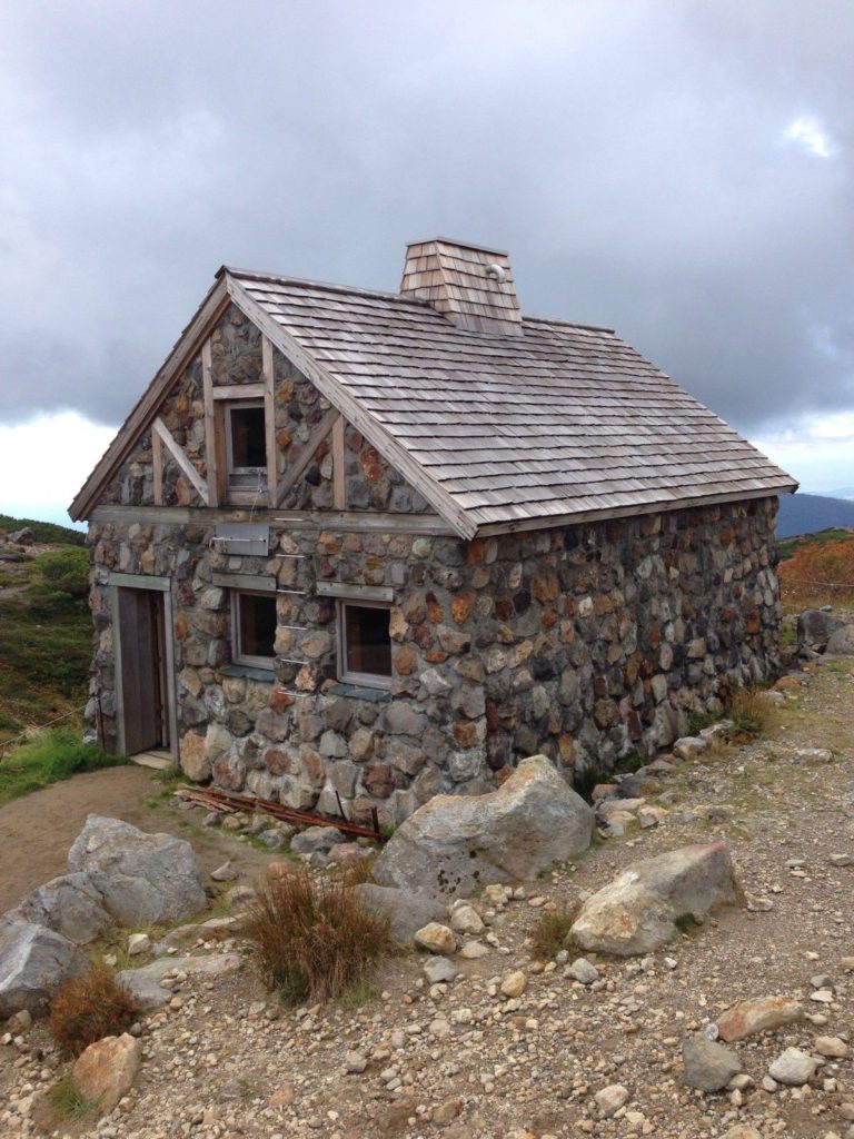
“Asahi-dake stones room” (旭岳石室) that will be visible soon as you reach Sugatami Pond.
Buildings made with a lot of stones can be used as a shelter cabin.
However, because it is for emergency purposes, it is forbidden to use it as an ordinary inn.
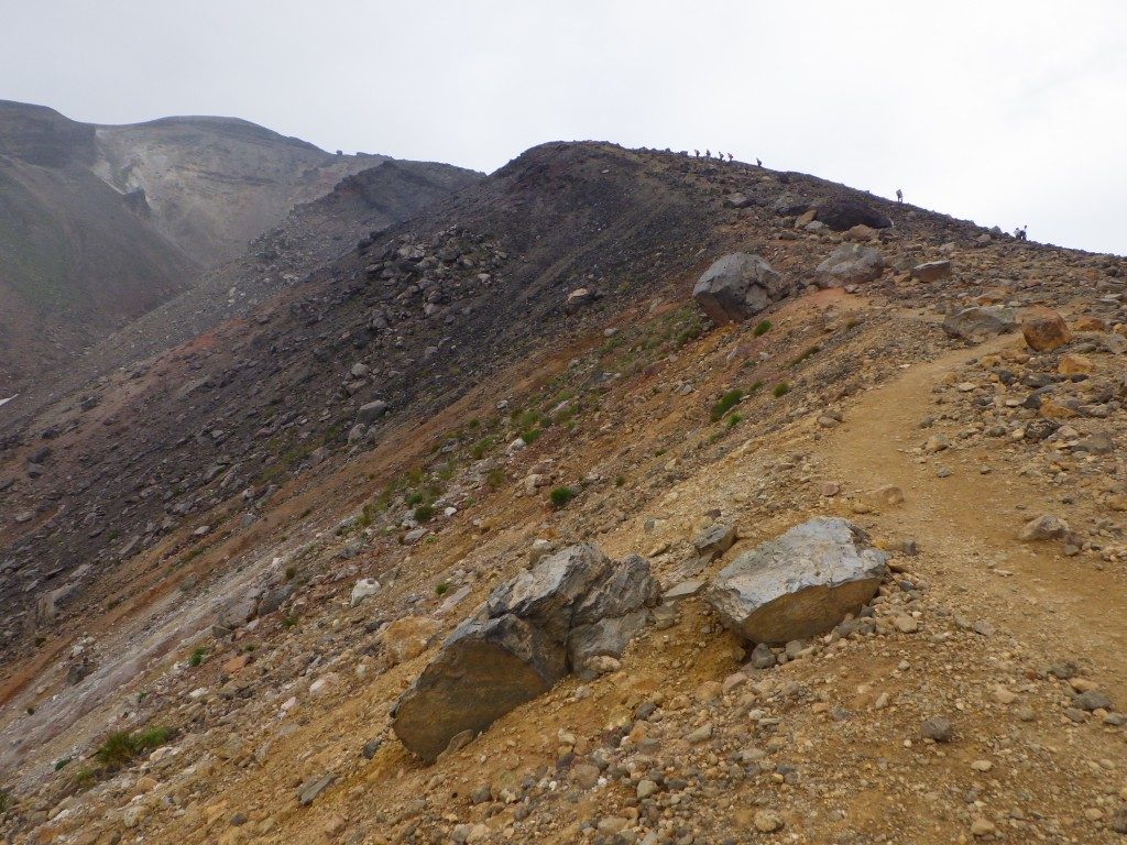
Walking for a while from the “Asahi-dake stones room”, the road will gradually become harder.
As rocky scenes appear as altitude increases, I recommend wearing climbing shoes instead of sneakers at your feet. As there are places that are slippery, let’s proceed carefully.
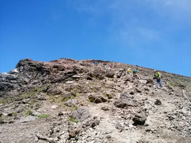
The climbing mountain road of Asahidake is linear when seen on the map, but since it is meandering in reality, it will consume more physical strength than it looks.
Passing Sugatami Pond and other sightseeing spots gradually increase in altitude, it is characterized by volcano gas, reddish brown soil and rocky areas turning into prominent areas.

From the refreshing mountain peak, you can look over Mt.Tomuraushi and Mt. Hakuundake of the same Daisetsuzan Natioal Park.
If the weather is okay, it is a 360 degree big panorama where Tokachi mountain can be seen.
The blue sky and green are beautiful and the outline of the mountain can be clearly seen.
This is a scenic spot where you can taste the ruggedness and elegance of nature at the same time.

How to go to the summit without using a ropeway
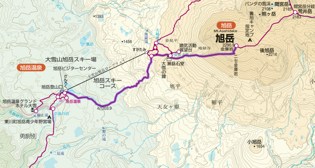
Distance:11.7 km
Total Time:9 hours and 5 minutes
Difficuly:★★★

Mt. Asahidake Trailhead (150 minutes) → Sugatami (姿見) 20 minutes → Sugatami Pond (姿見の池) 150 minutes → Mt.Asahidake (旭岳) 110 minutes → → Sugatami (姿見) 115 minutes → Mt. Asahidake Trailhead
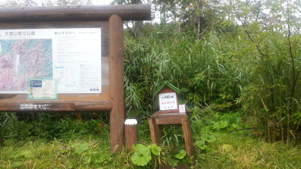
Trailhead at Asahidake is at the foot of Mt.Asahidake Ropeway Station.
In addition to the ropeway parking lot, you may use a public parking lot such as a visitor center.

You walk on the course of the trees, as you cross the sloping street of the rock, you arrive at Ashidake’s 1st station.
The hiking route is densely planted but it is an open space where there is sunlight and the sky is visible.
On the climbing road you can see small pretty flowers such as leiocarpa.

【Difficulty ★ ★ ★】 Tour around Asahidake

Course that runs longitudinally from Mt.Mamiya from Asahidake which is the main peak of Daisetuzan.
Even in the summer, snow will remain around the back of Mt.Asahidake’s route, and finally back to Sugatami this course will bring you a spectacular view of alpine plants and mountains.
However, there are places where the footing is bad, so let’s proceed carefully.
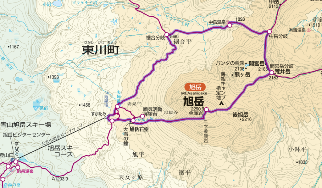
Distance:11.5 km
Total Time:7 hours and 40 minutes
Difficuly:★★★

Sugatami (姿見) 170 minutes→ Mt. Asahidake (旭岳) 60 minutes→ Mt. Mamiyadake branch (間宮岳分岐) 60 minutes→ Nakadake hot spring (中岳温泉) 60 minutes→ Susoaidaira (裾合平) 110 minutes→ Sugatami
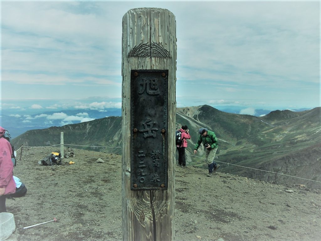
To the Sugatami station which is the start of the round trip course, I climb from the ropeway or climbing mouth and access it.
Until the summit the course goes through Sugatami Pond, Asahi-dake stones room and rocky road.
Beyond the Kinko-rock, you climb a steep hill to the last and you can see the summit of the mountain.
For the course to Asahidake summit top please refer to the course of 【Difficulty ★ ★】.
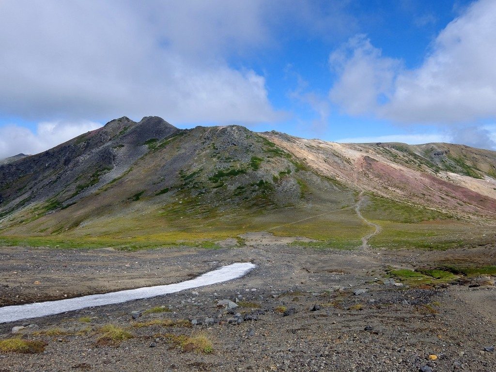
Route from Asahidake summit to the back Mt.Asahidake starts from downhill.
As steep slopes with many rocks are slippery, attention is necessary.
Hikage – yakubo Especially carefully in the summer as snow still remains.
Nakadake Onsen with its natural outdoor hot spring is the perfect spot for healing tired feet.
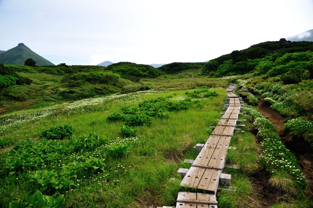
The route from Nakadake Onsen to Susoai-daira will walk along a refreshing blue sky and a nice view.
Along the wood road where the flower garden spreads in the summer, you can stroll while enjoying beautiful flowers such as white pentapetalum and pink Pedicularis.

Access to Mt.Asahidake · Parking information
Asahi-dake ropeway which makes it easy to enjoy the dynamic view of Daisetsuzan.
Because it operates all season, you can get on board at your own schedule.
There are also souvenirs and local gourmet at the station.

料金(普通運賃):

June 1 – October 20 October 21 – May 31st
Round-trip ticket One way ticket Round-trip ticket One way ticket
Adult 2,900 JPY 1,800 JPY 1,800 JPY 1,200 JPY
Child 1,450 JPY 900 JPY 900 JPY 600 JPY

Business period: whole year
Number of parked cars: 150 ordinary cars and bikes, 10 or more medium-sized cars etc.
Parking fee: once a day / ordinary car / bike 500 yen, non-ordinary car 1,500 yen ※ parking fee for November – May free
Address: Asahidake Onsen Higashikawa-cho, Kamikawa-gun, Hokkaido
Phone number: 0166-68-9111

【How to access Asahidake Ropeway】

Access by Train / Bus
Sapporo Station → Super Kamui No. 1 → Asahikawa Station → Asahikawa Denkikidō Bus Ideyu → Get off at Asahidake (Ropeway Foothills)

How to access by car
Asahikawa Kita IC of Road Traffic Route → Route 37 → Route 1160 → Asahidake Ropeway

Asahidake Onsen Parking lot

The parking lot of Asahidake Onsen is 4 places in total including the parking lot in front of the Asahidake Visitor Center.
There is a chargeable and free place in the parking lot, and there are places where the presence or absence of the fee changes depending on the season.

Fee: November – May is free, other periods are charged
Number of parking units: 100 (free), 150 (charged)

Roundup of Mt. Asahidake

Mt. Asahi-dake is the highest mountain in Hokkaido belonging to Daisetsuzan National Park. Even tourists and families who do not climb mountain can enjoy powerful elegant scenery and autumn leaves from the ropeway. Regardless of course difficulty when walking Asahi-dake, it is important to firmly prepare winter clothes / shoes. Please enjoy yourself with nice animals and plants!

【Points to note when climbing】

· Please haiking with a solid training on climbing equipment. Mountain climbing shoes, thick socks, rain gear up and down, cold weather protection, head lamp, hat, zack, quick-drying clothes, food, water etc.
· There are several climbing routes, so there are many branches so maps and compasses are indispensable.
· Just in case, do not forget mountain climbing notification and mountain insurance!
· These courses will change difficulty level depending on climbing experience, physical strength, weather etc. Please make reference only, please make a reasonable plan according to your own physical fitness and enjoy climbing.
Mt.Meakandake (雌阿寒岳) | 100 Famous Japanese Mountains #001

Due to the influence of the earthquake that occurred on September 6, 2018, there is a risk that the risk of aftershocks, sediment disasters, etc. may be increased. Please pay attention to future aftershock activity and rainfall situation. (As of September 6, 2018)

What’s Kind of Mountain about Mt.Meakandake (雌阿寒岳)

Source: 阿寒湖畔エコミュージアムセンター

Elevation : 1,499 m
Location : Kushiro City Hokaidō, Japan
Mountans : Akan (阿寒)
Highest Temperature (June-August) : 14.9℃
Lowest Temperature (June-August) : 1℃

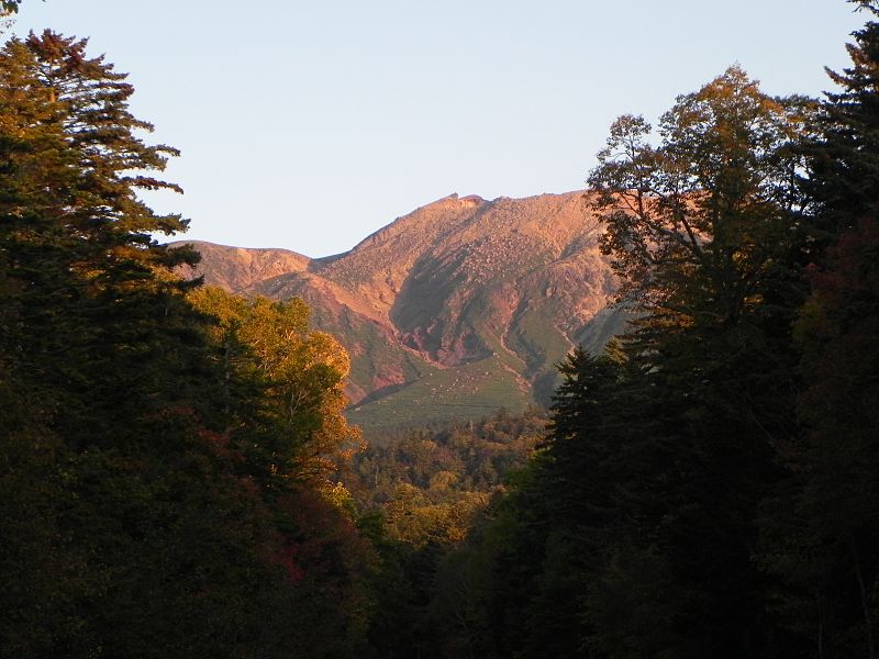
Mt.Meakandake (雌阿寒岳) is an active volcano with an altitude of 1,499 m located in the Akan Mountain Area between Kushiro City and Ashoro Town. “100 Fomaous Japanese Mountains” has also been selected, in Ainu language is also called “Ponmachineshiri”. Also, even in the mountain of Hokkaido the mountain trail is relatively well maintained, the view from the course is also a nice attractive mountain.

Powerful Crater Waching from The Top of Mt.Meakandake

Source: 阿寒湖畔エコミュージアムセンター

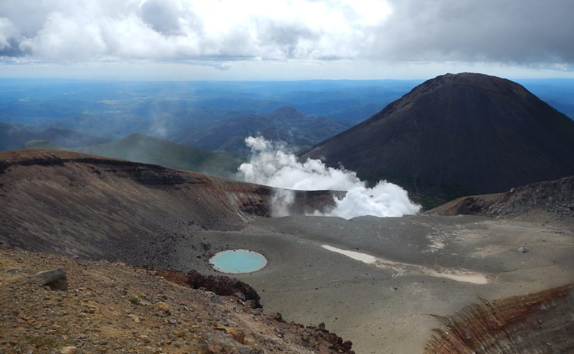
A magnificent view overlooking from Akan Lake is wonderful, but the crater which can be seen from the top of Mt.Meakan is a spot where you can experience the active lively volcano while smelling sulfur around.

Weather and Volcanic Activity of Akan-dake

Mt.Akan is an active volcano. Let’s prepare thoroughly so that you can check the weather information and the volcanic activity in advance and enjoy climbing safely.

Click here for weathet information of Akan

Click here for the volcanic activity of Akan 

Are There Bears at Mt. Akan?

Beers don’t seem to be witnessed much around Mt. Meaka.
But you must must be carefully. In order to avoid mutual unfortunate circumstances for both the bear and the human, let ‘s enjoy hiking with correct knowledge about the ecology and habits of the bears.

3 main hiking routes with peace of mind to beginners

Here, I will introduce Mt.Akan’s most common main hiking routes which is also recommended for beginner’s hikers.

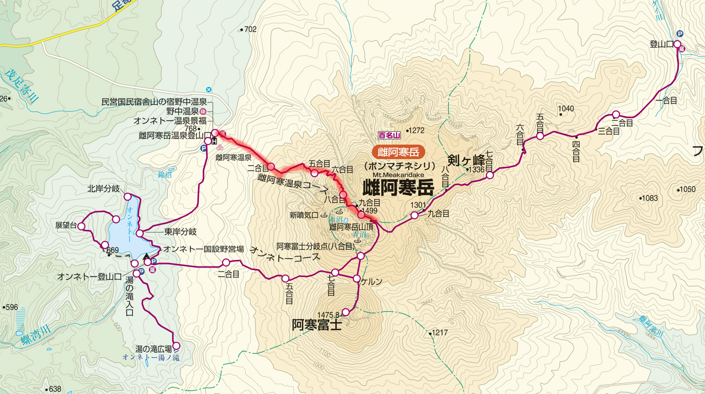
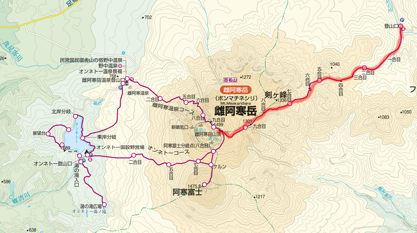
Meakan Hot Spring Course (雌阿寒温泉コース)

Source: ヤマプラ
Source: ヤマプラ

Distance:5.8 km
Total Time:3 hours and 40 minutes
Elevation Difference:794 m
Schedule:Day-hike
Difficuly:★☆☆☆☆

Meakan Hot Spring Trailhead (雌阿寒温泉登山口) 30 minutes → 2nd.Station (二合目) 40 minutes → 5th.station (五合目) 45 minutes → 8th.station (八合目) 25 minutes →the top of Mt. Meakan (雌阿寒岳山頂) 15 minutes → 8th.station (八合目) 25 minutes → 5th.station (五合目) 20 minutes → 2nd.Station (二合目) 20 minutes → Meakan Hot Spring Trailhead (雌阿寒温泉登山口)

Source: 阿寒湖畔エコミュージアムセンター

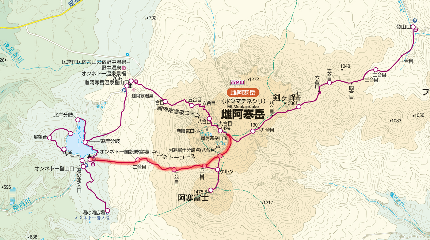
Onnetō Course (オンネトーコース)

Source: ヤマプラ
Source: ヤマプラ

Distance:8.1 km
Total Time:5 hours
Elevation Difference:857 m
Schedule:Day-hike
Difficuly:★☆☆☆☆

Onnetō Trailhead (オンネトー登山口) 30 minutes → 2nd.Station (二合目) 30 minutes → 5th.station (五合目) 60 minutes → 7th.station (八合目) 20 minutes → 8th.station Branch of Mt. Akanfuji (八合目 阿寒富士分岐) 40 minutes → the top of Mt. Meakan (雌阿寒岳山頂) 15 minutes → 8th.station Branch of Mt. Akanfuji (八合目 阿寒富士分岐) 15 minutes → 7th.station (七合目) 45 minutes → 5nd.Station (五合目) 20 minutes → 2nd.Station (二合目) 20 minutes → Meakan Hot Spring Trailhead (雌阿寒温泉登山口)

Source: 足寄町ホームページ
Source: 足寄町ホームページ

Onnetō Course departing from the campground and heading to the top, although it is steep, the distance is short and can climb in a short time. On the way, you can also go via Mt. Akanfuji if you have time to spare.

Akan Hot Spring Course (阿寒温泉コース)

Source: ヤマプラ
Source: ヤマプラ

Distance:12.3 km
Total Time:5 hours and a half
Elevation Difference:764 m
Schedule:Day-hike
Difficuly:★★☆☆☆

Meakandake Trailhead (雌阿寒岳登山口) 50 minutes → 859 m 45 minutes → 1000m 40 minutes → 1166m 30 minutes → 1332m 30 minutes → the top of Mt. Meakan (雌阿寒岳山頂) 20 minutes → 1332m 25 minutes → 1166m 25 minutes → 1000m 30 minutes → 859m 35 minutes → Meakandake Trailhead (雌阿寒岳登山口) 50 minutes

Source: Wikipedia
Source: Wikipedia

Although it is the longest distance among the three mountaineering routes of Mt. Meakandake, the gradient is relatively loose, and it is a route that can climb slowly while enjoying the powerful volcanic landscape.
On the way you can also enjoy alpine plants such as Arenaria merckioides.

About Mt. Akandake’s Winter · Snow Cover Season

Mt. Akandake’s climbing optimum season is from late May to late October. Since the temperature is sometimes below freezing even in June, let’s go for climbing with enough equipment! Snowy season is popular because it can enjoy different scenery. The pure white volcano is spectacular.

Access to Trailhead · Parking information

Public Transport

Kushiro Station, Kushiro Airport – (Bus: Akan Bus) – Akanko Onsen ━ (Taxi) ━ Meakandake Hot Spring Trailhead, Onetxō National Campsite, Lake Akan Mountain Trailhead

Click here for Akan Bus timetable and fare

Coming by a Car

① Meakan Hot Spring Public Parking Lot

National Route 240 – National Highway 241 – Prefectural Highway 664 – Meakan Hot Spring Public Parking Lot
For both Kushiro station and Kushiro airports, go north on Route 240 and continue on the road for a while and turn left on National Highway No. 241 which passed by Lake Akan.
Turn left to the prefectural highway No. 664 and go to Meakan Hot Spring, and the place you see on the left is Meakan Hot Spring Public Parking Lot. About 76.5 km to Meakan Hot Spring Public Parking Lot, required time 1 hour 16 minutes.

<Parking Lot Information>
Akan Onsen Public Parking Space (Free)
About 80 units can be stopped.
Address: Moashoro Ashoro Town Ashoro County, Hokkaido

② Onnetō National Parking Lot

National Highway 240 – National Highway 241 – Route 664 – Onnetō National parking lot
Both Kushiro Station and Kushiro Airport, go north on Route 240 and continue on the road for a while and turn left at National Highway No. 241 which passed by Akan Lake.
Turn left to the prefectural highway No. 664 ahead, head towards Meakan Hot Spring, Onnetō Lake over Onnetō The place that you can see on the left turning the tea house is Onnetō National parking lot.
It is approximately 79.8 km to Onnetō National parking lot, required time 1 hour 23 minutes.

<Parking Lot Information>
Onnetō National parking lot parking lot (free)
About 100 units can be stopped.
Address: Moashoro Ashoro-cho Ashoro-gun, Hokkaido

③ Akan Lake Trailhead Parking Lot

National Highway No. 240 – Lake Akan Trailhead Parking Lot
For both Kushiro Station and Kushiro Airport, go north on Route 240 and continue along the road for a while, then after passing Akan Lake, turn left immediately and after a while Lake Akan Trailhead Parking Lot.
Approximately 64.7 km to Lake Akan Trailhead Parking Lot, required time 1 hour 40 minutes.

<Parking Lot Information>
Lake Akan Trailhead Parking Lot (Free)
About four units can be stopped.
Address: Moashoro Ashoro Town Ashoro County, Hokkaido

Roundup of Mt.Akan

Mt.Akandake is one of the nine mountains “100 famous Japanese Mountains” in Hokkaido, which is lowest in altitude and less required for both difficulty and physical strength, so it is a mountain that is easy for beginners to challenge.
Let’s enjoy the natural environment of Akan by selecting the route that suits you!
Experienced people also recommend a route to climb via Mt.Akanfuji nearby.

【Points to note when climbing】

· Please haiking with a solid training on climbing equipment. Mountain climbing shoes, thick socks, rain gear up and down, cold weather protection, head lamp, hat, zack, quick-drying clothes, food, water etc.
· There are several climbing routes, so there are many branches so maps and compasses are indispensable.
· Just in case, do not forget mountain climbing notification and mountain insurance!
· These courses will change difficulty level depending on climbing experience, physical strength, weather etc. Please make reference only, please make a reasonable plan according to your own physical fitness and enjoy climbing.


断酒を「伸びしろ」と捉えてみる

まずは簡単に自己紹介します。
私Tokyo Sampo Masterは都内在住の現在39歳男性です。
不惑の40を前にして自らの人生を見つめ直す意味合いで2週間前から人生何度目かの断酒を開始しました。
実はこれまでに何度か断酒にトライしています。
たしか最長で1年半以上の断酒に成功していますが、結局のところすべて失敗に終わっています。

失敗の原因は様々ですが、
考えられる要因のひとつは飲酒の与えてくれる唯一のメリットである「酔い」への憧憬の念を捨てきれなかった点があります。
つまりどこかで「酔い」を「良い」ものとして捉えてしまった点です。
もちろん多くの人にとって「酔い」は「良い」ものであることは理解しています。しかしアルコールの与えてくれる恩恵を素直に享受出来るタイプとそうでない人間がいるとしたら私は明らかに後者です。
少なくとも私にとってはこれまで「酔い」がもたらしてくれるものは決して「良い」思い出ばかりではありませんでした。

思い返せば人生最大の恥ずかしい思い出は「酔った」状態で体験しました(ああ忘れたい!)、妻とのちょっとしたいさかいは大抵私が「酔った」状態のときに発生しています。かつて親友との喧嘩も泥酔状態でしたし(その後仲直りしました…。)、携帯電話を落としたのも酔っぱらった状態でした。
それどころか何度か命を落としかねない危ない失敗もしています(比喩ではなく穴に落ちたり)。
少なくとも私にとっては「酔い」がもたらしてくれたメリットはデメリットをはるかに凌駕する数々の苦い思い出に彩られています。

それに反して短い期間ではありますがこれまで何度かチャレンジしてきた「断酒」によってもたらされたメリットは凄まじいものがありました。
体に関するメリットはもちろん、金銭的なメリット、心の安定、交友関係の改善等、その他にもここでは書ききれない程の多くの「良い」体験をほんの短い期間ですが私の人生にもたらしてくれたのです。

このブログでは「断酒」を好きなお酒を「断つ」苦しい行為と捉えるのではなく、これまで私が何度か経験した「断酒」がもたらしてくれた強烈な「メリット」を、私の残りの人生に与えられた数少ない「伸びしろ」と捉え、40手前の男が断酒を継続していく過程で享受した日々の「喜び」をポジティブに綴っていけたらと思っています。