Daisetsuzan National Park Mt. Asahidake (旭岳) | 100 Famous Japanese Mountains #002

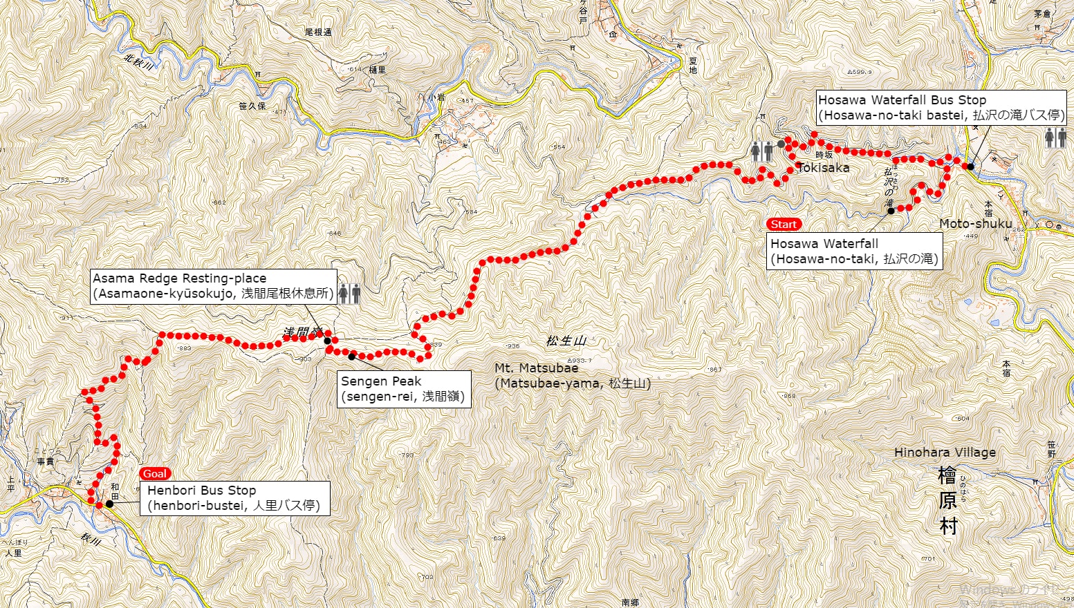
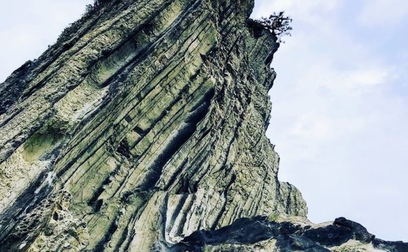
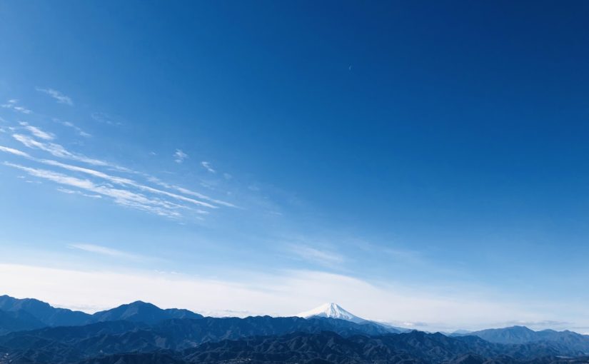
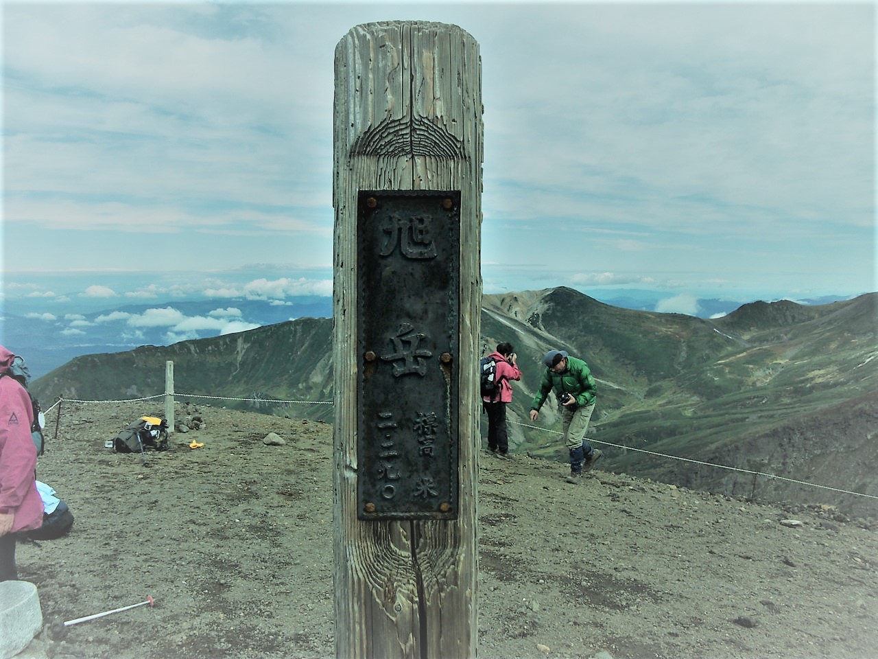
Mt.Asahidake (旭岳) which is the main peak of Daisetsuzan National Park spreads view.
It is the highest mountain in Hokkaido, but you can go to the fifth stop on a ropeway.
For that reason it is a popular mountain ranging from beginners to experts with various hikers.
The scenery around Mt.Asahidake is really wonderful and it shows us various scenes depending on the four seasons.
In this article I will introduce three recommended hiking courses, from a walk course for beginners to a course for advanced hikers.
Furthermore, I will introduce all your doubts, including ropeway, hot springs and access information.

Due to the influence of the earthquake that occurred on September 6, 2018, there is a risk that the risk of aftershocks, sediment disasters, etc. may be increased. Please pay attention to future aftershock activity and rainfall situation. (As of September 6, 2018)

What’s Kind of Mountain about Mt. Asahidake (旭岳)

Elevation : 2,291 m
Location : Higashikawa town kamikawa-gun Hokaidō, Japan
Mountans : Daisetsuzan National Park (大雪山国立公園)
Highest Temperature (June-August) : 10.6 ℃
Lowest Temperature (June-August) : -2.3 ℃

Mt.Asahidake, which has a magnificent landscape of nature, is the highest mountain in Hokkaido.
It is the main peak of Daisetuzan National Park with more than 2,000 meters of mountains, and many hikers and tourists gather from all over the country every year.
It is also one of Mt.Asahidake’s attractions that you can easily enjoy superb views by using the ropeway and that there is a lot of hot springs nearby.

Mt. Asahidake which can enjoy various views throughout the year

Mt.Asahidake can enjoy various landscapes every season.
Colorful alpine plants are in full bloom in summer, bright autumn leaves spread in autumn.
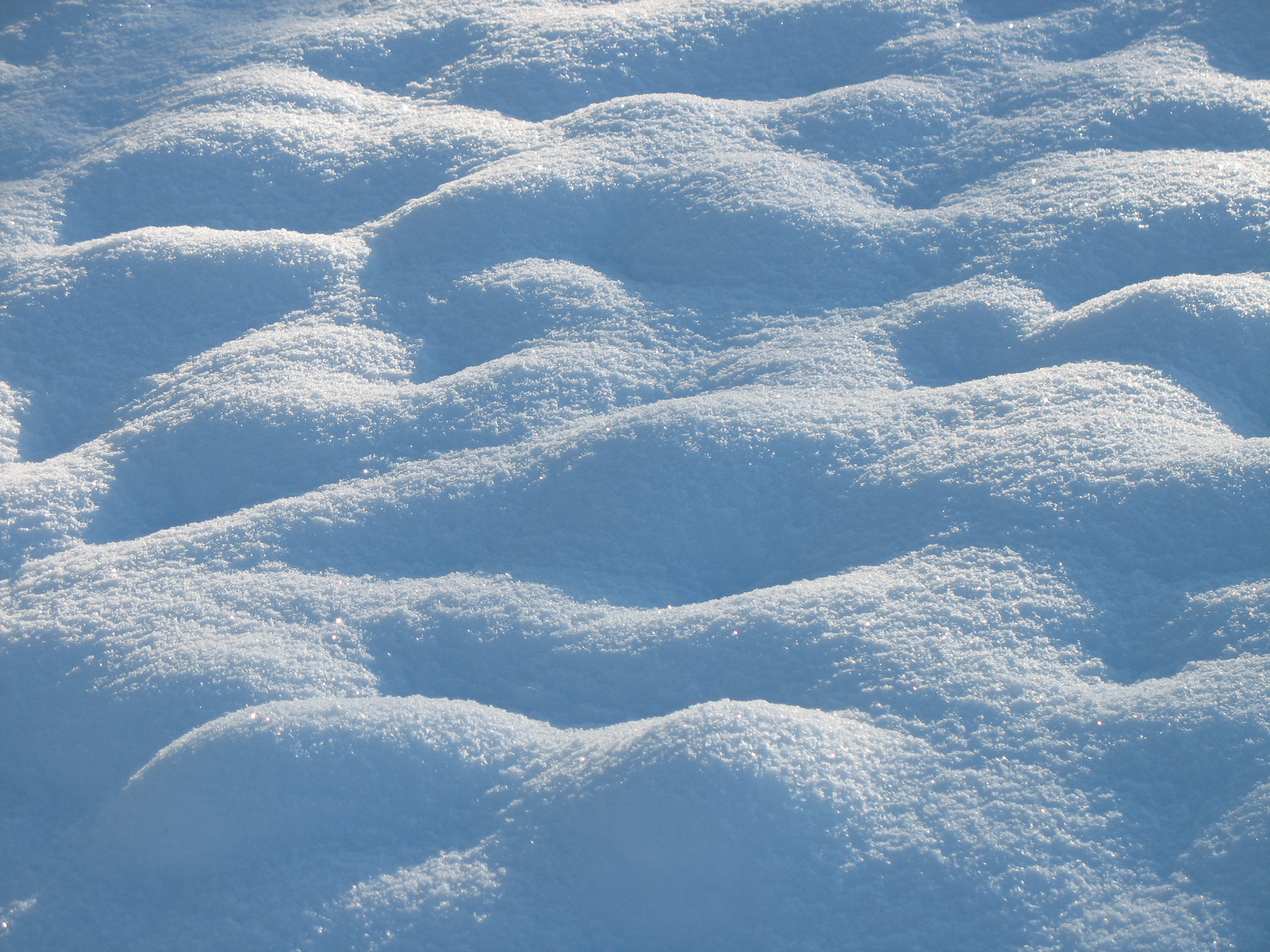
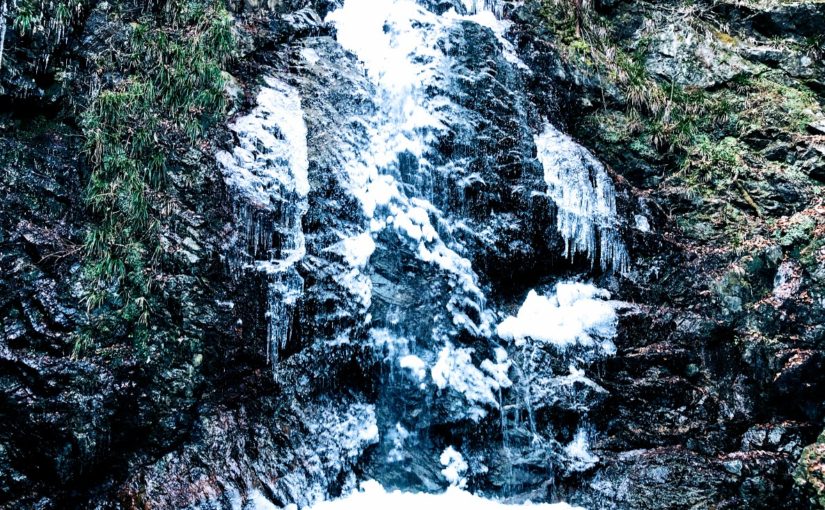
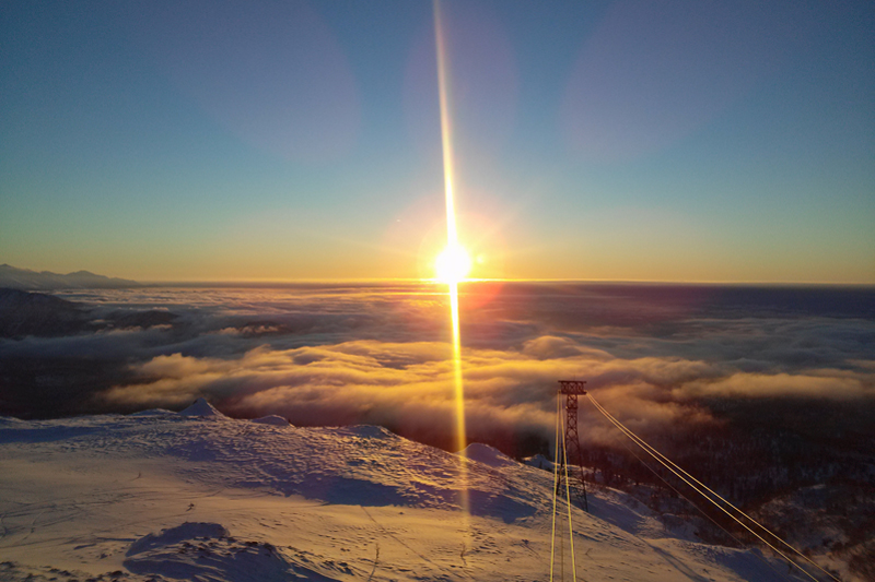
In the winter it is also possible to see rare scenery such as “Sunpillar” where the sun shines vertically and “Diamond dust” which shines brightly as sunlight reflects on countless ice particles.

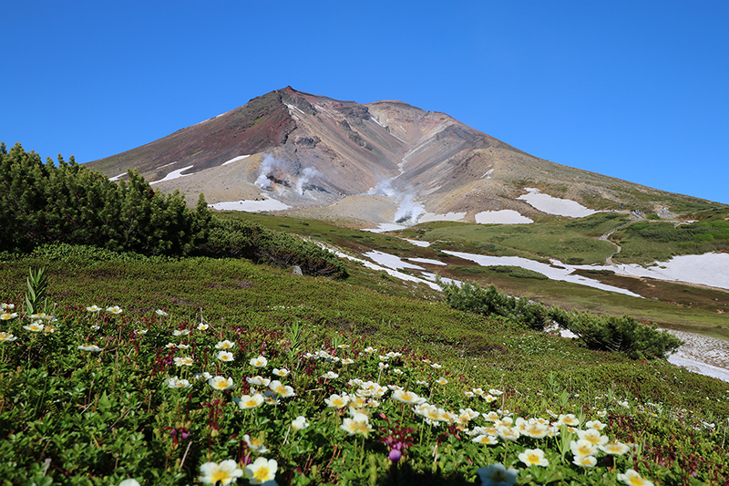
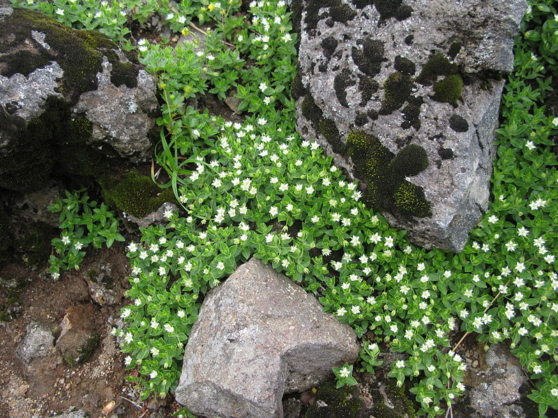
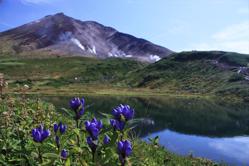
High altitude Asahidake is an area where many alpine plants are in full bloom.
A beautiful flower community that peaks in late July is also called “Kamiminimara (god ‘s garden)” in Ainu language.
Because Hokkaido has a high latitude and Asahi-dake is a high place, the temperature will be low even in the summer, so it is one of the attractions that you can enjoy both flower garden and snowy river at the same time. Blue sky and green color are added there, and Asahidake become a more gorgeous landscape.

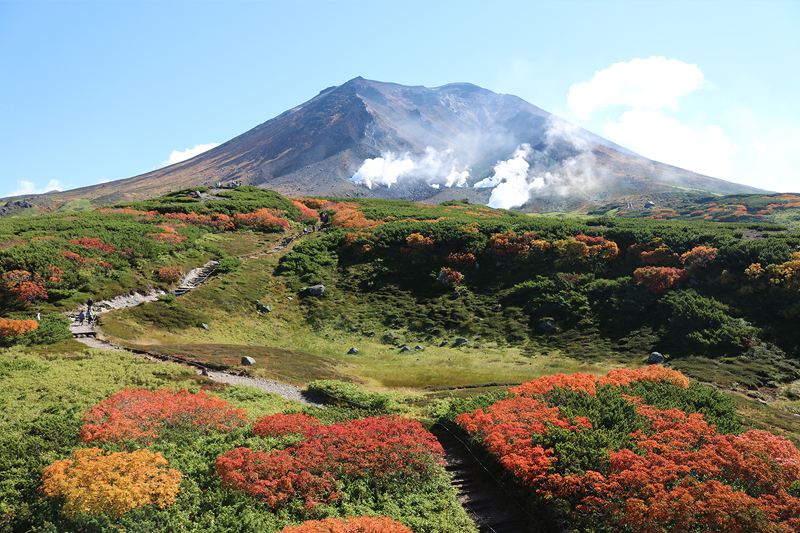
Mt.Asahi-dake is also famous as the earliest leaves spot in Japan, at the end of August the mountain starts preparing autumn leaves.
While the fresh green of summer still remains, the spectacle that stains in red and yellow such as Sorbus matsumurana and Geum pentapetalum is a beautiful figure.
In September’s long weekend which is the peak of autumn leaves, many tourists come from abroad to see the best view.

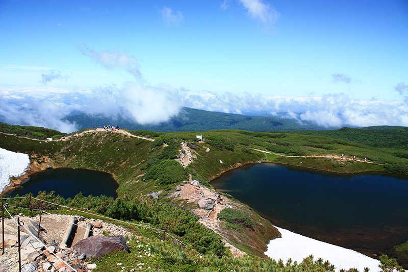
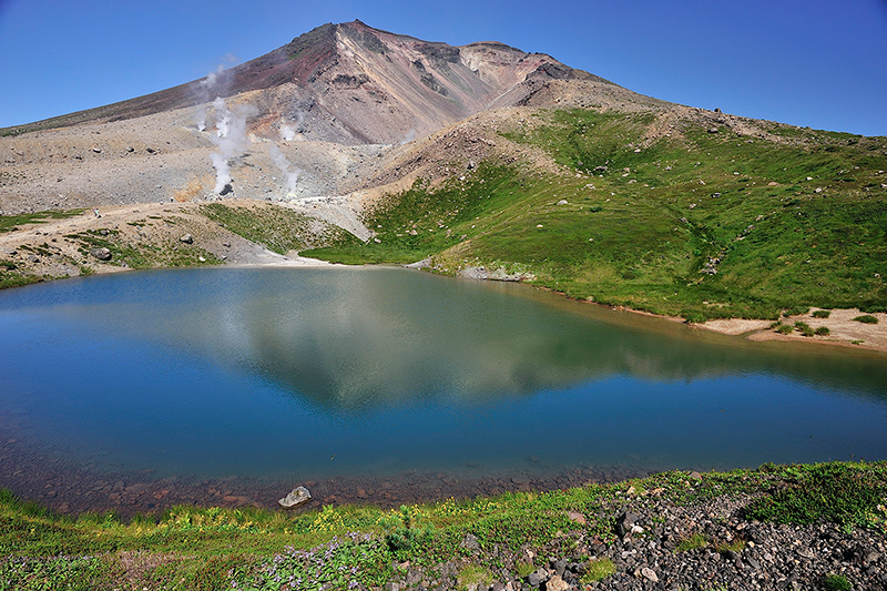
Sugatami Pond Shining Blue

If you visit Mt.Asahidake please be sure to visit “Sugatami Pond”. There you can see superb veiw of Mt.Asahidake from the altitude of 1,600 m so it is a popular photo spot.
Also, the appearance of Asahidake reflected on the blue shining water surface is a mysterious sight.
You can get there from the ropeway “Kyoto” station in about 30 minutes on foot.
Therefore it is a place recommended for tourists as well as full-scale climbers.

Easy to get to the elevation of 1,600 m by riding the ropeway

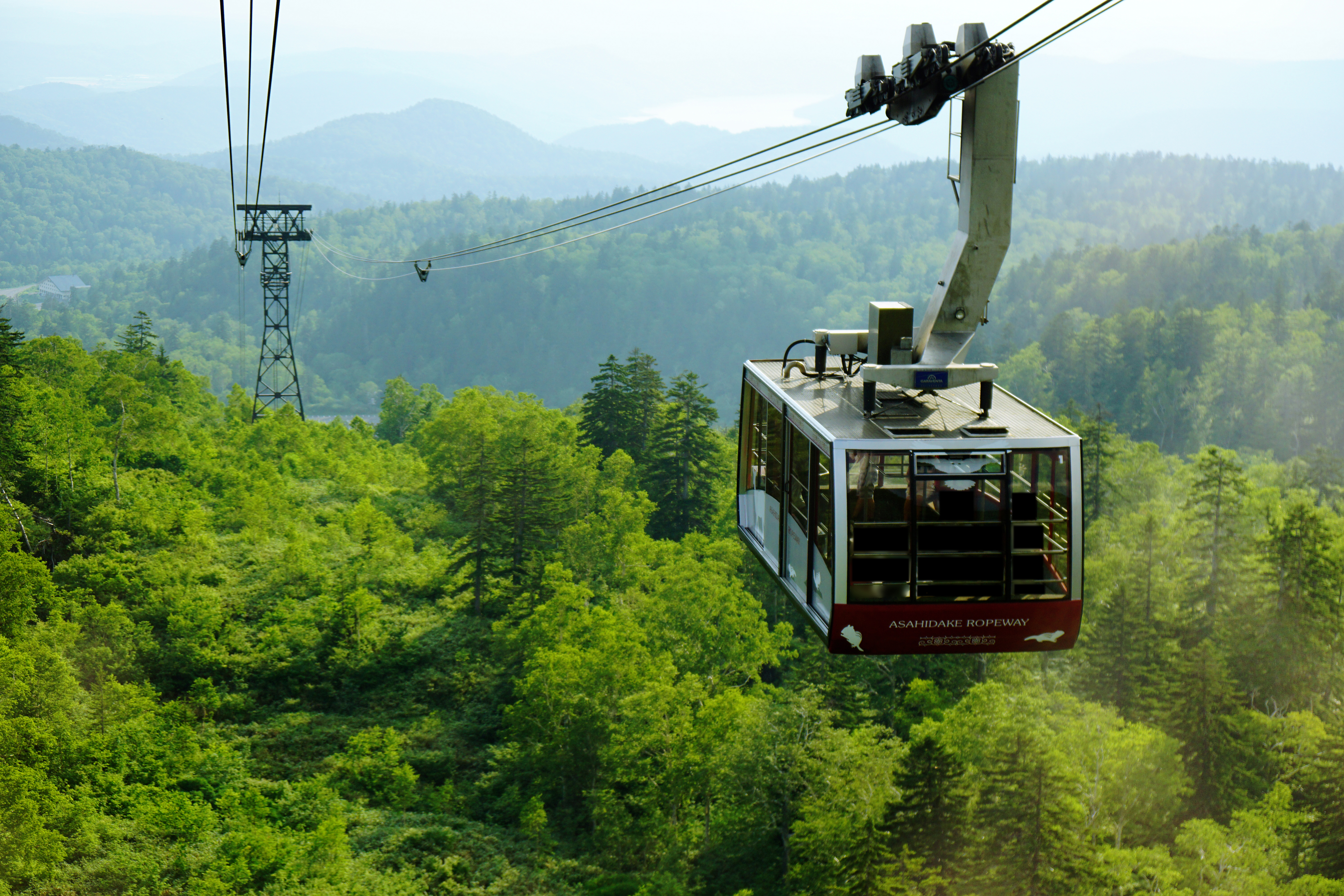
The reason that many tourists gather at Asahidake may be because you can easily enjoy a superb view by riding the ropeway.
With the ropeway which is the only service in Japan to the alpine zone, you can access up to 5th station in 10 minutes. As you can ride the ropeway and enjoy a spectacular view of Daisetsuyama including Asahikake, it is familiar to a wide range of people from mountaineering experts to families.

Click here for the operation status and fee of the ropeway

Let’s bring a map of Daisetuzan National Park

English Map of Daisetuzan National Park (Amazon)

How is the weather in Daisetuzan?

Let’s CHECK the local weather before going to Asahidake.

Click here for weathet information of Mt. Asahidake

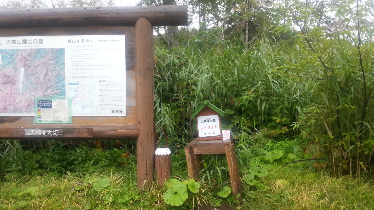
Notes on Asahidake hiking and mountain climbing

Even when you enjoy light walks such as hiking at Asahidake as well as climbing it is necessary to pay attention to clothes and shoes.
Nobody can predict what kind of happening will happen if walking in nature.
For that reason, let’s prepare firmly and go mountains.

Even at easy-walking courses let’s go with sneakers or climbing shoes!

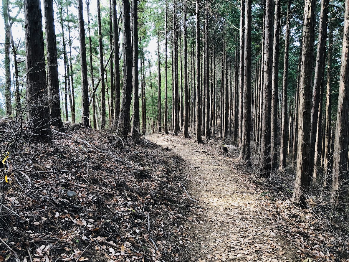
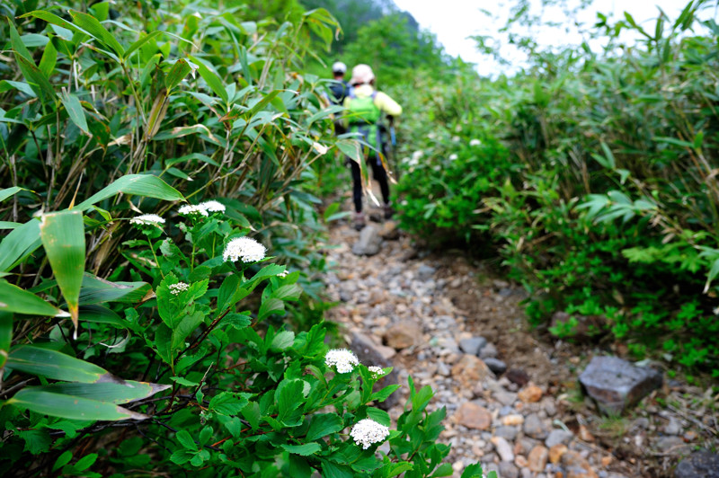
Asahi-dake has various courses ranging from easy-walking courses to full-scale climbing courses.
Easy walking courses have well meintained climbing paths, but there are also some gravel roads and so on, so it is recommended to go shoes with sneakers or climbing shoes.
If you have high heel shoes or sandals, you may suffer feet or injure you.
Also, Daisetuzan area has a lot of rain, so it is safe to have waterproof function in addition to easy walking.
People planning to go to the summit, be sure to wear climbing shoes.

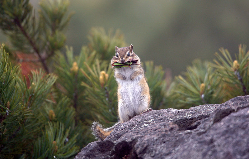
Brown bears are in the surrounding mountains! Let’s confirm the information just in case

The season when hiking is fun for human beings is also easy to encounter brown bears asking for food. There are not many sightings of brown bear at Asahidake, but many brown bears inhabit the mountains of the surrounding Daisetsuzan. Especially when you are hike longitudinally, you need to be careful, check the brown bear information in advance or take measures against bear with bells etc in advance.

Brown appearance information (Japanese)

【Difficulty ★】 Feel free to explore by riding the ropeway
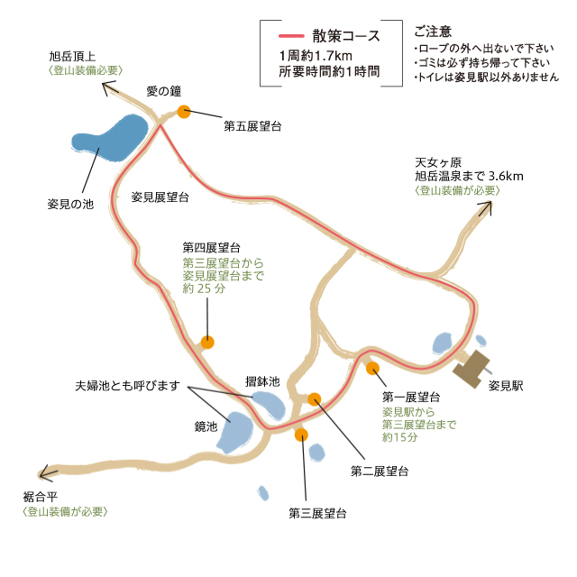
Distance:1.7 km
Total Time:45 minutes
Difficuly:★☆☆

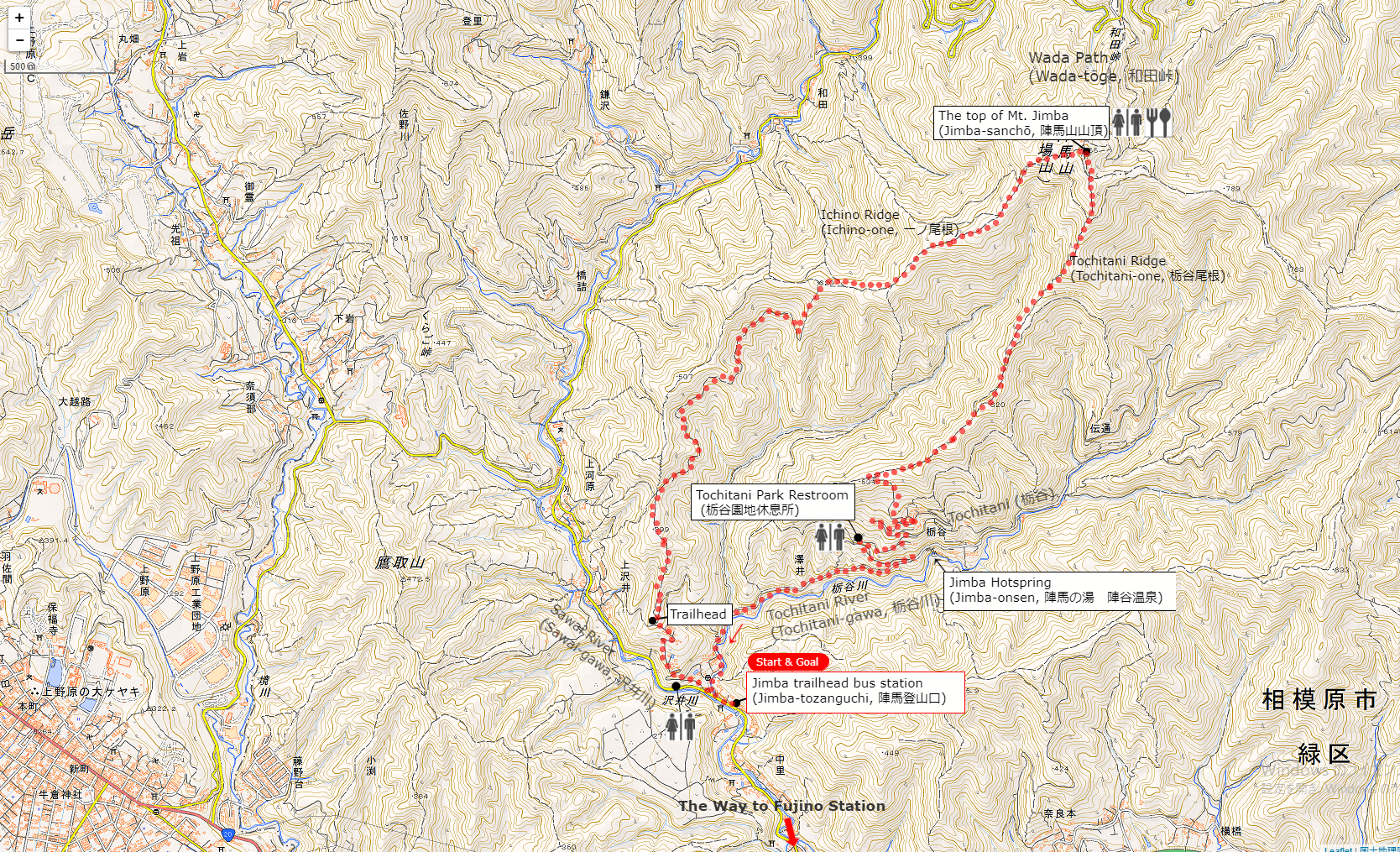
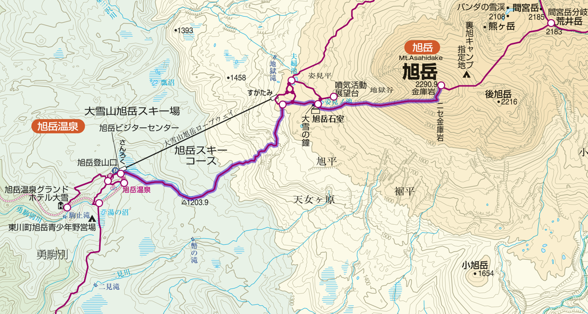
Sugatami Pond Ropeway Station (姿見駅) 15 minutes → 3rd observation platform (第三展望台) 25 minutes → Sugatami observation platform (姿見展望台)  → Sugatami Pond Ropeway Station (姿見駅)

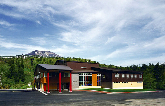
Start from Asahi-dake ropeway station.
The year round ropeway is easy to move because it is connected from the altitude of 1100 m to the Sugatami station of the terminal station.
Even if you are not confident in your physical strength, you can easily go by riding a ropeway.

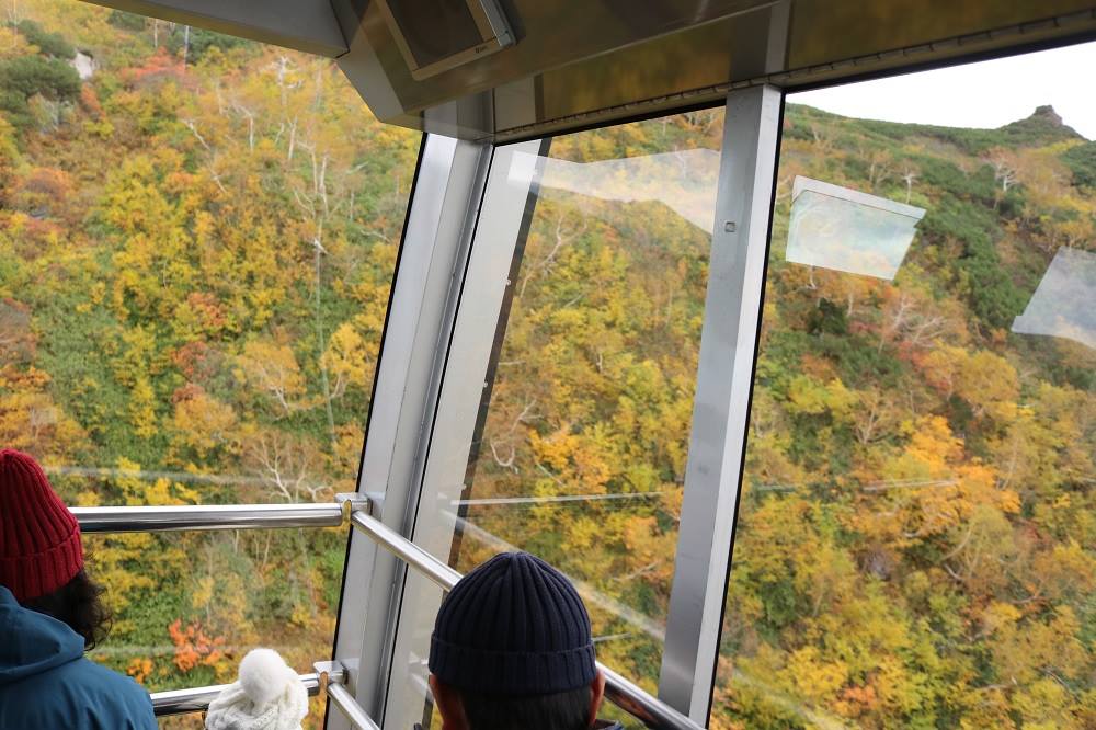
Popular ropeway arrives at Sugatami station in about 10 minutes.
Beyond the forest limits you can enjoy a large panorama of lush green mountains from the train window. In autumn we can see the autumn leaves neatly.

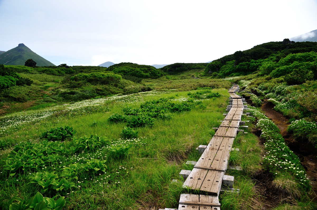
After enjoying the spectacular view from the ropeway, we will arrive at Sugatami station. From here we will enter the walk course on the boardwalk.
Since Mt.Asahidake can be seen also from Sugatami station, it may be good to look at the mountain of Mt.Asahidake slowly first.

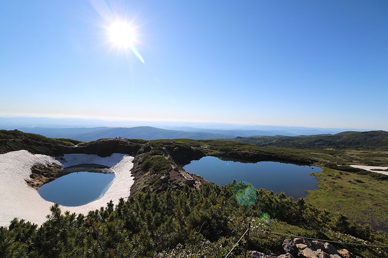
As you walk around the observation deck around the boardwalk, you can see two adjacent ponds called “couple pond” (夫婦池). It is the “suribachi pond” (擂鉢池) that has a deep shape like a mortar and the “mirror pond” (鏡池) that has a loose shape. On sunny days the blue sky appears on the surface of the water and you can enjoy the magnificent mountain scenery.

After walking for a while from the couple pond, you arrive at “Sugatami Pond” (Mimi pond). Behind Sugatami Pond, Mt.Asahidake of overwhelming scale feeling is near, and magnificent scenery spreads.
On a sunny day the lake shines on the emerald green and reflects Mt.Asahidake like a mirror, so please take a look when you visit.

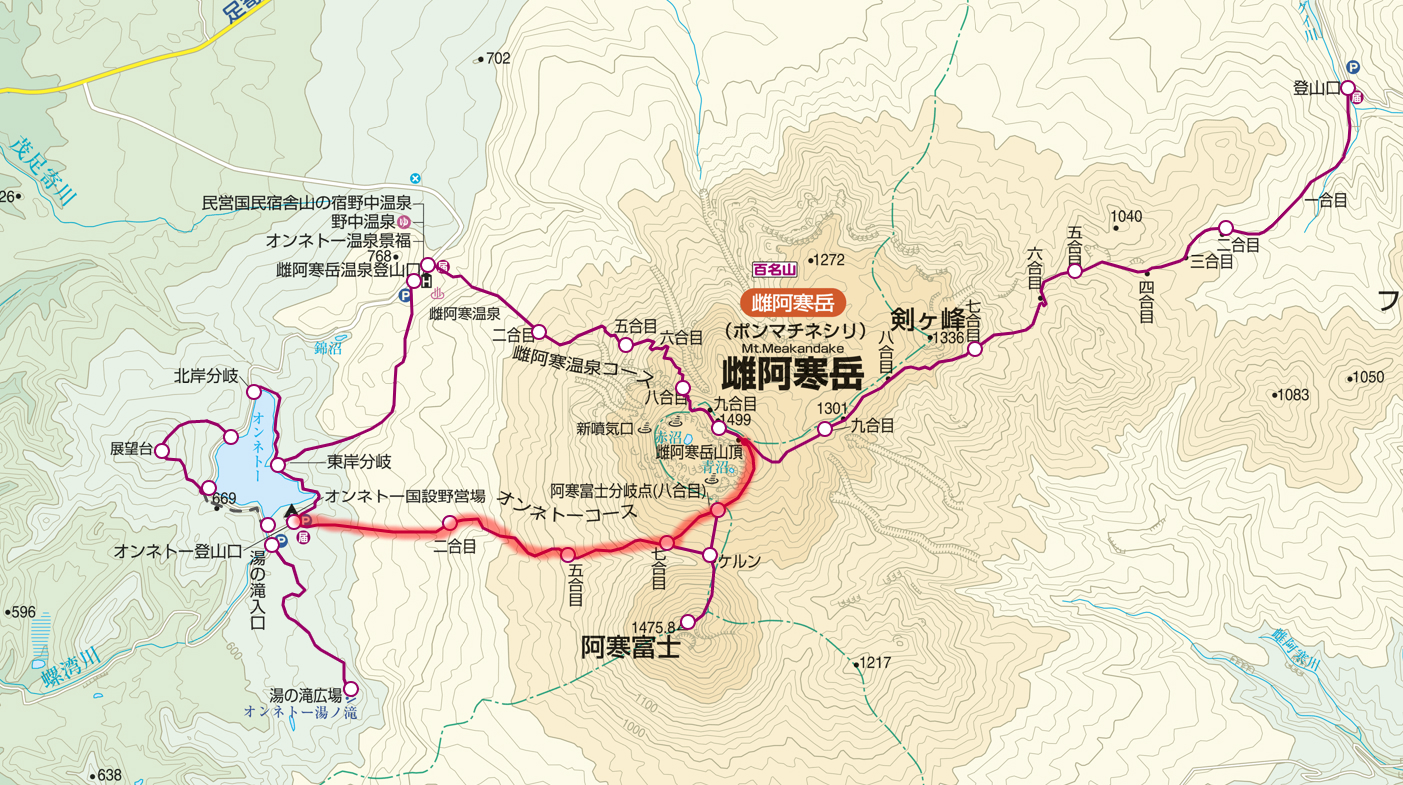
【Difficulty ★ ★】 From the ropeway to the summit

There are two ways to aim at the top of the Asahidake mountain: a way to climb using the ropeway and a way to access from Asahidake Trailhead. Most of the climbers seem to use a ropeway in many cases.

Distance:5.1 km
Total Time:4 hours and 55 minutes
Difficuly:★★☆

Sugatami (姿見) 20 minutes → Sugatami Pond (姿見の池) 150 minutes → Mt.Asahidake (旭岳) 110 minutes → Sugatami Pond (姿見の池) 15 minutes → Sugatami (姿見)

You go to the Sugatami station on the ropeway and start climbing from there towards the summit.
Movement of the ropeway is comfortable and physical strength can be preserved.
Besides, it is the best way to enjoy the wonderful panorama.
After finally checking the equipment at Sugatami station, hiking will start from here.

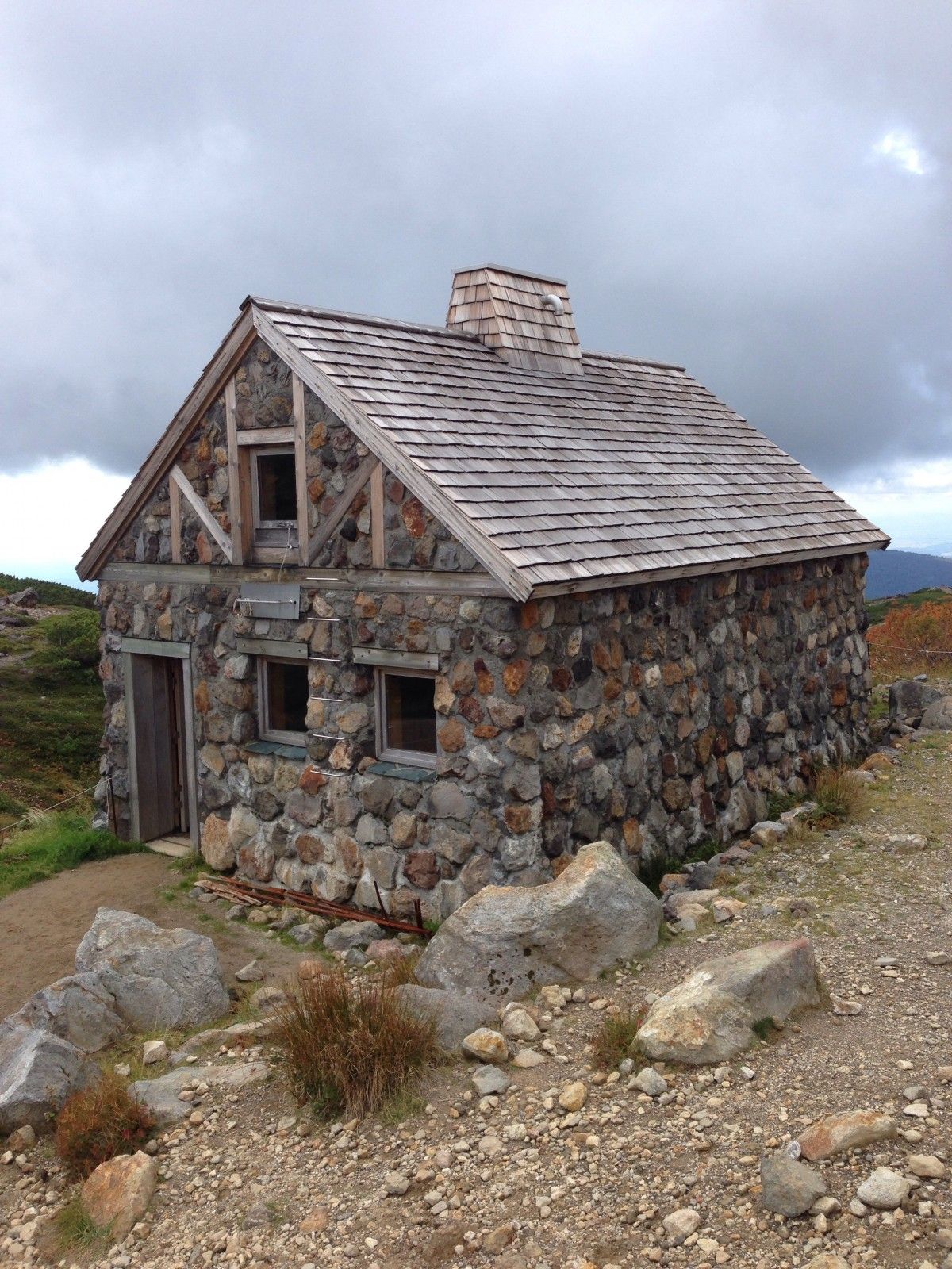
“Asahi-dake stones room” (旭岳石室) that will be visible soon as you reach Sugatami Pond.
Buildings made with a lot of stones can be used as a shelter cabin.
However, because it is for emergency purposes, it is forbidden to use it as an ordinary inn.

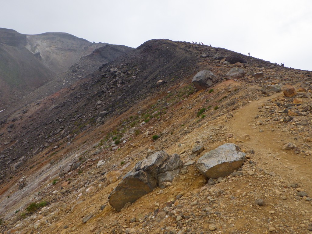
Walking for a while from the “Asahi-dake stones room”, the road will gradually become harder.
As rocky scenes appear as altitude increases, I recommend wearing climbing shoes instead of sneakers at your feet. As there are places that are slippery, let’s proceed carefully.

The climbing mountain road of Asahidake is linear when seen on the map, but since it is meandering in reality, it will consume more physical strength than it looks.
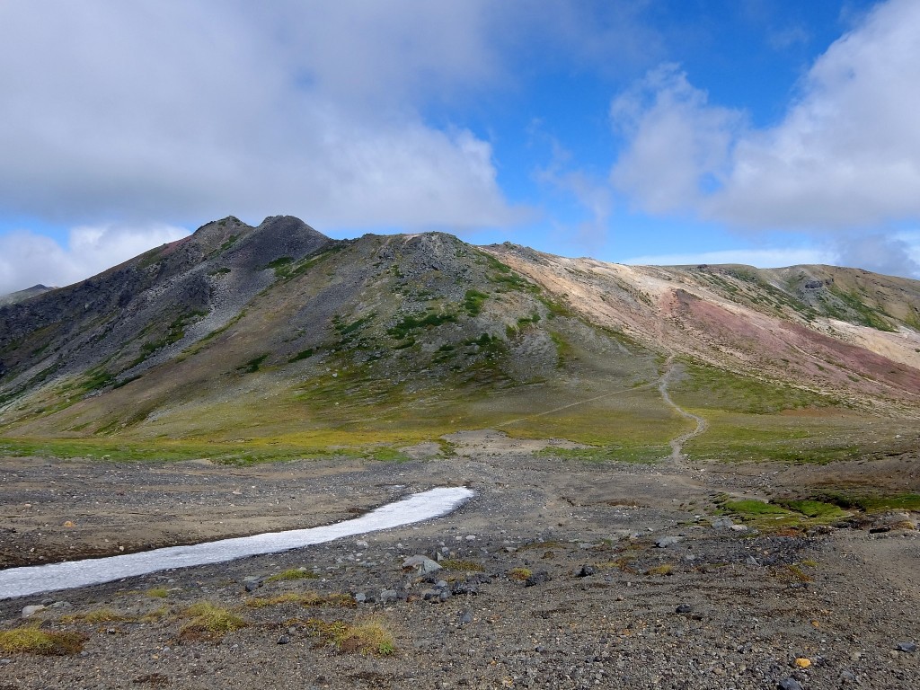
Passing Sugatami Pond and other sightseeing spots gradually increase in altitude, it is characterized by volcano gas, reddish brown soil and rocky areas turning into prominent areas.

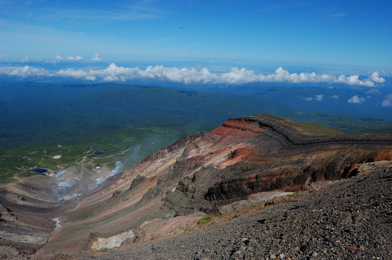
From the refreshing mountain peak, you can look over Mt.Tomuraushi and Mt. Hakuundake of the same Daisetsuzan Natioal Park.
If the weather is okay, it is a 360 degree big panorama where Tokachi mountain can be seen.
The blue sky and green are beautiful and the outline of the mountain can be clearly seen.
This is a scenic spot where you can taste the ruggedness and elegance of nature at the same time.

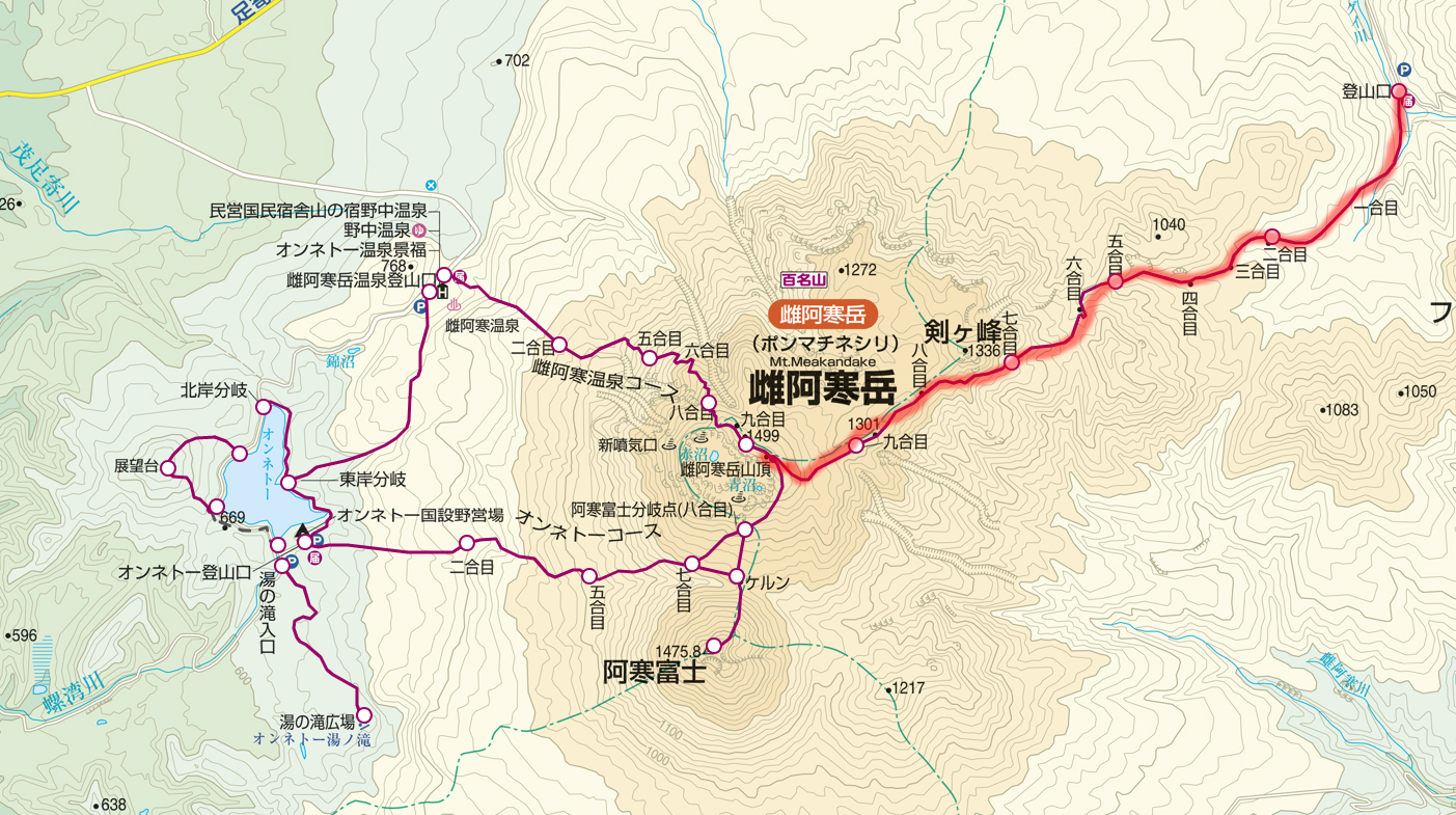
How to go to the summit without using a ropeway

Distance:11.7 km
Total Time:9 hours and 5 minutes
Difficuly:★★★

Mt. Asahidake Trailhead (150 minutes) → Sugatami (姿見) 20 minutes → Sugatami Pond (姿見の池) 150 minutes → Mt.Asahidake (旭岳) 110 minutes → → Sugatami (姿見) 115 minutes → Mt. Asahidake Trailhead

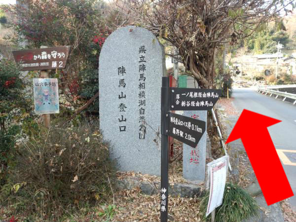
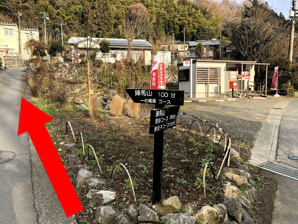
Trailhead at Asahidake is at the foot of Mt.Asahidake Ropeway Station.
In addition to the ropeway parking lot, you may use a public parking lot such as a visitor center.

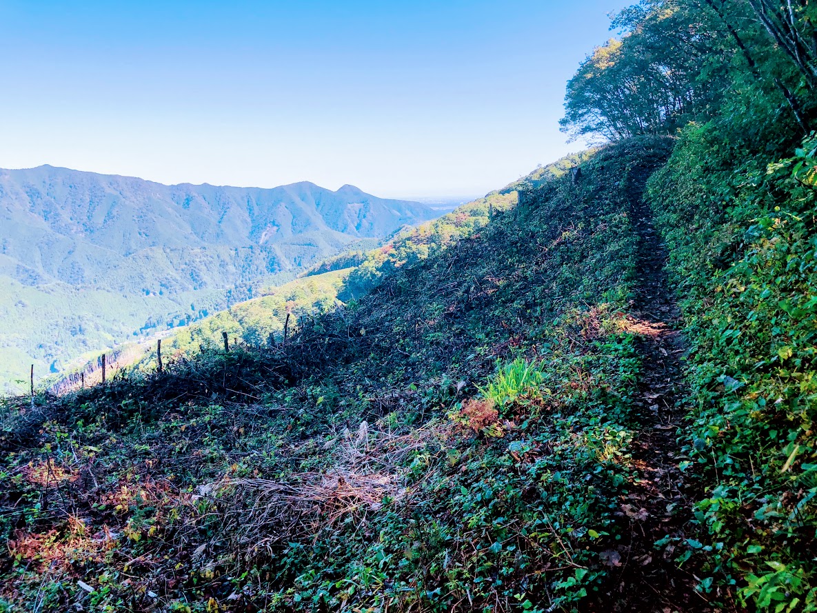
You walk on the course of the trees, as you cross the sloping street of the rock, you arrive at Ashidake’s 1st station.
The hiking route is densely planted but it is an open space where there is sunlight and the sky is visible.
On the climbing road you can see small pretty flowers such as leiocarpa.

【Difficulty ★ ★ ★】 Tour around Asahidake

Course that runs longitudinally from Mt.Mamiya from Asahidake which is the main peak of Daisetuzan.
Even in the summer, snow will remain around the back of Mt.Asahidake’s route, and finally back to Sugatami this course will bring you a spectacular view of alpine plants and mountains.
However, there are places where the footing is bad, so let’s proceed carefully.
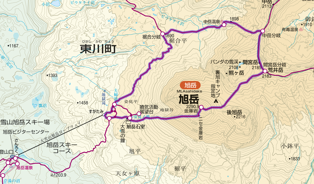
Distance:11.5 km
Total Time:7 hours and 40 minutes
Difficuly:★★★

Sugatami (姿見) 170 minutes→ Mt. Asahidake (旭岳) 60 minutes→ Mt. Mamiyadake branch (間宮岳分岐) 60 minutes→ Nakadake hot spring (中岳温泉) 60 minutes→ Susoaidaira (裾合平) 110 minutes→ Sugatami

To the Sugatami station which is the start of the round trip course, I climb from the ropeway or climbing mouth and access it.
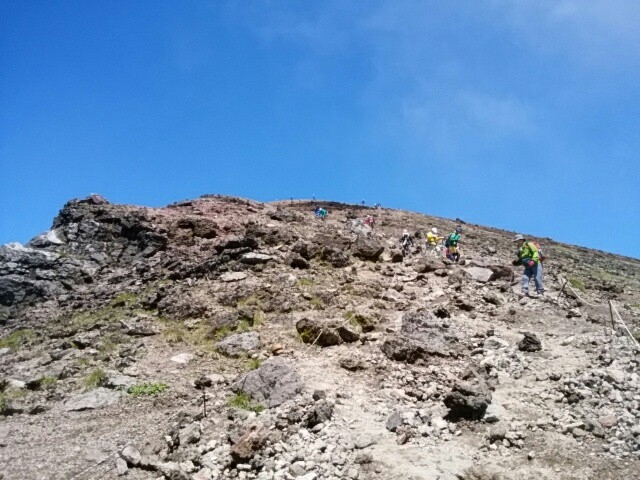
Until the summit the course goes through Sugatami Pond, Asahi-dake stones room and rocky road.
Beyond the Kinko-rock, you climb a steep hill to the last and you can see the summit of the mountain.
For the course to Asahidake summit top please refer to the course of 【Difficulty ★ ★】.

Route from Asahidake summit to the back Mt.Asahidake starts from downhill.
As steep slopes with many rocks are slippery, attention is necessary.
Hikage – yakubo Especially carefully in the summer as snow still remains.
Nakadake Onsen with its natural outdoor hot spring is the perfect spot for healing tired feet.

The route from Nakadake Onsen to Susoai-daira will walk along a refreshing blue sky and a nice view.
Along the wood road where the flower garden spreads in the summer, you can stroll while enjoying beautiful flowers such as white pentapetalum and pink Pedicularis.

Access to Mt.Asahidake · Parking information

Asahi-dake ropeway which makes it easy to enjoy the dynamic view of Daisetsuzan.
Because it operates all season, you can get on board at your own schedule.
There are also souvenirs and local gourmet at the station.

料金(普通運賃):

June 1 – October 20 October 21 – May 31st
Round-trip ticket One way ticket Round-trip ticket One way ticket
Adult 2,900 JPY 1,800 JPY 1,800 JPY 1,200 JPY
Child 1,450 JPY 900 JPY 900 JPY 600 JPY

Business period: whole year
Number of parked cars: 150 ordinary cars and bikes, 10 or more medium-sized cars etc.
Parking fee: once a day / ordinary car / bike 500 yen, non-ordinary car 1,500 yen ※ parking fee for November – May free
Address: Asahidake Onsen Higashikawa-cho, Kamikawa-gun, Hokkaido
Phone number: 0166-68-9111

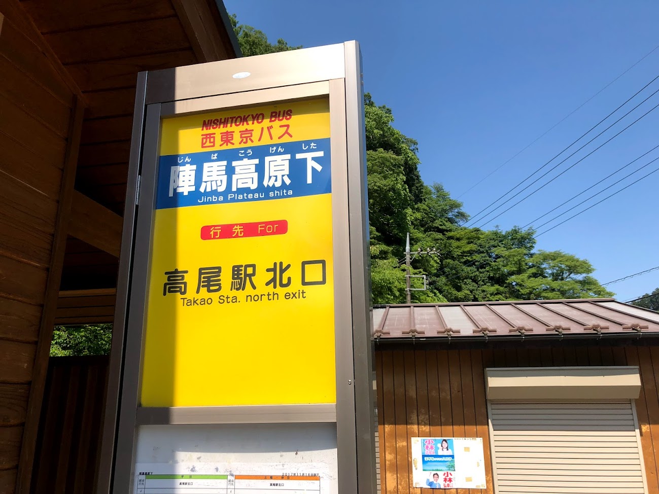
【How to access Asahidake Ropeway】

Access by Train / Bus
Sapporo Station → Super Kamui No. 1 → Asahikawa Station → Asahikawa Denkikidō Bus Ideyu → Get off at Asahidake (Ropeway Foothills)

How to access by car
Asahikawa Kita IC of Road Traffic Route → Route 37 → Route 1160 → Asahidake Ropeway

Asahidake Onsen Parking lot

The parking lot of Asahidake Onsen is 4 places in total including the parking lot in front of the Asahidake Visitor Center.
There is a chargeable and free place in the parking lot, and there are places where the presence or absence of the fee changes depending on the season.

Fee: November – May is free, other periods are charged
Number of parking units: 100 (free), 150 (charged)

Roundup of Mt. Asahidake

Mt. Asahi-dake is the highest mountain in Hokkaido belonging to Daisetsuzan National Park. Even tourists and families who do not climb mountain can enjoy powerful elegant scenery and autumn leaves from the ropeway. Regardless of course difficulty when walking Asahi-dake, it is important to firmly prepare winter clothes / shoes. Please enjoy yourself with nice animals and plants!

【Points to note when climbing】

· Please haiking with a solid training on climbing equipment. Mountain climbing shoes, thick socks, rain gear up and down, cold weather protection, head lamp, hat, zack, quick-drying clothes, food, water etc.
· There are several climbing routes, so there are many branches so maps and compasses are indispensable.
· Just in case, do not forget mountain climbing notification and mountain insurance!
· These courses will change difficulty level depending on climbing experience, physical strength, weather etc. Please make reference only, please make a reasonable plan according to your own physical fitness and enjoy climbing.

Mt.Meakandake (雌阿寒岳) | 100 Famous Japanese Mountains #001

Due to the influence of the earthquake that occurred on September 6, 2018, there is a risk that the risk of aftershocks, sediment disasters, etc. may be increased. Please pay attention to future aftershock activity and rainfall situation. (As of September 6, 2018)

What’s Kind of Mountain about Mt.Meakandake (雌阿寒岳)

Source: 阿寒湖畔エコミュージアムセンター

Elevation : 1,499 m
Location : Kushiro City Hokaidō, Japan
Mountans : Akan (阿寒)
Highest Temperature (June-August) : 14.9℃
Lowest Temperature (June-August) : 1℃

Mt.Meakandake (雌阿寒岳) is an active volcano with an altitude of 1,499 m located in the Akan Mountain Area between Kushiro City and Ashoro Town. “100 Fomaous Japanese Mountains” has also been selected, in Ainu language is also called “Ponmachineshiri”. Also, even in the mountain of Hokkaido the mountain trail is relatively well maintained, the view from the course is also a nice attractive mountain.

Powerful Crater Waching from The Top of Mt.Meakandake

Source: 阿寒湖畔エコミュージアムセンター

A magnificent view overlooking from Akan Lake is wonderful, but the crater which can be seen from the top of Mt.Meakan is a spot where you can experience the active lively volcano while smelling sulfur around.

Weather and Volcanic Activity of Akan-dake

Mt.Akan is an active volcano. Let’s prepare thoroughly so that you can check the weather information and the volcanic activity in advance and enjoy climbing safely.

Click here for weathet information of Akan

Click here for the volcanic activity of Akan 

Are There Bears at Mt. Akan?

Beers don’t seem to be witnessed much around Mt. Meaka.
But you must must be carefully. In order to avoid mutual unfortunate circumstances for both the bear and the human, let ‘s enjoy hiking with correct knowledge about the ecology and habits of the bears.

3 main hiking routes with peace of mind to beginners

Here, I will introduce Mt.Akan’s most common main hiking routes which is also recommended for beginner’s hikers.

Meakan Hot Spring Course (雌阿寒温泉コース)

Source: ヤマプラ
Source: ヤマプラ

Distance:5.8 km
Total Time:3 hours and 40 minutes
Elevation Difference:794 m
Schedule:Day-hike
Difficuly:★☆☆☆☆

Meakan Hot Spring Trailhead (雌阿寒温泉登山口) 30 minutes → 2nd.Station (二合目) 40 minutes → 5th.station (五合目) 45 minutes → 8th.station (八合目) 25 minutes →the top of Mt. Meakan (雌阿寒岳山頂) 15 minutes → 8th.station (八合目) 25 minutes → 5th.station (五合目) 20 minutes → 2nd.Station (二合目) 20 minutes → Meakan Hot Spring Trailhead (雌阿寒温泉登山口)

Source: 阿寒湖畔エコミュージアムセンター

Onnetō Course (オンネトーコース)

Source: ヤマプラ
Source: ヤマプラ

Distance:8.1 km
Total Time:5 hours
Elevation Difference:857 m
Schedule:Day-hike
Difficuly:★☆☆☆☆

Onnetō Trailhead (オンネトー登山口) 30 minutes → 2nd.Station (二合目) 30 minutes → 5th.station (五合目) 60 minutes → 7th.station (八合目) 20 minutes → 8th.station Branch of Mt. Akanfuji (八合目 阿寒富士分岐) 40 minutes → the top of Mt. Meakan (雌阿寒岳山頂) 15 minutes → 8th.station Branch of Mt. Akanfuji (八合目 阿寒富士分岐) 15 minutes → 7th.station (七合目) 45 minutes → 5nd.Station (五合目) 20 minutes → 2nd.Station (二合目) 20 minutes → Meakan Hot Spring Trailhead (雌阿寒温泉登山口)

Source: 足寄町ホームページ
Source: 足寄町ホームページ

Onnetō Course departing from the campground and heading to the top, although it is steep, the distance is short and can climb in a short time. On the way, you can also go via Mt. Akanfuji if you have time to spare.

Akan Hot Spring Course (阿寒温泉コース)

Source: ヤマプラ
Source: ヤマプラ

Distance:12.3 km
Total Time:5 hours and a half
Elevation Difference:764 m
Schedule:Day-hike
Difficuly:★★☆☆☆

Meakandake Trailhead (雌阿寒岳登山口) 50 minutes → 859 m 45 minutes → 1000m 40 minutes → 1166m 30 minutes → 1332m 30 minutes → the top of Mt. Meakan (雌阿寒岳山頂) 20 minutes → 1332m 25 minutes → 1166m 25 minutes → 1000m 30 minutes → 859m 35 minutes → Meakandake Trailhead (雌阿寒岳登山口) 50 minutes

Source: Wikipedia
Source: Wikipedia

Although it is the longest distance among the three mountaineering routes of Mt. Meakandake, the gradient is relatively loose, and it is a route that can climb slowly while enjoying the powerful volcanic landscape.
On the way you can also enjoy alpine plants such as Arenaria merckioides.

About Mt. Akandake’s Winter · Snow Cover Season

Mt. Akandake’s climbing optimum season is from late May to late October. Since the temperature is sometimes below freezing even in June, let’s go for climbing with enough equipment! Snowy season is popular because it can enjoy different scenery. The pure white volcano is spectacular.

Access to Trailhead · Parking information

Public Transport

Kushiro Station, Kushiro Airport – (Bus: Akan Bus) – Akanko Onsen ━ (Taxi) ━ Meakandake Hot Spring Trailhead, Onetxō National Campsite, Lake Akan Mountain Trailhead

Click here for Akan Bus timetable and fare

Coming by a Car

① Meakan Hot Spring Public Parking Lot

National Route 240 – National Highway 241 – Prefectural Highway 664 – Meakan Hot Spring Public Parking Lot
For both Kushiro station and Kushiro airports, go north on Route 240 and continue on the road for a while and turn left on National Highway No. 241 which passed by Lake Akan.
Turn left to the prefectural highway No. 664 and go to Meakan Hot Spring, and the place you see on the left is Meakan Hot Spring Public Parking Lot. About 76.5 km to Meakan Hot Spring Public Parking Lot, required time 1 hour 16 minutes.

<Parking Lot Information>
Akan Onsen Public Parking Space (Free)
About 80 units can be stopped.
Address: Moashoro Ashoro Town Ashoro County, Hokkaido

② Onnetō National Parking Lot

National Highway 240 – National Highway 241 – Route 664 – Onnetō National parking lot
Both Kushiro Station and Kushiro Airport, go north on Route 240 and continue on the road for a while and turn left at National Highway No. 241 which passed by Akan Lake.
Turn left to the prefectural highway No. 664 ahead, head towards Meakan Hot Spring, Onnetō Lake over Onnetō The place that you can see on the left turning the tea house is Onnetō National parking lot.
It is approximately 79.8 km to Onnetō National parking lot, required time 1 hour 23 minutes.

<Parking Lot Information>
Onnetō National parking lot parking lot (free)
About 100 units can be stopped.
Address: Moashoro Ashoro-cho Ashoro-gun, Hokkaido

③ Akan Lake Trailhead Parking Lot

National Highway No. 240 – Lake Akan Trailhead Parking Lot
For both Kushiro Station and Kushiro Airport, go north on Route 240 and continue along the road for a while, then after passing Akan Lake, turn left immediately and after a while Lake Akan Trailhead Parking Lot.
Approximately 64.7 km to Lake Akan Trailhead Parking Lot, required time 1 hour 40 minutes.

<Parking Lot Information>
Lake Akan Trailhead Parking Lot (Free)
About four units can be stopped.
Address: Moashoro Ashoro Town Ashoro County, Hokkaido

Roundup of Mt.Akan

Mt.Akandake is one of the nine mountains “100 famous Japanese Mountains” in Hokkaido, which is lowest in altitude and less required for both difficulty and physical strength, so it is a mountain that is easy for beginners to challenge.
Let’s enjoy the natural environment of Akan by selecting the route that suits you!
Experienced people also recommend a route to climb via Mt.Akanfuji nearby.

【Points to note when climbing】

· Please haiking with a solid training on climbing equipment. Mountain climbing shoes, thick socks, rain gear up and down, cold weather protection, head lamp, hat, zack, quick-drying clothes, food, water etc.
· There are several climbing routes, so there are many branches so maps and compasses are indispensable.
· Just in case, do not forget mountain climbing notification and mountain insurance!
· These courses will change difficulty level depending on climbing experience, physical strength, weather etc. Please make reference only, please make a reasonable plan according to your own physical fitness and enjoy climbing.


A Day Hike from Hosawa Waterfall to Sengen Ridge in Tokyo

The hiking course of Sengen ridge (Sengen-one, 浅間尾根) offers beautiful mountain views and Hosawa waterfall. You can access to this trailhead for about 1 hours and a half from Shinjuku station.   This trail was an important road from old times, called Koshu way (甲州道), which connects both countries of Bushu (武州) and Koshu (甲州), in the Edo period was a track for an important life for transporting charcoal. Let’s relax and enjoy hike while thinking of old time people in the clear air which hard to believe you’re still in Tokyo.

You can walk enjoying fine views of such nearby peaks as Mt.Gozen on your right side.

Area: Chichibu-Tama National Park, Hinohara village, Tokyo
Access: Musashi-Itsukaichi Station (武蔵五日市駅) on JR Itsukaichi Line, get off at Hosawa Waterfall Entrance (払沢の滝入口). For more information, click here
Start: Hosawa Waterfall Entrance Bus Stop (払沢の滝入口バス停)
Goal: Henbori Bus Stop (人里バス停)
Difficulty of this trail: ★ ☆ ☆ ☆ ☆
Trail appearance rate: ★ ★ ☆ ☆ ☆
Total distance: 8 km
Total difference in elevation: 661 m
Walking time: 3 hours and 30 minutes
Point of interest: Hosawa Waterfall (particularly in winter), wildflowers (spring to autumn), mountain views, japanese macaque (winter), an Edo-period track for transporting charcoal.

Access to Hosawa Waterfall Entrance (Hosawa-no-taki-Iriguchi, 払沢の滝入口)

Please refer to the following for detailed access method.

In Case of Coming by Car

In Case of Using Train and Bus

Access to Hosawa Waterfall Entrance (Hosawa-no-taki-Iriguchi, 払沢の滝入口)

A Map of Sengen Ridge Hiking Route (include Hosawa Waterfall)

A Map of Sengen Ridge Hiking Course | Click on the image above to open the enlarged image in a separate tab.

The source of above the three maps are “Digital Japan Web System” of The Geospatial Information Authority of Japan. The maps were edited a author of this blog.
In Japanese: これらの3枚の地図は国土地理院の電子国土Webシステムから配信されたものをこのブログの著者が加工したものである。

From Hosawa Waterfall Entrance Bus Stop (払沢の滝入口バス停) to Sengen Peak (Sengen-rei, 浅間嶺)

I also recommend popular menu fried donuts and soy milk, both of which are 100 yen at this tofu shop.

A sign above the road next to left side of the Tofu shop (檜原とうふ ちとせ屋) reads “Hosawa Waterfall” (Howasa no taki, 払沢の滝). Following this sign, go to the narrow road a little bit further on. To get to the waterfall, veer left at a fork a few minutes later onto a dirt path also marked for Hosawa waterfall, though with a simplified first character (払沢の滝). The waterfall is 5-10 minutes along this high rocky path, which crosses several small bridges. In winter, parts of the 60-meter fall and most of the pool at the bottom freeze over, and the icicles hanging off the face make for a splendid sight.

Hosawa Waterfall freezes from late January to early February. This photo above is February 2, 2019.

After visitting the waterfall, return to the previous junction, turn hard left in the direction of Sengen Ridge (Sengen-one, 浅間尾根). This path merges with a dirt road, which you follow uphill to the large bitumen road and bear left. The trail leaves and rejoins this road several times over the next kilometer or so, and passes many old wooden houses.
A few minutes further on, at the sign for “Zizaka Pass, Sengen Peak” (時坂峠 浅間嶺), take the steps up to the left. Rejoin the road 10 minutes later, again heading uphill to the left. The path (similarly signposted) resumes sharply to the left after about 10 more minutes. From here it zigzags up the hill, crossing the road (at a similar sign) after 5 minutes.
The Path soon bend left (near a tiny shrine), and begins to trace the line of Sengen Ridge, merging with the dirt road that enters from the left after 5-10 minutes.

This farmhouse has been built more than 400 years.

Walking for 7 minutes or so will bring you to a magnificent old farmhouse, rustic sheds, and a water supply system consisting of lengths of bamboo split in half to form open pipes, which are joined together and connected to a nearby stream. This was a soba noodle shop until 2018, but unfortunately closed down now.
Ascend steeply for 30-40 minutes, first next to small stream and past rock pools, and latter through a forest with broad-leaved magnolia trees (and where orange fungi used in a herbal cancer treatment can be fond). There are also many wildflowers at various times of the year, such as summer yamayuri (gold-banded lily).

After passing more open area with fine views of such nearby peaks as Mt.Gozen, you come to the junction marked “Observation Deck and Sengen peak” (展望台 浅間嶺) pointing to the left.
Turning left as follow this sign, ascend moderate slope for a while.
After walking for 10-15 minutes, you arrive at the highest point (904 meters above sea level) on Sengen Ridge. From there, you can enjoy superb views including Mt.Fuji and mountains of Okutama area.
From there, you can enjoy superb views including Mt.Fuji and mountains of Okutama area. Suitable area for lunch is Asama Ridge Resting-Place descending right side from here for approximately 3-5 minutes.
There are picnic area with tables and chairs, a shelter, a fire place, and toilets.

Since snow may be piled up during the winter, let's bring micro crampons. This photo above is February 2, 2019.
Since snow may be piled up during the winter, let’s bring micro crampons. This photo above is February 2, 2019.

The map board provides some history of the area, as follows:

KANTŌ COMMUNITY ROADS
Historical Path
The 8 kilometer route from Kami-Kawanori to Honjuku leads up in the direction of Sengen Ridge and traverses Jizaka Pass. Passing through the middle the Hinohara-mura area and tracing the comparatively moderate lie of the land, Sengen-one Road, also called Naka-Kōshū Road, has form olden times been an important traffic thoroughfare. During the Edo priod, it was an important route for hauling charcoal by horse and for the transport of daily necessities. Besides the village folk, people from Ogouchi and Saihara also used the trail.

Another interesting feature of this area is the presence of the Japanese macaque, which descend in winter from the cold upper reaches of the surrounding mountains to these slopes. They are quite shy and more likely to be sighted on the southern side of the ridge.

From Sengen Peak (浅間嶺) to Hembori Bus Stop (人里バス停)

There is a descend slope on the left side of the map board. After few meters on this slope there are the signposted junction. Turn left as fallow marked “Kazehari-touge and Hembori Bus Stop” (風張峠・人里バス停).
After 5 more minutes you go straight through another T-junction. From here, simply follow the Hembori (人里) signs for about 25 minutes, keeping with an adjacent bamboo stand, to a concrete road near some tea plantations. You take this road down past a few houses to the main road. Hembori bus stop is immediately to your right.

The bus ride to Musashi-Isukaichi Station takes about 45 minutes, and the fare is 820 JPY. To return to Shinjuku Station, in any case follow in reverse the instructions provided in bellow article for this walk.

Access to Hosawa Waterfall Entrance (Hosawa-no-taki-Iriguchi, 払沢の滝入口)


Guide for Hiking Trail of Mt. Jimba

New Year's Eve of 2018 with my hiker's friends at a restaurant on the top of the Mt. Jimba.
New Year’s Eve of 2018 with my hiker’s friends at a restaurant on the top of the Mt. Jimba. You can see Mt. Fuji on our background.

Area: Hachiōji city, Tokyo, Japan
Access: Fujino Station (Fujino-eki, 藤野駅) on the Chūō Main Line of East Japan Railway Company, board a bus bound for Wada (和田)  for 5 minutes, get off at Jimba trailhead (Jimba-tozanguchi, 陣馬登山口)
Start: Jimba trailhead bus station (Jimba-tozanguchi, 陣馬登山口)
Goal: Jimba trailhead bus station (Jimba-tozanguchi, 陣馬登山口)
Difficulty of this trail: ★ ☆ ☆ ☆ ☆
Trail appearance rate: ★ ★ ★ ☆ ☆
Total distance: 9 km
Total difference in elevation: 661 m
Walking time: 4 hours and 40 minutes
Point of interest: Good views of surrounding mountains (including Mt. Fuji and the Knatō Plain) , a bowl of soba noodles at restaurants of the summit, mountain village, hot spring, Japanese macaque (in winter).

Access to Jimba trailhead bus station (Jimba-tozanguchi, 陣馬登山口)

Please refer to the following for detailed access method.

In Case of Coming by Car

In Case of Using Train and Bus

A Map of Mt. Jimba Hiking Route

A Map of Mt. Jimba Hiking Course | Click on the image above to open the enlarged image in a separate tab.

The source of above the three maps are “Digital Japan Web System” of The Geospatial Information Authority of Japan. The maps were edited a author of this blog.
In Japanese: これらの3枚の地図は国土地理院の電子国土Webシステムから配信されたものをこのブログの著者が加工したものである。

From Jimba trailhead bus station (Jimba-tozanguchi, 陣馬登山口) to the Top of Mt. Jimba (Jimba-sanchō, 陣馬山山頂)

Walk along the road in the same direction as the bus wast traveling. You can find a sign beside a stone monument signposted “Mt. Jimba via Ichino Ridge” (一ノ尾根経由陣馬山) on the right side as you go about 100 meters.

Turn right at the sign written "Mt. Jimba via Ichino Ridge" (一ノ尾根経由陣馬山).
Turn right at the sign written “Mt. Jimba via Ichino Ridge” (一ノ尾根経由陣馬山).

As soon as you turn right at the T-junction as follow of the sign, you can see a sign in front of post office signposted “Mt. Jimba 100 minutes Ichino Ridge Course” (陣馬山 100分 一ノ尾根コース) .

Turn left at the sign written "Jimba 100 minutes Ichino Ridge course" (陣馬山 100分 一ノ尾根コース).
Turn left at the sign written “Jimba 100 minutes Ichino Ridge course” (陣馬山 100分 一ノ尾根コース).

Follow the signboard and turn left, the path ascend from here. After ascend slope for about 20 minutes you will see a sign written “Mt. Jimba 4.0 km”. This sign is the trailhead of Mt. Jimba and after that the path become dirt trail. After turning to the left according to the direction of signboard, the trail though the beautiful ceder forest in about 1 hour and a half.

the beautiful ceder forest

When you ascend the steep staircase, there is the mountain peak of Mt.Jimba. You can see 360-degree awesome panorama view include Mt.fuji and Kanto plain, Sagami Bay from here.

This place might be a best place to have a lunch, because there are three restaurants and hiking tables and benches on the summit of Mt.Jimba. Those shops offer some snacks and beverages including alcohol. Personally, I think the most delicious meal in those restaurants is a soba noodle with various vegetables and mushrooms (Jimba-soba, 陣馬そば) at Shimizu Tea-shop(Shimizu-jaya, 清水茶屋).

A soba noodle with various vegetables and mushrooms (Jimba-soba, 陣馬そば) 600 JPY

From the Top of Mt. Jimba (Jimba-sanchō, 陣馬山山頂) to Jimba trailhead bus station (Jimba-tozanguchi, 陣馬登山口)

The way to Jimba trail head bus station goes via Tochitani Ridge (Tochitani-one, 栃谷尾根). But there are no signposted Tochitani Ridge (Tochitani-one, 栃谷尾根) on this area. The way to return is on the left side path of the Fujimi Restaurant (Fujimi-chaya, 富士見茶屋) which is the most highest place restaurant on the summit.

Note that there are no signposted "Tochitani Ridge" (栃谷尾根) which is our return way on top of Mt.Jimba.
Note that there are no signposted “Tochitani Ridge” (栃谷尾根) which is our return way on top of Mt.Jimba.

If you down stairs beside Fujimi restaurant, there is a signboard written “Tochi-tani 2.7 km” (栃谷 2.7 km) ahead 100 meters from the restaurant, you can go to Tochitani Ridge as follow this sign.

Ignore paths branching off to the left side, a little farther on. There is a new branch and then veer right side path at this branch as follow signposted “Tochitani Ridge and Jimba Trailhead Bus Stop” (栃谷尾根 陣馬登山口バス停).

A steep descent leads down to cedar and cypress forest. There are the most steep slope in this hiking course, let’s walk slowly with attention to slips and falls.
After 1 hour and 20 minutes or so, you reach Tochitani village, you can see tea plantations and yuzu plantation against superb view of Mt. Fuji. If it’s winter, you can buy sweet smell yuzu at the roadside stand.

Tochitani (栃谷) is a relaxing village with tea fields and Yuzu fields.

Go through the path in the village. After a while there is a place named “Tochitani Park Restroom” (栃谷園地休息所) with a bath room and a table and chairs. You can wash your boots in the tap with a brush.
Just over 5 minutes leaving “Tochitani Park Restroom”, at a brunch signposted 陣屋温泉 where the path to the left to Jinya Hot Spring (Jinya-onsen, 陣屋温泉). If you visit the hot spring, bathing fee is just 1000 JPY.

You can enjoy a Japanese cypress wood bathtub at Jinya hot spring. I recommend to carry a towel.
You can enjoy a Japanese cypress wood bathtub at Jinya hot Spring. I recommend to carry a towel.

In 20-30 minutes, after passing the previous branch signposted hot spring, you can find a post office which you saw in this morning. You are a bus stop soon if you turn left at the T – junction ahead and go about 100 meters.

Note: The bus on the way back are very few numbers.
Even if there is no convenient bus, it is about 20 minutes on your foots to back Fujino station.
The timetable of returning bus is here.


Private Hiking Guide to Miura Reef Route | Seaside Stroll Along Beautiful Rocky Coast in Miura Peninsula

Miura Reef Route is a day walking route along the coast in Miura City, Kanagawa Prefecture, located south of Tokyo.
The rock is scraped by wave and wind to entertain beautiful and strange landscape.
It is also a wonderful hiking route where you can taste the caves that the ancients lived in the Yayoi period and delicious seafood.
Especially in the winter it is recommended because the air is clear and the adjacent Bōsō Peninsula is clearly visible.

There are roads that submerge at high tide.

Tour details

Price : 3500 JPY per person

Distance : 10.3 km

Private Tour (Your family and friends are OK.)

Difficulty : ★☆☆☆☆

Language : English, Japanese

Meeting point : Miura-kaigan Station or Tokyo station.
The exact meeting point will be set by your guide after booking confirmation, but I respond flexibly according to your area of accommodation. Transportation to the start point is not included in the tour price.

Meeting time : negotiable

What you can experience at this Course :

Dwellings of the Yayoi people (from the 10th century BC to the 3rd century AD)

・Cape Tsurugi Lighthouse
・Beautifully strange rock art
・Nusuto-gari (A Deep cliff name)
・Caves
・Seaweed Cultivation
・Delicious Tuna with Tuna Bowl

Nusutogari (盗人狩)
Nusutogari (盗人狩)

With this hiking you can pass through a number of Japanese fishing ports in the country and you can also taste the local food of the fishing port.
Do not you relax, escaping from the hustle and bustle of the city, with the voice of the gulls and the sound of the waves and the walking path of the quiet rocks that can not be experienced?

Lunch set menu (Tuna with Tuna Bowll) 1200JPY

For more information on this hiking course, click here.

Disclaimer

Please read and give me consent before booking for this tour.

Hiking is an inherently dangerous activity that can lead to serious injuries including but not limited to slip and fall injuries, fractures, snake bite, heat exhaustion, poison oak, ticks and frostbite. By participation in this event you agree to not hold these organizers liable for any harm that may come to you, your guests, or your property. Always remember to let the event organizer know if you are leaving the group. Stay on the trail, never walk alone and use your own common sense.

Booking Now

[contact-form-7 id=”4438″ title=”Private Hiking Guide to Miura Reef Route”]

Hike to Sengen-one-ridge’s long down hill in Okutama, Tokyo

Course Date

Difficulty: ★ ☆ ☆ ☆ ☆
Start spot: Tomin-no-Mori Bus Stop 都民の森
Goul spot: Hossawa no taki iriguchi bus stop 払沢の滝入り口バス停
Total distance: 15.7 km
Total difference in elevation: 963 m

Hiking Course overview

Go through the pleasant forest of a single track with few ups and downs.

1). Hinohara-Tomin-no-Mori Bus Stop 檜原 都民の森

2). Sengen-One Ridge Parking 浅間尾根駐車場

3). Sengen-One Ridge 浅間尾根

4). Sengen-One Ridge Resting Place 浅間尾根休憩場

5). Hossawa no taki iriguchi bus stop 払沢の滝入り口バス停

Map of “Sengen-One” Hiking Course

sengen one hiking course map
Clicking the image will display the enlarged size with a new tab.

Access

"Tomin-no-mori" is the trailhead of Mt. Mitou popular with hikers. Hiking routes are stretched all around in this area, but let's proceed to "Kaze-hari-touge 風張峠" in this area.
“Tomin-no-mori” is the trailhead of Mt. Mitou popular with hikers. Hiking routes are stretched all around in this area, but let’s proceed to “Kaze-hari-touge 風張峠” in this area.

JR Musashi-Itsukaichi Line End · From Musashi-Itsukaichi Station, take the West Tokyo bus to “Tomin-no-Mori Bus Stop 都民の森 バス停” for about 1 hour and 10 minutes.
On the way back, “the Hossawa no taki iriguchi bus stop払沢の滝入口 バス停” is used.
Or if you move to “Moto-shuku-yakubamae bus stop 本宿役場前 バス停”, the number of buses is large.
There is a free parking lot in “the Hossawa no taki iriguchi 払沢の滝入口”.

ADVICE

There is no public drinking fountain to the end of the course.
However, since there is a shop, vending machine, and toilet in the starting point “Tomin – no – Mori”, you can prepare here for running.
There is a lot of escape route to paved road called Hinohara – Kaidou in the way of Sengen – One, so beginners are safe course.

Features of “Sengen-One” course

The origin of the name of the ridge, "Sengen-One Ridge" is the highlight of the course.
The origin of the name of the ridge, “Sengen-One Ridge” is the highlight of the course.

This course is known to special people, you can down hill like crazy.
If you are thinking that “climing is the best part of hiking”, “You have ups and downs in life”, for such a hikers, this course can not be recommended. (I’m sorry)
Because the bus carries you to a high place, the course is generally in descending and on the way it is a runable trail with a flat part of about 5 km.
Therefore this course will be the best course for your hiking debut in Tokyo.

First of all,
Depending on the signpost in “Tomin-no-mori” you will go to “Saiguchi-Touge 鞘口峠”
It’s just a fine climb up to your warm-up.
Let’s proceed from “Saiguchi-Touge 鞘口峠” to “Kaze-hari-Touge 風張峠”.
As you go about 1.5 km, if the signpost of “Sengen-One 浅間尾根” appears, proceed to “Sengen-One 浅間尾根” direction.
Let’s move carefully since there are parts where the trail around here is collapsing.

Once you leave the paved road and enter the dart road again, the downhill of “Sengen-One Asama Ridge” will begin.
Because this course is easy to walk anyway, it is a satisfying course for those who want to run alone, those who want to enjoy at their own pace, both types of people.

Furthermore, since there are many escape routes and signs are substantial, I really recommend it for debuting hiking in Tokyo.

It is certainly inconvenient that the bus is indispensable to the starting point of the hiking course, but thanks to that, the course has few people crowded.
Moreover, it is mostly gentle downhill, mostly single track, you can monopolize luxurious course.
Perhaps you will face your face with your colleagues and say “Feel so good!”

After hiking…

Hinohara-Tofu Chitose-ya

Tofu store in front of “Hossawa no taki iriguchi bus stop”.
Tofu using Hinohara’s source water and Hokkaido soybean is a rich flavor.
We also recommend popular menu fried donuts and soy milk, both of which are 100 yen.

Do you need a guide for this hiking course?

If you are looking for guide of this hiking course, please refer to the following.

Private Hiking Guide to Sengen Ridge | Beautiful Long Down Hill in Okutama

Guide for Hiking of The Sea of Trees (Aokigahara Jukai at the Foot of Mt.Fuji)

What you can experience at this Course :

・Mt. Fuji magnificent view
・Ice hole created about 1,000 years ago
・Mysterious and beautiful Aokigahara Jukai
・Hot spring while watching Mt. Fuji

Jukai’s running course :

jukai
jukai

The Aokigahara Jukai is a vast primitive forest spreading over Lake Motosu, Lake Saiko, Lake Shoujin, which is the foot of Mount Fuji.

On this day I started from the side of Lake Motosu, passed by Lake Shoujin, stopped by ice hole and the highlight looked at Lake Saiko from Kouyoudai.
I could completely relax at the goal’s hot spring, because in this hot spring I can soaking in a natural hot water while looking at the magnificent view of Mt.Fuji.

A landscape with 300 years old trees such as fir and beech growing on the lava flows is beautiful and you can enjoy a mysterious sight as if you landed on another planet that is not the earth.

If you believe that you get lost if you go to Jukai it is a mistake.
The hiking road is well maintained and easy to understand and it is not easy to get lost as it is installed along the national highway.
People who are likely to get lost are people who ignore hiking roads for the purpose of collecting mushrooms and wild plants.

There are some ancient ice holes in jukai.
The Narusawa ice hole which I visited that day is a natural cave that was created about 1,000 years ago and you can experience the world of ice with an average annual temperature of 3 degrees.
If you will visit at Jukai for hiking, you can cool down your body that burned for the running at this ice hole.

Also,
On Kouyoudai, you may be able to see the magnificent view of Mt.Fuji that is colored with autumn leaves. (If you visit in early November. )

Since the goal is a hot spring, you can take a return trip after healing the tired body slowly.

Difficulty of this course :

It is Beginners Level.
Although there are some ups and downs, it is a relatively flat road of about 15 km.
This course is also recommended for hiking beginners.

Belongings :

· Shoes for hiking
It is okay if you do not have shoes for hiking.
However, please be aware that there are some uneven parts.

· Backpack for hiking
It is okay if you do not have a backpack for hiking.
However, a backpack that is easy for you to run is good.

My recommended rental shop for outdoor goods in Tokyo is here.
If you have shoes for hiking, it’s better.

·water

· Light snacks (rice balls, sandwiches, etc.)

· Clothes for cold weather
Windbreaker etc…

·towel

· Change clothes (if you will visit hot spring.)

· Others you need in the mountain …

Schedule of the day :

Mt. Fuji station (9:30) → departure from the bus (9: 50) → Lake Motosu (10:50) → trailhead (11:10) → snack break (13: 00) → Narusawa ice hole (14: 00) → Kouyoudai (15: 00) → hot spring (15: 30)

Jukai Hiking Course Map :

Jukai Hiking Map | Click on the image above and you can see the enlarged version.
Recommended after running :
Fuji viewing hot spring Yurari | 富士眺望の湯 ゆらり

Address :
8532-5 Narusawa village South Tsuru County, Yamanashi Prefecture
Tel:
0555-85-3126
website:
https://www.fuji-yurari.jp/
Map:

Closed:
open 365 days per year
Business hours:
10: 00 ~ 22: 00 Reception is until 21:00
Usage fee:
(Rental bath towel with face towel)
■ 10: 00-19: 00
Weekday 1,300 yen Saturday, Sunday and public holidays 1,500 yen
■ 19: 00-22: 00
Weekday 1,100 yen Saturday, Sunday and public holidays 1,300 yen

Do you need a guide for this hiking course?

If you are looking for guide of this hiking course, please refer to the following.

Private Hiking Guide to Aokigahara | Explore the Sea of Trees!

Miura Reef Route (the Miura Gansho no Michi) | Seaside Stroll Along Beautiful Rocky Coast in Miura Peninsula

One Day Hike in Miura Peninsula Kanagawa, Japan

miura peninsulaMiura Peninsula, the part of Kanagawa Prefecture to the south of Tokyo, just out into the Pacific Ocean and, together with the Bōsō Peninsula, forms Tokyo Bay.
Among them, Miura Reef Route, the last remnants of untouched coast provide probably the great walking course close to Tokyo, and are excellent for the less adventurous walker.
The Keihin Kyūkō Line (from Shinagawa) and its associated branches serve most areas, with JR Yokosuka Line an alternative in some cases.

Guide for hiking of Miura Reef Route

Area: Miura city, Kanagawa prefecture, Japan
Access: From Keihin Kyūkō Miura Kaigan Station, board a Keihin Kyūkō Bus bound for Cape Tsurugi (Tsurugizaki, 劒崎)  for 20 minutes, get off at Tsurugizaki
Start: Tsurugizaki Bus Stop 劒崎バス停
Goal: Miyakawa-cho Bus Stop 宮川町バス停
Difficulty of this trail: ★ ☆ ☆ ☆ ☆
Trail appearance rate: ★ ☆ ☆ ☆ ☆
Total distance: 10.3 km
Total difference in elevation: 40 m
Walking time: 3 hours
Point of interest: Rugged coastline and sea views, Cape Tsurugi Lighthouse, Caves, Dwellings of the Yayoi people, and Seaweed cultivation.
Note: At high tide, the route may be impassable, if not dangerous.
Approximate times of high and low tides can be found on website below.
https://www.tidetime.org/asia/japan/miura.htm

Access to Miura Reef Route

From Shinagawa Station, take a Keihin Kyūkō Line (京浜急行線) limited express (tokkyū, 特急) or a slightly faster and more comfortable rapid limited express (Kaisoku tokkyū, 快速特急) bound for Misaki-guchi (三崎口). The last part of the journey actually runs along the Keihin Kurihama Line (京浜久里浜線), but no transfer is needed. Get off at Miura-kaigan (三浦海岸) Station, the second from last stop.
Rapid limited expresses take just over 1 hour to reach Miura kaigan; limited expresses take 1 hour and 14 minutes; and other, slower trains considerably longer. The fare in all cases is 740JPY.

Please check the latest timetable, because the timetable and fare are sometimes changed.
Timetable and Route Serch “HyperDia”
http://www.hyperdia.com/sp/index.html.en

Leave the station by the only exit, walk slightly to the right to Bus Stand No. 2, and board a bus bound for Cape Tsurugi (Tsurugizaki, 劒崎). The Bus route runs along the shoreline, providing good views of this beach that is popular with windsurfers.
After about 20 minutes, get off at Cape Tsurugi (Tsurugizaki, 劒崎) which is the terminus of this line. The fare is 290JPY.

Maps of Miura Reef Route

Miura Reef Route (the Miura Gansho no michi, 三浦 岩礁の道) is part of The Kantō Fureai Trail (Knatō Fureai no michi, 関東ふれあいの道) that the Japanese government’s Ministry of the Environment manages.

The whole map of Miura Reef Route(the Miura Gansho no Michi)
The whole map of Miura Reef Route (the Miura Gansho no Michi) | Clicking the image will display the enlarged size with a new tab.

The source of above the three maps are “Digital Japan Web System” of The Geospatial Information Authority of Japan. The maps were edited a author of this blog.
In Japanese: これらの3枚の地図は国土地理院の電子国土Webシステムから配信されたものをこのブログの著者が加工したものである。

From Tsurugizaki Bus Stop (劒崎バス停) to Bisha-mon Bay (毘沙門湾)

The first half of Miura Reef Route(the Miura Gansho no Michi)
The first half of Miura Reef Route(the Miura Gansho no Michi) | Clicking the image will display the enlarged size with a new tab.

Click here for a map of the latter half.

Walk along the road in the same derection as the bus wast traveling. You can find a small signboard with the direction of the Tsurugizaki lighthouse on the left side as you go about 50 meters.

A small signboard with the direction of the Tsurugizaki lighthouse (剣崎灯台方面).

After turning to the left according to the direction of signboard, the road of Daikon radish field continues. After a while you can see the lighthouse for the direction of travel, if the weather is good you can see Mt.Fuji when you look back on the road.
On this road, the track carrying Daikon radish is coming and going, the black kite is slowly flying in the sky. On the other side of the lighthouse is the sea, behind which there is the Bōsō peninsula. You will find the road to the Maguchi port on the left side, but ignore that road. When you walk toward the lighthouse, there is a parking lot on the right side, there is the bath room too.
There is a branch to the lighthouse where you have gone a little from the parking lot. The path to the lighthouse is on the right side and the left is on the beach, the lighthouse will arrive in about 1 minute.

the Tsurugizaki lighthouse 劒崎灯台
One of the eight lighthouses where the Edo Shogunate promised construction by the “Tax Treaty” tied with the four countries of the United States, the UK, France and the Netherlands in 1866. The designer was Richard Henry Brunton.

Go back to the lighthouse and go down the road on the left and you will come to a small beach. As you go to the right along the coast, rocky road will continue for a while. There are some dangerous places that will injure if you fall, choose a place that you can easily walk on and take care.

There are roads that submerge at high tide.

You advance along the rocky road along the coast until Ena Bay. Once from Ena Bay, go to the prefectural road and proceed a quiet fishing village. There is a convenience store on the way and you can buy snacks and drinks. Ena Bay is a small tidal flat and you can see various kinds of crab and shellfish in the summer. In winter you can see a white daffodil blooming on the shore.

daffodil (suisen, 水仙) Jaunuary, 2019

There is a branch on the slope along the paved road along Ena Bay.
Let’s go to the right slope, not the road of the left tunnel.
Let’s not miss a signbourd on the left side as you climb up the slope. Turn left at the sign and go straight to the old Jiun Temple. Once it passes through the temple, the reef route will start again.
You will have a big cave as you go along the rocky road for a while.
This is the residence of the Yayoi era you can enter inside.

Dwellings of the Yayoi people (from the 10th century BC to the 3rd century AD)

From Bisja-mon Bay (毘沙門湾) to Miyagawa-cho Bus Stop (宮川町バス停)

The latter half of Miura Reef Route(the Miura Gansho no Michi)
The latter half of Miura Reef Route (the Miura Gansho no Michi) | Clicking the image will display the enlarged size with a new tab.

When you arrive at Bisha-mon Bay you will walk the prefectural road again paved for a while. Let’s not miss the signbord of The Kantō Fureai Trail on the left side, find the signbord and follow the arrow and turn left.

the signbord of The Kantō Fureai Trail

Go through the small fishing port. There is a bath room although it is not very clean in the fishing port.
If you pass this a bath room, the reef route will start again.
While enjoying the strange and beautiful rocks scattered by the wind and wave, You will arrive at a splendid cliff called Nusutogari.
Nusuto (盗人) means a thief in Japanese, gari (狩) means arresting.
It is said that a thief who fled to this cliff was unable to move due to fear on the cliff, and this name comes from that legend.

Nusutogari (盗人狩)
Nusutogari (盗人狩)

Pass through some big caves from Nusutogari and you will arrive at Miyagawa Bay, the end of the reef route. This fishing port has a clean a bath room.
Pass through some big caves from Nusutogari and you will arrive at Miyagawa Bay, the end of the reef path.
This fishing port has a clean a bath room.
Also, we recommend a seafood restaurant with a delicious seafood specialties called “Marayoshi Restaurant”.

Lunch set menu (Tuna with Tuna Bowll) 1200JPY

Miyagawa-chō Bus Stop is a few meters to the left following the crossroad where you climbed the slope that continues from this restaurant.
It is not frequent on buses, it is about one in one hour.
If you have too much time on your hands I recommend walking to Sakae-cho Bus Stop.
It is about 15 minutes on foot to Sakae-cho Bus Stop.

Do you need a guide for this hiking course?

If you are looking for guide of this hiking course, please refer to the following.

Private Hiking Guide to Miura Reef Route | Seaside Stroll Along Beautiful Rocky Coast in Miura Peninsula

Guide For Hiking to Oku-Musashi Nature | Gentle Trail from Kitamuki Jizou to Mt. Hiwada

About Oku-Musashi Nature Hiking Course

Oku-Musashi is a generic term for the mountains and hilly areas in the southwestern part of Saitama Prefecture.
Oku-Musashi Nature hiking course is a natural sidewalk in there.
It is a hiking course of about 11 km in length connecting Kamakita Lake, Kitamuki jizou, Mt.Mooni, Mt.Takasasu-yama, Mt.Hiwada, Kinchakuda, Koma Pass, Mt.Tenran, which is a landmark of Oku-Musashi.
It is suitable for beginner of a hiker because it is a trail that is easy to walking with a relatively gentle slope.

Paved road on the way to Kitamuki jizou

Map of Oku-Musashi Nature Hiking Route

Map of Oku-Musashi Nature Trail
↑ Click on the image to enlarge. Open link in a new tab.

Schedule of the day:

Seibu Lailway Musashiyokote Station(9:05)

Gojo Falls(9:45)

Kitamuki Jizoson(10:20)

Mt.Hiwada(11:20)

Kinchakuda(12:00)

Lunch break

Koma Pass(13:00)

Lake Miyazawa hot spring Kirari-bettei(13:30)

Gojo Falls was off limits on this day, I did not know whether I will come in the future or not.
The outlook from Mt. Hiwada is wonderful and Kinchakuda had a festival of Cluster amaryllis and it was very crowded.

Kinchakuda's Cluster amaryllis
Kinchakuda’s Cluster amaryllis

After Hiking:

After the running is over, I ran from the end point of Koma Pass and got to a hot spring about 30 minutes.
This hot spring is named “Miyazawa Lake Spa Kiraku-bettei”, the bathing fee of the hot spring is 1000 yen.
From Hot Springs to Hanno Station is about ten minutes by bus.
Buses are about 1 to 2 per hour.

Miyazawa Lake Spa Kiraku-bettei

Do you need a guide?

If you are looking for guide of this trail, please refer to the following.

Private Hiking Gide to Oku-Musashi Nature | From Kitamuki Jizou to Mt. Hiwada

Hiking for Mt.Takao to Mt.Jinba | Let’s eat shaved ice at the summit!

The course which goes from “高尾山 Mt. Takao” to “陣馬山 jimbayama” is a very popular course that you can enjoy historical temples and various types of tea houses and is a popular course for many hikers.

As we arrive within one hour by train from Shinjuku, good access is possible,The climbing mouth is directly connected when you get off the station, and there are hot spring facilities at the station.
Takaosanguchi Station

area:
Hachioji City, Tokyo
Genre:
Hiking
LEVEL:
Intermediate
Traveling time (not including breaks):
About 5 hours
Distance:
About 15km
Maximum elevation difference:
857m
Access:
Forward:JR Chuo Line「高尾山口 Tkaosan-guchi station」
Return:JR Chuo Line「高尾山 Takaosan station」


※This is a rough overview of the course.The mountain trail is not an accurate map.If you want to know the exact mountain trail, please refer to the map on the market.

Although there are many routes leading to the summit of Mt. Takao, “No. 1 Road” is connected to the Yakuin House, the summit, and you can enjoy worship and history.
Guide board in front of Takaosanguchi station

There are sightseeing spots such as shops and stone garden on the way, so you can slowly aim for mountaintop while enjoying Mt. Takao.
No. 1 Road of Takaosan

Heading towards the sign “Mt. Takao · Vistor Cenrer”
the sign "Mt. Takao · Vistor Cenrer"

You can enjoy various statues and monuments on the way to the summit.
various statues
various statues
various statues
various statues
various statues

You can enjoy all-you-can-eat buffet while enjoying the night view at “Takao beer mount” on the way.
It may be good to use for launch after running!
Duration: June 15, 2018 (Friday) to October 15 (Monday) 2018
Takao mountain beer mount

There are lots of restaurants dealing with souvenir and snacks.
souvenir shops
souvenir shops
restaurants

”薬王院 Yakuouin” was opened by high priest Buddhist bodhisattva by Emperor Shomu in the Tenpyo 16th year (744) years ago from now.
薬王院 Yakuouin

薬王院 Yakuouin

薬王院 Yakuouin

Tengu Statue

薬王院 Yakuouin

A giant tengu face

薬王院 Yakuouin

薬王院 Yakuouin

薬王院 Yakuouin

At the summit of Mt. Takao, if the weather is nice, Mt. Fuji can be seen, and many climbers take a meal break.
the summit of Mt. Takao

There are many restaurants offering snacks such as buckwheat and curry rice.many restaurants
veiw of Mt.Takao

Hiker may buy onigiri etc. before departure and take breakfast here may be just right.
onigiri

The guide board is written as 5 hours to “陣馬山 Mt.Jimba” of the destination.
The guide board

Let’s start with Mt. Kobotoke Shiroyama!
The guide board
trail

Various snacks and drinks are sold at Mt. Kobotoke Shiroyama, and if the weather is nice, you can enjoy your meal with the best view.
Mt. Kobotoke Shiroyama
shop of Mt. Kobotoke Shiroyama

I enjoyed the shaved ice this day!
the shaved ice

When You take a rest, You will head to Kobotoke Pass and Mt. Kagenobu.
Guide board

raccoon dog Statue

veiw of trail

guide board

flowes

veiw of trail

Mt.Kagenobu tea house is only open on Saturdays and Sundays until around 3 pm
Mt.Kageyama

Mt.Kageyama

trail
flowers
trail

It is finally arriving at Mount Jinjimayama which is the destination.Mount Jinjimayama
There is a monument of White horse Statue on the summit of Mt.
White horse Statue on the summit of Mt

White horse Statue

There is a wide lineup from snacks such as soba noodles and noodles to alcohol, soft drinks and ice cream at “Shimizu tea shop” at the summer mountain mountain mountain.
Shimizu tea shop

Drinking beer while drinking in sense of accomplishment is the best!
Shimizu tea shop

A steep descent continues to the bus stop “陣馬高原下 Jinbakougenshita”.guide boardtrail

trail

Washing your face in a creece will heal your tiredness.
stream

You can have soba with freshly picked vegetables on “Jinba Soba Yamashita”.
Jinba Soba Yamashita

Jinba Soba

“甘酒 amazake” is a sweet drink made by mixing glutinous rice (koji) into glutinous rice.
甘酒 amazake
yamashitaya
yamashitaya

Only one bus will come almost in an hour.Let’s eat also soba slowly and wait!
bus stop

time table of bus stop

Do you need a guide?

If you are looking for guide of this course, please refer to the following.

Mt.Takao to Mt.Jimba | Private Hiking Tour JPY3000