Formal name: Mount Kōbō 弘法山
Difficulty of this trail: ★ ☆ ☆ ☆ ☆
Trail appearance rate: ★ ☆ ☆ ☆ ☆
Area: hadano city, Kanagawa prefecture
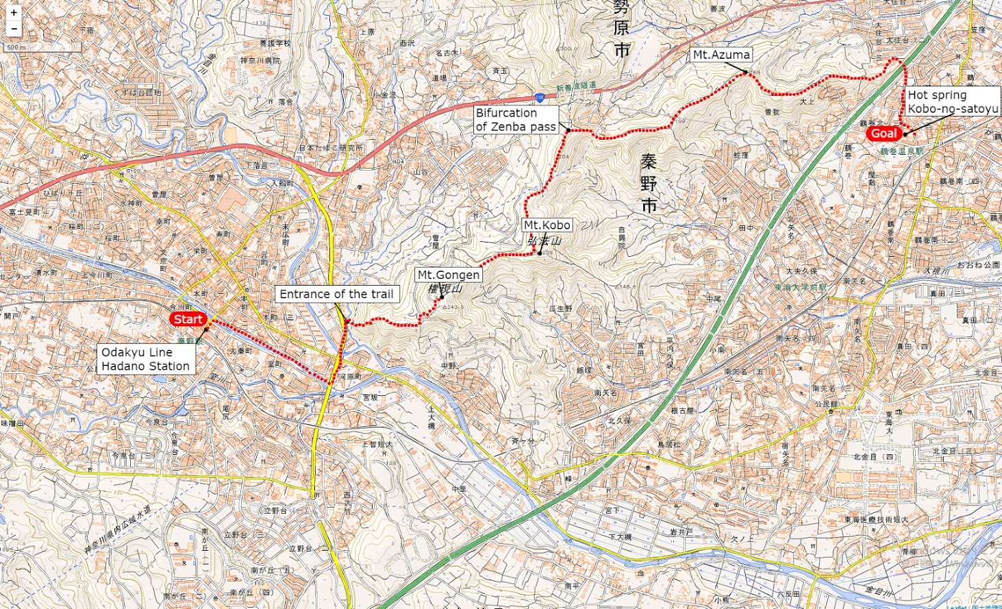
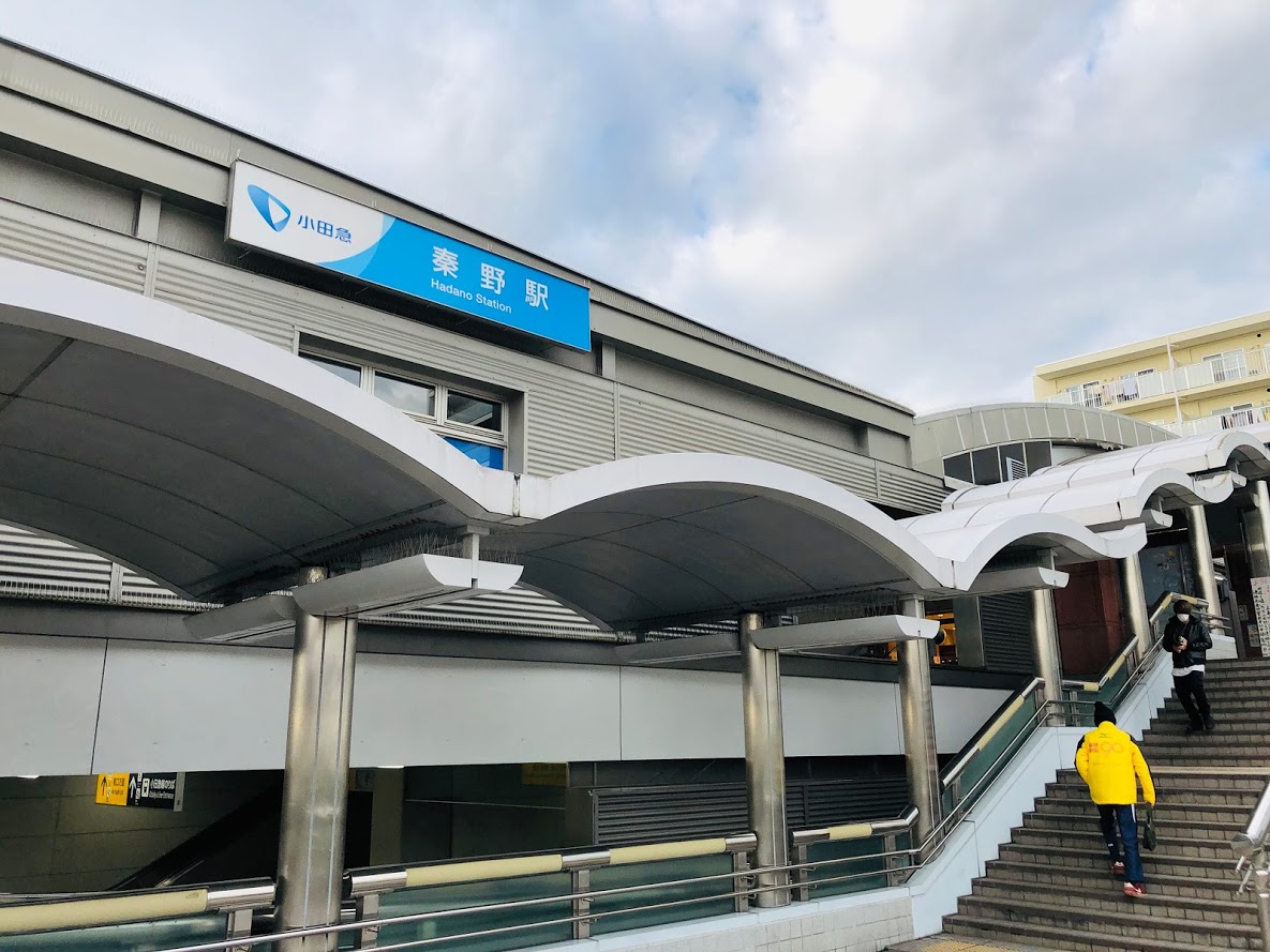
Start: Hadano station on the Odakyū Electric Railway’s Odakyu Odawara Line小田急線 秦野駅
Goal: Tsurumaki-Onsen station on the Odakyū Electric Railway’s Odakyu Odawara Line 小田急線 鶴巻温泉駅
Total distance: 7.3 km
elevation: 235 m
Walking time: 2 hours and 20 minutes
Course Guide of Mt.Kobo
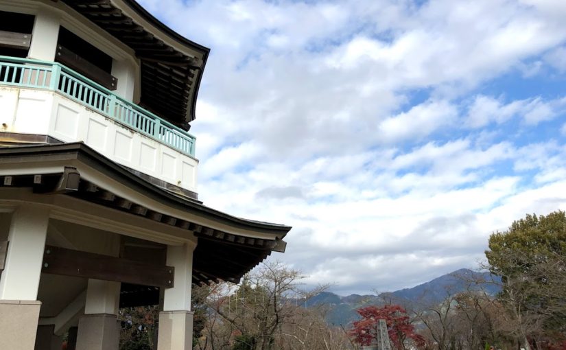
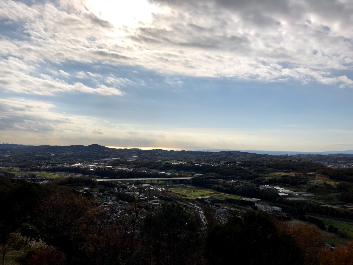
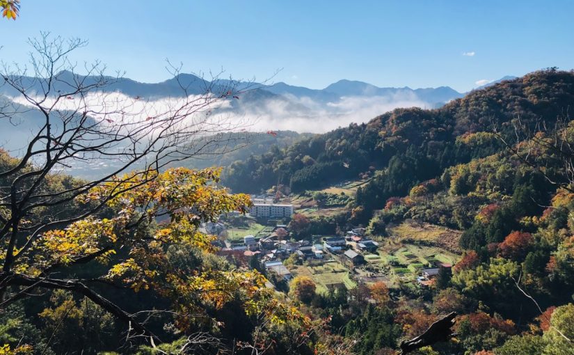
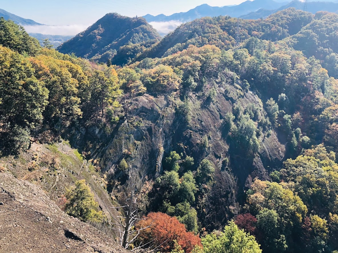
An observatory stand on the summit of Mt. congen and autumn leaves
Hadano station on the Odakyu Line 小田急線秦野駅
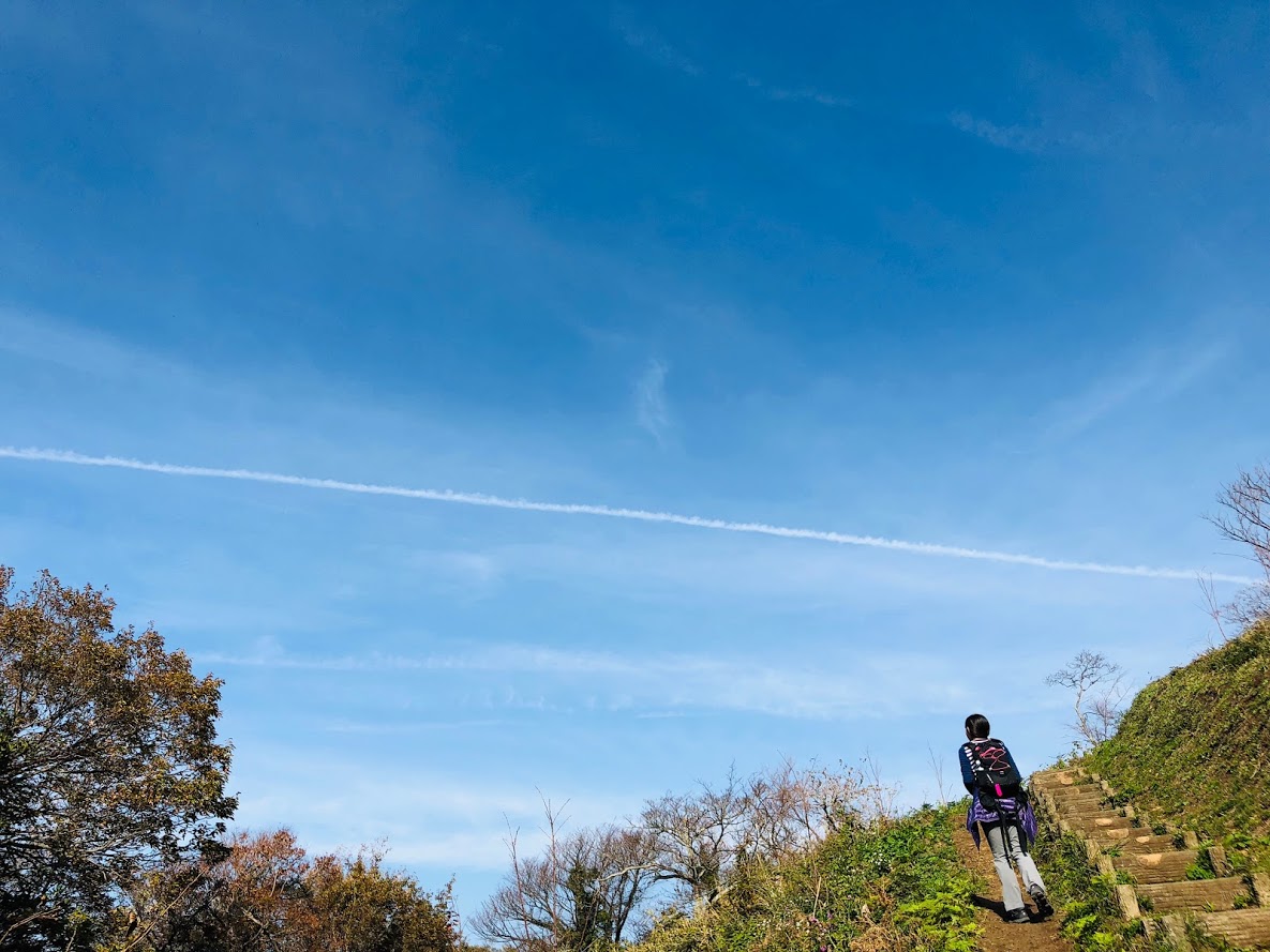
Entrance of the trail ハイキングコース登山口
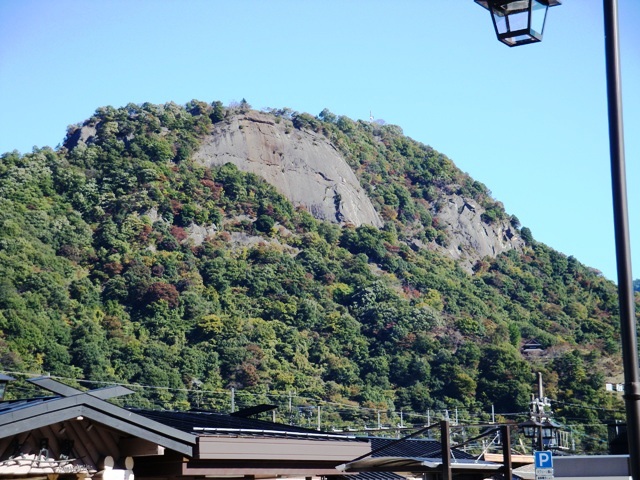
Mt.Gongen 権現山
Mt.Kōbō 弘法山
Bifurcation of Zenba pass 善波峠への分岐
Mt.Azuma 吾妻山
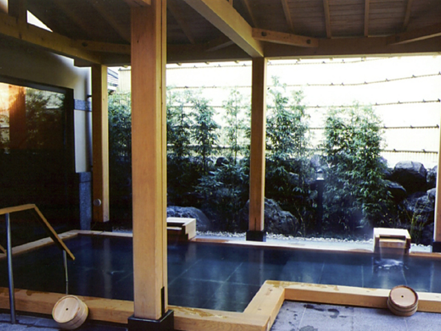
Kobo-no-satoyu (hot spa) 弘法の里湯
Hiking Map of Mt.Kobo
Mt.kobo hiking map | Clicking on the above image opens a separate tab and the enlarged image is displayed.
Features of Hiking Course of Mt.Kobo
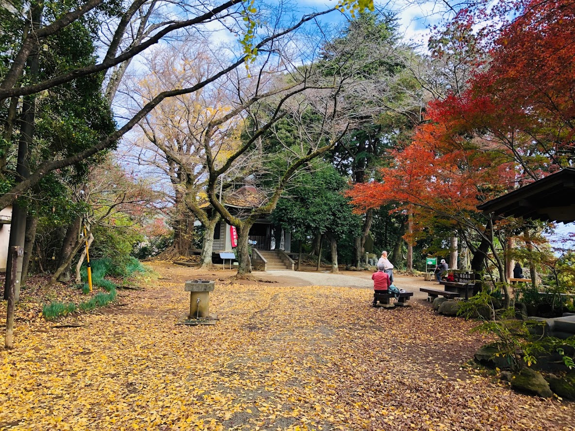
The summit of Mt. kobo has a well and you can drink natural water.
Hiking course of Mt.Kobo is a easy for hiking course with hot springs at end of the course, with a small mountains with an altitude of around 200 – 300 m that is easily accessible from Hadano Station on Odakyū Odawara Line.
This course is a perfect course for the beginner of hiker as a gradual slope continues.
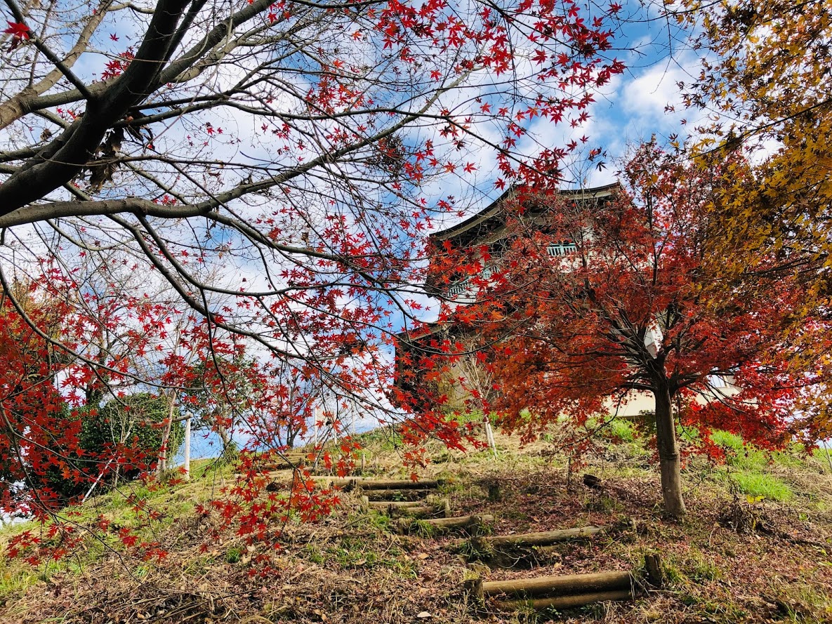
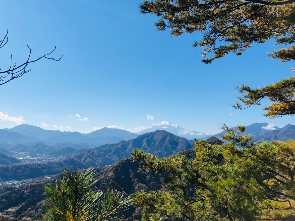
If the weather is good, you can enjoy the view of Mount Fuji from the top of Mt.Gongen.
You can also enjoy the panorama overlooking Sagami Bay and Izu Peninsula.
Also, as the snow does not accumulate so much during the winter, you can enjoy hiking in a idyllic Satoyama landscape all year long.
Hot spring “Kobo – no – satoyu” at the end of the course is a natural hot spring that you can use on a day trip, enjoying an outdoor bath, you can relax slowly in a spacious tatami room on the 2nd floor,
This hot spring is in front of the Tsurumaki Onsen Station on the Odakyu Line, returning home is also easy.
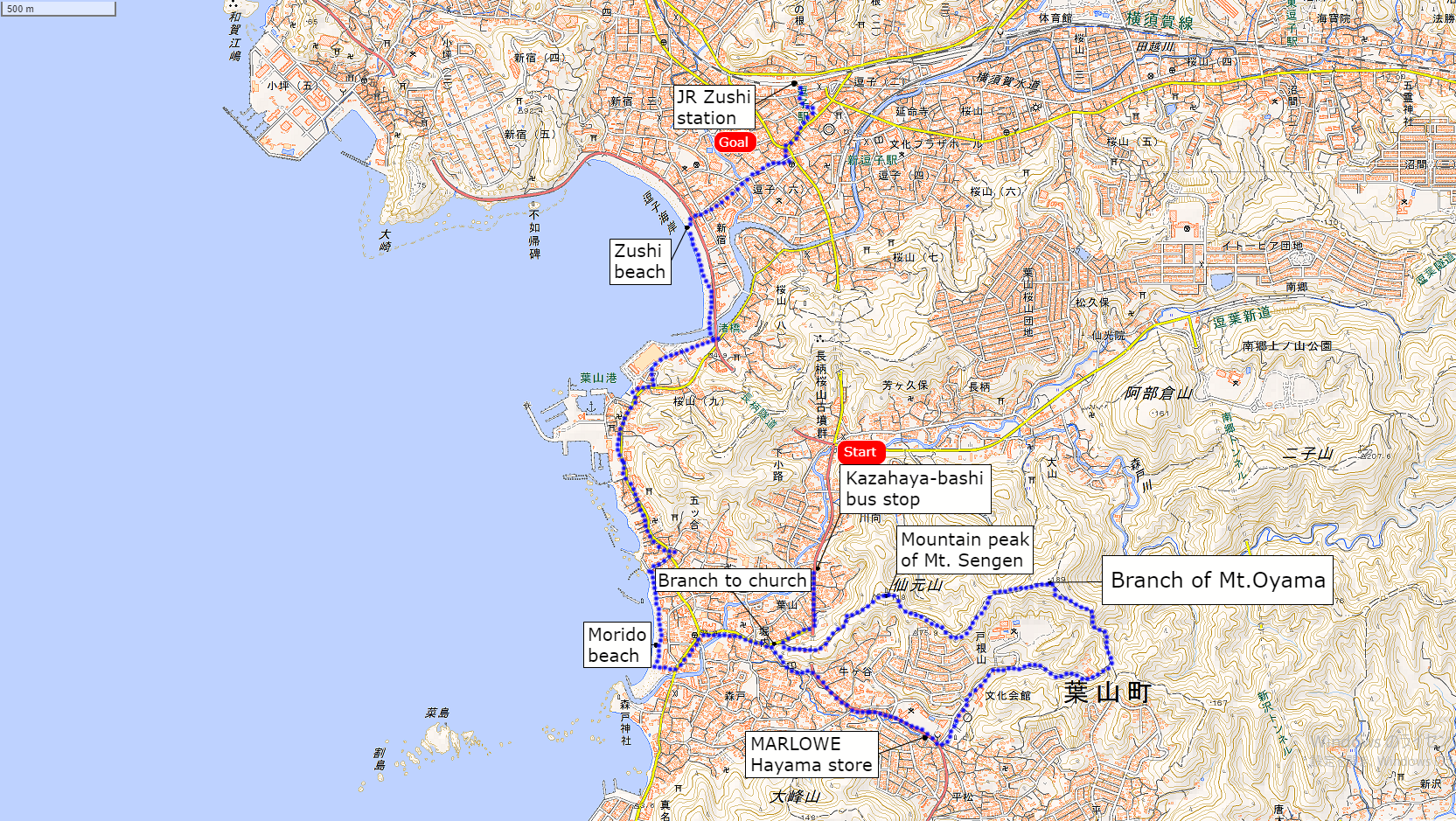
Formal name: Sengen mount 仙元山
Difficulty of this trail: ★ ☆ ☆ ☆ ☆
Trail appearance rate: ★ ☆ ☆ ☆ ☆
Area: Hayama town, Kanagawa prefecture
Start: Kazahaya-bashi bus stop 風早橋バス停
Goal: Zushi station 逗子駅
Total distance: 10 km
elevation: 180 m
Total difference in elevation: 360 m
Walking time: 4 hours
Course Guide of Mt.Sengen
Trail of Mt.sengen
Kazahaya-bashi bus stop 風早橋バス停
Branch to church 教会への坂道分岐
Mountain peak of Mt. Sengen 仙元山の山頂
Branch of Mt.Oyama 大山方面の分岐
MARLOWE Hayama store マーロウ葉山店
Morido beach 森戸海岸
Zushi beach 逗子海岸
JR Zushi station JR逗子駅
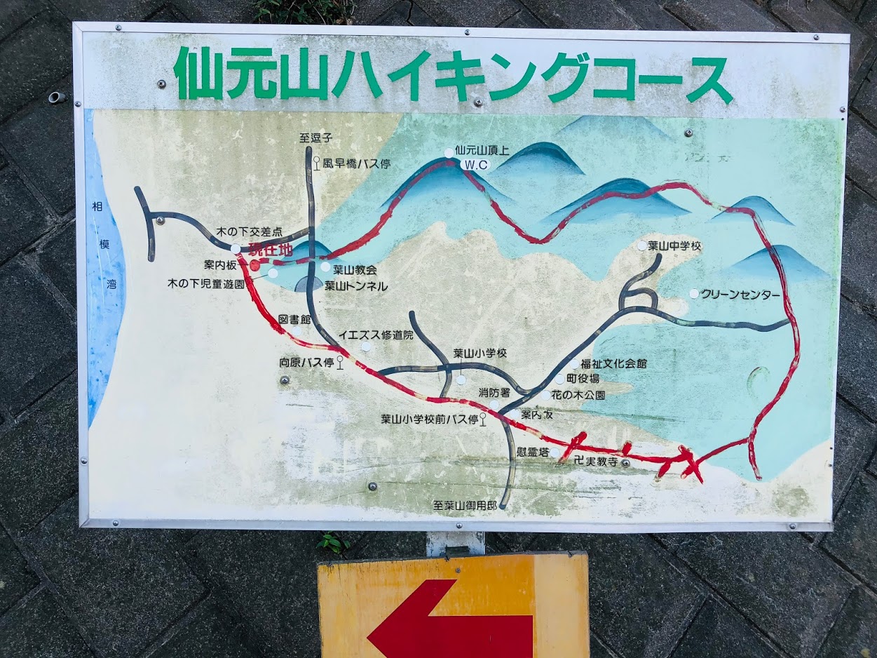
Map of Mt.Sengen
the map of Sengen mount | Clicking the image will display the enlarged size with a new tab.
Access Guide of Mt.Sengen
Entrance of mt.sengen’s hiking course
Shinjuku station as a departure place.
Shinjuku Station
↑
JR Shonan Shinjuku Line (fast): 30 min
↓ Yokohama Station
↑
JR Yokosuka Line (Normal): 30 min
↓ Zushi Station
↑ Keihin Kyuko Bus: 7 min
↓
Kazahaya-bashi bus stop
Transportation expense
2240 yen (round trip)
Advice of access
From Shinjuku Station you can use Zushi going to Shinjuku Shonan line.
If Keihin Kyuko is convenient, you can also get on the bus from Shin-Zushi station.
There are frequent buses to Kazahaya-bashi bus stop, so you can get on without having to wait much.
Features of “Mt.Sengen” hiking course
The sumit of Mt.Sengen | If it is sunny, you can see Mt. Fuji.
Sengen mount is a low mountain that reaches the summit in about 20 minutes from the foot of mountain.
The view is excellent, and you can see Sagami Bay and Mt.Fuji from the summit at the same time.
It is not enough to stand on the summit so I added it to the course from Morito beach to Zushi beach.
As soon as we move in the direction of travel from Kazahaya-bashi bus stop, there is a Hayama tunnel.
Go to the intersection in front of this tunnel to the right, turn back the next signal and climb the “branch to church”.
When you walk a steep slope for a while it is Hayama church.
The trail of the Mt.Sengen hiking course starts from the left side of the church.
As you go along the ridge path surrounded by lucid trees, you will soon pass through the forest and arrive at the summit of Mt.Sengen.
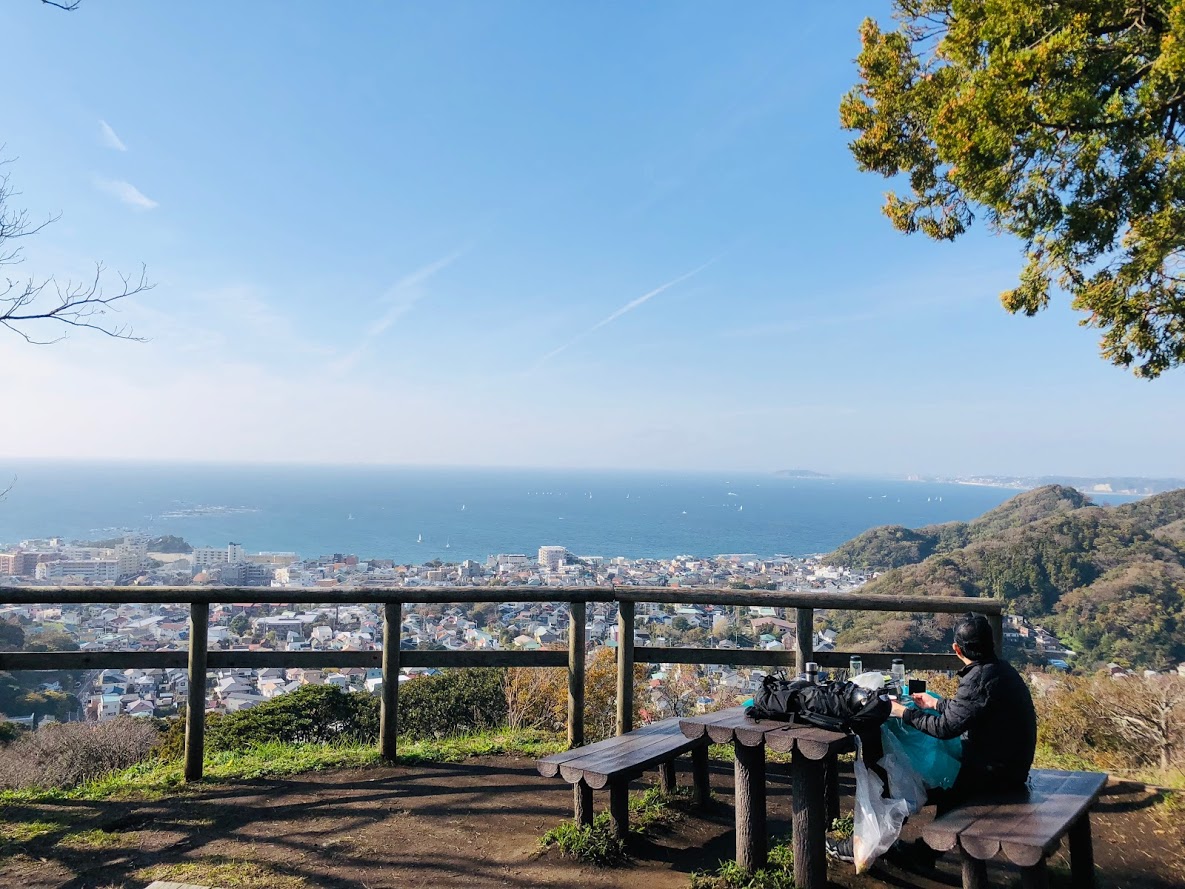
There are benches, toilets and Juniperus chinensis trees on wide mountaintops, yachts floating on the sea of Sagami Bay, Enoshima and Mt.Fuji etc. can be seen.
If you fully enjoy the view, let’s go down the stairs by hiking course.
Once on the slope, it gets gentle again, goes down the stairs again and if you climb the steepest staircase in the course it is a peak of 189 m.
Nice view from the logging area
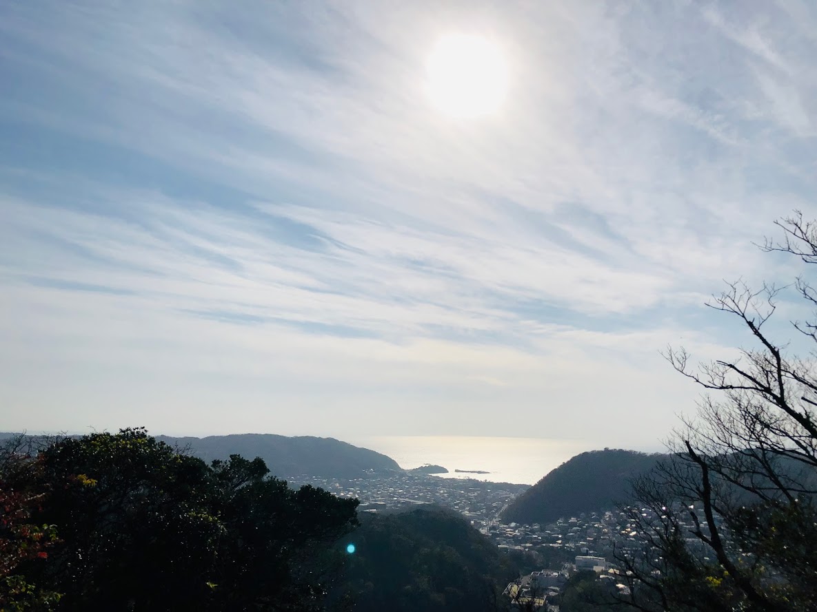
As soon as you cross the ridge after taking a rest, you will find “Branch to Mt.Oyama”.
Proceed on the right road, but let’s take a short rest there as you can see Mt.Fuji and the south west side from the logging area just above.
Go back to the bifurcation and go on a gentle slope.
As soon as you go to the right towards the Clean Center, you will have a branch to “Branch of the Cannon Mound and Jikkyo Temple”.
Go straight here and go down the next branch to the right.
After a while it will arrive at the observation deck where the sea can be seen, if you go down the groove style from here, it is a Jikkyo temple.
If you go between the private houses and go out to the national highway go to the right is the Hayama elementary school bus stop.
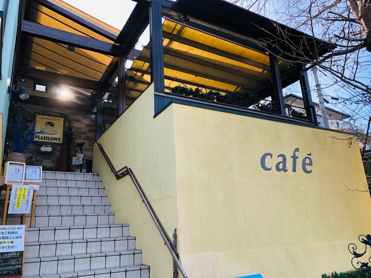
There is a MARLOWE Hayama store where the pudding is delicious in front of the bus stop.
To Morido beach, proceed to the left at the Mukaihara intersection and arrive at the coast, if you proceed along the sea as it is, you will find the Zushi beach.
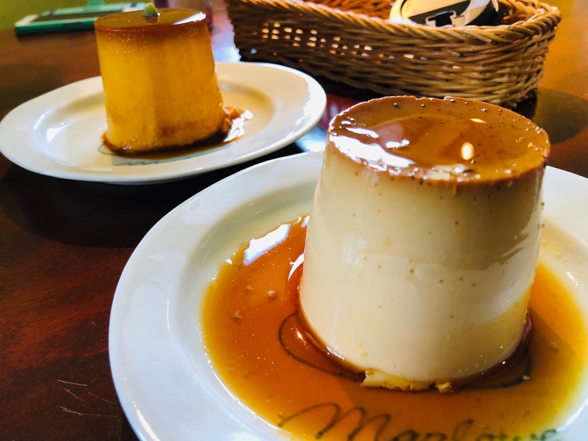
Sweets and beaches after hiking…
Pudding of MARLOWE Hayama shop
MARLOWE Hayama shop
Continue making beaker pudding since its founding in 1984 is a popular product that can sell 2000 pieces a day. You can also eat in the cafe inside the store.
MARLOWE葉山
Business hours: 10 o’clock – 19 o’clock
Non-business day: Wednesday
Access: Hayama primary school bus stop in front
Tel: 046-875-0412
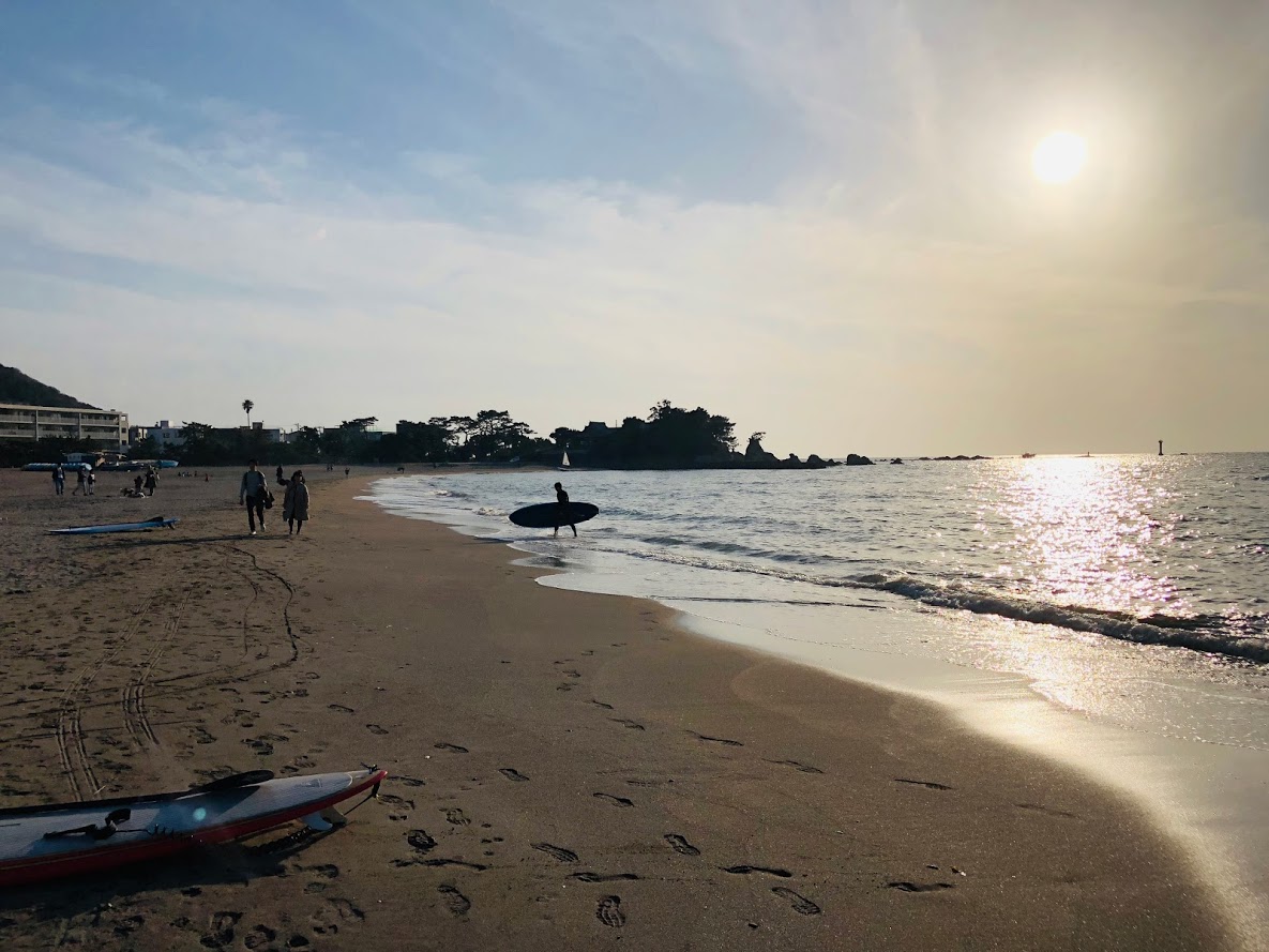
Morito Beach and Zushi Beach
Sunset of Morito beach
Morito Beach is a beach known as the shallow and calm waves of the beach that looks at Enoshima and Mt. Fuji. Morito shrine is enshrined in the beach.
The Zushi coast is a beautiful beach characterized by the shallow and calm waves in Zushi City, Kanagawa Prefecture.
There are many cafés and restaurants in the surrounding area, and there are many surfers and tourists crowded on holidays.
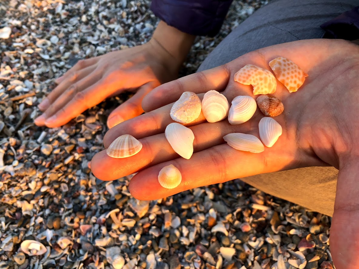
Beach combing at zushi beach
Do you need a guide?
If you are looking for guide of this hiking course, please refer to the following.
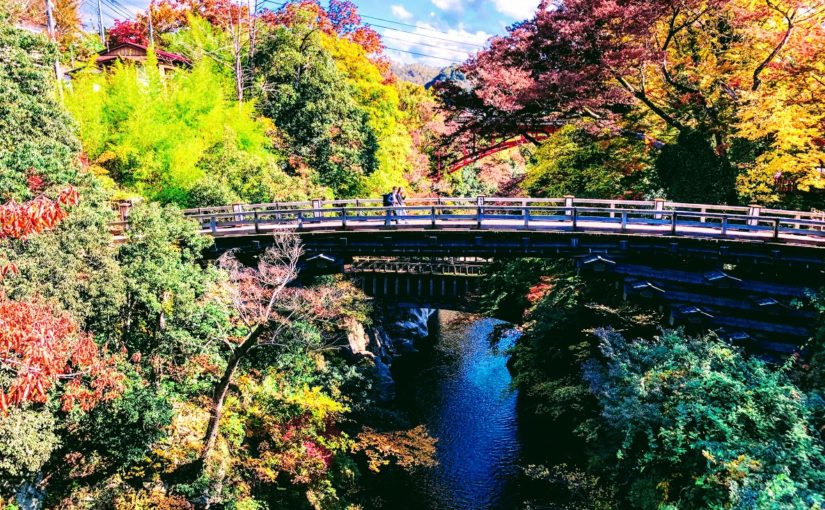
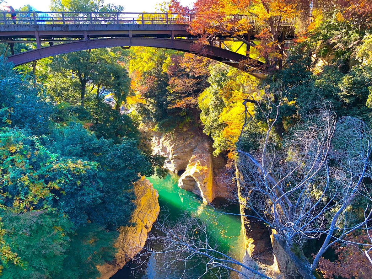
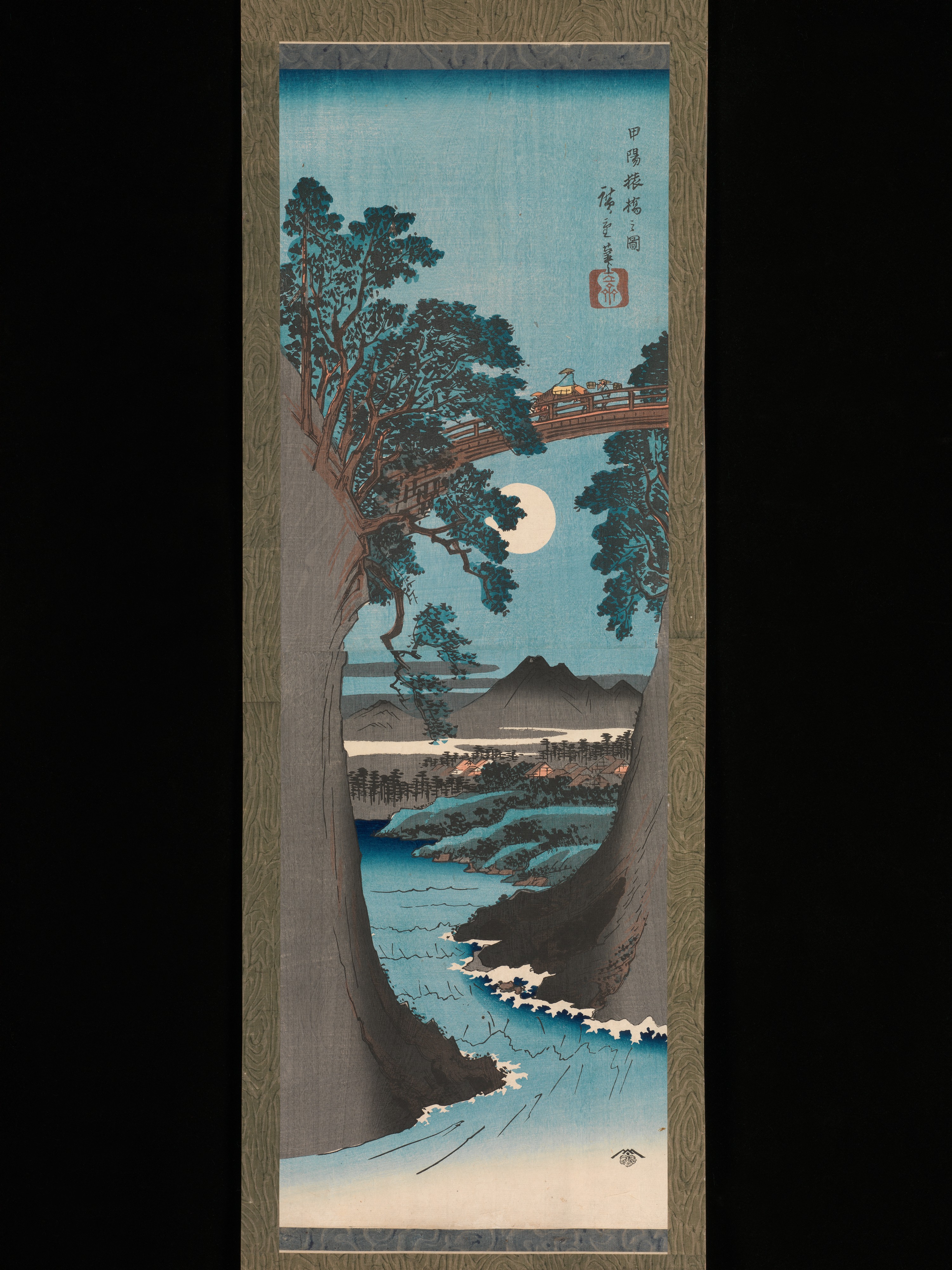
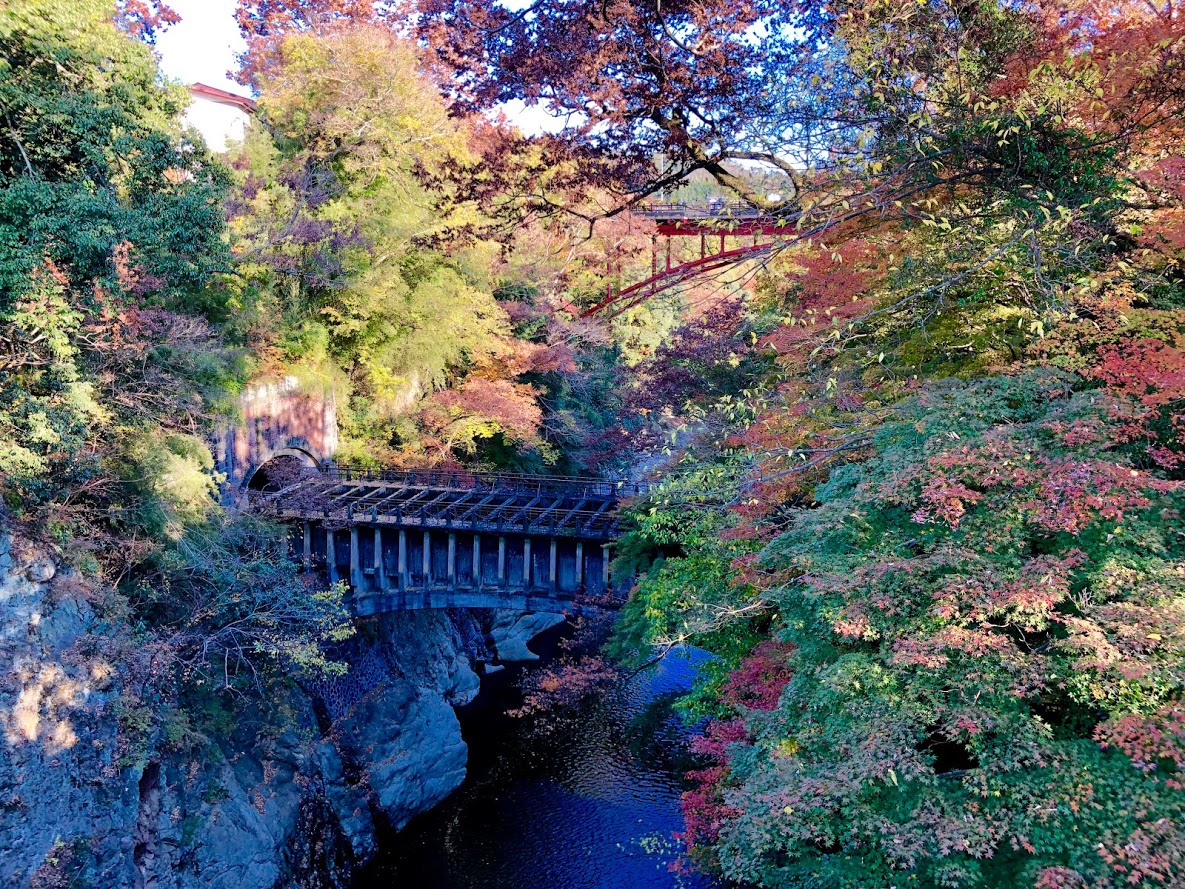
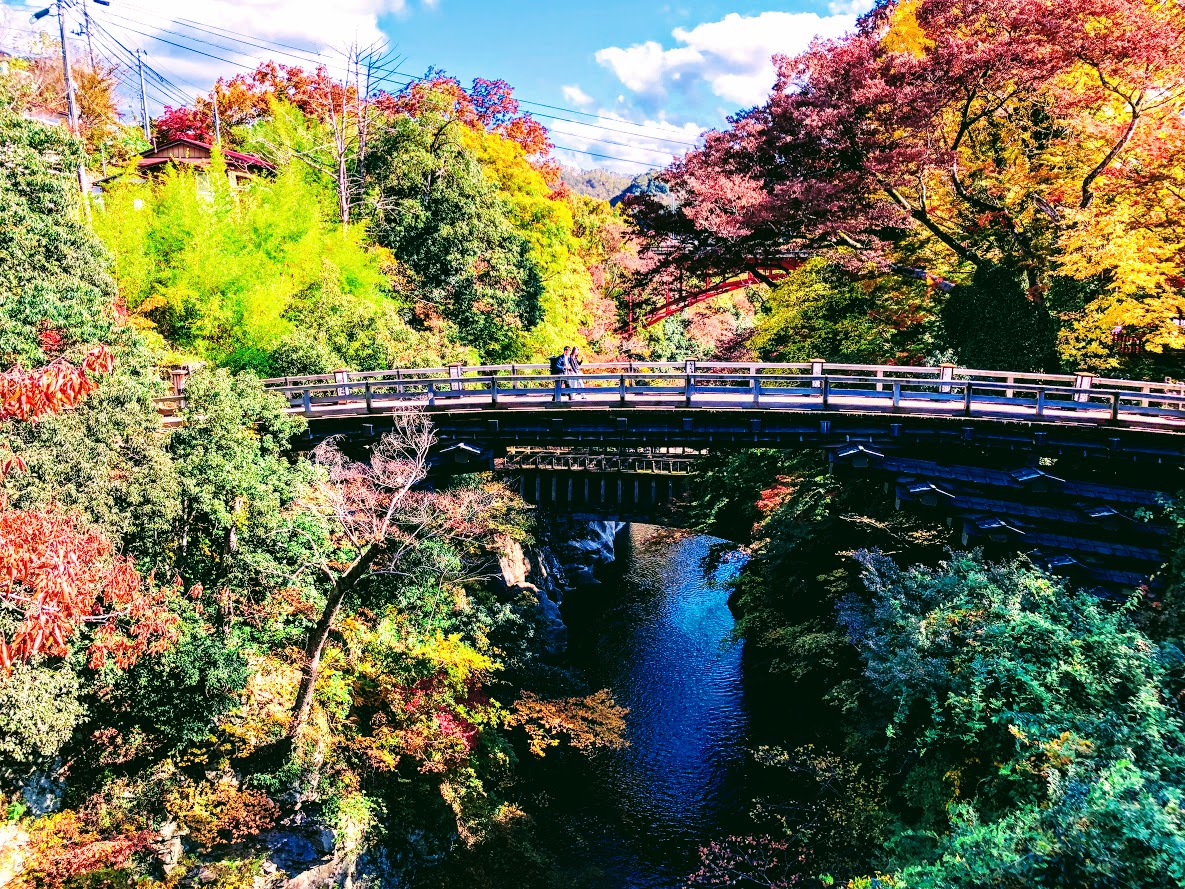
The scenic spot “Saruhashi Bridge” crosses the deep and beautiful valley of Kake River.
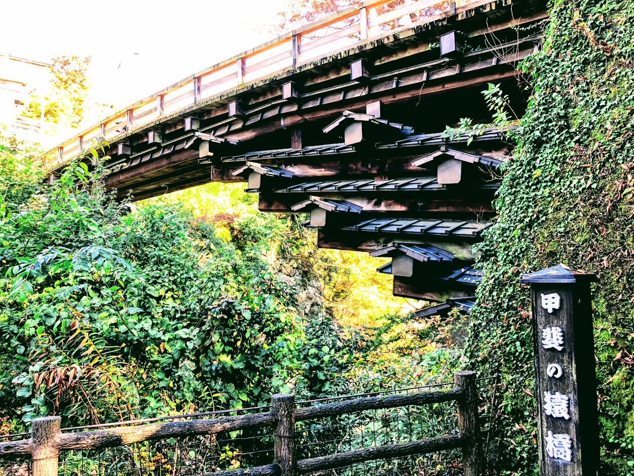
This bridge, together with “The Kintaikyo Bridge” and “Kisonokakehashi”, was chosen as Japan’s three largest Strange bridge, its length of 30.9 m, its width of 3.3 m and its height of 31 m did not use bridge pier at all and sharply towering shore It is supported by the 4 layers of reinforcement that overhang from.
The 4 layers of reinforcement wood supported Saruhashi.
Although the origin of the unusual structure of Saruhashi Bridge is not certain, Shirako (志羅呼) of the landscape guru who came from Kudara ‘s era of Emperor Suiko (About 600 AD) took over the construction of this bridge. However, the construction of this bridge has failed many times becouse of a deep valley.
Although he attempted various methods, he did not go well and gave up the construction of the bridge.
But one day he witnessed a lot of monkeys connected each other and they crossed river and reached the other side, then he came up an idea with the structure of this bridge.
And finally Saruhashi Bridge was built in the valley of this Kake river.
It seems that the origin of the name of Saruhashi “the monkey bridge” was also attached from this legend.
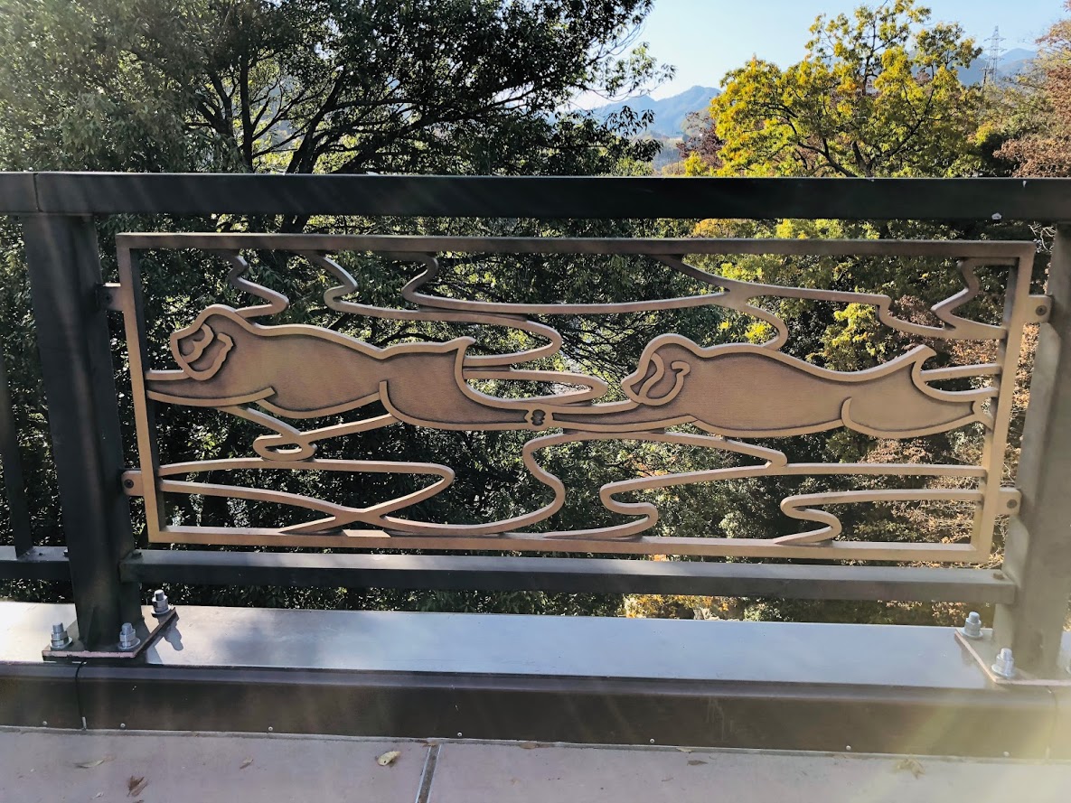
A bridge of monkeys drawn on the railings of Saruhashi Bridge
According to the records, since there is a description of Saruhashi bridge in Goindokou’s journal “Rinkoku Zakki”, you can see that this bridge certainly existed 500 years ago.
The valley beauty of Saruhashi Bridge which were also loved by Culture people
The beauty of the valley of the Kake River from the view of Saruhashi
The scenery of the Saruhashi crossing a beautiful valley that changes every season is called one of the most scenic beauty of the Koshu Highway which was developed by the Edo Five Routes, many writers and painters visited.
Among them, Ukiyo-e artist Hiroshige Utagawa is very moved by this scenery and draws “Koyo Saruhashi no zu”.
The current Saruhashi was restored faithfully in 1986 based on the data of Kaei 4 (1851).
After the Meiji era, new bridges are built one after another with the Saruhashi Bridge in between, and now you can look at the historic bridge at the same time with a steeply and beautiful landscape.
Utagawa (Ando) Hiroshige Ukiyoe “Koyo Saruibashi no zu”
Utagawa (Ando) Hiroshige Ukiyoe “Koyo Saruibashi no zu”
Hiroshige “Koyo Saruhashi no zu”, published in 1842, relies on several sketches and his own memories for the scenery of the monkey bridge that he stopped on his way to Kofu for the production of the festival’s painting It is a very large painting created on.
Once, Hiroshige saw this beautiful scenery and said, “I can not speak, I can not draw in a picture.”
Such Nishiki-e of Saruhashi is said to be the highest masterpiece among works of Hiroshige.
Yatsusawa Power Plant No. 1 Aqueduct Bridge
Yatsusawa Power Plant No. 1 Aqueduct Bridge
Another story that can be seen from Saruhashi
This bridge is a water bridge built to supply water to the Yatsusawa Power plant that was built in 1912 (Meiji 45).
It is made of reinforced concrete, and red bricks similar to those of Komabashi power generation facilities are used for both Sluice gates of the bridge.
A very innovative design that takes advantage of the characteristics of the material is blending in the beauty of the valley.
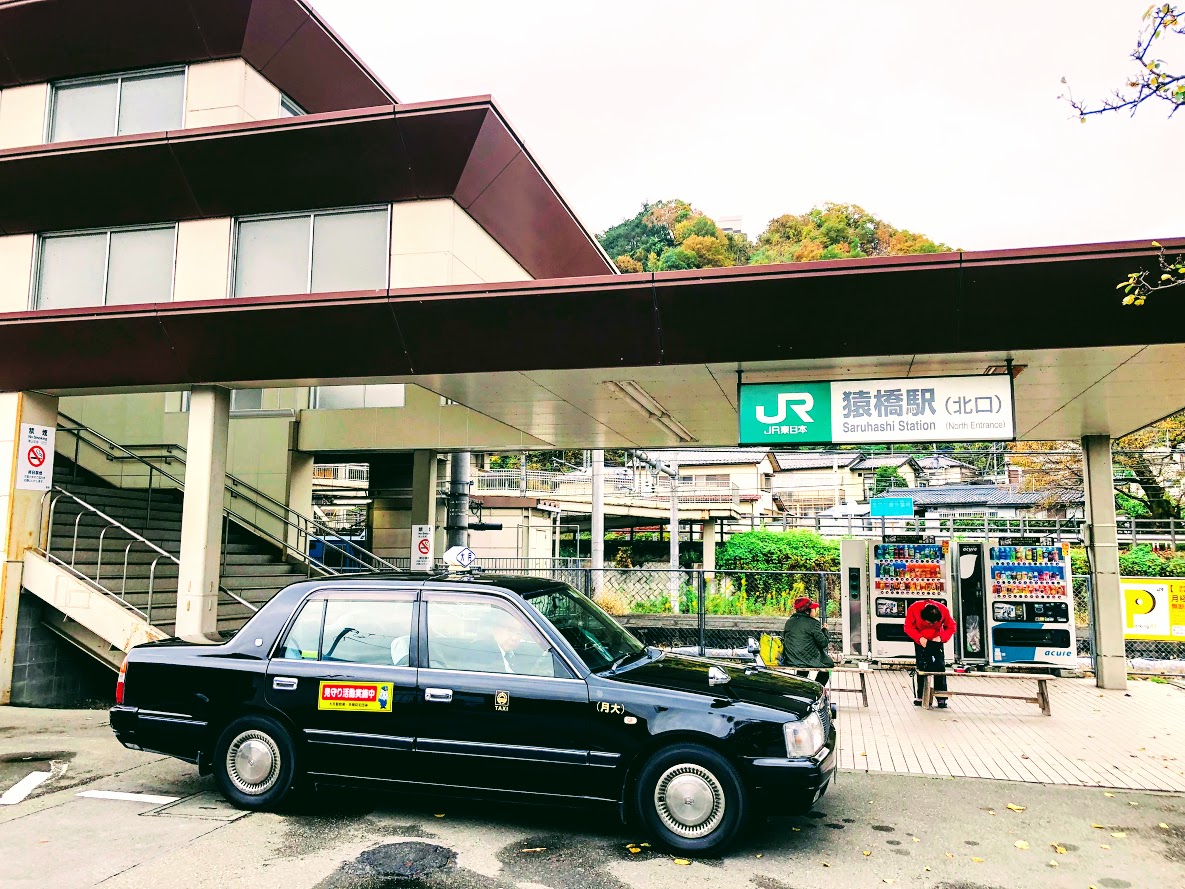
Access information to Saruhashi
By car: 15 minutes from the Central Expressway Otsuki IC, turn left at the “New Saruhashi west” signal on Route 20
By train: 15 minutes on foot from Saruhashi Station on JR Chuo Main Line
By Central Highway Bus: 10 minutes on foot from Saruhashi Bus Stop
Difficulty of this trail: ★ ★ ☆ ☆ ☆
Trail appearance rate: ★ ★ ☆ ☆ ☆
Start: Saruhashi station 猿橋駅
Goul: Saruhashi station 猿橋駅
Total distance: 13 km
elevation: 1003.4 m
Total difference in elevation: 683 m
Walking time: 4 and a half hours
Course Guide of Mt.Momokura
Trail of momokura mount
Saruhashi Station 猿橋駅
Fukusenji temple 福泉寺
Mt.Momokura 百蔵山
Bus Stop “Entrance of Mt.Momokura’trail” 百蔵山登山口バス停
Yutando Spa 湯立人鉱泉
Saruhasih bridge 猿橋
Saruhashi Station 猿橋駅
Map of Mt.Momokura
the map of momokura mount | Clicking the image will display the enlarged size with a new tab.
Access Guide of Mt.Momokura
North gata of saruhashi station
Shinjuku station as a departure place.
Shinjuku Station
↑
JR Chuo Line: 53 min
↓ Takao Station
↑
JR Chuo Main Line: 32 min
↓ Saruhashi Station
Transportation expense
2640 yen (round trip)
Advice
The dangerous place on this course is a steep slope that has gone a little from the top of the mountain.
It is very slippery so let’s slowly proceed while grasping the tree in front of your eyes.
Of course climbing shoes are necessary.
If you plan to go to the next Mt.Ogi it will take at least 4 hours to Torisawa station.
Features of “Mt. Momokura” course
group photo of the summit
Mt.Momokura is popular with hikers as it can be accessed directly from Saruhashi station.
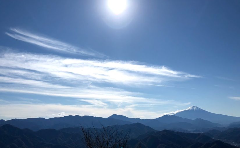
It is also popular that you can enjoy the wonderful view of Mount Fuji from the top of the mountain.
There are five hiking routes on this mountain, but on this blog I will introduce a route from Saruhashi station along Kazuno river to Fukusenji temple to the summit.
After going down the mountain, I will introduce a hot spring with a mysterious atmosphere called Yutando Spa and a bridge with a splendid view called Saruhashi Bridge.
Start from Saruhashi station and cross Katsura river and you can see Mount Momokura.
If you go straight ahead, it is the shortest course, but turn left and proceed along Kazuno river.
Mount Momokura on the right from the river road and Mount Iwadono on the left are the best views.
When you return to the road again from the river road, you will arrive at the small and beautiful Fukusenji temple.
As soon as you follow the road that turns left before the temple, you will arrive at the trail soon.
Iwadono mounts and settlements watching from the trail are also good views.
After passing the small shrine in the trail you will be on the ridge road.
We arrive at the top of Mt.Momokura in about 2 hours from the temple at the foot.
The summit is a large square, all the hikers are facing in the same direction and enjoying lunch.
That’s right, they are facing the direction of Mt.Fuji.
From the summit of Mt.Momokura, we can enjoy the magnificent view of Mt.Fuji which are chosed as “beautiful Mt.Fuji 12 scenery” if the weather is good.
When stepping a little from the top of the mountain, a steep slope will appear, please proceed carefully not to fall.
You will arrive at Bus Stop “Entrance of Mt. Momokura ‘trail” in about an hour.
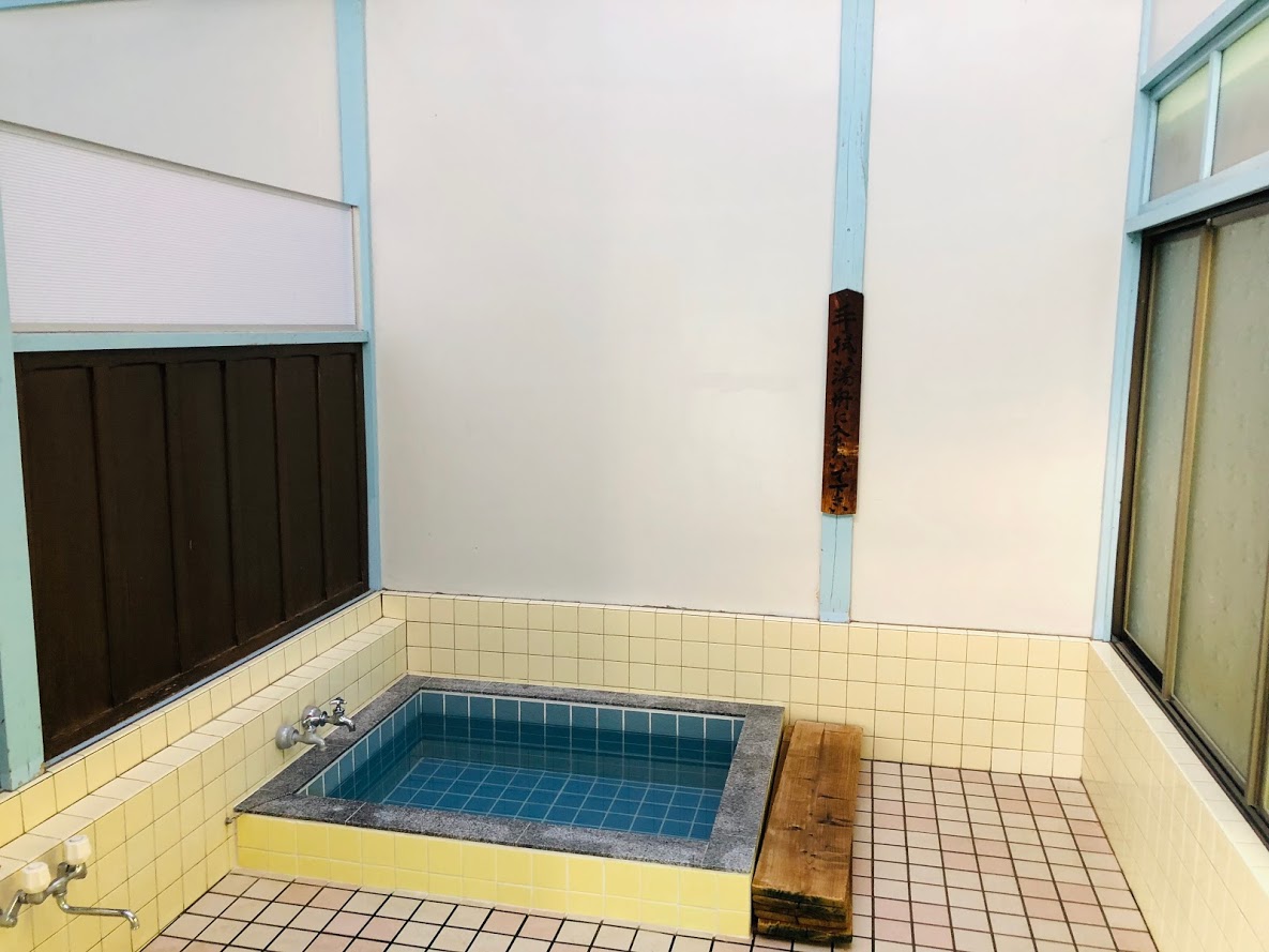
The last destination is Yurando Spa, which is a mysterious spa like an ordinary private house.
Currently it is open only on weekends and offers shower and natural hot spring at 1000 yen.
In addition, you can enjoy pickles and japanese tea made by grandma in the wide room of tatami mat.
If you have time, I recommend visiting “Saruhashi Bridge” which became famous as a strange bridge in the Edo period.
After Hiking…
Yutando Kosen 湯立人鉱泉
Yutando Sapa
Yutando Sapa may not be considered a hot spring as it is apparently an ordinary private house.
But this mysterious Spa is a mysterious spa that has been going on since 300 years ago.
Business hours: 12 o’clock – 17 o’clock
Business days: only on Saturdays and Sundays
Access: 15 minutes on foot from Sarikebashi Station North Exit
Tel: 0554-22-0622
Saruhashi Bridge
saruhashi bridge
The bridge with an unusual structure became the theme of the picture of Ukiyo painter Hiroshige Utagawa.
Saruhashi called the 3 most strange bridge in the Edo Period.
The carpenters could not make a stepladder because the valley was deep, they supported the bridge with reinforcing material that protruded from both sides.
Hiroshige Utagawa visited this bridge in 1841 and sketched and later released Kōyō_Saruhashi_no_zu(甲陽猿橋之図).
Using a vertically long screen, fresh composition while keeping the natural landscape and lyricism, is said to be the best masterpiece of Hiroshige.
Kōyō_Saruhashi_no_zu(甲陽猿橋之図). Utagawa Hiroshige (Japanese, Tokyo (Edo) 1797–1858 Tokyo (Edo)Valley seen from Saruibashi
Do you need a guide?
If you are looking for guide of this hiking or Trail running course, please refer to the following.
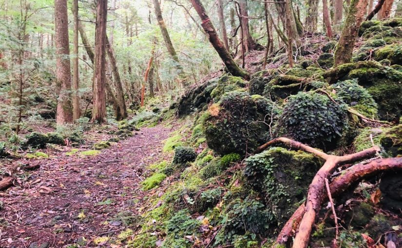
When I went to Fuji’s Jukai on November 2, 2018, I found a stone wall like a castle wall in the forest of Jukai.
It seems to be the ruins of Motosu castle in the Kai era of the warring States era (1532 – 1555) later examined.
The country of Kai is the area of Yamanashi prefecture now, Motosu close to the border of the country of Kau Kai at that time Nakamichi Highway, there was a road Nakamichi, it seems there was a main castle as a key point to protected it.
I feel romance when thinking about a castle ruin which is about 400 years old or more.
Mt. Iwasaki is a low mountain with an altitude of 563m at the prefectural border of Yamanashi and Tokyo area.
I think that there are probably no people who get lost in such a low mountain, but I write down on this blog in the sense of reflection on myself.
This mountain was a mountain where I was interested for a long time, because when I headed from the Chuo Line to the Kawaguchiko area by train, the mountain rocks were always conspicuous.
Mt.Iwatono seen from the center line
At the summit of Mt.Iwadono during the Warring States period there was a castle of Mr. Oyamada, which seems to be an important castle related to Mr. Takeda’s destruction.
Certainly cliff walls are quite overlooked and I think that this steep cliff plays the role of a natural castle wall, so that it worked well when it was attacked by enemies.
Mt. Fuji seen from the mountain path (I’m lost on this point, but I have not noticed yet.)
About Autumn Leaves
It was November 10, 2018 that I visited.
It will be the peak of the autumn leaves in middle of next week. They will be turning red and yellow.
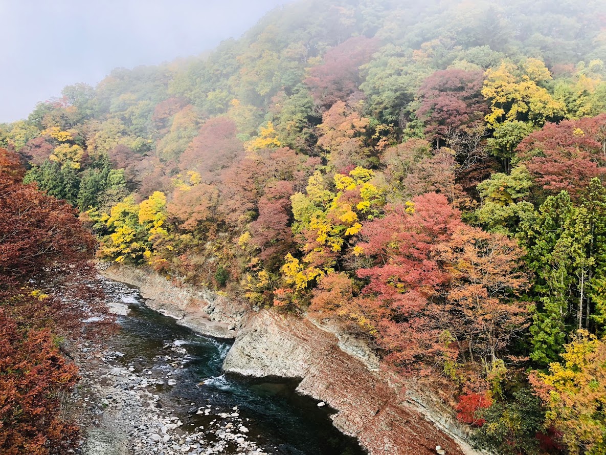
Perhaps because the temperature drops around the water field, the area of Katsura river has already reached the peak of the autumn leaves.
浅利集落付近の桂川
Road closure due to collapse of the trail, and the detour route thereby
Arriving at JR Otsuki station, I was listening to the information on the trail at the tourist information office in front of the station, so the information that the east route is blocked was obtained in advance.
On this day I began climbing from Asari.
After that we went down the east course from the summit of Mt.Iwatono and when we arrived at Nigioka town we planned to go to Mt.Momokura next door.
But I quickly changed this schedule for the detour.
On this day I started climbing from the Asari direction opposite to the usual route, it seems that I mistook a trail at a branch heading from Mt.Tenjin from a cliff called Chigo-otoshi.
As a result I seem to have entered the wrong trail for Okuyama.
I was in Sasazuka if I noticed, I was on the way to Tozura Pass, Mt. Takanomaru.
Apparently I was fascinated the view from Chigo-otoshi and overlooked the signboard.
As a result, I went out to the paved road of the Tozura Pass, descended on the paved road as it was, visited the original plan Saruhashi bridge and went home.
Refrections
This time, I was got lost in the morning, and although it was a regular climbing trail so it was not particularly dangerous.
But since I started hiking it is actually the second time for me to get lost.
I got lost in another mountain before, and I was very dangerous then.
The following is the tweet at that time.
Two days ago, I was distressed at the highest “Mt.Kumotori” in Tokyo.
I was able to get back to the regular route at last by wandering the slope of the mountain for about two hours, this picture was taken at that time.
I learned about that advance preparation is very important. pic.twitter.com/b20xR2aKog
Since that time I took a “map reading classroom” and received a hands-on lesson with compass and 25000 maps.
Nonetheless yesterday I was fascinated to see the scenery from the top of the cliff called a Chiogo-otoshi, and as a result I neglected to check the current position and the direction of travel.
I was fascinated by the view from the Chigo-otoshi.
From now on I will pay attention to the following 3 points and I will be careful not to get lost after that.
I will check the branch on the map beforehand and check my current location and direction of travel.
If I do not understand my current location, I will go back to where I can see it.
Be sure to activate the GPS application before entering the trail.
In the first place I would not get lost if I had just launched the GPS application, I wrote this blog in reflection.
Perhaps I do not think there is such a foolish person like me, but independent hiking is more likely to get lost compared to the group.
If you like hiking alone, please take care.
Mt. Takao’s trail is just off the Keio Takao Line Takaosanguchi station | 京王高尾線高尾山口駅.
It takes about 1 hour by train from Shinjuku staition.
HIKING OVERVIEW:
If you can not enjoy hiking because it is too hot in summer in Japan.
How about hiking starting from the evening?
August 15, 2018 I went hiking at Mt. Takao at night.
There are two reasons.
The first one is to see the japanese giant squirrel at Mt. Takao at night.
Mt. Takao lives a lot of the japanese giant squirrel, but since they are nocturnal they can not meet without visiting at night.
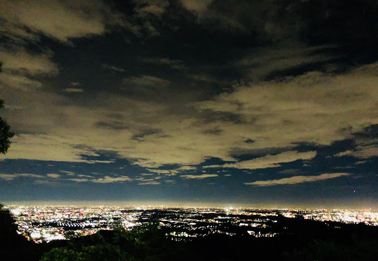
Another reason is to enjoy the night view of Tokyo from Mt. Takao.
You can look over Tokyo from near the cable car platform. If the air is clear, you can hope for Sky Tree and Tokyo Tower.
The night view of Tokyo from mountain was simply stunning.
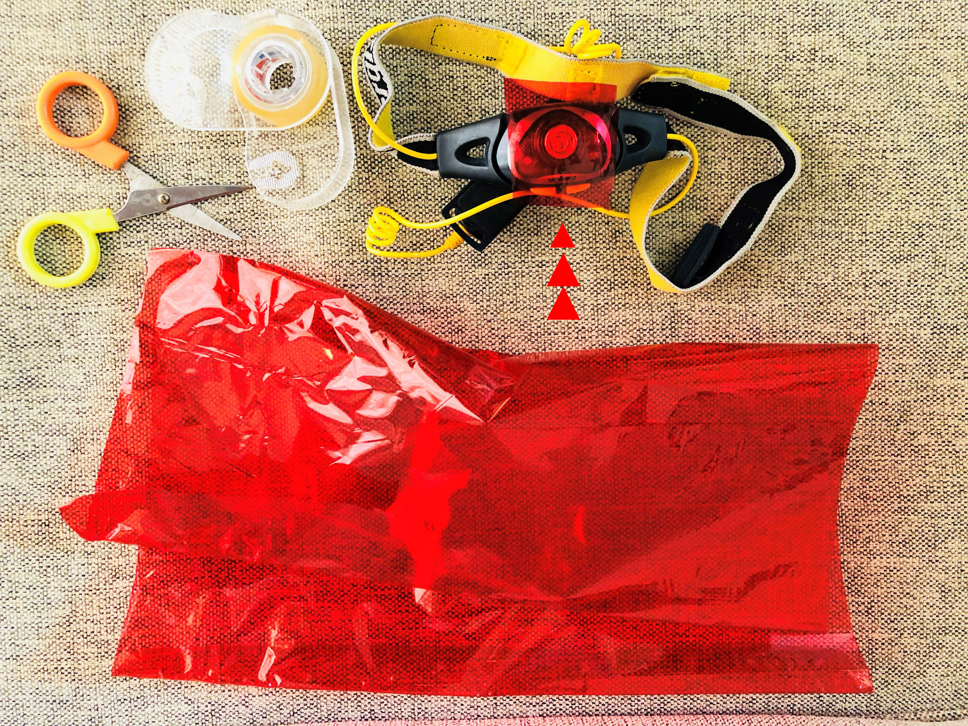
WHAT TO BRING:
• mountaineering shoes
• Sufficient water (1.5 liters on this day)
• Light snack (Sandwiches and rice balls etc…)
• the mosquito repellent spray
• changing clothes (If you visit a hot spring.)
• Light with red cellophane attached
↓↓↓↓
The japanese giant squirrel is very timid.
If you hit the light of the light directly, they may scare and may not come out of the nest. Be sure to put a red cellophane on the light.
SCHEDULE FOR THIS DAY:
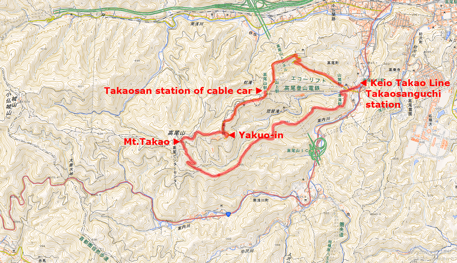
Keio Takao Line Takaosanguchi station | 京王高尾線高尾山口駅(4:00 PM)
(Mt. Takao has some trails, but I chose Inariyama Trail this day.)
↓
Mt.Takao| 高尾山山頂(5:30 PM)
↓
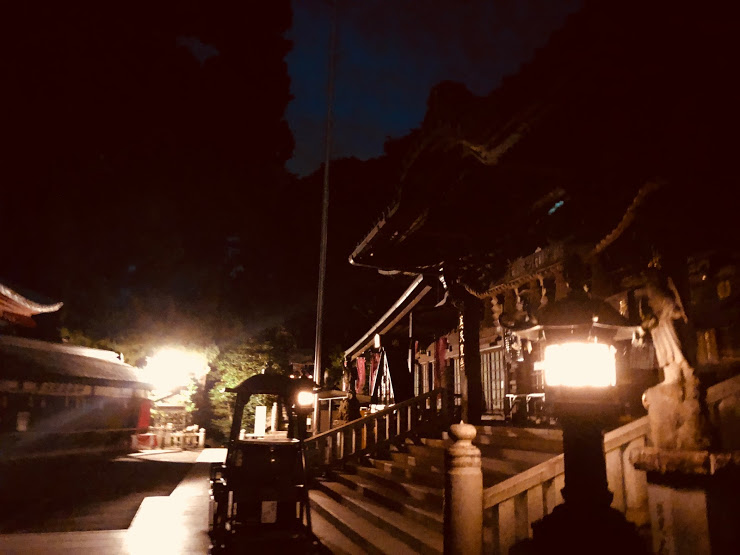
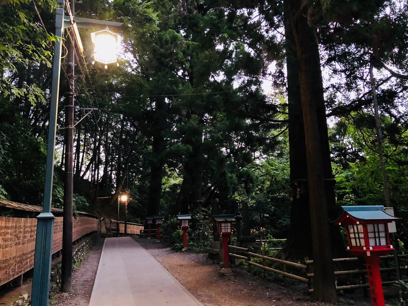
Yakuo-in | 薬王院有喜寺(6:00 PM)
(you have to report the observation of the Giant Flying Squirrel to the company office of shrine which is called as Shamu-Sho 社務所.)
↓
Takao station of cable car | ケーブルカー 高尾山駅(7:30 PM)
↓
Keio Takao Line Takaosanguchi station | 京王高尾線高尾山口駅(8:30 PM)
As a result, did I see Giant Flying Squirrel?
On this day, I was able to see Giant Flying Squirrel, I will summarize concrete actions below.
6:00 PM
I arrived at Yakuo-in as planned, the sunset of this day is scheduled for 6:32 PM.
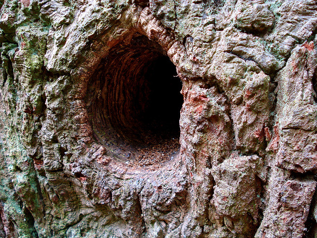
I immediately looked for Tree hollow which is the nest of Giant Flying Squirrel.
tree hollow or tree hole
A tree hollow or tree hole is a semi-enclosed cavity which has naturally formed in the trunk or branch of a tree. They are found mainly in old trees, whether living or not. Hollows form in many species of trees, and are a prominent feature of natural forests and woodlands, and act as a resource or habitat for a number of vertebrate and invertebrate animals.
Quote: Wikipedia
6:30 PM
I found 2 Tree hollows that seemed to be nest of Giant Flying Squirrel in 30 minutes after arrival.
One in the back of Oku-no-Fudoin and one in the middle of the staircase leading to the summit.
A few minutes to sunset, I waited for sunset.
6:45 PM
I kept observing the Tree hollows in the stairs for about 15 minutes, but Giant Flying Squirrel did not show up, I headed for another candidate Oku-no-Fudoin.
I came to foot of the tree and turned on the light and looked up to the Tree hollow.
Then …
There was! ! !
Clearly the red eyes of Giant Flying Squirrel from the Tree hollow were watching me!
Because Giant Flying Squirrel is afraid of lights, I knew that if I shine a lot of light on him, he will not come out of the nest.
Nonetheless, I could not hide joy and excitement in the face of the first Giant Flying Squirrel and I did shine a lot of light on to his nest many times.
But due to my misbehavior, Giant Flying Squirrel did not come out easily from the nest.
7:10 PM
The first excitement I found Giant Flying Squirrel settled down little by little, I tried to shift the light from the nest and shine a light on.
Then Giant Flying Squirrel was relieved, came out of the nest and showed me the whole picture.
The Giant Flying Squirrel I met for the first time was bigger than I imagined, surprisingly it was about the size of a cat.
The Giant Flying Squirrel is also called “a flying a zabuton” and is the largest species of mouse in Japan in the eyes.
7:15 PM
After leaving the nest The Giant Flying Squirrel wandered around the trees, for a while, then disappeared into the depths of the forest without flying through the sky.
I could not see The Giant Flying Squirrel which is flying this day after all in the end.
I think now, it may be because I was too excited at the Giant Flying Squirrel who appeared at last, and shine a light on too many times.
The lesson I got this day is that if you discover the Giant Flying Squirrel, do not shine a light directly on the light.
Apparently the Giant Flying Squirrel is a very cowardly creature, and if you shine a light directly on too, they will alarmed and will not move at all.
I can witness the giant of the Giant Flying Squirrel to fly at a later date, but it can be said that reflection at this time was useful.
It will also summarizes it in another blog.
Map of the hiking course
↑Click the image to open a map expanded with new tab↑
CAUTIONS WHEN OBSERVE:
If you want to directly illuminate the musasabi, use red cellophane paper and gently light up with red light and let’s observe.
Let’s observe quietly without loud voice.
Let’s minimize the photography with the strobe.
Bon fires are forbidden.
setting up a tent is prohibited.
Please do not leave any trash.
Please stop acts that threaten the living things.
Please do not enter into the fence or the implantation.
Please do not light the inside of the building with a powerful light.
AFTER THE HIKE:
There is a hot spring at Takao-San-guchi station which is the goal of the hiking course.
Keio Takaosan hot spring “Gokuraku-yu” is able to enjoy an outdoor bath and a variety of compatible bathtubs and saunas for a bathing rate of 1,000 yen.
If you go home on a hot spring and relax, take a change of clothes.
Store Information
Name: Gokuraku-yu | 極楽湯
Address : 2229 7th Takao-machi, Hachioji, Tokyo
Tel: 042-663-4126
website: http://www.takaosan-onsen.jp/english/
Access : Next to the Keio Takao Line Takaosanguchi station
Closed: open 365 days per year
Business hours : 8: 00 ~ 23: 00 (last entrance reception 22: 00)
Usage fee : 1000 yen (Bathing fee included)
If you are looking for guide of this tour please refer to the following.
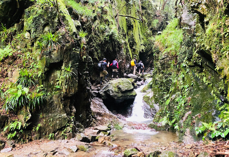
It takes about two hours by train and bus from Shinjuku to this course, but it is worth it.
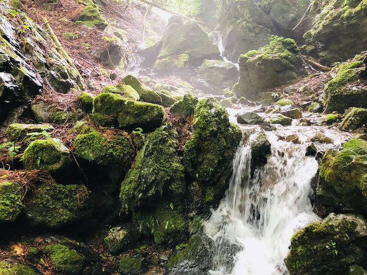
Because “Shirayasawa valley” which can enjoy beautiful valley and waterfall is included in the course.
Furthermore, the goal of this hiking course is a hot spring so you can relax and go home with natural hot water.
Of course it depends on you whether you enter a hot spring or not.
The altitude of Mt. Bonore is 969 m and it is located at the prefecture border between Tokyo and Saitama prefecture.
The first half of the hiking course starts from about 400 altitudes and climbs this mountain at once.
The second half of the hiking course goes down the beautiful valley called Shirayatani.
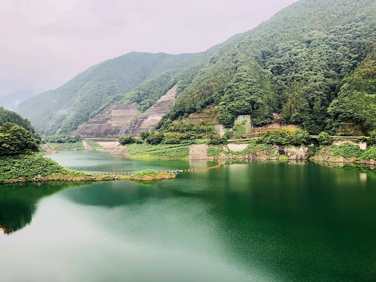
When the valley trail is over, you can enjoy magnificent views of the Arima Dam.
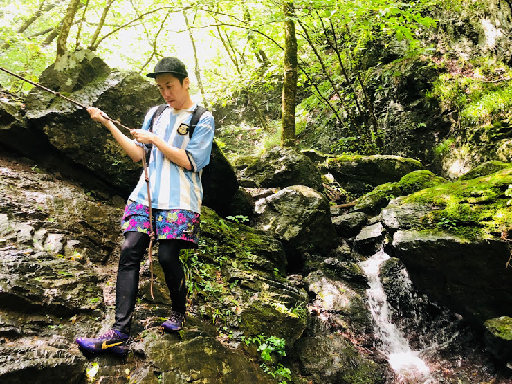
Valley is slippery, sometimes you can put your feet on water so let’s go wearing climbing shoes that are hard to slip.
It rained on the summit of the mountain, it was very slippery, so the ride time was around 4 and a half hours.
WHAT TO BRING:
• Non-slip mountaineering shoes
• Sufficient water (1.5 liters on this day)
• Light snack (Sandwiches and rice balls etc…)
• the mosquito repellent spray
• Sunscreen
• Trekking Poles (if you use them)
SCHEDULE FOR THIS DAY:
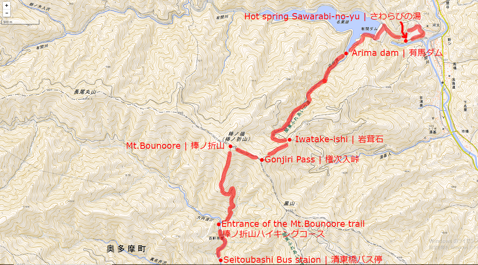
Seitoubashi Bus staion | 清東橋バス停(9:45)
↓
Entrance of the Mt.Bonore trail | 棒ノ折山ハイキングコース(10:00)
↓
Mt.Bonore | 棒ノ折山(11:30)
↓
Gonjiri Pass | 権次入峠(10:45-11:15)
↓
Iwatake-ishi | 岩茸石(13:15)
↓
Arima dam | 有馬ダム(13:45)
↓
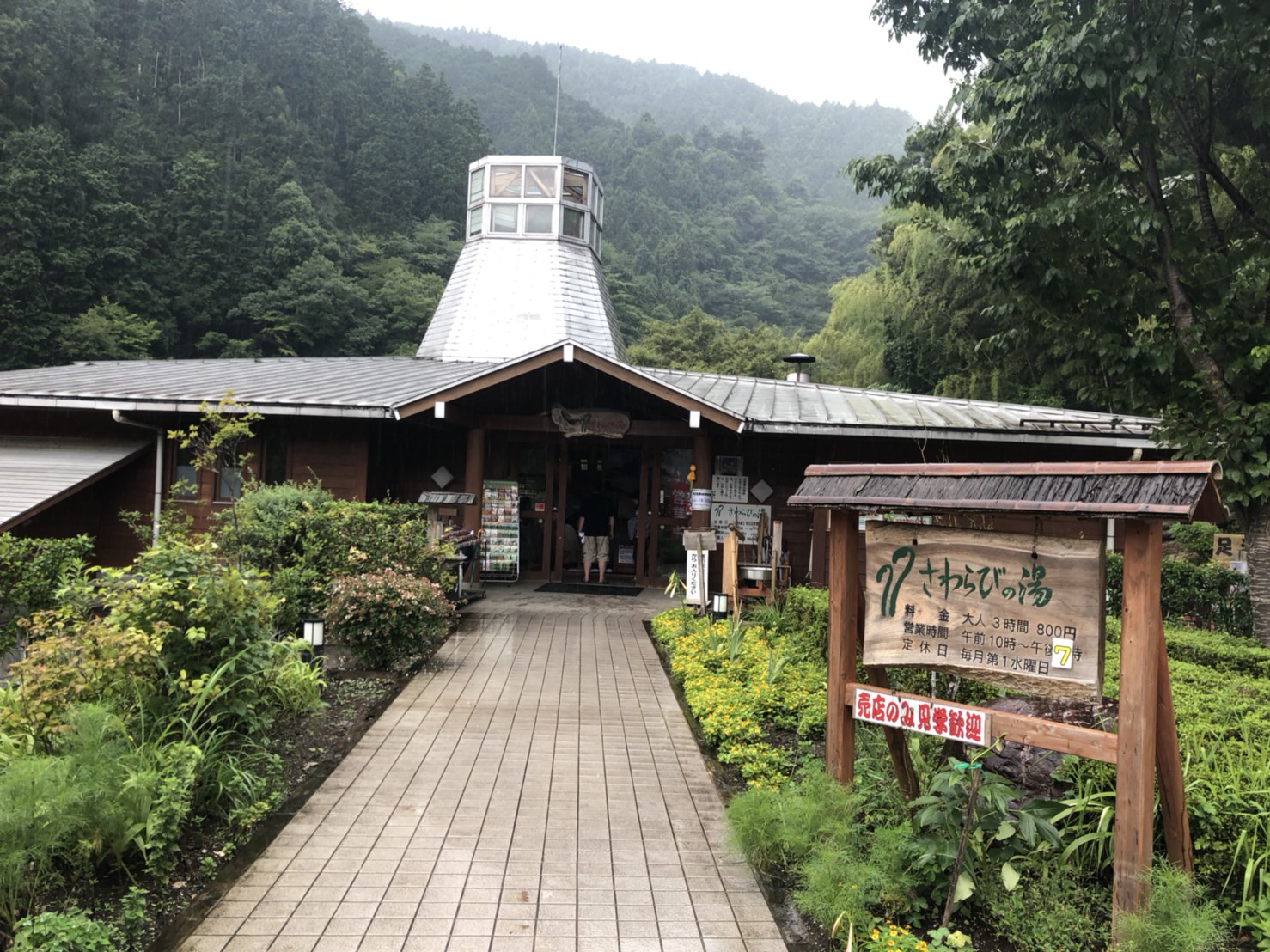
Hot spring Sawarabi-no-yu | さわらびの湯(14:15)
Map of the hiking course
↑Click the image to open a map expanded with new tab↑
AFTER THE HIKE:
There is a hot spring on the goal of this hike.
The name of this hot spring is “Sawarabi-no-yu | さわらびの湯”.
Bathing fee is 800 yen, you can enjoy outdoor bath and various types of bathtub.
If you go into a hot spring and relax and go home, I recommend you take clothes.
The way to go back to Tokyo from Sawarabi-no-yu is by bus and train.
First go by bus to Seibu Ikebukuro Line Hannō Station | 西武池袋線 飯能駅.
Seibu Railway Ikebukuro From Line Hannō Station | 西武池袋線 飯能駅 to JR Ikebukuro station | JR池袋駅 will arrive in about 50 minutes.
However, the express red arrow | 特急レッドアロー号 can be used with plus 500 yen.
If you are looking for tour guide of this hiking course please refer to the following.